Saturday, December 12, 2015

China's 'Airpocalypse' Visible from Space


China has a really gross problem, and it's only getting worse.
Smog levels have gone far beyond what's considered safe in Beijing and other parts of eastern China, which has led officials to take unprecedented measures. In Beijing, the first ever "code red" was issued because of what is being called the "airpocalypse," Live Science reported.

http://www.weather.com/science/environment/news/china-smog-pollution

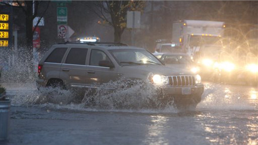
High Surf, Coastal Flooding Inundates California Coast

Powerful waves pounded the California coast on Friday, causing damage and street flooding, while also forcing evacuations in some communities.
In Ventura, California, local police issued a high surf alert and advised residents to stay out of the water and use caustion near the beach. Roads that were close were eventually reopened although the police said more roads along the coast could see closures through the weekend.
The Ventura County Fire Department was called to initiate a water rescue near Mondos Beach.
http://www.foxnews.com/weather/2015/12/11/photos-high-surf-coastal-flooding-inundates-california-coast/

Beijing air pollution reaches 'red alert' for first time ever

The first ever ‘red alert' for poor air quality was issued for Beijing, China, by the city government due to heavy smog, multiple sources report.
This alert began on Tuesday morning and will be in effect until Thursday Reuters said.
"High pressure over the area has provided almost calm winds, allowing pollutants to build up with little to no influx of fresh air," AccuWeather Meteorologist Tony Zartman said.
The Beijing city government ordered all outdoor construction to stop and all schools to remain closed until the smog clears.
"Construction waste, excavation transport vehicles, cement trucks, gravel transport vehicles and other large-scale vehicles are prohibited from driving on roads," authorities added in the notice.
This poor air quality will impact the 22.5 million people who live in and around the city.
China has a four-color warning system for pollution conditions. The four levels include blue, yellow, orange and red. The four-color warning system was created in October 2013 according to Xinhuanet news.
A ‘red alert' is issued when there is expected to be at least three consecutive days of very poor air quality, according to the Associated Press (AP).
http://www.foxnews.com/weather/2015/12/08/beijing-air-pollution-reaches-red-alert-for-first-time-ever/?intcmp=ob_article_sidebar_video&intcmp=obinsite

Northwest Oregon pummeled by rain as forecast calls for more storms

Oregon and the rain are synonymous — but the downpours that have caused flooding, landslides and evacuations in the state this week are getting to be too much even for the Pacific Northwest.
Residents in the Portland area and throughout northwest Oregon and southwest Washington were pummeled by a second barrage of heavy rains on Tuesday, as rain continued to soak already saturated ground, bringing some area creeks and rivers to flood stage.
Officials predicted that residents could face a repeat of Monday's scenario: streets turned into creeks, flooding near rivers and streams, landslides and delays in traffic and mass transit. Some buildings and residences were stacking up sandbags to prevent further flooding.
http://www.foxnews.com/weather/2015/12/08/northwest-oregon-pummeled-by-rain-as-forecast-calls-for-more-storms/?intcmp=ob_article_sidebar_video&intcmp=obinsite
portlandoregonflooding128.jpg

Buffalo has yet to see snow in December, breaks 116-year-old record

A 116-year-old snow record has fallen in Buffalo. This time, it's for lack of snow.
The city had yet to see its first measurable snowfall by Friday, breaking the record for latest first snow set on Dec. 3, 1899.
The wait will continue, National Weather Service meteorologist Jim Mitchell said. There's no snow in the forecast until at least mid-December.
During an average season, Buffalo gets its first measurable snow, considered a tenth of an inch or more, on Nov. 8 and sees about 93 inches through the winter.
http://www.foxnews.com/weather/2015/12/05/buffalo-has-yet-to-see-snow-in-december-breaks-116-year-old-record/?intcmp=ob_article_sidebar_video&intcmp=obinsite
1205 buffalo snow.jpg

Highway connecting Oregon, Washington collapses after torrential rains

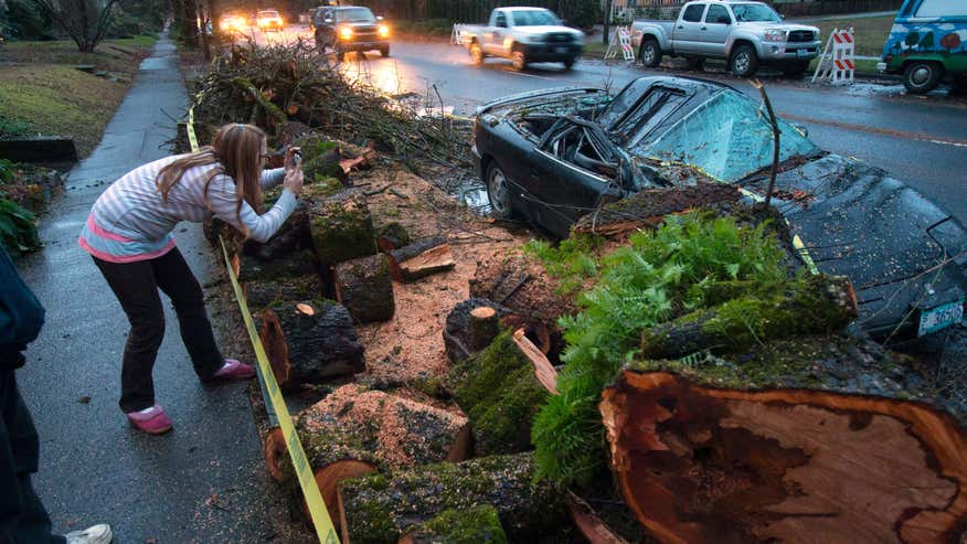
A rain-soaked hillside collapsed on the main highway connecting Washington and Oregon, stranding thousands of motorists for hours Thursday while rain continued to fall throughout the region.
The storms that have been sending rivers out of their banks, closing roads and killing at least two people in the Pacific Northwest this week were easing a bit, but forecasters said mudslide danger on the saturated hills would remain high through the weekend.
"It was crazy and I was scared," said Diane Smith of Lacey, Washington, who was stuck for three hours behind the landslide on Interstate 5 about 26 miles north of Portland, Oregon, and then drove a steep, windy mountain road to get around the slide.
The massive landslide blocked the lanes Wednesday afternoon after a hillside of rocks and dirt collapsed on the roadway after days of pounding rain. Crews were able to reopen one lane Thursday evening and transportation officials estimate all lanes will be reopened by Sunday evening.
More rain is on the way through the weekend.
http://www.foxnews.com/weather/2015/12/11/highway-connecting-oregon-washington-collapses-after-torrential-rains/?intcmp=ob_article_sidebar_video&intcmp=obinsite

1211 northwest storms.jpg

Landslide closes interstate, tornado reported as major storm slams Pacific Northwest

Thousands of motorists were stranded Thursday during a major storm in the Pacific Northwest that caused a landslide that stopped all northbound traffic on a major highway connecting Washington and Oregon.
Forecasters say the storms that left two people dead, flooded rivers and caused mudslides, were easing up, but the threat from slides and flooding remained.
"It was crazy and I was scared," said Diane Smith of Lacey, Washington, who was stuck for three hours behind the landslide on Interstate 5 just 26 miles north of Portland, Oregon, and then drove a steep, windy mountain road to get around the slide.
The massive landslide blocked the lanes Wednesday afternoon after a hillside of rocks and dirt collapsed on the roadway after days of pounding rain.
http://www.foxnews.com/weather/2015/12/10/dramatic-storms-easing-up-in-pacific-northwest/?intcmp=ob_article_sidebar_video&intcmp=obinsite
White Christmas

Tuesday into early Wednesday morning, localized flooding was reported in Mississippi, Arkansas, southern Missouri, northwest Louisiana and eastern Texas, resulting in several road closures in those areas. Flash flooding moved into parts of Georgia by Wednesday afternoon.
The most numerous flood reports were in southern Missouri Tuesday where more than 5 inches of rain has fallen in some locations. A storm total of 6.85 inches was measured in Pershing, Missouri. 

http://www.weather.com/storms/severe/news/flood-threat-texas-louisiana-mississippi-valley-november-2015


Friday, December 11, 2015

Who Will Have A White Christmas This Year?

Christmas is getting closer and many are wondering if they will see a white Christmas this year.
Our latest white Christmas forecast is shown in the map below. Meteorologists define a "white Christmas" as one in which there is at least one inch of snow on the ground on Christmas morning. It doesn't have to be snowing on the holiday for that to happen, of course.
This year, we have one of the strongest El Niños of record in play. That and a persistently warm East and Midwest, along with a cold, wet West, is setting the table for what we may see Christmas morning. 
http://www.weather.com/forecast/national/news/white-christmas-forecast

White Christmas Forecast

El Niño Has Matured and Will Rank Among Top 3 Strongest, NOAA Says

The current strong El Niño event has matured and will finish ranked among the top three strongest since 1950, according to the latest monthly outlook released by NOAA on Thursday.
El Niño conditions are likely to last through the winter before finally easing up and transitioning to neutral conditions by late spring or early summer. This means sea surface water temperatures in the equatorial central and eastern Pacific Ocean will return to near-average levels from their current above-average state. El Niño is an anomalous, yet periodic, warming of the central and eastern equatorial Pacific Ocean. For reasons still not well understood, every two to seven years, this patch of ocean warms for six to 18 months, then cools.

http://www.weather.com/news/climate/news/strong-el-nino-december-2015

Northwest Flooding: State of Emergency Declared in Oregon; Tornado Confirmed in Washington

Roads in Portland, Oregon, were left impassable by flooding that ejected manhole covers and left drivers stranded on Interstate 5, while mudslides broke sewer pipes and sent sewage into the streets. Forecasters say the wave of moisture won't be as potent in the coming days, but could still cause additional problems. The latest round of stormy weather on Thursdayeven spawned a tornado that caused damage in the southwest Washington town of Battle Ground.

http://www.weather.com/storms/severe/news/pacific-northwest-storm-impacts

High Surf, Coastal Flooding Inundates California Coast

Powerful waves pounded the California coast on Friday, causing damage and street flooding, while also forcing evacuations in some communities.
In Ventura, California, local police issued a high surf alert and advised residents to stay out of the water and use caustion near the beach. Roads that were close were eventually reopened although the police said more roads along the coast could see closures through the weekend.
http://www.foxnews.com/weather/2015/12/11/photos-high-surf-coastal-flooding-inundates-california-coast/

Thursday, December 10, 2015

City Clouds


http://www.weather.com/slideshows/news/cities-skylines-fog-images

"The most common form of fog, known as radiation fog, typically occurs on clear nights as the earth's surface cools moist air immediately above it," said weather.com meteorologist Jon Erdman. "If just enough light wind is present – a couple of mph, at most –  this chilled air can be gently stirred through a deeper layer, forming a deeper radiation fog."

The fog can be seen as dangerous for pilots or navigators. More than 500 people have been killed from fog related crashes

Indonesian Volcano


http://www.weather.com/photos/news/blue-fire-crater-reuben-wu-kawah-ijen-indonesia

During the day, the Kawah Ijen volcano in East Java, Indonesia, resembles any other. However, what appears to be electric-blue lava streams down the mountain at night. The unique blue glow is actually a result of the sulfuric gases in the volcano combusting, similar to a natural gas flame...

The interior of the volcano is still seen as dangerous. Noxious sulfur fumes linger through the volcano and you have to be very careful or you could potentially get lost in the volcano. The volcano has caused major landscape changes unlike other volcanos.

EL Nino vs Polar Vortext


http://www.usatoday.com/story/weather/2015/12/09/el-nino-polar-vortex-weather/77030892/

Ski areas are getting nervous in the Northeast, a confused southern bird has been spotted in New York City, and Buffalo has yet to see snow, something that hasn't happened there in December since records began shortly after the Civil War...

El Nino has been winning the battle causing record warmth across the area. Business who rely on snow are worrying because snow has yet to touch the ground. The strength of El Nino at this rate could keep artic air out of the USA for winter. 

Washington Flooding


http://www.king5.com/story/weather/2015/12/09/thousands-without-power-flooding-remains-rain-subsides/77030070/

SEATTLE – Governor Jay inslee on Wednesday declared a state of emergency in Washington after days of heavy rain caused rivers to rise, flooding and landslides across Western Washington. Multiple rivers remained under a flood warning...

The heavy rains slowed down but the rivers are still over flooded. Power was knocked out in thousands of homes from the high winds. Flood watch is still in effect

Cumbrian Village

http://www.theguardian.com/environment/2015/dec/10/people-told-to-stay-indoors-as-cumbrian-village-floods-for-second-time


Police have urged people to stay indoors after a Cumbrian village was flooded for the second time within a few days. The Liberal Democrat leader, Tim Farron, a local MP, said the government must learn that flooding is likely to become more frequent...

Rescue services, volunteers, and the army came out to help civilians. The village people are unable to go north due to the destruction of their bridge caused by the massive rainfall. The village plans to rebuild over 9000 homes in 20 zones.

Super Cell


http://www.weather.com/storms/severe/news/severe-weather-hail-may

A multi-day severe system hit the Plains this weekend, bringing tornadoes, large hail and torrential floodings...

Van, Texas, Nashville, Arkansas, and Lake City, Iowa all received major storm damage. Delmont, South Dakota was partially destroyed by a large twister. 4 deaths were recorded from the storm. 

Midwest Storms


http://www.weather.com/storms/severe/news/photos-midwest-storms

A severe weather outbreak hammered the Plains and Midwest on Monday, spawning several reported tornadoes that left homes and other buildings heavily damaged.The town of Coal City, Illinois, suffered a direct hit from a likely tornado Monday night. Homes were destroyed and five people were injured, though there were no deaths.

12 tornadoes were recorded in the High Plains. Several people were trapped under damaged homes and buildings. There were no recorded deaths. Atleast 10 injuries were reported.

Flood in New York


http://www.weather.com/storms/severe/news/flash-flooding-brooklyn-new-york-july15

Flash flooding swamped parts of Brooklyn, New York, around the lunch hour Wednesday, turning some streets into shallow rivers, snarling traffic and delaying flights...

Rain lasted for hours. A projection of 1 inch of rain had fell in 30 minutes in New York. Cars were damaged and houses were flooded.

Fort Brag


http://www.weather.com/storms/severe/news/lightning-strikes-soldiers-fort-bragg

More than a dozen soldiers were injured by a lightning strike Wednesday night at Fort Bragg in eastern North Carolina, officials said...

None of the injuries were considered life threatening.  16 of the soldiers were hospitalized and another two only showed symptoms but no physical damage of a lightening strike.

Baseball Hail

http://www.weather.com/storms/severe/news/baseball-hail-italy-pozzuoli-naples-sep2015


Baseball-sized hail came smashing down near Naples, Italy on Saturday in a storm that injured several people and animals in addition to causing damage to vehicles, crops and more...

The Hail caused billions of dollars in damage.the storm was brought on by a vigorous southward plunge of the jet stream that carved into western Europe.

Hard Hail

http://www.weather.com/storms/severe/news/queensland-australia-hailstorm

Hail as big as golf balls fell from a severe storm in Queensland, Australia, Wednesday afternoon, leaving damage that knocked out power to thousands and forced the closure of at least one school...

Damage occurred to many buildings, trees, and cars. Hail filled up the streets. Buildings had to be evacuated because the damage they took from the hail. Damage from the storm is expected to rise in the millions.

Great Lakes Windstorm


http://www.weather.com/storms/severe/news/great-lakes-wind-storm

A storm system that dumped snow in the West and Plains and spawned at least one tornado in the Midwest moved into the Great Lakes region on Thursday, bringing strong winds that led to travel problems and power outages.

Many Toll routes and roadways were closed due to the windiest. Chicago closed the Chicago Skyjack due to high winds. Flights were also canceled because of the winds.

Northwest Flooding


http://www.weather.com/storms/severe/news/pacific-northwest-storm-impacts

Persistent flooding and mudslides have left the Pacific Northwest with damage and messy driving conditions, and the rivers could continue to rise on Wednesday. At least one person has been killed by this round of dangerous weather...

Roads in Portland and Oregon have taken a lot of damage. Some roads have been left impassable and will take time to fix the damage. The flood did major damage to homes and trees and even left one person dead after a tree fell on her home.

Hailstorm In Argentina


http://www.weather.com/storms/severe/news/argentina-hailstorm-tornado-brazil-flooding-nov2015

Severe thunderstorms tore through parts of northern Argentina and southern Brazil Wednesday into early Thursday, dumping damaging hail, flooding rain, even spawning a tornado...

Homes and cars were severely damaged by the hail. The hail was compared to the size of a tennis ball. Soon after the flood a Tornado developed. More flooding occured. 

Storm Desmond


http://www.weather.com/storms/severe/news/storm-desmond-united-kingdom-uk-england-scotland-ireland

Britain's army was called in to help put down sandbags and evacuate people from their homes Sunday as Storm Desmond, the fourth named storm of the season, soaked parts of England, Scotland, Northern Ireland and Ireland over the weekend...

Many cars are under water due to the massive flooding that occurred.  Homes have been destroyed and  rescue team has been guiding families out their homes to safety. Travel has been delayed due to the storm.

DeRidder Tornado


http://www.srh.noaa.gov/lch/?n=e04192015

A line of severe storms developed over North Central Texas during the late afternoon of the 18th and moved into East Texas and Central Louisiana during the early morning of the 19th. While the line of storms had weakened considerably through the late evening hours while moving through Texas one storm did produce a brief tornado in De Ridder....

Damages started on Highway 27 with minor tree damage. As the Tornado moved north the strength of the tornado increased. Damages occurred to buildings as the tornado reached high 171. As the Tornado moved further north, it died down and caused minor tree damage.

Tropical Storm Bill


http://www.srh.noaa.gov/lch/?n=2015Bill

The genesis of Tropical Storm Bill began as a tropical disturbance across the Western Caribbean Sea and the interaction with an upper-level trough on June 12th. For the next couple of days, the tropical disturbance moved northwest, eventually crossing the Yucatan Peninsula on June 13-14th. The disturbance emerged over the southern Gulf of Mexico late on June 14th and moved across the central Gulf of Mexico on June 15th...

The center of Tropical Storm Bill made landfall in Texas at 11:45 AM. Tides raised to 3 feet tall. Texas was struck heavy with rain. Kirbyville, Texas received 9.51 inches of rain. The rain had a huge impact on Southern Texas, even after Bill moved North of Dallas.

Pine Belt Tornadoes


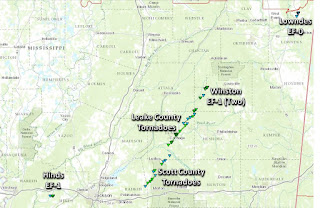
http://www.srh.noaa.gov/jan/?n=2015_10_31_tor_pinebelt


Brief Tornadoes hit Marion County and Hattiesburg County. The Tornadoes were small and ranged from EF-0 to EF-1. Damages were mainly done to trees. Some minor damages were done in Hattiesburg to homes. The highest maximum wind was recorder at 95 mph in Marion County. There were no fatalities from the tornadoes.

November 17-18 Tornadoes

http://www.srh.noaa.gov/jan/?n=20151117_tor
A potent upper level storm system developed and intensified across the Plains on Monday into Tuesday (Nov 16-17) and set the stage for high winds and some severe weather across the ArkLaMiss region. As the storm system tracked across the Plains, it brought fairly rare severe weather to Texas, Oklahoma and Kansas for November late in the evening and overnight hours of the 16th and 17th...

The area received damaging winds throughout the day. 12 tornadoes had developed across the region. All of them were short term and EF0-EF1'S.

March 25TH

http://www.srh.noaa.gov/images/oun/wxevents/20150325/maps/150325_moore_tornado_prelim.png

A series of severe thunderstorms produced damaging winds, large hail, and tornadoes in central and southern Oklahoma  during the afternoon and evening hours of March 25th and early morning hours of March 26th. One supercell thunderstorm tracked through parts of Canadian, Oklahoma, and Cleveland counties, producing a small, weak anticyclonic tornado near Yukon, OK....

An EF2 tornando was eventually produced later that day. Southwest Oklahoma was hit hard by damaging wind. Some storms had a peak high of 73 mph wind gust.

Severe Flooding

http://www.srh.noaa.gov/oun/?n=events-20150506

A series of severe thunderstorms produced tornadoes, large hail, damaging winds and flash flooding in  Oklahoma western north Texas during the afternoon and evening hours of May 6th. Several supercell thunderstorm tracked through parts of the I-44 corridor in Caddo, Grady, McClain and Cleveland counties, and produced several tornadoes in the area. These slow-moving storms also dropped 1 to 3+ inches of rain over areas that had received heavy rains of 2 to 4+ inches on May 5th, and severe flash flooding occurred in several locations...

The Thunderstorms and flash flooding lasted all day. A supercell was dropped a tornado in Oklahoma. Rainfall reached up to 7 inches in parts of Oklahoma.

Wednesday, December 9, 2015

The Tornado That Couldn't Make Up Its Mind

Satellite image showing the strange path of the Aug. 2, 2015 Iowa tornado. (Credit: National Weather Service Des Moines, Iowa)


Storm survey illustration of the strange path the Aug. 2, 2015 tornado took. (National Weather Service Des Moines, Iowa)
 
  The white arrows highlighting the tornado scar in the image show how it moved south initially, then made a cyclonic loop, before eventually heading back to the northeast. According to the NWS, the path of the tornado was in mostly rural portions of Adams County and Adair County. It was rated EF1, leaving some damage to silos and farm buildings about 8 miles north-northeast of Prescott, Iowa.             
 

The Big Thaw


**Peru's Quelccaya ice cap is the largest in the tropics. If it continues to melt at its current rate—contracting more than 600 feet (182.8 meters) a year in some places—it will be gone by 2100, leaving thousands who rely on its water for drinking and electricity high, dry, and in the dark.


So far, the results have been positively chilling. When President Taft created Glacier National Park in 1910, it was home to an estimated 150 glaciers. Since then the number has decreased to fewer than 30, and most of those remaining have shrunk in area by two-thirds. Fagre predicts that within 30 years most if not all of the park's namesake glaciers will disappear.

Scientists who assess the planet's health see indisputable evidence that Earth has been getting warmer, in some cases rapidly. Most believe that human activity, in particular the burning of fossil fuels and the resulting buildup of greenhouse gases in the atmosphere, have influenced this warming trend. In the past decade scientists have documented record-high average annual surface temperatures and have been observing other signs of change all over the planet: in the distribution of ice, and in the salinity, levels, and temperatures of the oceans.


http://environment.nationalgeographic.com/environment/global-warming/big-thaw/


Pacific Northwest Storm Parade to Bring More Rain

A parade of Pacific storms that began last week will continue to impact the Northwest into the coming weekend, though their nature will be changing from those producing flooding rain, to those with lower snow levels more typical of mid-December.

According to the National Weather Service, about 10 locations in southwest Washington and northwest Oregon have reported a foot or more of total rainfall in the three days ending 5 a.m. PST Wednesday. The top rainfall total so far is 18 inches at Lee's Camp in Oregon's northwest coastal range. Parts of coastal northwest Washington have seen 4 to 12 inches, while interior locations have seen 2 to 5 inches since this past weekend.

Rivers have topped flood stage at over two dozen river gauges in western Washington and northwest Oregon. Stretches of the Snoqalmie, Snohomish, Cowlitz and Chehalis Rivers, among others, are either forecast, or have already pushed into major flood stage Wednesday, but will fall by later Wednesday or Thursday.


http://www.weather.com/forecast/regional/news/ice-wind-snow-rain-northwest-dec-2015

Artic Sea Ice

he rate of ice growth for the first half of November 2015 was quite rapid, but the pace of ice growth slowed during the second half of the month, only to increase again at the end of the month. Throughout the month, sea ice extent remained within two standard deviations of the 1981 to 2010 average.


he unusual warmth at the 925 millibar level north of the Barents Sea is related to an atmospheric circulation pattern featuring unusually high sea level pressure centered over northern Eurasia and unusually low pressure centered over the Arctic Ocean and northern North Atlantic. The strong pressure gradient (difference in pressure) between the areas of high and low pressure led to strong (and apparently warm) winds from the south. Open water in this area also extends unusually far to the north; while this likely contributed to above average temperatures even as high as the 925 millibar level, the wind pattern itself likely also helped to keep the ice from advancing south.


http://nsidc.org/arcticseaicenews/

Winter Is 5 Weeks Away and New Hampshire's Mountains Are Covered in Rime Ice


An observer at the summit of Mt. Washington, N.H. (Credit: Jim Cantore)

Lenticular clouds hover near Mt. Washington, N.H. on Dec. 22, 2002

 
Pink and yellow hues paint a winter sunset from the balcony of the Mt. Washington Observatory.


Mount Washington, the tallest peak in the Northeast standing at 6,288 feet, and Mount Adams, sitting just below it at 5,794, are among the places that see the wild effects of rime ice.
Rime ice is supercooled droplets of water that freeze when they come in contact with an object, creating amazing formations that look as if they’re blown by the wind, but really they grow in the direction of the wind.


http://www.weather.com/science/news/new-hampshire-rime-ice

Derecho Produces Wind Damage

10 tornadoes were preliminarily confirmed by the National Weather Service in Iowa, including an EF2 tornado and a pair of EF1 tornadoes. One tornado near Avoca, Iowa overturned semis and destroyed outbuildings. Another tornado formed on the Mississippi River before moving into Le Claire, Iowa, removing the roof of one home and damaging several others.


http://www.weather.com/storms/tornado/news/severe-weather-forecast-november-10-11-2015

El Niño Creates More Favorable Conditions for Winter Tornadoes in Florida

A strong El Niño may raise the chances for an above-average tornado season this winter in Florida, according to meteorologists at the National Weather Service.
The Tallahassee office of the NWS says El Niño is known to push severe weather south in the winter, which leaves central and southern Florida in the bull's-eye. Upon studying El Niño years and otherwise, the NWS found a higher likelihood of tornadoes from November through April than with any other pattern.


The period from November 1997 through April 1998, influenced by one of the strongest El Niño events in recent memory, produced 43 tornadoes in Florida, which the NWS says was the worst year since records began. Of those 43 twisters, seven were at least F3 strength (this was before the Enhanced Fujita Scale was adopted).

http://www.weather.com/safety/tornado/news/el-nino-florida-tornadoes

Tuesday, December 8, 2015

Traces of enormous solar storms in the ice of Greenland and Antarctica

http://www.sciencedaily.com/releases/2015/10/151026112106.htm


Sun over the NEEM research station in Northern Greenland.
Credit: Raimund Muscheler

Houston-Galveston region could be better protected from impact of hurricanes and severe storms

http://www.sciencedaily.com/releases/2015/11/151113105628.htm


FULL STORY


New structural and nonstructural solutions could better protect the Houston-Galveston region from the impact of hurricanes and severe storms, according to a research paper by energy, engineering and environmental law experts at Rice University's Baker Institute for Public Policy.
The paper, "Legal Issues in Hurricane Damage Risk Abatement," examines various alternatives for mitigating floods and storm damage and analyzes the federal regulations that could apply in seeking funding for the proposals. It was co-authored by Jim Blackburn, a professor in the practice of environmental law at Rice and Baker Institute Rice Faculty Scholar; Regina Buono, the Baker Botts Fellow in Energy and Environmental Regulatory Affairs at the institute's Center for Energy Studies; and Larry Dunbar, project manager for Rice's Severe Storm Prediction, Education and Evacuation from Disasters Center (SSPEED).
Past discussions of hurricane-protection options for the Houston-Galveston region have focused on constructing a floodgate at the mouth of either Galveston Bay or the Houston Ship Channel. In the latest analysis of options that federal, state and local officials might consider, SSPEED experts this summer issued a report offering a third alternative: a mid-bay gate halfway between the previously discussed sites.
"It is impossible to discuss mitigating these hurricane-surge damage issues without taking federal environmental law and policy into account, particularly if federal money is being relied upon, a point that seems to be missed by many local advocates," said Blackburn, who is co-director of SSPEED. "At least two alternatives exist that offer substantial protection of industry and residences in the bay's high-risk zone, but the law and policies relate to each in different ways. The mid-bay alternative might be able to be funded with local and/or state monies, whereas the lower-bay alternative almost certainly will require federal money, thereby more directly invoking federal environmental laws and funding policies."

Top U.S. Scientist: World Must Act Now to Reverse Climate Change

http://news.nationalgeographic.com/2015/12/151207-climate-change-holdren-white-house-science-paris/

 Picture of Fishing and fish-farming communities are scattered across the low lying Obando area
Populations in an area outside of Manila have extended onto coastal mudflats and waterways that are susceptible to flooding and rising sea levels. Top U.S. science advisor John Holdren says this global problem has been amplified by climate change.

 
 You are in Paris for the final week of the United Nations' climate talks, where more than 195 countries are scrambling to draw up a pact to lower global greenhouse gas emissions. What is your role this week? Why are you here?

One of my own fields for many decades now has been the causes, consequences, and remedies of climate change. So I am here, in part, so that if questions arise in negotiations that depend on details of science, I can provide those details.
But I am also here amplifying the Obama Administration’s messages about why climate change requires an international solution in which everybody participates, both with respect to reducing the emissions that are driving climate change and with respect to increasing preparedness and resilience for the changes in climate that are already ongoing and that we will not be able to stop overnight.

Mexico Braces For Impact From Most Powerful Hurricane On Record

http://www.huffingtonpost.com/entry/hurricane-patricia-mexico-strongest-storm-ever_562a7336e4b0443bb563e0df?utm_hp_ref=extreme-weather


ASSOCIATED PRESS

PUERTO VALLARTA, Mexico (AP) — Hurricane Patricia barreled toward southwestern Mexico Friday as a monster Category 5 storm, the strongest ever in the Western Hemisphere. Residents and tourists were hunkering down or trying to make last-minute escapes ahead of what forecasters called a "potentially catastrophic landfall" later in the day.
 
The storm was homing in on a Pacific coastline dotted with sleepy fishing villages and gleaming resorts, including the popular beach city of Puerto Vallarta and the port of Manzanillo. After hitting land, Patricia's projected path would quickly take it over mountainous terrain that is prone to dangerous flash floods and landslides.
 
In Puerto Vallarta, residents reinforced homes with sandbags and shop windows with boards and tape, and hotels rolled up beachfront restaurants. The airport was closed to all flights and all but deserted, but lines formed at a bus station by people anxious to buy tickets to Guadalajara and other inland destinations.

Southern California Finds Itself Waist-Deep In Mud After Thunderstorms

http://www.huffingtonpost.com/entry/southern-california-thunderstorms-flooding-mud_5621d30ae4b02f6a900c8fde?utm_hp_ref=extreme-weather


ASSOCIATED PRESS
LOS ANGELES (AP) — A section of Southern California found itself waist-deep in mud as the weekend arrived, and a highway overtaken with by flowing debris looked like a buried junkyard of hundreds of cars that would likely take days to dig up.
The worst of the thunderstorms had passed, but the continued chance of rain could dampen cleanup and relief efforts in northern Los Angeles County's Antelope Valley, where the most serious slides occurred.
On Friday, rescuers and those stranded in the highway debris flow described a chaotic scene that somehow left no reported injuries or deaths.
"It was terrifying," 51-year-old Rhonda Flores of Bakersfield told The Associated Press. "It was a raging river of mud. I've never experienced anything like it, ever."
Rescuers threw ladders and tarps across mud up to 6 feet deep to help the hundreds of trapped people from cars that got caught in the roiling river of mud along State Route 58 about 30 miles east of Bakersfield, a major trucking route, California Highway Patrol officials said.
They were rescued in darkness about 10 hours after the storm hit and taken to three shelters.
Flores said she, her mother and her stepfather were driving back to Bakersfield from her sister's funeral in Utah when the storm hit out of nowhere.