Tuesday, June 21, 2016

Europe to be hit by ‘once-in-a-century’ extreme weather event every year

Link

May 2016 – UNITED KINGDOM – Europe will soon be hit by deadly, “once-in-a-century” extreme weather events every year, a study has found. Severe wildfires, river floods and windstorms will affect certain areas of the continent annually by 2050, according to research published in the journal Climatic Changes. The study concludes the issue is at “historically high levels” and Europe will undergo a “progressive and strong increase in overall climate hazard”, with a particular impact on the south-western regions.
The researchers suggest key hot-spots will emerge along coastlines and in floodplains in southern and Western Europe, which are often highly populated and economically pivotal. Europe’s entire Mediterranean seaboard will be confronted annually with extreme droughts, coastal floods or heat-waves by the end of the century, the study adds. Giovanni Forzieri, lead author and a scientist at the European Commission’s Institute for Environment and Sustainability, said: “This should be a warning to governments and institutions tasked with preparing solutions and adaptation strategies.”
“In Spain, you will see at least two hazards every year by 2080 that – in the current climate – only show up once in 100 years.” The projections are based on climate models which assume Earth’s surface temperatures will rise by about two degrees Celsius above the pre-industrial era benchmark by 2050.

Europe Climate Extreme

Farmer suicides soar in India, as deadly heat-wave hits 51 degrees Celsius

Link

May 2016 – INDIA – India has set a new record for its highest-ever recorded temperature – a searing 51degrees Celsius or 123.8F – amid a devastating heat-wave that has ravaged much of the country for weeks. Hundreds of people have died as crops have withered in the fields in more than 13 states, forcing tens of thousands of small farmers to abandon their land and move into the cities. Others have killed themselves rather than go to live in urban shanty towns.
Rivers, lakes and dams have dried up in many parts of the western states of Rajasthan, Maharashtra and Gujarat. India’s previous record high was 50.6C (123 F), which was set in 1956 in the city of Alwar, also in Rajasthan. The world record temperature is 56.7C, which was recorded in July 1913, in Death Valley, California. Human body temperature is normally 37C. The India Meteorological Department (IMD) warned that heat-wave conditions were expected to continue for much of the next week in parts of central and north-west India, interspersed with dust and thunder storms in places.
The India Meteorological Department (IMD) warned that heat-wave conditions were expected to continue for much of the next week in parts of central and north-west India, interspersed with dust and thunder storms in places. Dr Laxman Singh Rathore, the IMD’s director general, firmly pinned the blame for the rising temperatures on climate change, noting the trend dated back about 15 years. “It has been observed that since 2001, places in northern India, especially in Rajasthan, are witnessing a rising temperature trend every year,” he said in a statement. –Independent
India Heatwave

Massive dust storm sweeps across Xinjiang region of China

Link

May 2016 CHINA – The residents of the Chinese city of Kashgar were shocked to see their roads and houses disappear under the dust cloud within minutes of the storm’s arrival. Many locals began suffering breathing difficulties from the eerie ash-filled streets. The wall of sand laid a thick blanket of dust on Kashgar and plunged the city in darkness. Residents were forced to endure the severe sandstorm for hours as the choking winds swept over the entire Xinjiang Uighur Autonomous Region, in northwest China.
Forecasters fear the catastrophic weather event will return later this week. Video clippings of a major sandstorm that swept China early this week are garnering huge hits on social media platforms. The sandstorm swept across Kashgar Prefecture in China’s Xinjiang Uygur Autonomous Region. Walls of red sand fell from as high as 100 meters over several regions that also reduced visibility to a few feet. These regions included Tumxuk City and Minfeng County in northwest China’s Xinjiang Uygur Autonomous Region besides Minfeng County in Hutan Prefecture.
China Sandstorm

Flooding kills dozens in Europe and Texas, displaces thousands more

Link

June 2016 – EUROPE – Flooding across Western Europe this week has killed at least 15 people and displaced tens of thousands. That figure includes 10 dead in southern Germany, two in France, two in Romania, and one in Belgium, with more rain expected this weekend, the BBC reports. The storms have also hit Austria, the Netherlands and Poland, with officials saying climate change is likely to blame. A study released in March 2014 predicts climate-change related flooding in Europe will double by 2050, with costly damage that spans borders.
In Texas, floods have killed at least 12 people, including seven who died late last week and five soldiers from Fort Hood who died Thursday when their Army truck overturned in a flooded creek. Four other service members are still missing. CNN notes this is the second year in a row for 500-year floods to hit the state. “It just so happens that parts of Texas have seen them now in back-to-back years, and maybe even twice this year,” CNN Senior Meteorologist Brandon Miller told the network. “The odds of that happening are infinitesimally small.” –Huffington Post

Flooding Europe

500,000 in Bangladesh flee Cyclone Roanu; at least 24 killed as storm sweeps inland

Link

May 2016 – BANGLADESH – Powerful Cyclone Roanu weakened Saturday afternoon after crashing into coastal Bangladesh, flooding towns and villages, triggering landslides and leaving at least 24 people dead across the region. An estimated half-million people fled their homes for cyclone shelters following warnings from the authorities. After the storm made landfall around noon local time, gusts reaching 90 kph uprooted trees, destroyed houses, and disrupted electricity and communications.
According to a statement issued Saturday evening by the disaster management authority in Dhaka, at least 24 people died across seven districts in southern Bangladesh. Seven people died in Banskhali in Chittagong district after a surge in the sea breached dikes and flooded coastal villages. Three people, including a child, drowned on Hatiya Island after seawater flooded their village. Mohammad Shahabuddin, an official with the Bangladesh Red Crescent Society’s Cyclone Preparedness Programme, said that a mother and her 13-year-old son died on Bangladesh’s largest island of Bhola.

Cyclone Roanu 1

U.S. Southwest braces for heat wave with temperatures reaching 120 F

Link

June 2016 – PHOENIX (AZ— In 120 degree temperatures, some airplanes might not takeoff. Power grids strain as the outside air keeps transmission lines from cooling. And for desert dwellers, a cold bottle of water and some shade can mean the difference between life and death. Parts of the U.S. Southwest, long accustomed to triple-digit temperatures, are preparing for a heat wave and, in Phoenix, officials are warning residents that the mercury may rise to 120, approaching Phoenix’s all-time record of 122.
Dr. Cara Christ, director of the Arizona Department of Health Services, is warning residents to watch for signs of heat illness: thirst, red skin, cramping, exhaustion and a lack of sweat. The agency is telling local officials to prepare for an influx of heat-related illnesses. The Phoenix parks department is posting extra rangers at hiking trails warning visitors of the dangers and asking them to be off the trails by noon.

Heat Wave

Wildfires in California, New Mexico trigger evacuations

Link

June 2016 – CALIFORNIA – Firefighters worked into early Friday morning to try to contain a growing wildfire in coastal Southern California and a larger blaze in rural New Mexico as hot weather fed flames that triggered hundreds of evacuations. The Sherpa Fire in California grew to about 1,400 acres (560 hectares) overnight after forcing authorities to evacuate 400 homes and businesses and to close part of the 101 Freeway, according to the Santa Barbara County Sheriff’s Office and fire information center InciWeb.
About 1,200 firefighters were trying to keep the fire from exploding out of control as airplane tankers and helicopters dropped water, according to officials and online videos. The blaze, which ignited on Wednesday in a wilderness area northwest of Santa Barbara, has consumed chaparral and tall grass in the Los Padres National Forest, according to InciWeb. Because of the fire, officials said they had closed two state beaches and some ranch land, forcing out campers and horses. Southeast of Albuquerque, New Mexico, the Dog Head Fire, which broke out on Tuesday about 6 miles (10 km) northwest of the town of Tajique, has also forced evacuations and grown to about 16,000 acres (6,500 hectares) overnight.

CA fires

Friday’s ‘unusual’ weather brought downed trees, high heat index

Link

Charleston’s intense heat on Friday nearly reached the record high when the temperature maxed out at 98 degrees just before a damaging string of thunderstorms rolled through the area.
The historical high for June 17 is 101 degrees, set in 1981.
The storms left behind downed trees and powerlines. The National Weather Service could not verfiy how many.
The heat index reached 110 degrees on Friday. But in an unusual twist, the thunderstorms that came through the area dropped the index more than 20 degrees in a very short time span, said Doug Berry, a meteorologist with the National Weather Service.

Severe Storms Slam South, Killing 1 and Injuring Several

Link

An infant was killed and injuries and damages were reported in South Carolina and Georgia as a round of severe storms rushed across the South on Friday.
Friday an infant was killed in West Point, Georgia, after a tree fell onto a home during severe weather, WTVM reports. Officials with the West Point Fire Department and the West Point Police Department arrived on the 1200 block of E. 8th Street around 5:30 p.m. to respond to a call that a tree had fallen on a house with occupants inside. The child was found unresponsive and was later pronounced deceased by the Troup County Deputy Coroner.
Emergency managers told the National Weather Service that an unknown number of people suffered minor injuries in Candler County, Georgia, near the town of Pulaski, when three mobile homes were flipped by strong winds and numerous trees were downed. The injuries occurred along Interstate 16 in southeastern Georgia, the report also said.
The storms were also responsible for power outages that left at least 100,000 customers in the dark in South Carolina, according to the Associated Press. At the height of the outages, more than 35,000 homes and businesses in Columbia were without power, and tens of thousands lost electricity near the coast as well.

Severe Weather Outbreak, Including Widespread Damaging Thunderstorm Winds, Likely in the Midwest Wednesday

Link

An outbreak of severe thunderstorms appears likely Wednesday and Wednesday night in parts of the Midwest, with the potential for widespread damaging wind gusts over several states from the southern Great Lakes to the Ohio Valley.
Low pressure pushing east along a warm front separating oppressively hot air from cooler air while being accompanied by a mid-level atmospheric disturbance is the setup for this potentially volatile severe threat. 
Derechos, long-lived and widespread thunderstorm wind damage events, sometimes develop in this type of atmospheric setup, though it remains to be seen whether one of those will develop Wednesday or not. 

Friday, June 10, 2016

Scientists scurry to Southeast to study storms, chase tornadoes

Link

(CNN)Tornado Alley isn't the only area prone to violent tornado outbreaks. The Southeast, known as Dixie Alley, is home to some of the most violent storms in the country. In fact, a study conducted by Mississippi State University found that more residents are hit by tornadoes in Dixie Alley than in Tornado Alley, which spans the Midwest and the South.
Tornadoes in the South tend to stay on the ground longer and move faster. Many of the storms occur overnight, when most people are sleeping and unaware that a tornado is approaching. Unlike the Plains, where a tornado can be seen coming from miles away, the South has much more rugged terrain, making it difficult to spot a tornado. Because of this, this region has been difficult to study, until now.

    1 to 4 major Atlantic hurricanes possible this year, NOAA says

    Link

    (CNN)This year's Atlantic hurricane season could generate more activity than in recent years and possibly bring one to four major hurricanes, the federal government said.
    The season, which begins Wednesday and ends November 30, "will most likely be near-normal," but this year's predictions have higher levels of uncertainty than usual.
    The center predicts a 45% chance of a near-normal season. There is a 30% chance of an above-normal season and a 25% chance of a below-normal season.

      5 Fort Hood soldiers dead, 4 missing amid Texas flooding

      Link


        Two more soldiers were found and confirmed deceased at Fort Hood after their military vehicle overturned, the base said. "This brings the total deceased to five soldiers. The search continues for the remaining four missing soldiers," the statement said.
        Three Fort Hood soldiers are dead and six are missing, the latest victims of an onslaught of flooding in Texas that shows no sign of letting up.
        The search continued for six missing soldiers amid a flood warning in the area, after a May that saw record rainfall in locations across Texas. So far, June has not brought a reprieve and more rain and flooding is expected, CNN meteorologist Chad Myers said.

        After dumping rain on Florida, Colin moves out to sea

        Link

        Colin, which brought heavy rains and wind gusts to the Southeast after it made landfall in Florida early Tuesday, is no longer a tropical storm and is moving out into the Atlantic.
        The National Hurricane Center said Colin is now a post-tropical cyclone with only a few outer bands still over land.
        Rains have also pounded southern Georgia, South Carolina and the North Carolina coast.

        ‘99 Percent Chance’ 2016 Will Be Hottest Year

        Link

        Odds are increasing that 2016 will be the hottest year on the books, as April continued a remarkable streak of record-warm months.
        Last month was rated as the warmest April on record by both NASA and the National Oceanic and Atmospheric Administration, which released their data this week. In the temperature annals kept by NOAA, it marked the 12th record warmest month in a row.
        Global temperatures have been hovering around 1.5°C (2.7°F) above pre-industrial averages — a threshold that’s being considered by international negotiators as a new goal for limiting warming.
        While an exceptionally strong El Niño has provided a boost to temperatures in recent months, the primary driver has been the heat that has built up from decades of unabated greenhouse gas emissions.

        Alaska Continues to Bake, on Track For Hottest Year

        Link


        Alaska just can’t seem to shake the fever it has been running. This spring was easily the hottest the state has ever recorded and it contributed to a year-to-date temperature that is more than 10°F (5.5°C) above average, according todata released Wednesday by the National Oceanic and Atmospheric Administration.
        Alaska, for first time in modern records, had a spring average temperature of 32°F (0°C) — that may sound cold, but warmth is a relative term. That temperature handily beat the previous record hot spring of 1998 by 2°F (1°C), according to NOAA.

        Recent Deluge in France Boosted By Warming

        Link


        Relentless rains falling across Europe over the last week caused the waters of the Seine to burst their banks in the heart of Paris and sent flash floods roaring through towns in southern Germany, crushing cars and houses in their path.

        The rains began falling in parts of western Europe on May 26, thanks to a large low pressure system that parked over the area. The situation played out slightly different in France and Germany: While small thunderstorms popped up across southern Germany and dumped rain over small areas, more widespread rains fell for days across northern France.

        Africa’s Most Vulnerable Face an Even Hotter Future

        Link

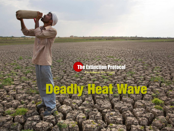
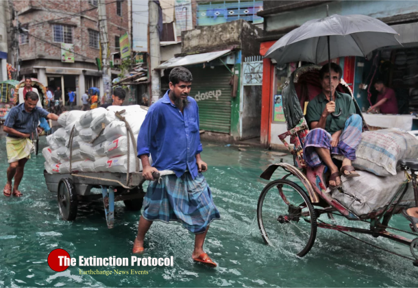
        Already home to some of the most environmentally vulnerable populations on the planet, Africa looks to increasingly feel the sting of climate change through more frequent, widespread and intense heat waves.
        Extreme heat that would be considered unusual today could become a yearly occurrence there by mid-century, one new study suggests, and the trend will emerge earlier there — and in the rest of the tropics — before it does in more temperate areas, another finds.
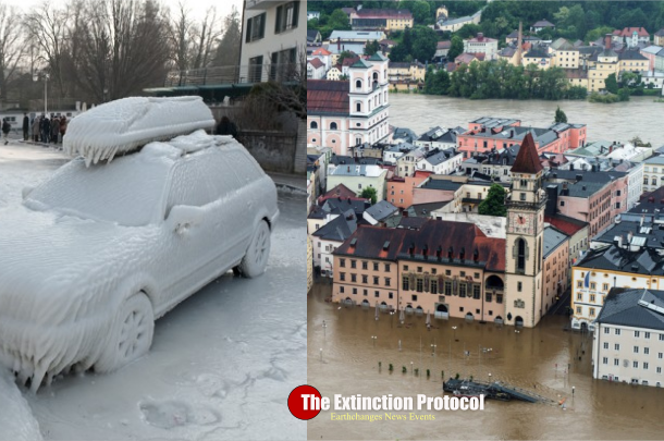
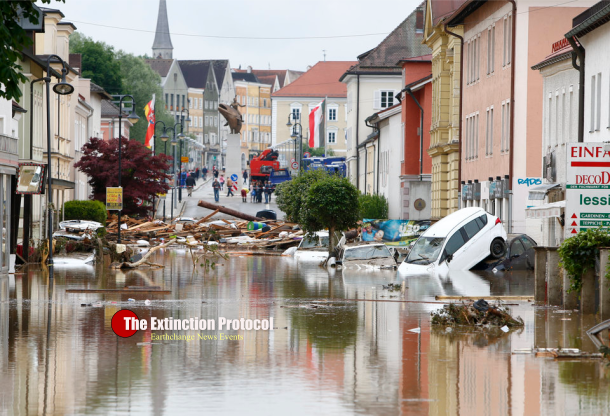
        The studies, both detailed this month in the journal Environmental Research Letters, emphasize the undue burden that some of the poorest populations on the planet — often those that have contributed least to global warming — will face from climate change, the authors say.
        “They don’t have the capacity to respond to such heat waves,” lacking the kind of warning systems and regular access to health care that help those in wealthier countries cope, said Jana Sillman, a co-author of the first study, and a climate researcher at the Center for International Climate and Environmental Research in Norway.
        An increase in extreme heat is one of the clearest implications of the overall warming that has resulted from decades of unabated emissions of carbon dioxide and other heat-trapping greenhouse gases. Warming has been shown to increase the odds of such extreme events already today, and heat waves are expected to become increasingly intense and frequent at all regions across the planet as temperatures continue to rise.

        Greenland’s Melt Season Started Nearly Two Months Early

        Link


        Warm, wet conditions rapidly kicked off the melt season this weekend, more than a month-and-a-half ahead of schedule. It has easily set a record for earliest melt season onset, and marks the first time it’s begun in April.
        Little to no melt through winter is the norm as sub-zero temperatures keep Greenland’s massive ice sheet, well, on ice. Warm weather usually kicks off the melt season in late May or early June, but this year is a bit different.
        Record warm temperatures coupled with heavy rain mostly sparked 12 percent of the ice sheet to go into meltdown mode (hat tip to Climate Home's Megan Darby). Almost all the melt is currently centered around southwest Greenland. 

        Sea ice update

        Link

        Preliminary data from the NSIDC indicates that the average May 2016 Arctic sea ice extent was the lowest extent in the satellite record going back to 1979. It was also over 1 million sq/km below that of May 2012. (2012 was the year with the lowest, minimum sea ice extent in the Arctic in the satellite era).

        This year's sea ice extent decline in the Arctic was running anywhere from two to four weeks ahead of 2012.
        In addition to May, the months of January, February and April 2016 also set new monthly record low sea ice extents in the Arctic

        Severe weather Friday and Saturday

        Link

        Severe storms will hit the Upper Midwest Friday then the eastern Ohio Valley Saturday. The storms will produce damaging winds and a few tornadoes. I think Saturday will be the nasty day for severe weather. Also, storms around Chicago this evening could be severe as well.

        The heat will build into the Plains today and peak Friday and Saturday. The combination of high humidity and high heat will make it feel like it's over 100 degrees. In some areas, the heat will be dangerous for outdoor activities.

        2015 Brought Warmest, Wettest December on Record in U.S.

        Link

        December 2015 was both the warmest and wettest December on record in the contiguous United States, according to a report released Thursday by NOAA's National Centers for Environmental Information. The month capped a year in which every state in the Lower 48 was warmer than average.
        The December mean temperature over the contiguous U.S. of 38.6 degrees Fahrenheit topped the previous record warm December of 37.7 degrees set in 1939, according to NOAA/NCEI's State of the Climate report. December 2015 was 6 degrees warmer than the 20th-century average. Temperature records for the Lower 48 as a whole date back to 1895.
        Twenty-nine states, including every state east of the Mississippi River, set record warm Decembers. Only the West featured near-average December temperatures. No state had a cooler-than-average December.
        States With Record & Near-Record Warm Decembers

        Hurricane Pali Recap, Earliest Central Pacific Hurricane on Record

        Link

        Pali became the earliest hurricane on record in the central Pacific Ocean on Jan. 11, 2016, later dissipating as a tropical system on Jan. 14. In addition to being a rare January hurricane, Pali also took a peculiar track close to the equator. close to the equator for a tropical cyclone.

        Pali defied odds, strengthening to a Category 2 hurricane for a time, all while moving in an unusual southward direction across the low latitudes. Around the time of Pali's peak intensity on Jan. 12, the hurricane even displayed a fairly well-defined eye on satellite imagery.
        The previous record for the earliest hurricane in the central Pacific was Hurricane Ekeka which reached hurricane status on January 30, 1992.
        Dating to 1949, only two tropical storms had formed in the central Pacific in the month of January prior to Pali. Tropical Storm Winona was the first on Jan. 13, 1989, and the second was Ekeka on Jan. 28, 1992. Ekeka reached Category 3 hurricane intensity amidst the moderate El Niño of 1991-92.

        Thursday, June 9, 2016

        Colin Heads out Sea After Drenching Florida With Rain


        Tropical Weather
        Colin headed out to sea Tuesday after dumping as much as 9 inches of rain on parts of Florida, forcing at least one city to pump partially treated sewage into the Gulf of Mexico ocean because the system was overloaded with rainwater.
        Colin flooded roads and caused thousands of power outages in Florida and a team investigated a possible tornado related to the storm that damaged homes and toppled trees in Jacksonville. The city of St. Petersburg said it was pumping sewage into Tampa Bay because its sewer system has been overloaded with rainwater infiltrating leaky sewer pipes.
        The U.S. Hurricane Center said Colin, which formed Sunday, was the earliest a third named storm had developed during the Atlantic hurricane season, which officially began June 1.
        In Dare County, North Carolina, which includes pencil-thin territories from Kitty Hawk down to Hatteras Island, Emergency Management Director Drew Pearson said rain had been falling nearly continuously since Tropical Storm Bonnie, which formed May 28. So far, there had been no major flooding.

        Storms likely as steamy air mass approaches

        Sunset in the Country

        Temperatures ranged as much as 21 degrees across the metro area Wednesday afternoon. While readings approached 80 degrees over the far southwest suburbs, lakefront temperatures dipped to around 60 as a lake breeze pushed onshore. Meanwhile, residents of the Plains experienced 90-degree heat, and rising humidity. The transition zone between these air masses will be a breeding ground for thunderstorm clusters. Storms are expected to focus on Chicago Thursday and Thursday night, bringing a threat of heavy rainfall to the city, and points north. The season’s hottest air to date is then forecast to sweep into the region.

        Here Comes Summer Heat


        Our first heat wave of the summer is upon us. Temperatures are expected to reach to near 90 degrees Thursday, and then soar into the 90s Friday and Saturday. Although 90 degree heat is considered typical summer weather in many parts of the country, it is rare enough around here to be thought of as extreme by many people, even though it happens virtually every summer.
        Most of our hot weather typically happens in July and August. In June, the average number of 90 degree days is just one and a half. Last year, there was one 90 degree day during June. In both 2014 and 2013, June passed by without any 90 degree weather. In 2012, there were two such days. Historically, many June months have gone by without any 90 degree weather but the average is skewed upward by the occasional summer with a June heat wave. The record number of 90 degree days in June is 13 days set in 1988. The record for a summer is 39, also set in 1988.
        The Northern Plains region is not known for its hot weather.  Cool breezes from central Canada often keep the heat from building in for more than the occasional hot day. However, we are located in the center of the North American continent and are entirely land locked, unaffected by cool ocean waters, and so our weather is prone to go to extremes. There are no solid barriers keeping all the hot weather in the south. So when it gets hot, it can get very hot.