South Carolina Flooding Will Continue For Days as Drier Pattern Sets In
South Carolina's record-smashing rain event has ended, but rivers will take days to return to their banks.
Dr. Matt Sitkowski, coordinating weather producer for The Weather Channel, calculated before the event that if 10 inches of rain fell over the entire Palmetto State, that would equate to 5.5 trillion gallons of water. This is about 17,500 gallons of water for every American, or enough to fill the world's largest swimming pool 84,242 times over.
Peak rainfall totals from Carolinas historic rain event through Oct. 5, 2015. (National Weather Service, CoCoRaHS)
Now all that water is draining downstream.
South Carolina's elevation varies. The Blue Ridge Mountains touch South Carolina's far northwest, with elevations up to 3,560 feet.
The state's rolling Midlands, the transition between the relatively more rugged Upstate and the Lowcountry, contributed to the destructive power of the flash floods.
There is only a 272 foot elevation difference between Columbia – the state's capital in the Midlands – and Charleston on the Atlantic coast.
Major rivers draining the South Carolina coastal plain in the area of heaviest rain.
This gentle elevation change from the Midlands to the coast, the prolific rainfall and slowly falling tide levels mean some rivers will remain in flood for days, and some will be rising as the tremendous volume of water moves downstream into the Lowcountry.
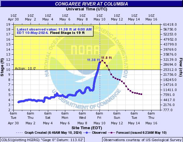
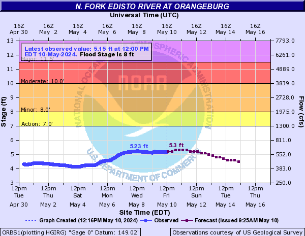
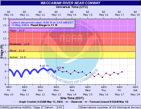
The following forecast graphics are updated regularly by National Weather Service forecast offices. Minor (orange), moderate (red) and major (purple) flood stages are denoted on each graph. Some graphs also have the current or previous record stages labeled, as well.
Congaree River at Columbia, South Carolina
- Crested at 31.81 feet on Oct. 4; highest crest since April 8, 1936, seventh highest on record
North Fork Edisto River at Orangeburg, South Carolina
- Crested at 13.64 feet on Oct. 5; highest crest since Sep. 18, 1945, third highest on record
Waccamaw River near Conway, South Carolina
- Crest is the highest, there, since just after Hurricane Floyd (Sep. 27, 1999).
Drier Trend Ahead
No heavy rainfall is in the forecast for the next several days as weak high pressure and drier air settles into the Carolinas.

Rainfall Forecast Through the Weekend
A cold front will slide in Saturday, then weak low pressure will form off the coast of the Carolinas by Sunday.
Thankfully, this weekend setup won't produce anywhere near the prodigious rainfall that fell last weekend.
Rainfall amounts will be light, generally less than one-half inch over the hardest hit areas of the Carolina coastal plains and Lowcountry. This will likely have little to no effect on existing flooding.
http://www.weather.com/storms/severe/news/south-carolina-flood-forecast-oct2015
http://www.weather.com/storms/severe/news/south-carolina-flood-forecast-oct2015


No comments:
Post a Comment