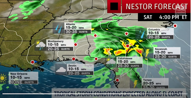
Southeast surface winds will be pulling warm, moist air across Florida ahead of Nestor. This air mass will become increasingly unstable on Saturday.
There is some uncertainty over how far north the most unstable air will get. This will largely dictate the northward extent of the most intense thunderstorms.
There will be at least some potential for waterspouts or tornadoes on Sunday along the North Carolina coast and Outer Banks as whatever is left of Nestor races northeastward through the region.
Nestor may produce significant surge along Florida's Gulf Coast. However, the storm's rapid motion will reduce the threat of inland flooding from heavy rain.

No comments:
Post a Comment