Showing posts with label Emily Richards. Show all posts

Wednesday, November 26, 2014

Risk from extreme weather set to rise


The Royal Society warns that the risk of heatwaves to an ageing population will rise about ten-fold by 2090 if greenhouse gases continue to rise.
They estimate the risk to individuals from floods will rise more than four-fold and the drought risk will treble.
The report’s lead author Prof Georgina Mace said: “This problem is not just about to come… it’s here already."
She told BBC News: "We have to get the mindset that with climate change and population increase we are living in an ever-changing world – and we need much better planning if we hope to cope."
The report says governments have not grasped the risk of booming populations in coastal cities as sea level rises and extreme events become more severe.

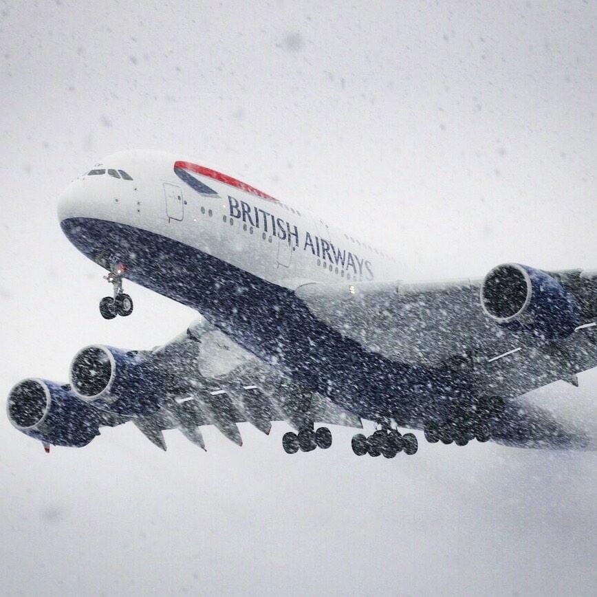
UK faces SNOWSTORMS and plunging temperatures as ARCTIC December hits


A dramatic swing in the position of the jet stream threatens to send temperatures in parts Britain plummeting to an unprecedented levels by the end of NEXT WEEK.
Even the Met Office, which has so far distanced itself from the growing body of severe predictions, now agrees there could be “very cold spells” this winter.
A set of freak circumstances will collide to trigger a perfect storm of conditions capable of sparking a near NATIONWIDE whiteout.
The phenomenon, which also fuelled last week’s chaotic scenes in the United States, threatens to throw Britain into months of winter misery.

http://www.express.co.uk/news/nature/540052/UK-weather-December-forecast-heavy-snow-winter-freeze

October 2014 Global Weather Extremes - U.S

October was globally the warmest such on record according to NOAA
It was the 4th warmest October on record for the contiguous U.S. with an average temperature of 57.1°F (13.9°C), some 3.0°F (1.7°C) above the long-term average and the first month since July 2013 that no single state reported an average temperature in the below-average category (bottom third of the historical record). The warmth was most pronounced along the Pacific Coast where Seattle, Portland, and many sites in California had their warmest October on record (San Francisco had its 3rd warmest October since records began 140 years ago at the downtown location).

http://www.wunderground.com/blog/weatherhistorian/comment.html?entrynum=316#commenttop

Extreme Weather Caused By Global Warming Could Become Normal


“Today’s report confirms what scientists have been saying – past emissions have set an unavoidable course to warming over the next two decades, which will affect the world’s poorest and most vulnerable people the most,” said Jim Yong Kim, President of the World Bank Group.  “We’re already seeing record-breaking temperatures occurring more frequently, rainfall increasing in intensity in some places, and drought-prone regions like the Mediterranean becoming drier.
Extreme heat is the biggest problem, the report found, because it can reduce crop yields, negatively impacting food security and future economic growth as well as economic development, social stability and well-being.
“These changes make it more difficult to reduce poverty and put in jeopardy the livelihoods of millions of people,” Kim said. “They also have serious consequences for development budgets, and for institutions like the World Bank Group, where our investments, support and advice must now also build resilience and help affected populations adapt.”

Massive Glacial Boulder Unearthed at Construction Site


About 30 feet below the surface, construction workers in Everett, Washington, made an enormous find that harkens back to times of much colder weather.
While using an excavator on Nov. 13 at the site of a new Courtyard by Marriott hotel, construction workers made contact with something solid, the Daily Herald reported. After geotechnical engineers were able to analyze the object, they concluded that it was a glacial rock weighing some 300,000 pounds and roughly the size of an SUV, the report added.
The huge boulder, known as a glacial erratic, could be as old as two million years, though scientists would need to study the rock closer to get a better estimate for its age, the Daily Herald also said.

At Least Five Tornadoes Confirmed in South Recently

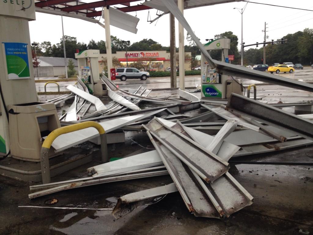
At least five tornadoes have been confirmed after a round of severe weather moved through the Deep South Sunday night into Monday, and at least one of these storms caused serious damage to structures in the Florida Panhandle.
"A powerful jet stream, relatively warm, humid air and low-level wind shear ahead of a cold front combined to spawn supercell thunderstorms, a few of which spun up tornadoes in the Deep South," said weather.com senior meteorologist Jon Erdman. "November is notorious for tornadoes in the Deep South."
The severe weather comes on a day when the Ohio Valley pauses to mark one year since a tornado outbreak scarred parts of Illinois, Kentucky, Indiana and Ohio, spawning several violent tornadoes on a Sunday afternoon.


http://www.weather.com/storms/tornado/news/severe-weather-deep-south-latest-news-20141117

Coldest Thanksgiving in Chicago area in 58 years


With the southern edge of cold Arctic high pressure nosing into the Midwest and western Great Lakes, Thursday may well turn out to be Chicago's coldest Thanksgiving Day since 1956 when the high was 25.
http://www.chicagotribune.com/news/weather/

Florida's Risk For Sea Level Rise - Illuminated in Photo by NASA


NASA's Earth Observatory just released an awe-inspiring photo (in the slideshow above) that shows just why so many Floridians are at risk to tropical cyclones and global sea level rise.
The photo, taken by astronauts aboard the International Space Station (ISS) in October 2014, shows Florida's peninsula illuminated at night. As NASA notes, the brightest areas in the photo indicate the most populous areas in the state. Notably, the Miami-Fort Lauderdale metro area, home to 5.6 million people, is the most noticeable blip on the landscape, lighting up the entire southeastern coast of Florida a brilliant white.
Global sea level rise is another risk to the millions along Florida's coast. Since 1880, sea levels along the Florida coast have risen by nearly a foot, and are projected to rise another 3 to 6 feet by the end of the century due to climate change. So great is the concern for sea level rise in the coastal areas of South Florida, where some areas are currently just five feet above sea level, that local politicians in South Miami, Florida, recently proposed splitting Florida into two separate states, North and South Florida, in order to better sort out sea level rise implications.

http://www.wunderground.com/news/nasa-photo-florida-coast-night-20141119

Buffalo Lake-Effect Snowband Looked Like a Haboob


An impressive band of lake-effect snow off Lake Erie hammered parts of western New York Monday into Tuesday, leaving parts of the Buffalo metro area with several feet of snow.
A haboob is a massive dust storm caused by strong winds, typically flowing outward from thunderstorms. This is typically seen several times each summer in the Desert Southwest, but was also more recently seen with an arctic front diving down the High Plains of the U.S. on Veterans Day 2014.
Of course, there are many differences between this lake-effect snowband and a haboob.
The two phenomena occur at different times of year in different regions of the country with different precipitation regimes (heavy snow falling vs. mainly dry outflow winds kicking up dust from the ground).
Also, a lake-effect snowband can remain parked for a time while a haboob typically races quickly thanks to outflow winds propagating away from their parent thunderstorms, or a fast-moving arctic front in the Veterans Day case, kicking up the dust cloud.


http://www.wunderground.com/news/buffalo-lake-effect-snowband-resembles-haboob-20141118

Record-Breaking November Arctic Cold, Round Two


A second push of bitterly cold air has blasted its way south and east, bringing extremely cold temperatures for millions of Americans who have already endured nearly a week of January-like chill. There have been more than 350 record lows and record cool highs set, covering 42 states, since Sunday.
On Wednesday morning record lows were broken or tied from New York to New Orleans and more record lows and record cool high temperatures are possible.
With blocking high pressure aloft over eastern Alaska and northwest Canada, a direct pipeline of cold air will come from Siberia to near the North Pole, then southward into Canada and the U.S., particularly the Plains and Midwest. While not nearly as cold in magnitude, the arctic surges will also sweep into parts of the East.
This is a classic Arctic outbreak pattern that will remain largely locked in over these areas this week. 


http://www.wunderground.com/news/arctic-cold-outbreak-november-locked-20141110

High Winds Cause Damage from Kentucky to Canada


Thousands of people in Michigan woke up without power Tuesday morning after a vicious wind storm raked a large swath of the U.S. and eastern Canada Monday.
Strong low pressure over the Midwest was responsible for the winds, which gusted over 60 mph in some cases. At least three people were hurt during the storm and thousands of flights were delayed or canceled.
Outages also hit parts of Canada hard, with some 140,000 customers lacking electricity Monday evening. About 78,000 of those were in Ontario, with the rest in Quebec.

Winter Storm Cato

Winter Storm Cato is moving up the Eastern U.S., dumping a wintry mix of snow and rain as it pushes into highly populated areas of the Eastern Seaboard. Tens of thousands are without power, and countless accidents have slowed travel for drivers on the day before Thanksgiving.
Over a foot of snow has already fallen in parts of the Mid-Atlantic region, and Cato could dump more than a foot in parts of New England later today. All that wintry precipitation is making for slick, treacherous roads for the estimated 41.3 million people traveling via vehicle today. 
As for air travel, there were already more than 1,200 cancellations and 450 delays at airports across the U.S.as of 11 a.m. Wednesday, according to FlightAware. Those numbers will likely continue to jump as Cato moves into high air traffic areas like New York and Boston.

http://www.weather.com/safety/winter/news/winter-storm-cato-news-and-impacts

Snowstorm Continues to Slam New England

A storm with rain and heavy snow is stretching across the East Coast, continuing to cause delays for Thanksgiving travelers.
The heaviest snow will continue through Maine and interior New England through the night.
The most recent update from Accuweather: 9:25 p.m. EST Wednesday: More than 89,000 customers are without power across Maine, including 79,000 Central Maine Power customers.

Wednesday, October 15, 2014

Severe Weather in South


A severe weather outbreak, including at least two dozen tornadoes, swept through the South over a span of several days.
The outbreak began Sunday evening as storms broke out across parts of Oklahoma and Texas. One home lost part of its roof in Elmer, Oklahoma, and wind gusts of 75 to 80 mph were reported in southwestern parts of that state.
Monday, destructive storms turned deadly in Little River County, Arkansas, with one home destroyed and several vehicles flipped. One man died in the EF2 tornado that hit the county, and a second woman was killed later Monday in Alabama.

In Preparation for 2014-2015 Winter Storms...

In an effort to increase awareness and enhance communication of disruptive, impactful winter storms, The Weather Channel named winter storms starting in the 2012-2013 season. We are using a new list of names, shown above, for the 2014-2015 season. (Note: The "W" name is up to you, our fans. Vote now to help us pick.)
In 2012-2013, there were 27 named winter storms spanning over five months beginning with the post-Sandy Winter Storm Athena in early November and ending with Winter Storm Achilles in early May.
In 2013-2014, there were 26 named winter storms beginning in early October with historic High Plains Winter Storm Atlas and ending with a mid-May Rockies snowstorm, Winter Storm Zephyr.
Not every winter weather system will receive a name. The Weather Channel has specific criteria in place to determine when we name a particular winter storm. Our two main criteria for naming a winter storm are:
  • It is forecast to produce conditions that meet the National Weather Service winter-weather warning threshold(s) over a main population center or multiple states, beginning generally within 48 hours.
  • It is forecast to produce winter weather conditions that would be historic, especially unusual, or memorable, beginning generally within 48 hours.

Weather-Prone Health Risks City Dwellers Face

Heat Waves and Cold Fronts

During the infamous 1995 Chicago heat wave, 750 city residents died, again, mostly elderly individuals in the heart of urban areas.
Besides social isolation, the other main issue is a lack of air conditioning among lower income, sometimes elderly residents. After all, AC is one of the top factors that prevents heat deaths, Dr. Breysse said. "The elderly in particular are susceptible to the impact of either very cold or very hot waves," he emphasized.

Air Pollution

Outdoor air pollution — whether it's the particulate matter spewing from factories, cars and aerosols, or ozone smog, which gets worse on hot, humid days — can harm those with respiratory conditions, heart disease and allergies.
It can hurt skin, sleep and even damage concentration in children. It's also worse for those living closest to major roads and factories. Outdoor air pollution's affect on cancer is so pronounced, the World Health Organization officially labeled it a carcinogen. (To see the country's worst cities for air pollution, click through the slideshow above.)
Indoor air pollution in cities is still the deadlier global threat, however. It kills between 3.5 and 4.3 million people worldwide every year, primarily because of burning fuels and cooking fires, according to a study in The Lancet Respiratory Medicine. "Urban poor people in Africa often bring a simple cooking stove indoors to keep their sleeping area warm at night," researchers wrote.

Sewage and Cities

When heavy rains hit cities, municipal sewer systems are often overwhelmed, dumping a mix of storm water and untreated sewage into nearby waterways.
It's a nationwide problem — an estimated 775 communities in the United States have sewer systems constructed this way, with combined sewage and storm water pipes, including New York City and Chicago. Combined sewer overflows, as these events are known, can have far-reaching impacts. For example, CSO outfalls are "the single largest source of pathogens to the New York Harbor system," according to the New York Department of Environmental Protection," Newsweek recently reported.
Sewer overflows in cities create environmental problems as well, such as toxic algae blooms (shown above), one reason why the Environmental Protection Agency is currently regulating municipalities to ensure an overhaul of city sewer systems.

Hurricane Gonzolo


A hurricane warning has been posted for Bermuda as it braces for major Hurricane Gonzalo, which earlier became the firstCategory 4 hurricane in the Atlantic Basin since Hurricane Ophelia in October 2011.
Hurricane Gonzalo is now a Category 3 hurricane, though it is only slightly weaker than its peak intensity. It has made the anticipated right turn, now moving due north, and will make a perilously close pass to Bermuda Friday.
Hurricane Gonzalo is near its peak intensity now. Gonzalo has experienced an eyewall replacement cycle, a process during which an outer ring of convection chokes off the existing eyewall, eventually collapsing inward and replacing it. With that process apparently complete and Gonzalo moving over warm water in a low-shear environment, Gonzalo is expected to generally hold on to its intensity through Thursday with only minor fluctuations.
Gonzalo is moving north and will eventually curl northeastward thanks to a southward dip in the jet stream coming off the eastern U.S. 
Unfortunately, this puts Bermuda, once again, in the potential crosshairs of a tropical cyclone for the second time this week.

Tuesday, October 7, 2014

Is the recent sunny and warm stretch an ''Indian Summer''?


October has been on quite the sunny and warm kick. Four of the first six days in the 70s, with a 75 and record-tying 78 on the board already when average highs are in the mid 60s. None of the days the first week have been considered officially "cloudy" and there's been nary a drop in the rain bucket. 

For many, these nice stretches in the early stages of autumn are colloquially known as an "Indian Summer." But is there any sort of official definition to make it qualify?

Their definition of Indian summer is a period of at least 70 degree weather for 7 days or more after the autumnal equinox. 

Our current streak is four days through Monday and touching 70 is a possibility the next three days. 

If you're wondering how it got the term "Indian Summer", there doesn't seem to be a consensus over its origin. The Farmer's Almanac presents two possibilities: One: Early American settlers mistook the sight of sunrays through the autumn haze as Native American campfires -- not sure I buy that one. The second is that Native Americans recognized the pattern as time to gather for winter. 

http://www.komonews.com/weather/blogs/scott/Is-the-recent-sunny-and-warm-stretch-an-Indian-Summer-278417211.html

Typhoon Phanfone Slams Japan, Tokyo With Heavy Rain, High Winds


Typhoon Phanfone whipped through the Tokyo metropolitan area late Sunday into early Monday, and soon after was declared a post-tropical cyclone by the U.S. Joint Typhoon Warning Center.
The typhoon's effects proved deadly. One U.S. airman was been found dead and two others were missing after waves caused by Typhoon Phanfone swept them away in Okinawa, according to a U.S. military official.
At one point on Saturday, the U.S. military's Joint Typhoon Warning Center analyzed 150 mph winds within Phanfone, designating it super typhoon.
The Japan Meteorological Agency, the official regional center for tropical cyclone forecasts in the western North Pacific, indicated 10-minute sustained winds as high as 110 mph within Phanfone Saturday. JMA's 10-minute wind speeds are usually lower than the 1-minute wind standard used by the U.S.
Phanfone strengthened from a Category 1 equivalent typhoon (75 mph estimated max winds) early on the evening of October 1, local time (Japan is 13 hours ahead of U.S. EDT) to a Category 4 equivalent typhoon (130 mph estimated max winds) just 24 hours later, a jump of 55 mph (or 50 knots) in 24 hours. 

Tropical Depression Simon: Another Southwest Flood Threat


Tropical Depression Simon continues to slowly spin down after earlier becoming the eighth major hurricane and sixth Category 4 hurricane of the 2014 Eastern Pacific hurricane season.

Simon continues to churn northeastward less than 100 miles off the central Baja California coast. It will continue to lose strength over colder water, likely becoming a remnant low before it ever makes landfall Tuesday night or early Wednesday.

Large swells, high surf and rip currents will continue along the Baja coast, as well as some beaches of Southern California (for at least the third time this season) through Tuesday before subsiding.

First, heavy rainfall will spread into the central and northern Baja peninsula, then into northwest Mexico's Sonora state. Rainfall amounts of 3 to 6 inches may trigger flash flooding and mudslides.
Moisture from Simon, as well as lift from its leftover mid-level circulation, will spread clusters of slow-moving thunderstorms into parts of Arizona, New Mexico and Colorado from late Tuesday through Friday.