Showing posts with label Mariah Divis. Show all posts

Wednesday, October 28, 2015

Olaf Weakening After Bringing High Surf to Hawaii

Olaf Weakening After Bringing High Surf to Hawaii

Olaf has weakened to a tropical storm over a thousand miles east-northeast of Hawaii. The former hurricane brought high surf to Hawaii the last few days, but that is now subsiding.

Here is the latest on Olaf:
  • Olaf is located more than 1,000 miles east-northeast of the Big Island of Hawaii.
  • Olaf is moving to the east-northeast and will continue to weaken, becoming a remnant low soon.
  • This storm is not a direct threat to Hawaii or any other land areas.
  • However, high surf generated by Olaf has affected the Hawaiian Islands the last few days, but has now subsided.
  • Last Monday morning, Oct. 19, Olaf strengthened into a major hurricane (Category 3 or stronger), and by Monday afternoon had rapidly intensified to a Category 4 hurricane. Olaf remained a Category 4 until early Wednesday morning, Oct. 21, when it was downgraded to a strong Category 3 hurricane.
  • According to the National Hurricane Center, Olaf was the farthest south forming major hurricane on record in the eastern Pacific basin. Reliable records in that basin began in 1971.
  • Hurricane specialist Eric Blake from the National Hurricane Center says Olaf was the first tropical cyclone on record to track from the eastern Pacific basin (east of 140 degrees W longitude) to the central Pacific basin (west of 140 degrees W longitude), then back to the eastern Pacific basin again.

Latest Storm Status and Satellite Image

   Forecast Path, Intensity


Original Article: http://www.wunderground.com/news/tropical-depression-nineteen-e-tropical-storm-hurricane-olaf-eastern-pacific

Persian Gulf could experience deadly heat

Detailed climate simulation shows a threshold of survivability could be crossed without mitigation measures


The research reveals details of a business-as-usual scenario for greenhouse gas emissions, but also shows that curbing emissions could forestall these deadly temperature extremes.

The study, published in the journal Nature Climate Change, was carried out by Elfatih Eltahir, a professor of civil and environmental engineering at MIT, and Jeremy Pal PhD '01 at Loyola Marymount University. They conclude that conditions in the Persian Gulf region, including its shallow water and intense sun, make it "a specific regional hotspot where climate change, in absence of significant mitigation, is likely to severely impact human habitability in the future."

That tipping point involves a measurement called the "wet-bulb temperature" that combines temperature and humidity, reflecting conditions the human body could maintain without artificial cooling. That threshold for survival for more than six unprotected hours is 35 degrees Celsius, or about 95 degrees Fahrenheit, according to recently published research. (The equivalent number in the National Weather Service's more commonly used "heat index" would be about 165 F.) This limit was almost reached this summer, at the end of an extreme, weeklong heat wave in the region: On July 31, the wet-bulb temperature in Bandahr Mashrahr, Iran, hit 34.6 C -- just a fraction below the threshold, for an hour or less.

But the severe danger to human health and life occurs when such temperatures are sustained for several hours, Eltahir says -- which the models show would occur several times in a 30-year period toward the end of the century under the business-as-usual scenario used as a benchmark by the Intergovernmental Panel on Climate Change. The Persian Gulf region is especially vulnerable, the researchers say, because of a combination of low elevations, clear sky, water body that increases heat absorption, and the shallowness of the Persian Gulf itself, which produces high water temperatures that lead to strong evaporation and very high humidity.

While the other side of the Arabian Peninsula, adjacent to the Red Sea, would see less extreme heat, the projections show that dangerous extremes are also likely there, reaching wet-bulb temperatures of 32 to 34 C. This could be a particular concern, the authors note, because the annual Hajj, or annual Islamic pilgrimage to Mecca -- when as many as 2 million pilgrims take part in rituals that include standing outdoors for a full day of prayer -- sometimes occurs during these hot months.

Original Article: http://www.sciencedaily.com/releases/2015/10/151026174106.htm

Tropical Update

Tropical Update: Atlantic, Pacific Quiet; Watching Indian Ocean


  • There are still three invests in the Indian Ocean, at least one of which, in the Arabian Sea, is likely to further organize & strengthen and could eventually head toward land by this weekend or early next week.
  • The tropics have quieted down elsewhere.

INDIAN OCEAN

Land is in play in the path of invests 93B (near Sri Lanka) and 92S (near northern Madagascar) for moisture/rainfall, but neither system is expected to further organize/strengthen much. Whereas, models are adamant that Invest 94A in the central Arabian Sea will crank up. While details of landfall location, should one occur, are uncertain as is always the case so far in advance, all indications are a track in the direction of land.  

ATLANTIC

There are no active areas of interest in the Atlantic basin at this time.

PACIFIC

Olaf has weakened to a remnant low. High surf is subsiding in Hawaii.
Eastern Pacific Basin Satellite Image

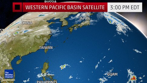
Western Pacific Basin Satellite Image
Original Article: http://www.weather.com/storms/hurricane/news/tropical-update-atlantic-pacific-hurricane-season

Intensifying Storm to Bring Strong Winds, Heavy Rain and Some Snow to Midwest, East

Intensifying Storm to Bring Strong Winds, Heavy Rain and Some Snow to Midwest, East

An intensifying area of low pressure is delivering a trifecta of inclement weather to portions of the Midwest and East through Thursday. Those impacts include strong winds, soaking rainfall that will contribute to commuting hassles, and even a little snow. Strong winds from the storm system have already caused scattered power outages in several states, including parts of western Pennsylvania, southwest New York and Virginia. 

The main threat of strong winds will be Wednesday and Thursday from two different sources. First, bands of rain and thunderstorms may produce strong wind gusts ahead of a cold front from the Appalachians to much of the Eastern Seaboard from the Carolinas to southern New England. The strong wind gusts over 50 mph may lead to some power outages and downed trees and limbs Wednesday afternoon into Wednesday night. In addition, the pressure gradient around the large-scale low pressure system pivoting into eastern Canada will produce strong winds over a larger area of the Plains, Midwest and Great Lakes Wednesday. Those strong winds will persist in the Great Lakes through Thursday. Most locations will see sustained winds of 20 to 30 mph with higher gusts. However, even stronger winds with gusts in excess of 60 mph are possible along the east and southeast shores of Lakes Erie and Ontario. The National Weather Service has posted high wind warnings for those locations. Tree damage, power outages and lakeshore flooding are possible.Wind advisories and high wind warnings have also been issued in parts of Pennsylvania and New England. Wind gusts up to 60 mph in coastal Maine may lead to power outages and downed tree limbs.
Steady rainfall, heavy at times, will continue to spread through the Ohio Valley, Great Lakes, Mid-Atlantic and Northeast into early Thursday. Here's an overview of the forecast timing showing when you can expect travel hassles.
Through Wednesday Night: Most of the Northeast and Mid-Atlantic will be impacted by the rain, which could be heavy at times. This may result in both commuting delays on the roads and at all major airports in the region. Some minor or poor drainage flooding is also possible. The rain may also be accompanied by localized strong wind gusts as mentioned above.
The powerful low-pressure system will allow some colder air to sweep through the Midwest into Thursday. It's not a noteworthy cold air mass for late October, with high temperatures about 5 to 10 degrees below average in most spots across the region. However, the combination of strong winds and chilly temperatures will produce wind chill values in the 10s and 20s across parts of the Upper Midwest and northern Plains Wednesday night and Thursday morning. However, just enough moisture and cold air may combine to bring snow or a rain-snow mix to parts of the Upper Midwest into early Thursday. Any slushy accumulations should be minor, and confined to elevated or grassy surfaces in North Dakota, Minnesota, Wisconsin and the Upper Peninsula of Michigan.
Current Radar

Current Winds

Wednesday's Thunderstorm Forecast

Original Article: http://www.wunderground.com/news/eastern-storm-rain-wind-snow


Halloween Plans May Be Impacted By Wet Weather For Some This Year

Halloween Plans May Be Impacted By Wet Weather For Some This Year

An area of low pressure will bring the return of rain to portions of the southern Plains and Lower Mississippi Valley late this week. Flooding may be a concern by Halloween as well, especially in areas that received very heavy rainfall this past weekend.

Northeast

High pressure is expected to bring dry conditions and near-average temperatures to the Northeast for most of Halloween weekend. Temperatures will reach the 50s for much of the region with 40s in parts of northern New England and 60s toward the Mid-Atlantic states. Clouds will increase and showers will likely develop in interior sections of the Northeast toward evening and for Halloween night. Temperatures will dip into the 30s by Sunday morning in portions of New England with 40s or low 50s for most of the Northeast.

South

The Lower Mississippi Valley, Deep South and northern Gulf Coast will see rain and thunderstorms for Halloween, as a southward dip in the jet stream moves east across the area.
The rain may be locally heavy at times and flooding may be a concern in areas that are already saturated from the rain this past weekend. A few severe thunderstorms cannot be ruled out.
Rain may spread as far east as north Georgia and eastern Tennessee by Saturday evening.
Meanwhile, much of the Southeast coast and Florida will see mainly dry conditions, courtesy of high pressure over the East. Highs will generally be a few degrees within average, ranging from the 80s along the Gulf Coast to the 60s near the Tennessee Valley and the Ozarks.

Midwest

An upper-level disturbance may bring light rain to portions of the Great Lakes, middle Mississippi Valley and Ohio Valley during daylight hours on Halloween. Otherwise, the remainder of the region will see a mix of sun and clouds. Temperatures will top out in the 50s and 60s across the area, with a few locations not reaching 50 degrees in northern Minnesota, northern Wisconsin and the Upper Peninsula of Michigan.

West

The Pacific Northwest will see rain as a plume of moisture ahead of a cold front soaks the region. High-elevation snow and valley rain are also expected in the northern Rockies. Winds will be quite strong ahead of the Pacific frontal system along the Front Range of the Rockies in Montana and Wyoming. Elsewhere, dry conditions are expected. High temperatures will be near to above average in most areas.
Halloween Forecast

Halloween Night Forecast

Original Article: http://www.wunderground.com/news/halloween-forecast-2015

Monday, October 26, 2015

Continued Threat For Gulf Coast

Heavy Rain, Flood Threat Continues For Gulf Coast, Lower Mississippi Valley

  Soaking rainfall is expected to spread east along the Gulf Coast and through other parts of the South into Monday night, potentially causing flooding problems in areas where rain persists the longest. An upper-level low pressure system and an area of low pressure sliding east along the Gulf Coast have combined to deliver the drenching downpours. The surface low pressure system in the Gulf of Mexico formed partially in response to the mid- and upper-level remnants of Hurricane Patricia. Also involved is the leftover moisture from Patricia.
  This setup resulted in flooding along parts of the Texas Gulf Coast, including the Houston metro area, on Saturday. Many roadways and vehicles were reported to be under water around Houston Saturday night. Other parts of Texas have also seen flooding in recent days, with localized rainfall totals of more than one foot. Corsicana, Texas, has already received more than 20 inches of rain since Thursday, causing serious flash flooding. In addition to flooding, a few rotating thunderstorms may spawn brief tornadoes along the Gulf Coast through Monday night.

Rainfall Reports

Forecast: Flood Threat Spreads East:
The heavy rain will continue to spread a bit farther east, into portions of Alabama, Georgia, the central Florida Panhandle, as well as into North and South Carolina and Tennessee. The threat of flooding may be enhanced in southern Alabama, southern Mississippi and the western Florida Panhandle due to a persistent inflow of Gulf moisture. A few severe storms capable of producing damaging wind gusts or isolated tornadoes from southern Alabama into the western and central Florida Panhandle. Strong winds will continue along the immediate Gulf Coast, with gusts topping 30 mph at times on Monday.
Current Winds

Current Radar

Forecast Additional Rainfall 

Original Article: http://www.wunderground.com/news/patricia-gulf-coast-lower-mississippi-valley-flooding


Tuesday, October 20, 2015

Season's First Snow

Season's First Snow From Northern Michigan to Interior Northeast; Coldest Air Mass of Season Continues Into Monday

The coldest air mass of the season so far has swept from the Midwest into parts of the East, with widespread frost and freeze conditions and even the first snow of the season for some. Accumulating snow fell this weekend, especially near the Great Lakes. Flurries were widespread across the Northeast on Sunday.
Chilly Blast Brings Frost and Freeze Condition
Lows dipped to freezing or below (32 degrees) Sunday morning as far south as Tennessee and North Carolina, though not every location in those states saw a freeze. A few spots in the north Georgia mountains also recorded a freeze. Monday morning, lows dipped to freezing or below (32 degrees) once again in parts of Tennessee, North Carolina, north Georgia and upstate South Carolina. Farther north, parts of New England and Upstate New York saw lows in the teens or 20s Monday morning. The typically cold spot of Saranac Lake, New York, had dipped to 10 degrees as of 6 a.m. EDT. Freeze watches, warnings and frost advisories are posted into Monday morning from the Tennessee Valley to North Carolina, the mid-Atlantic, central Appalachians, portions of Long Island and coastal parts of southern New England.
  • Chicago: The suburbs had a freeze Saturday and Sunday morning, while O'Hare fell to 33 degrees. Temperatures stayed in the 50s on Sunday.

Interior Northeast/Northern Great Lakes Snow

Saturday morning, an observer near Darragh, Michigan, measured 5.7 inches of snow.
The city of Marquette picked up 2.5 inches of snow, the first time the city had seen at least two inches of snow in any single October day in 14 years, according to the National Weather Service.
Snow was reported once again in northern Michigan on Sunday morning, and to the southeast of Lake Erie in northwest Pennsylvania and southwest New York. Some higher terrain areas of Erie County and Crawford County, Pennsylvania, had picked up 4-5 inches of snow as of late Sunday morning.
Up to 9 inches of snow was measured in Oswego County, New York, in the towns of Mexico and Parish from a narrow band of lake-effect snow streaming off of Lake Ontario.
Flurries were reported across New England on Sunday afternoon, as well as parts of Pennsylvania and New York, including Long Island. A trace of snow was reported in Albany, New York as well as Bridgeport, Connecticut on Sunday.

Forecast Morning Lows

                                                                          Frost and Freeze Alerts


Original Article: http://www.wunderground.com/news/pattern-change-winter-preview-northeast-western-warmth


Heavy Rain, Flooding Possible For Lower Mississippi Valley, Southern Plains

Heavy Rain, Flooding Possible For Lower Mississippi Valley, Southern Plains

Persistent southeasterly winds will pump moisture from the Gulf of Mexico into the southern High Plains by Wednesday, where it will interact with an area of low pressure forming aloft over the Southwest. This will contribute to heavy rains as far west as eastern New Mexico, western Texas and western Oklahoma by Wednesday night and Thursday.This rain will then spread across the rest of Texas, Oklahoma and possibly parts of Louisiana and Arkansas by Thursday night or Friday. A separate weather disturbance moving through the southern tier of the U.S. will prolong the heavy rain threat into this weekend across those states.In addition, moisture and energy from Tropical Depression Twenty-E in the eastern Pacific could be involved in this setup. Computer forecast models are showing that after it makes landfall in Mexico as a tropical storm or hurricane, the mid-level remnants will get pulled northeastward into the south-central states by a southward dip in the jet stream over the western and central United States.
This rain is needed to help a relatively rapidly-developing flash drought, which set in over the southern Plains and Lower Mississippi Valley from mid-summer on.The heavy rain threat, while squelching the recent wildfires, may be too much of a good thing in these areas, instead triggering flash flooding. It's also possible some of the drought area may see little or no rain at all from this setup.
 A broad area of thunderstorms has been percolating near Mexico's Yucatan Peninsula the last several days. Since this weekend, the National Hurricane Center has been highlighting this area at times for a low chance of development into a tropical depression or storm over the western Caribbean Sea or the southwest Gulf of Mexico.Right now, unfavorable winds aloft are in place across the Gulf of Mexico due to the subtropical branch of the jet stream. This wind shear is a common nemesis of both developing and active tropical cyclones and has played a significant role already with several named storms this hurricane season.
Southwest Upper Low

Rainfall Outlook

Original Article: http://www.wunderground.com/news/southern-plains-gulf-moisture-heavy-rain-oct2015

Tuesday, October 13, 2015

It's October and Fall's Heat Continues in Parts of the West

It's October and Fall's Heat Continues in Parts of the West

September temperatures kept that pace going, as Utah, Colorado and New Mexico registered their warmest September on record. California, Nevada, Arizona and Wyoming all experienced a top 10-warmest September, according to NOAA's recent monthly report.High temperatures will be 10 to 20 degrees above average for most of the West. Areas in southwestern Oregon and northern California may see highs 20 to 25 degrees above average through Friday, rising into the 80s and even lower 90s.

The warmth in the West is courtesy of an area of high pressure aloft over the region, diverting the jet stream into southwestern Canada. Typically, the jet stream will begin to dip farther south allowing cooler temperatures to dive southward during the fall. However, so far this year the cold air has remained over Canada for the most part. This week, the jet stream will become more amplified with the jet stream sliding farther north over western Canada and dipping southward over the eastern U.S. The result will be the record high temperatures in the West while portions of the Midwest and Northeast will see colder conditions and possibly some flakes of snow.Indications are that the warmth in the West will persist through the second half of October. In fact, the Climate Prediction Center is projecting above average temperatures to continue through much of October across the western two-thirds of the United States. Besides the record warm temperatures, another impact of this setup will be the continuation of dry conditions. The ridge of high pressure is associated with sinking air, which favors a relatively dry weather pattern, which in turn could worsen the already severe drought across much of the West and also bring elevated fire danger.There may be hope for changes as an upper-atmospheric area of low pressure is expected to move into the Southwest later this week and a cold front will approach the Northwest by the weekend. This will bring cooler temperatures across the West and rain chances will increase as well.
Possible Record Highs Tuesday in the West

Forecast Highs Next 3 Days 

Original Article: http://www.wunderground.com/news/record-warm-temperatures-west-mid-october

Coldest Air Mass of Season Likely This Weekend; Snow in the Interior Northeast?

Coldest Air Mass of Season Likely This Weekend; Snow in the Interior Northeast?

A shift in the weather pattern across North America may bring the coldest air mass so far this fall to parts of the Midwest and East.
It looks like the colder pattern will develop from the upper-Mississippi Valley to the Great Lakes, Ohio Valley and parts of the Northeast by this weekend. In fact, some locations may see their frost and/or freeze of the season and their coldest morning lows since mid-late April.
The first wave will bring cooler air for midweek, but it's the end of the week and this weekend that may present the coldest air of the season so far. Many cities could see their first official readings in the 30s so far this fall. This would result in the first frost and/or freeze of the season for parts of the Upper Mississippi Valley, Great Lakes, Ohio Valley and interior Northeast.
  • Chicago: First 30s of the season possible this weekend. Highs only in the 50s Friday-Sunday
The upcoming cold shots will be quite a contrast from the near-record to record warmth the region saw in September.  Burlington, Vermont, and Sault Ste. Marie, Michigan, were among the cities that observed their warmest September on record last month.Things can change, but there is growing evidence that, in some locations, the first accumulating snow of the season may be on the horizon. The area we are watching for this potential snowfall includes a swath from the Catskills and Adirondacks of New York to the higher elevations of Vermont, northern New Hampshire and northern Maine.

Think of a see-saw and the jet stream pattern is kind of like that. It is rarely completely flat (west-east) across North America. A ridge on one side, generally featuring warm weather, is usually offset by a trough, or cooler air, on the opposite side. As we move through mid-October, the jet stream will be driven north through western Canada, thanks to a building ridge across the western United States. This means that warm weather continues across the western states and extends down into the south-central states as well. Conversely, the jet stream tilts south with eastward progression. The polar jet stream will penetrate south across eastern Canada, eventually bringing bouts of chilly air into the Upper Great Lakes and Northeast in the coming week. With time, the cooler air will ultimately become cold enough to support some snow in the region, given a supply of adequate moisture.
Temperature anomalies in the middle levels of the atmosphere (deeper blue/orange correspond to colder/warmer than average temperatures) and the jet stream pattern forecast for late this week.

Forecast Morning Lows

Original Article: http://www.wunderground.com/news/pattern-change-winter-preview-northeast-western-warmth

Monday, October 5, 2015

Hurricane Joaquin Moving Away From Bermuda

Hurricane Joaquin Moving Away From Bermuda

Hurricane Joaquin is now moving away from Bermuda, after lashing the archipelago with wind gusts over 60 mph and heavy rainfall on Sunday.
Joaquin is now forecast to head across the open northern Atlantic Ocean while transitioning to a non-tropical low pressure system by Wednesday.
Winds gusted frequently over 50 mph Sunday in Bermuda, with the strongest official wind gust reaching 64 mph at the Bermuda International Airport shortly before 9 p.m. Gusts over 50 mph continued in Bermuda as of early Monday morning.
After Joaquin moves over the open waters of the Atlantic and transitions to a non-tropical low pressure system it may impact Europe with rain and gusty winds. There are differences in the computer forecast models in where it will head, with some bringing it towards the United Kingdom, while others take it in the direction of Portugal and Spain.Joaquin had another bout of intensification early Saturday. Utilizing an instrument for estimating surface winds, the stepped frequency microwave radiometer (SFMR), a Hurricane Hunter reconnaissance mission Saturday estimated surface winds of around 135 knots, or 155 mph just before noon. This was just 2 mph shy of becoming a Category 5 hurricane. By wind speed, Joaquin at that time was the strongest Atlantic hurricane since Hurricane Igor in 2010 also had 155 mph maximum winds. It has been over eight years since the last Category 5 hurricane in the Atlantic basin, Hurricane Felix in 2007.
Flooding from storm surge and torrential rainfall has been documented on Long Island and Acklins, among other central Bahamas locations. A Weather Underground personal weather station at Pitts Town, Crooked Island, reported winds up to 84 mph before it stopped reporting.
Visible Satellite and Bermuda Conditions

Hurricane Joaquin Information

Original Article: http://www.wunderground.com/news/hurricane-joaquin-bahamas-atlantic-east-coast-bermuda-2015

Tidal Onslaught Brings Flooding

Tidal Onslaught Brings Flooding to 7 States, Highest Tide Since Hurricane Hugo in Charleston, South Carolina

    A days-long onslaught of tidal flooding, high surf and beach erosion along the Atlantic coast of the United States will persist through early this week. Strong onshore winds have already brought coastal flooding to oceanfront communities in at least seven East Coast states.Where these winds are blowing onshore, they're piling ocean water into the coastline, resulting in coastal flooding. Those same winds are also whipping up high surf on top of the high water, causing waves to break on sections of beach not typically affected by waves or tides during quiet weather.
    Adding to the high water, swells from Hurricane Joaquin are propagating to parts of the East Coast. Joaquin, itself, will also indirectly chip in to help maintain the stubborn onshore flow as it moves north and northeast in the western Atlantic Ocean.According to the warning bulletins, moderate to major coastal flooding may occur with the Monday evening high tide along the coast of the Delmarva Peninsula and the Virginia Tidewater. This includes the Hampton Roads metropolitan area encompassing Norfolk, Virginia Beach, Portsmouth, Newport News, and other nearby cities in southeastern Virginia.The large breakers and strong rip currents affecting the Atlantic coast now and for the next several days will be exceptionally dangerous for anyone caught in them.

    The setup for this coastal mess is a case of persistence and a blocked atmosphere. Strong surface high pressure is anchored over eastern Canada, as the tangled web of non-tropical surface low pressure near the Southeast coast and Hurricane Joaquin dominate farther south. Strong winds are one major factor in generating large ocean waves. Another is the distance that winds of a similar direction travel over water, known as the "fetch."High pressure aloft over the north Atlantic Ocean, and a reinforcement of high pressure aloft that will push in from eastern Canada, is blocking the normal west-to-east progression of weather systems, forcing low pressure aloft to simply sit and spin, if you will, over the southeastern U.S.

Current Coastal, Offshore Sustained Winds and Gusts

Surface setup for coastal flooding/beach erosion event. Generally higher surface pressure is shaded in blue, lower pressure in red. Position of Hurricane Joaquin is a model forecast for this past weekend, and does not constitute an official forecast position by either the National Hurricane Center or The Weather Channel.

Coastal Flood Alerts

Original Article: http://www.wunderground.com/news/east-coast-coastal-flooding-beach-erosion-high-surf-october-2015

Coastal Carolina Continued Flood Threat

Flood Threat Continues Into Monday Night in Coastal Carolinas, But a Drying Trend is on the Way 

Until that drier air arrives Monday night into Tuesday, a threat of flash flooding will continue in northeast South Carolina and southeast North Carolina, including locations such as Myrtle Beach and Wilmington.
This weekend, severe to catastrophic flash flooding occurred in many locations across South Carolina, including in Charleston and Columbia. Click the link below for more detailed news on the impacts of the catastrophic flooding.
Portions of South Carolina have seen more than 20 inches of rain from this storm, and widespread totals of a foot or more cover much of an area bounded by Interstate 26 on the west, Interstate 20 on the north and the Atlantic Ocean on the south and east.
Charleston International Airport broke its all-time calendar day rainfall record with 11.50 inches on Saturday. The storm-total rainfall (Oct. 1-5) through Monday was 17.32 inches, which makes it the wettest October on record at that location, crushing the old record of 12.11 inches in October 1994. This also ranks as the fourth wettest month on record overall.
Through Monday night, a feed of rich tropical moisture from the Atlantic will continue to unleash heavy rainfall on the coastal Carolinas. This will only aggravate the ongoing catastrophic flooding in parts of South Carolina and southeastern North Carolina. However, by late Monday night or early Tuesday, a drying trend will finally arrive. Dry weather will then persist through much of the week ahead in the hardest hit areas.
Inland Flood Alerts

Monday Night's Forecast

Original Article: http://www.wunderground.com/news/soaking-weather-pattern-east-flooding

Joaquin Enhances Storm Surge Up and Down East Coast

Joaquin Enhances Storm Surge Up and Down East Coast

    Hurricane Joaquin may be passing several hundred miles east of the U.S. East Coast, but coastal affects in part attributable to the storm will be felt up and down the Eastern Seaboard.
    A widespread storm surge, or how high water levels could rise above normal tides, in the range of 1 to 2 feet is expected once again on Sunday from Georgia to Massachusetts, even with the center of Joaquin tracking more than 400 miles east of the Outer Banks of North Carolina.
   Although a player in the water level rise, Joaquin is not the sole reason for coastal flooding concerns. A large area of high pressure over southeastern Canada is causing an increased pressure gradient, or sharp change from high pressure to low pressure, from north to south.Winds rotating clockwise around the high pressure system coupled with counter-clockwise winds around Joaquin and the developing non-tropical low pressure area over the Southeast create a persistent easterly fetch of winds along the East Coast.That scenario results in wind pushing water and waves against the coast. With nowhere for the water to go, it piles up onto beaches and into bays. Water levels should continue to remain above normal through Sunday across much of the Eastern Seaboard, before tides return closer to normal early this upcoming week.
A computer model forecast for water level rises

Coastal Flood Alerts

Original Article: http://www.wunderground.com/news/hurricane-joaquin-storm-surge-georgia-maine-2015