Showing posts with label Natalia Galica. Show all posts

Wednesday, November 4, 2015

Melting ice in west Antarctica could raise seas by three metres, warns study

A key area of ice in west Antarctica may already be unstable enough to cause global sea levels to rise by three metres of ocean rise, scientists said on Monday.
The study follows research published last year, led by Nasa glaciologist Eric Rignot, warning that ice in the Antarctic had gone into a state of irreversible retreat, that the melting was considered “unstoppable” and could raise sea level by 1.2 metres.
This time, researchers at Germany’s Potsdam Institute for Climate Impact Research pointed to the long-term impacts of the crucial Amundsen Sea sector of west Antarctica, which they said “has most likely been destabilized”.
While previous studies “examined the short-term future evolution of this region, here we take the next step and simulate the long-term evolution of the whole west Antarctic ice
sheet,” the authors said in the Proceedings of the National Academy of Sciences.
They used computer models to project the effects of 60 more years of melting at the current rate.
This “would drive the west Antarctic ice sheet past a critical threshold beyond which a complete, long-term disintegration would occur.”
In other words, “the entire marine ice sheet will discharge into the ocean, causing a global sea level rise of about three meters,” the authors wrote.
“If the destabilisation has begun, a three-meter increase in sea level over the next several centuries to millennia may be unavoidable.”
Even just a few decades of ocean warming can unleash a melting spree that lasts for hundreds to thousands of years.
http://www.theguardian.com/world/2015/nov/02/melting-ice-in-west-antarctica-could-raise-seas-by-3m-warns-study

Florida Heat Wave Is Setting November Records

November may have a cold reputation in some places, but much of Florida is sweating through a heat wave that is rewriting the November record books.
This week, the following locations have already set or tied record highs for the month of November:
  • Tampa: 91 degrees on Nov. 4 as of 3 p.m. EDT
  • Daytona Beach: 90 degrees on Nov. 2
  • Gainesville: 91 degrees on Nov. 3 (previous record was set in the Dust Bowl of 1936)
  • Jacksonville: 89 degrees on both Nov. 1 and Nov. 3
  • Tallahassee: 88 degrees Nov. 1, then 89 degrees on Nov. 3; also tied record warmest daily low temperature of 75 degrees on Nov. 2
In Daytona Beach, 90-degree heat is typical from July through mid-August. Early November average highs, there, are in the upper 70s.
In fact, the hottest temperature anywhere in the U.S. on Nov. 3, often found in the Desert Southwest or South Texas this time of year, was at Jacksonville's Naval Air Station, soaring to 93 degrees.
Current Heat Index
Enlarge
Current Heat Index
The heat index combines air temperature with humidity to give an idea of what it feels like to the human body.
    Of course, it's not just the heat, but also the humidity.
    Typically, beginning in late fall, a succession of cold fronts sweeps southeastward through the Sunshine State, clearing out summer's oppressive humidity. 
    So far this month, that certainly hasn't happened.
    http://www.weather.com/forecast/regional/news/florida-record-heat-november-2015

    El Niño Effect on Plankton Could Hurt Food Supply for Fish, and Ultimately Humans

    This year’s El Niño, projected to be a strong one, may leave a lot of fish and seafood lovers hungry. 
    Two new images from October 2014 and 2015  from NASA's Earth Observatory show chlorophyll levels in the Pacific Ocean. The shades of green indicate more chlorophyll, which means there is blooming phytoplankton – a major source of food for fish –  and shades of blue indicate less chlorophyll and less phytoplankton.
    The decrease in phytoplankton between the two years is plain to see, and a cause for concern in terms of marine life. Less plankton means a significant reduction in food supply for small fish, which causes a lack of food for the bigger fish that feed on them.  Humans could ultimately feel the effects through a seafood shortage.
    “Already some of the stocks that have been coming back are showing big declines,” said Laurie Weitkamp, fisheries researcher at NOAA’s Northwest Fisheries Research Center.
    “We won’t know the full impact on salmon or crab for a few years. But I think they are going to do terribly,” said copepod expert Bill Peterson, who is also based at NOAA’s Northwest Fisheries Research Center.
    http://www.weather.com/news/news/el-nino-marine-life-food-supply-disrupted-plankton

    Rare Earthquake Trio Shakes Phoenix: What Happened?

    A rare trio of earthquakes shook central Arizona Sunday (Nov. 1), startling residents in Phoenix event surrounding areas.

    The largest quake was a magnitude-4.1 temblor, which hit at 11:29 p.m. local time. It was preceded by a magnitude-3.2 foreshock at 8:59 p.m. and was followed by a magnitude-4.0 aftershock at 11:49 p.m. Smaller aftershocks may follow, said Ryan Porter, a seismologist at Northern Arizona University.

    Earthquakes are "pretty uncommon for Arizona," Porter told Live Science. "So it's not unexpected, but it's not a very common event.

    This does not mean Arizona is seismically inactive. In fact, geophysicists have recorded hundreds of quakes each year in the state, though most are too small to be felt by humans. Particularly active is the Northern Arizona Seismic Belt in the north central part of the state, which is part of the wider Intermountain Seismic Belt of Nevada, Utah, New Mexico and southeastern California. Central Arizona is seismically quieter, however.

    Researchers haven't yet fully analyzed Sunday's quakes, which occurred between the depths of 3.1 miles and 5.9 miles (5 and 9.5 kilometers), near Black Canyon City.

    http://www.livescience.com/52673-phoenix-earthquakes-explained.html

    Dust Storm Sweeps Through Middle East, Disrupts Travel in Israel and Jordan

    A major dust storm swept through portions of the Middle East on Wednesday, severely obscuring skies and impacting air travel in both Israel and Jordan.
    Photos from Tel Aviv, Israel, and Amman, Jordan, showed the thick dust covering the skies of those two cities. Satellite imagery also showed a mixture of dust and clouds over the region.
    The dust forced a delay of Michelle Obama's trip to Jordan. Obama was on a two-nation visit to the Middle East to promote a girls' education initiative and was set to fly in from Qatar.
    In Israel, travel was disrupted for thousands of people when domestic flights to the resort town of Eilat were cancelled because of the weather, according to Ofer Lefler, a spokesman for the Israel Airports Authority. The Airports Authority web site showed incoming and outgoing flights to Eilat's airport cancelled until the evening.
    The haze shrouded parts of Israel, and the Israeli flag could be seen poking through above the Knesset in Jerusalem. Images in Israeli media showed a few beachgoers seen through the fog on Israel's Mediterranean coast.
    http://www.weather.com/news/news/dust-storm-middle-east-israel-tel-aviv

    Friday, October 23, 2015

    Hurricane Patricia: Mexico awaits 'strongest ever' storm

    The strongest hurricane ever recorded in the Americas is bearing down on Mexico's Pacific coast, threatening a "potentially catastrophic" landfall.
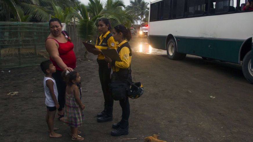
    Mexican authorities have begun evacuating residents ahead of the arrival of Hurricane Patricia.
    The storm is comparable to Typhoon Haiyan, which killed 6,300 people in the Philippines in 2013, the World Meteorological Organization says.
    A state of emergency has been declared in three states in Patricia's path.
    The category five hurricane is expected to make landfall on Friday afternoon or evening, with winds of 325km/h (200mph).
    The US National Hurricane Center said on its website: "Potentially catastrophic Hurricane Patricia moving northward toward landfall in south-western Mexico."
    The centre added that it was the strongest storm it had recorded in the eastern Pacific or the Atlantic.
    http://www.bbc.com/news/world-latin-america-34614864

    Saturday, October 10, 2015

    South Carolina's Catastrophic Floods Caused By One of the Most Prolific Rainfall Events in Modern U.S. History

    The catastrophic floods striking South Carolina will go down in the history books, not only because of the lives they've taken or the destruction they've wrought, but also because of the sheer amount of rainfall. By the time the last raindrop is counted, the October 2015 storm will go down as one of the most prolific rainfall events in the modern history of the United States.
    Rainfall totals from the early October storm have shattered or jeopardized countless records in South Carolina.
    • The official statewide 24-hour rainfall record was exceeded in several locations; an official determination may take months to complete.
    • The unofficial state record for 5-day total rainfall, which had stood for 107 years, has been surpassed at more than a dozen reporting sites.
    • The rainfall exceeded that of any tropical cyclone in South Carolina history.
    • Seven sites with more than 50 years of data achieved their wettest Octobers on record.
    • The October monthly precipitation record for any location in the state has likely been broken.
    Data are still being assimilated into the National Oceanic and Atmospheric Administration's database, but here is how the Carolinas flood disaster stacks up in various categories.
    http://www.weather.com/news/news/south-carolina-historic-flood-rainfall-record-extreme

    Below-Average 2015 Atlantic Hurricane Season Likely, Forecasters Say

    NOAA's Atlantic hurricane season forecast update agrees with earlier forecasts of a season with fewer named storms than historical averages in 2015.
    NOAA, which released its final forecast update of the season Thursday, calls for a 90 percent likelihood of:
    - 6-10 named storms (including three tropical storms that formed earlier in the season: Ana, Bill, and Claudette)
    - 1-4 of which would become hurricanes
    - 0-1 of which would become major hurricanes – those of at least Category 3 strength on the Saffir-Simpson Hurricane Wind Scale.
    This is below the 30-year average of 12 named storms, six hurricanes and three major hurricanes.
    http://www.weather.com/storms/hurricane/news/hurricane-season-forecast-atlantic-2015-noaa-weather-channel-csu

    Tropical Storm Nora to Eventually Become a Hurricane in the Central Pacific Ocean

    • Tropical Depression Eighteen-E was upgraded to Tropical Storm Nora Friday night, about 1,500 miles east-southeast of Hawaii.
    • This new tropical storm will move west-northwest over the next several days.
    • Steady strengthening is expected to a hurricane later this weekend or early next week.
    • Most forecast guidance curls this system toward the north in the Monday/Tuesday timeframe well east of the Hawaiian Islands, however, this isn't guaranteed at this point. 
    • Interests in the Hawaiian Islands should monitor the progress of this new system.

    http://www.weather.com/storms/hurricane/news/tropical-depression-eighteen-e-tropical-storm-hurricane-nora-eastern-pacific

    Historic Rainfall, Flooding Hits the Southeast (PHOTOS)

    Days of heavy rain led to catastrophic flooding that swamped virtually the entire state of South Carolina.
    Some residents were trapped inside their homes as the floodwaters rose, which forced authorities to make hundreds of life-saving rescues. Others were trapped on roadways that were rapidly overtaken by
    raging rivers.
    At least 19 people have been killed by the dangerous floods in North and South Carolina. Officials warn that even though the rain has stopped, river flooding is likely to continue for a few more days as billions of gallons of water meander downstream, toward the coast.
    Throughout the event, we collected the most gripping images from areas affected by flooding, and you can see all of those photos at the top of this page.
    http://www.weather.com/news/weather/news/east-coast-flooding-photos

    Thursday, September 24, 2015

    9 States Set to Lose State Birds to Climate Change

    The results were sobering, as more than 300 species could be affected by the end of the century. “Three-hundred fourteen out of 588 birds that we were able to model are seriously threatened by climate change,” Gary Langham, Audubon’s chief scientist and lead report author, told weather.com of the report last year, after its initial publication. “Unless we take dramatic action, we could lose these birds.”
    NPR's Arun Rath asked Langham about what this means — particularly if you don't care for birds. “We're from Audubon, so, of course, we think that you should care about birds.,” he said on Sept. 13. “But if you don't care about birds, the other reason is as the birds go, so does everything else. This should be a wake-up call for all of us.”
    Although the methodology behind the initial report was criticized by some as faulty, the findings echo separate studies on the status of U.S. birds. Either way, the key is action toward conversation, Langham told weather.com.
    http://www.weather.com/science/nature/news/state-birds-climate-change

    World’s Longest Continental Volcano Chain Discovered In Australia

    The world’s longest continental volcano chain has been discovered in Australia, according to a study recently published in Nature.
    Researchers from Australia National University have plotted a 1,200-mile line of volcanic activity running from Cape Hillsborough in northern Queensland south to Cosgrove in Victoria and even extending on to the island of Tasmania.
    "The track is nearly three times the length of the famous Yellowstone hotspot track on the North American continent," said study coauthor Dr Rhodri Davies in a release from ANU.
    Enlarge

    Pinnacle Rock, located in Eastern Queensland, is visible remnant of the massive chain of volcanoes that once stretched across the continent.  (Mike Griinke)
      According to Davies, a seismology and mathematical geophysics researcher at ANU, some sections of the track were already well known, areas where volcanic activity has created impressive rock formations you can see from miles away.
      But the new research indicates that these areas are part of the larger chain, and the gaps between are simply areas where the Australian continent is too thick to allow the hot rock in mantle plumes to rise close enough to the Earth's surface for it to melt and form magma.
      http://www.weather.com/science/news/longest-volcano-chain-discovered-in-australia

      Climate Change Will Bring More Large Mosquitoes To The Arctic

      An unwelcome guest is making its way to the arctic in record numbers and it could spell problems for local wildlife. According to a new study from Dartmouth College, rising temperatures will cause the mosquito populations in the world’s coldest regions to soon double. Worse yet, those mosquitoes will live longer allowing them to grow bigger than ever before. 
      The study, published earlier this month, claims that a 35.6 degree temperature increase in the arctic will make conditions ripe for the pesky bugs to thrive. The Guardian reports that temperatures in the arctic have been rising at double the global average, a trend that is expected to only get worse in the next century if nothing is done to regulate emissions.
      Enlarge

      A group of female mosquitoes captured in a study by Dartmouth College. (Lauren Culler)
        While they don’t carry the same diseases as mosquitoes in warmer climates, the arctic bugs could still wreak havoc in the tundra. The report says that rising temperatures allow mosquitoes to hatch earlier and develop faster than they usually would. This makes them less susceptible to attacks from predators and more likely to survive to adulthood

        http://www.weather.com/science/nature/news/arctic-climate-change-mosquitoes

        Sunday's Rare Celestial Event: Will Forecast Hamper Your View of Supermoon, Full Moon and Lunar Eclipse?

        Most all of North America, South America and Africa will have a chance to see something truly amazing on Sunday when three celestial events – a full moon, a supermoon, and a lunar eclipse – will coincide for a few hours.
        The majority of the viewing area will see the full eclipse for about an hour, but where you are in the world will determine just how late you need stay awake (or how early you need to get up) to take it all in.
        According to USA Today, the West Coast of the United States and Canada have the best timeframe. Folks in Vancouver and Los Angeles can enjoy the sight over dinner with the full eclipse happening around 7:11 p.m. It will last one hour and 12 minutes.
        Eastern U.S. cities, including New York and Atlanta, will have to wait until 10:11 p.m., and South American cities such as Rio will have to wait a further hour.
        http://www.weather.com/science/news/who-has-best-views-of-supermoon-eclipse

        Wednesday, September 16, 2015

        ​Tsunami warning issued for Hawaii after Chile earthquake

        A powerful earthquake shook Chile's capital Wednesday night, causing buildings to sway and people to take refuge in the streets. Several strong aftershocks hits within minutes as tsunami alarms sounded in the port of Valparaiso and authorities issued a tsunami alert for the country's entire coast.
        The U.S. Geological Survey reported the quake had a preliminary magnitude of 7.9. Chilean authorities recorded it as 7.2.
        U.S. officials said the quake struck just offshore in the Pacific at 7:54 p.m. and was centered about 141 miles north-northwest of Santiago. It said the quake was 4.8 miles below the surface.
        Chile's emergency office warned that big waves caused by the quake could hit the coast by 11 p.m.
        The National Weather Service warning tsunami waves could strike Hawaii around 2:30 a.m. Thursday, local time.
        http://www.cbsnews.com/news/tsunami-warning-issued-for-hawaii-after-chile-earthquake/

        Sunday, September 13, 2015

        Japanese volcano Mount Aso on island of Kyushu erupts


        Mount Aso, a volcano on Japan’s main southern island of Kyushu, erupted on Monday, Japan’s Meteorological Agency said, blasting a plume of black smoke 2km (1.2 miles) high, but there were no immediate reports of damage or injuries. 
        The 1,592-metre (5,222ft) Mount Aso is one of the most active peaks in Japan but is also a popular hiking spot. There were a handful of people at a parking lot near the peak but they were being evacuated safely, officials said.
        They said the eruption had come without warning. 
        Kyushu Electric Power Co said the eruption would have no impact on its nuclear plants, one of which – the Sendai nuclear plant, roughly 160km (100 miles) south of Mount Aso – was restarted in August.
        http://www.theguardian.com/world/2015/sep/14/japanese-volcano-mount-aso-on-island-of-kyushu-erupts

        California Wildfires Cause State of Emergancy

        At least one person has been killed in a California wildfire, The Associated Press reports. The California Department of Forestry and Fire Protection confirmed one fatality in the wildfire north of San Francisco that raced through dry brush and exploded in size within hours. Two of the fastest burning wildfires in decades have overtaken several Northern California towns.

        California Gov. Jerry Brown has declared a state of emergency as firefighters in the state's north battling expanding wildfires, intensified by a prolonged drought, that have spread to tens of thousands of acres north and east of San Francisco, Capital Public Radio in Sacramento reports.
        Brown said the declaration would speed up the clearing of debris after the fires and waive fees for people needing to replace official documents that were lost in the disaster.
        At least 25,000 acres are on fire in Lake and Napa counties and another 65,000 have been engulfed at San Andreas. Four firefighters were injured battling the blaze overnight.

        http://www.npr.org/sections/thetwo-way/2015/09/13/439981097/wildfires-rage-through-northern-california

        Friday, September 11, 2015

        Mysterious Chunk of Ice Crashes Through CA Home

        It looked a garbage bag and sounded like a bomb, but authorities still don’t know where it came from. A basketball-sized chunk of ice smashed through the roof of a Modesto, California, home just after 11 a.m. Wednesday, damaging a car in the garage, and giving the neighbors quite a shock.
        "It looked like a garbage bag flying in the air," Lisa Lawrence, who lives a few streets away, told the KCRA. "I looked up at it, and it was a big old ball of ice, bigger than a basketball and I watched it go down and it went off like a bomb."
        Enlarge


          The massive block of ice hit the home of Amnuay Savath, who was sitting in the living room, just yards away, with three other members of her family, reports the Modesto Bee. Savath told the paper she initially thought someone had driven into her garage door. But when she ehcekd the garage, she found the remains of the ice chunk, which had struck the rear bumper of the family’s Honda Accord and shattered into numerous pieces.
          So where did it come from?
          Jonathan Erdman, meteorologist for The Weather Channel, says it definitely wasn’t a hailstone from a thunderstorm.
          “Skies were clear over California's Central Valley Wednesday morning, so it could not have been a hailstone,“ he said
          http://www.weather.com/news/news/mysterious-ice-chunk-crashes-through-california-roof

          Japan Floods, Landslides Leave At Least 3 Dead, 23 Missing; Search and Rescue Continues

          Japanese authorities continued efforts to rescue the stranded and find the missing after torrential rains associated with former Tropical Storm Etau dumped unprecedented rainfall on parts of eastern and northern Japan Wednesday, Thursday and Friday. Three people are confirmed dead, 23 are reported missing, and 27 others have been injured due to the storm, which has flooded thousands of buildings, caused at least 99 landslides, and left several thousand people stranded.
          Dramatic helicopter rescues unfolded on live television in Japan on Thursday as a flood-swollen river breached a levee, sending raging floodwaters into a neighborhood north of Tokyo and leaving dozens of residents trapped on the roofs or upper floors of their homes.
          [...]
          The Japan Meteorological Agency issued a rare emergency heavy rainfall warning for Miyagi Prefecture and its 2.3 million residents early Friday as torrential rains continued to drench the prefecture, which includes the city of Sendai, raising concerns of landslides and river flooding. The JMA observation site near Sendai's central business district reported 269 millimeters (10.59 inches) of rain in the 24-hour period between 7:40 a.m. Thursday and 7:40 a.m. Friday local time. (Japan is 13 hours ahead of U.S. Eastern Daylight Time.) JMA lowered the warning for Miyagi Friday evening.
          http://www.weather.com/storms/typhoon/news/tropical-storm-etau-japan-flooding-landslides

          Tens Of Thousands Of Walruses Come Ashore As Sea Ice Melts Off Alaska

          The walruses have been gathering, or “hauling out,” near Point Lay, a small village on Alaska’s northern coast about eight hours by plane from Anchorage. Andrea Medeiros, a spokesperson for the U.S. Fish and Wildlife Service, told BuzzFeed News that observers found about 35,000 walruses on Sept. 2 during an aerial survey.
          Authorities flew back over the beach Thursday and estimated there were between 15,000 and 20,000 walruses, though Medeiros said the estimates were rough


          because they were made from an airplane. The numbers also rise and fall as the animals come and go for feeding.
          [...]
          Other big haul outs happened in 2010, 2011, 2013, and 2014, according to the FWS. Large events also happened in the 1930s and 1970s, but FWS reported that the current haul out is unusual for “its timing, location, and number of animals involved.”
          According to data from the National Snow and Ice Data Center, the amount of sea ice reported that this year “is likely to be the third or fourth lowest in the satellite record.” 
          currently in the Arctic is well below average. Though there’s more ice cover than at this time in 2012, NSID
          http://www.buzzfeed.com/jimdalrympleii/tens-of-thousands-of-walruses-come-ashore-as-sea-ice-melts-o#.dfWXzbYE0