Showing posts with label Taziah Geralds. Show all posts

Tuesday, December 10, 2019

Flash Drought engulfed the US Southeast in September 2019

A potent combination of record-breaking heat and a lack of rain has led to the rapid development of drought across the southeastern United States and Tennessee and Ohio Valleys during September 2019.

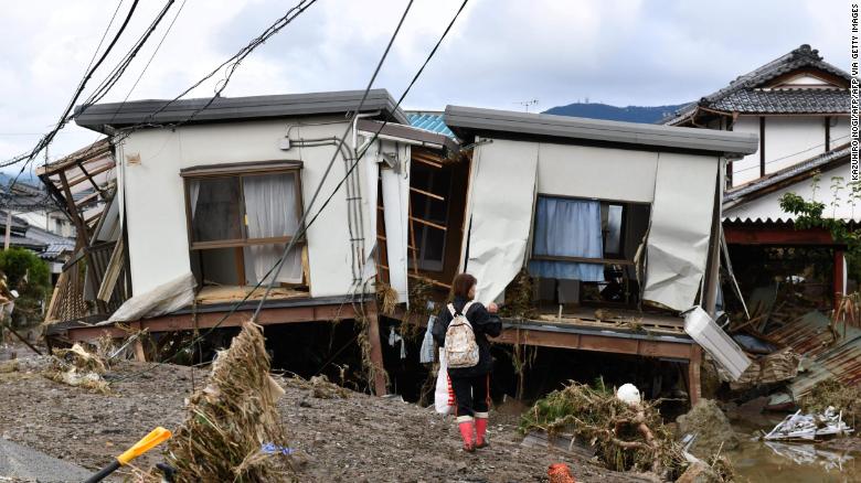
Coming off an extremely wet 2018 east of the Rockies, the fast onset of widespread extensive drought has been quite the climate whiplash for millions across the Southeast.  With warmer than average temperatures expected to continue and October being a generally dry month based on climatology, drought conditions are likely to continue and possibly expand.

The rapid onset and severity of the event qualified it as a “Flash drought.” Generally, droughts are caused by a lack of precipitation over an extended period of time.

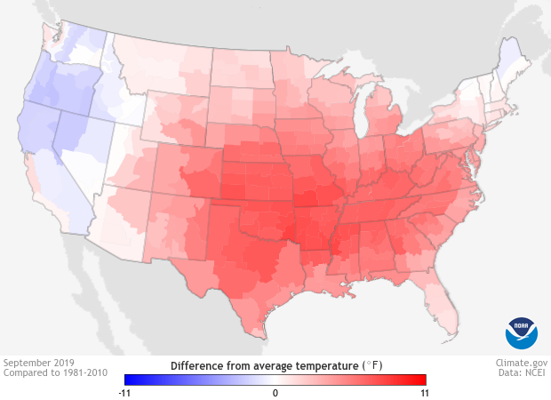
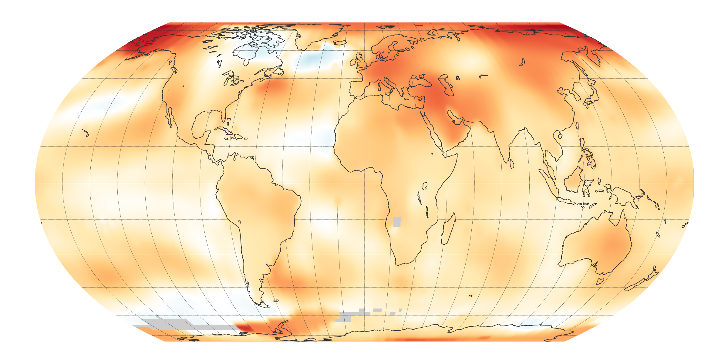
As rains didn’t fall, temperatures soared. September was among the five hottest Septembers on record for every state in the entire Southeast U.S. New Orleans, for instance, recorded its driest and warmest September on record with 7 daily record highs set during the month.


temperature, anomaly, United States, September

Sydney Smoke: Impact of Bushfire on Australian City

Thick smoke from Australia's catastrophic bushfires is still enveloping parts of Sydney, leaving residents to breathe hazardous air after skies turned orange and brown.

The air quality dropped to hazardous levels in many areas of Sydney and the surrounds area today, according to CNN affiliate Nine News Network.

Meanwhile, New South Wales is experiencing the "longest and most widespread" period of air pollution. Australia's Bureau of Meteorology said Monday that spring 2019 was the country's driest on record, fueling one of the country's worst bushfire seasons ever. As of Thursday, more than 117 bush and grass fires were burning, with more than 60 not yet contained.


A Storm Brought on Largest Waves Ever Recorded

The bomb cyclone that pounded the West Coast last week brought with it some of the tallest waves ever recorded off the California coast.

A monstrous 75-foot wave was recorded about 20 miles off the coast of Cape Mendocino in northern California, according to the University of California.

In the 15 years, the program has operated a station in that location, the significant wave height -- or the average height of the tallest third of waves that occur over 30 minutes -- typically doesn't exceed 10 feet tall during the winter.

The 75-footer was the tallest of the waves recorded in that period, which averaged around 43 feet tall. Still, that's "definitely unusual" for this time of year.


https://www.cnn.com/2019/12/06/us/75-foot-wave-california-bomb-cyclone-wxc-trnd/index.html

New Zealand Glaciers are Turning Red

One of the most startling consequences of the bushfires that are still raging across Australia is that they have turned some of New Zealand's famed glaciers red and pink. 

Travel photographer and blogger Liz Carlson snapped the pictures of the discolored snow-capped glaciers on November 28 while on a helicopter flight around Mount Aspiring National Park, in New Zealand's South Island. 

Australia has been experiencing one of its worst bushfire seasons on record. As of Thursday, there were more than 117 bush and grass fires with more than 60 not yet contained. 

Westerly winds blew the smoke from the Australian fires toward New Zealand. The heavier particles in the smoke fall out and, in this case, discolored the snow in New Zealand. 

Until the material on the glaciers is tested, it is not possible to know for sure what material it is.


A glacier turning red in Mount Aspiring National Park.


https://www.cnn.com/2019/12/05/australia/australia-bushfires-new-zealand-glaciers-scn-scli-intl/index.html

Thursday, November 28, 2019

Cyclones in Indian Ocean

Year 2018 was the Indian Ocean cyclone season and the most tropical cyclones form in the northern Indian Ocean.

Kyarr and Maha are the 2 cyclones at same time developed over the past 10 days in the Arabian Sea. Cyclone Kyarr moved towards the towards the Gulf of Aden from Indian coast while cyclone Maha is coming to the west coast of India, There have been four cyclones in the Arabian in 2019 – Vayu, Hikka, Kyarr and now Maha.

Cyclone Vayu in northwestern India caused moderate damage in the states, form in the Arabian Sea and did damage in the state of Gujarat.

Cyclone Fani is Extremely Severe cyclone and storm in the shape of hood of a snake, threatening Indian states of Odisha and Andhra Pradesh and the first severe cyclonic storm of the 2019 in India.

Cyclone Phethai is part of the ongoing 2018 North Indian Ocean cyclone season over the Bay of Bengal.

The Orissa cyclone in the year of 1999 was the strongest storm to hit the Indian coast and also the strongest tropical cyclones that affected India, Here is the list of strong tropical cyclones that affected India.
Cyclone Maarutha – 2017
Gujarat Cyclone – 2015
Cyclone Viyaru – 2013
Cyclone Laila – 2010
Cyclone Bijli – 2009
Cyclone Nisha – 2008
Machilipatnam Cyclone – 1990
Andhra Pradesh cyclone – 1977
http://www.walkthroughindia.com/offbeat/top-9-intense-strongest-cyclones-india/

Extreme Heat and Drought in Middle East

Temperature records have been repeatedly broken in the MENA region in recent years. The highest recorded temperature in the region to date was 129.2 degrees F at Mitribah,Kuwait in 2016. In the same week, Basra in Iraq recorded 128.8 degrees F.

In June 2017, Sweihan, Abu Dhabi reached a record high of 122 degrees F. In Dubai, authorities warned drivers not to leave aerosols in their vehicles after several cars caught fire in the extreme heat.

The region has been subject to an almost continuous drought since 1998, according to NASA, which says the current dry period is the worst for 900 years. The World Bank, which is spending $1.5 billion to fight climate change in the region, estimates that 80-100 million people will be exposed to water stress by 2025.

By 2050, temperatures in the MENA will be 39.2 degrees F or higher, according to Germany’s Max Planck Institute. By the end of the century, daytime highs could reach 122 degrees F, with 200 days of exceptional heat every year. And without urgent action to curb global emissions, according to research, cities in the region may become uninhabitable before 2100.


The dried cracked bed of the Qaraoun artificial lake is seen in West Bekaa, September 19, 2014. Unusually warm weather and low rain levels in Lebanon this year has caused the unusual drying of the Litani river that feeds the Qaraoun artificial lake, residents said. Picture taken September 19, 2014. REUTERS/ Mohamed Azakir (LEBANON - Tags: ENVIRONMENT) - GM1EA9M04PK01


https://www.weforum.org/agenda/2019/04/middle-east-front-lines-climate-change-mena/

6.4 Magnitude Earthquake Strikes Albania

At least 23 people have been killed, several more are missing and hundreds have been injured after an earthquake struck Albania on Tuesday, November 26,2019.
The quake, which had a preliminary rating of 6.4 magnitude, hit the European nation at an approximate depth of 12 miles early Tuesday local time, according to the United States Geological Survey. It is the strongest to hit Albania in 40 years. 
The epicenter was in the port city of Durres, about 22 miles from the capital. Social media videos from the area show several buildings have collapsed.
Albanian Prime Minister Edi Rama's office revised the death toll upwards several times on Tuesday. At least four victims died in Durres, spokesman Endri Fuga told CNN. Another two died in Thumane, one person died after jumping from a building in panic in Kurbin, and one victim died while driving on a badly damaged road in Lezhe, the spokesperson added.
Around 45 people were rescued from the rubble, Fuga told CNN, and more than 650 people have received medical attention throughout the day. He added that 30 people are being treated in hospitals.
Fuga did not want to speculate on how many people may still be missing but added that search and rescue teams would continue working throughout the night in the affected areas.
Nearby Bosnia and Herzegovina were also struck by an earthquake on Tuesday morning, the country's interior ministry told CNN. That quake had a 5.4 magnitude rating.
Rama said nearby countries, including Italy and Greece, have been assisting Albania with the recovery operation, while other European leaders have also offered their assistance.


An aerial photo taken on Wednesday, November 27, shows emergency crews searching the rubble of a collapsed building in Thumane, Albania, the day after a devastating earthquake struck the region.

https://www.cnn.com/2019/11/26/europe/albania-earthquake-tirana-intl-hnk/index.html


Shedding New Light on Earthquake that Killed 9,000 people

For decades, scientists have debated the structure of the Main Himalayan Thrust -- the fault responsible for a 2015 earthquake that killed nearly 9,000 people, injured 22,000, and destroyed 600,000 homes in Gorkha, Nepal. This fault is a direct result of ongoing collision between two tectonic plates -- the Indian and Eurasian -- that gives rise to the Himalayas. A team of researchers has determined a new geometric model for the fault that will allow officials to better prepare for future shakers.

Following the quake, Ghosh, a UCR associate professor of geophysics, and his collaborators rushed to Nepal to operate a network of 45 seismometers in the ground. Their journey was complicated by the difficulty of traveling in that high-altitude, rocky region as well as the timing of the quake during monsoon season.

"The geometry of the fault also matters," Ghosh said. "It's critical to look at smaller earthquakes and aftershocks to determine where the stress points are in a fault. Fault geometry plays a major role in earthquake generation."
It is also critical to learn the shape of a fault, as well as earthquake "style," meaning the ways in which a block of rock moves relative to other rocks during an earthquake.
The team found that the Himalayan Thrust, which runs more than 1,000 kilometers from Pakistan to Myanmar, is built in a shape known as a duplex in the area where the magnitude 7.8 earthquake occurred in 2015.
The team concluded the fault is still accumulating stress, and that the 2015 event may have increased the likelihood of another big earthquake nearby. This last point may be of interest to Californians.

Those residing anywhere near major fault lines should always have an emergency plan and supplies on hand because earthquakes are inevitable.


https://www.sciencedaily.com/releases/2019/11/191112073557.htm


Climate Changes Might Affect Flooding in Europe

Austrian flood expert Prof. Günter Blöschl from TU Wien (Vienna) has led a large international study involving a total of 35 research groups that provides clear evidence that changes in the magnitude of flood events observed in recent decades can be attributed to climate change. However, climate change does not have the same effect on floods everywhere: In northwestern Europe, floods are becoming increasingly severe, in southern and eastern Europe flood magnitudes mostly tend to decrease, although, in small catchments, they may actually increase.

"We already knew from our previous research that climate change is shifting the timing of floods within a year," says Günter Blöschl. "But the key question is: Does climate change also control the magnitude of flood events? So far, the available data had not been sufficient to ascertain whether this is the case or not. We have now examined this question in great detail and can say with confidence: Yes, the influence of climate change is clear."

In central and north-western Europe, between Iceland and Austria, flood magnitudes are increasing because precipitation is increasing and the soils are becoming wetter. In southern Europe, on the other hand, flood levels are decreasing, as climate change results in declining precipitation and the higher temperatures cause increased evaporation of water in the soil. However, for small rivers, floods may actually increase due to frequent thunderstorms and deforestation. In the more continental climate of Eastern Europe, the magnitudes of floods tend to decrease due to shallower snow packs in winter associated with higher temperatures. "Processes differ across Europe -- but the regional patterns all correspond well with predicted climate change impacts," says Blösch.


https://www.sciencedaily.com/releases/2019/08/190828140128.htm

Hurricane Sandy: The Frankenstorm

Sandy began as a tropical wave in the Caribbean on Oct. 19. It quickly developed, becoming a tropical depression and then a tropical storm in just six hours. Tropical Storm Sandy was the 18th named storm of the 2012 Atlantic hurricane season. It was upgraded to a hurricane on Oct. 24 when its maximum sustained winds reached 74 mph.

Sandy tore through the Caribbean, making landfall at Jamaica on Oct. 24. After leaving that island, the storm gained strength over open water and became a Category 2. The storm hit Cuba early Oct. 25, then weakened to a Category 1. On Oct. 26, it swept across the Bahamas. Sandy briefly weakened to a tropical storm on Oct. 27, then gained strength again to become a Category 1 hurricane before turning north toward the U.S. coast.

Hurricane Sandy made landfall in the United States about 8 p.m. EDT Oct. 29, striking near Atlantic City, N.J., with winds of 80 mph. A full moon made high tides 20 percent higher than normal and amplified Sandy's storm surge. Streets were flooded, trees and power lines knocked down and the city's famed boardwalk was ripped apart. Along the Jersey shore, people were left stranded in their homes and waited for rescue teams in boats to rescue them.

Sandy, the 10th hurricane of the 2012 Atlantic hurricane season, earned the nickname "Frankenstorm," as well as other descriptive appellations, such as "Blizzacane" and "Snor-eastercane." The National Hurricane Center's official name for the storm is "Post Tropical Cyclone Sandy." Many media outlets started calling it "Superstorm Sandy" after the storm made landfall, weakened and was downgraded from hurricane status.


Image result for Hurricane Sandy

https://www.livescience.com/24380-hurricane-sandy-status-data.html


Snow and 'Bomb Cyclone" have Flights Canceled

Heavy snows, reaching 30 inches in some areas, disrupted travel across the center of the United States on Tuesday and threatened to make more trouble on Wednesday as the Thanksgiving holiday approached. Hundreds of flights were canceled, thousands of travelers were stranded at airports, and stretches of major highways were closed because of unsafe conditions and periods of poor-to-nonexistent visibility.

At the same time, the Northwest was warned of a separate “bomb cyclone” storm blowing in from the Pacific Ocean that could sock that region with powerful winds and heavy precipitation.


Some coastal areas in Northern California and Oregon should brace for “stronger than hurricane-force winds,” the National Weather Service said, warning that the high winds could bring down power lines, ripping branches from trees and threaten to push eighteen-wheelers and RVs off the roads.


Almost 500 flights were canceled to and from Denver International Airport beginning late on Monday, and hundreds of passengers were stranded at the airport overnight, as nearly a foot of snow fell on the Denver area by Tuesday morning. A number of airlines, including American, Southwest, and Delta, issued travel waivers, allowing passengers to change their flights without incurring fees.


A plaza in Boulder, Colo., was covered by snow.

Severe Storms, Tornadoes Strike the South

Severe storms struck the South Sunday night into Monday, spawning at least three tornadoes, one particularly damaging in Dallas.
A tornado was first reported near Dallas Love Field Airport Sunday evening, and went on to damage several homes and businesses.No deaths or serious injuries have been reported, but three people have been hospitalized for non-life-threatening injuries.
Photos show damage to the KNON-FM radio station in Dallas as well as the roof ripped off of Northway Church in North Dallas. Power lines are downed and Oncor reported nearly 140,000 customers were experiencing power outages early Monday in north and central Texas.
Severe storms hit parts of Arkansas, Oklahoma and Missouri overnight as well, bringing hail and damaging winds. A man was killed in Rogers, Arkansas, when a tree fell on a home. Another person died when several large trees fell onto a mobile home park near Valliant, Oklahoma.


Tuesday, November 19, 2019

Severe Weather Batters Tampa Bay

At least three tornadoes were reported in the Tampa Bay area on Friday, October 19, 2019, and into early Saturday morning from Tropical Storm Nestor, which is now a post-tropical cyclone. The National Weather Service says an EF-0 tornado came through a Mobile Home Park in Seminole. Firefighters in Seminole says no one was injured in the Pinellas County city. At least two homes were damaged and a couple other trailer parks suffered damages. While another tornado reportedly touched ground in Polk County, leading to dozens of damage reports. Around noon on Saturday, NWS confirmed reports of an EF-1 tornado in Cape Coral that caused damage to at least one home and several vehicles. Hillsborough, Pinellas, Pasco and Polk counties were issued tornado warnings before expiring late Friday night. The strong storms have knocked out power for over 2,400 customers in Pinellas County as of midnight, according to Duke Energy. Over 900 were without power in Pasco County. No one was injured at all due to the tornadoes.


SEMINOLE-HOUSE-DOWN.png


https://www.abcactionnews.com/news/region-pinellas/severe-weather-batters-tampa-bay-knocking-out-power-for-thousands-in-the-area

Sunday, November 3, 2019

Tornadoes in Dallas: A mystery no meteorologist could resist

Hours after 10 tornadoes tore through North Texas late Sunday, meteorologists gathered at the National Weather Service in Fort Worth early Monday to start working on a puzzle. Some of the pieces were photos of damage sent in by residents, storm spotters, and law enforcement officials. Others were videos showing a tornado when lightning struck and illuminated the night sky. The rest were radar images captured at the time of the storms. By gathering the clues — storm damage pictures, videos, and radar images — meteorologists decided where they needed to visit to survey the damage. Later that morning, they split up into teams and deployed across North Texas to take a closer look at the destruction.

The surveys ultimately confirmed Sunday night’s storms produced 10 tornadoes: four EF-0 storms in Allen, Ferris, Kaufman County, and Wills Point; four EF-1 whirlwinds in Kaufman County, Midlothian, Rowlett and Rockwall; an EF-2 twister in Garland; and the EF-3 monster that tracked from northwest Dallas to Richardson. The strongest storm of the night, which tore through North Dallas and Richardson, was also one of the most difficult to assess. Surveyors determined the Dallas tornado was on the ground for more than 15 miles, tearing a path up to three-quarters of a mile wide. Survey teams were aided by the fact that the tornado struck a densely populated area. When survey teams assess storm damage, they rate it on a scale of 8 degrees, where visible damage such as lost roof shingles registers a 1, up to an 8 where the concrete slab under a home is swept clean.


Damage to Primera Iglesia Bautista Mexicana church, bottom, on Walnut Hill and homes behind it is seen in an aerial view of tornado damage on Monday, Oct. 21, 2019, in Dallas. (Smiley N. Pool/The Dallas Morning News via AP)

https://www.dallasnews.com/news/weather/2019/10/25/monster-tornado-in-north-dallas-was-a-mystery-no-meteorologist-could-resist/

Wednesday, October 16, 2019

Wildfires contained in Cali

Firefighters are making progress containing the largest of the wildfires currently burning in California, authorities said.
The Saddleridge Fire in Los Angeles is 41% contained, up from 19% Saturday, the California Department of Forestry and Fire Protection said on Sunday. The fire is almost 8,000 acres in size.
All evacuation orders were lifted Saturday in Los Angeles after the Saddleridge Fire moved away from neighborhoods and into hillsides, and as wind conditions improved.
"With the arrival of the onshore weather pattern yesterday, firefighters will take advantage of lower wind speeds and directly attack any remaining hot spots," the Los Angeles Fire Department said Sunday morning.
    The red flag warning for increased fire risk expired at 6 p.m. Saturday, the National Weather Service in Los Angeles said.
    About 100,000 people had been forced to evacuate homes in several Los Angeles neighborhoods when the blaze began spreading rapidly, fueled by strong Santa Ana winds and low humidity. The fire destroyed at least 31 homes.
    In Calimesa, about 70 miles east of Los Angeles, the Sandalwood Fire is 77% contained, CAL FIRE said. It's now about 1,000 acres.
    The Sandalwood Fire killed an 89-year-old woman in a mobile home and another person who hasn't yet been identified, the Riverside County Sheriff's Department said.
      The Reche Fire in Moreno Valley is now 100% contained, CAL FIRE said. It started as a fast-growing blaze, but firefighters were able to keep it from growing more than 350 acres in size.
      All three fires started on Thursday.

      Typhoon Hagibis: Death Toll Rises, Thousands Stranded


      The death toll from Typhoon Hagibis has risen to 72 in Japan, as thousands of residents remain without power or water and evening temperatures hover around 59 degrees F. The storm -- one of the strongest to hit the country in years -- made landfall on Saturday evening local time, southwest of Tokyo, leaving a trail of destruction in its wake. On Tuesday, the arduous search for survivors continued in flood-hit areas. A total of 110,000 personnel have been deployed from the fire department, self-defense force and police, as well as 110 helicopters, to aid in search and rescue efforts

      Although typhoons are not uncommon in Japan, Hagibis -- which means "speed" in the Philippine language Tagalog -- was particularly brutal, leading to the high death toll. It is one of the deadliest typhoons to have hit Japan in the past decade, surpassed only by Typhoon Talas in 2011, which caused 82 deaths.
      For many, the impact of the storm will be felt for many weeks ahead. An estimated 5,500 people remain housed in shelters, according to Japan's Cabinet Office. More than 230,000 people had been evacuated ahead of the storm. The Fire and Disaster Management Agency said in a release that 9,962 houses had been flooded across the country.

      The number of households without power stood at 34,000 as of Tuesday morning, down from a peak of 520,000. The Industry Minister of the country has indicated that areas severely flooded could remain without electricity for more than a week. More than 130,000 households were also without water, according to the Cabinet Office.


      A woman looks at flood-damaged homes in Nagano on October 15, 2019, after high winds and torrential rain and triggered landslides and catastrophic flooding.

      https://www.cnn.com/2019/10/15/asia/japan-typhoon-hagibis-aftermath-intl-hnk/index.html

      A bomb cyclone is likely along the Northeast coast

      A potential bomb cyclone is quickly taking shape along the eastern seaboard and is getting ready to wallop the Northeast. The storm is expected to begin rapidly intensifying later Wednesday morning. The pressure of the system could drop more than 30 millibars in 24 hours -- making this a bomb cyclone. 

      "The system will have the equivalent low pressure of a Category 1 hurricane," said CNN meteorologist Dave Hennen. Generally, a bomb cyclone is defined by a pressure drop of 24 millibars (a unit of pressure) within 24 hours. Although it is not likely the storm will meet the criterion of a classic nor'easter, it will be just as strong as the storm that impacted the mid-Atlantic and Northeast last week, if not a little stronger. Winds could reach tropical-storm force (39 mph+) with even higher gusts by Wednesday and Thursday for places such as New York City, Boston and Portland, Maine.
      Many locations in the Northeast will receive 2-4 inches of rain, with isolated areas receiving up to 6 inches. The rain will taper off throughout the day on Thursday, then completely lift out of northern New England by Friday.
        The storm will not be a major snow-maker for most of the region, except for a small portion of upstate New York.
        This is the second coastal storm to impact New England in a week. Last week's storm sat off the coast of the mid-Atlantic, churning up seas and bringing a strong onshore wind that shredded beaches up and down the East Coast. It caused costly damage along the coast due to beach erosion and coastal flooding.

        https://www.cnn.com/2019/10/16/weather/noreaster-bomb-cyclone-new-york-boston/index.html

        Tuesday, October 1, 2019

        Hail, Tornado, and Low Temps Hit California

        A series of unusual weather events hit the city of Davis, California, on September 28 and 29, 

        2019. Thunderstorms swept through the state's central part, producing dime-sized hail. A 

        tornado was also spotted near the area. The tornado touched down on September 29 to the east. 

        Meanwhile, gustnadoes were reported as well on the same day, near HWY 80 Westbound near 

        Davis. According to Robert Shackelford, CNN Weather producer, the tornado was weaker 

        then those of typical Midwestern. "California sees about 10 tornadoes a year, so this is rather rare 

        for the area," he said. They are more likely to see tornadoes in the winter and spring, but it isn't 

        uncommon to see tornadoes in the fall. Heavy hailstorms were reported in the area prior to the 

        tornado. On Sunday morning, September 29, a record low temperature of 45 °F was 

        experienced in nearby Sacramento, breaking the previous record of 46 °F in 1986.


        Hail, tornado, and record-low temperatures hit California, USA

        September Snowstorms hits Montana

        A record-smashing snowstorm with wet snow and strong winds hit parts of the Northern Rockies on September 28 and 29, 2019, resulting in power outages, uprooted trees, and road closures. Several parts of Montana experienced blizzard conditions and more than a foot of snow, setting new daily rainfall records. Wind gusts from 40 to 60 mph were measured in Montana.
        AccuWeather Senior Meteorologist Alex Sosnowski explained the cause behind the historic snowfall, saying "the combination of a storm from the Pacific Ocean, a fresh injection of cold air from northern Canada, moisture from the Gulf of Mexico and a northeast-ascending flow that squeezed extra moisture from the atmosphere produced the amazing snowfall."
        The highest snowfall was recorded in Browning, Montana with a total of 4 feet. Meanwhile, East Glacier Park received 2 feet of snow.
        It beat the daily record of 6.1 inches set in 1954. With a total of 19.3 inches, the two-day record came second to that of April 27 to 28 in 2009, with 24.2 inches, which was the city's heaviest snowfall in two days.
        It usually takes until a week before Christmas for the area to have a total of 19.3 inches of snowfall in an average winter.
        Blizzard conditions were experienced across the northern and southern Rocky Mountain front, including at the Cut Bank, Montana, Airport where there was moderate to heavy snowfall with sustained winds of 30 mph on September 29.

        Record-breaking September snowstorm dumps 4 feet of snow on parts of Montana, USA

        Tropical Storm Nardan Kills Two

        What was once Tropical Storm Narda dissipated on Tuesday morning but not before killing two people while raking along Mexico’s Pacific coast.
        The two deaths occurred in the southern state of Oaxaca on Sunday, according to the Associated Press. A 26-year-old man died while trying to cross a river in San Pedro Mixtepec, and a 17-year-old boy was swept away in a river at San Jeronimo.
        Also in Oaxaca, where Narda made landfall Saturday, thousands were evacuated. Thirteen municipalities suffered serious damage, according to Mexico News Daily.
        Narda's rainfall also caused a landslide that buried a butcher shop and a clothing store in the Oaxacan town of Santa Catarina Juquila, Mexico News Daily also said. No injuries were reported in the landslide.
        Floodwaters dragged three vehicles off the roads in Acapulco, and flooding damaged a public hospital.
        A number of people had to be rescued after getting caught in fast-flowing rivers, Televisa reported.