Showing posts with label Vanessa Martinez. Show all posts

Monday, December 12, 2016

Hurricane Matthew’s Strength Is Yet Another Climate Change Indicator

Hurricane Matthew’s Strength Is Yet Another Climate Change Indicator

It’s unusual for a storm like this to hit in October.

 10/05/2016 06:27 pm ET | Updated Oct 06, 2016
HECTOR RETAMAL VIA GETTY IMAGES
People try to cross the overflowing La Rouyonne river in the commune of Leogane, south of Port-au-Prince, Haiti, on Oct. 5.
Hurricane Matthew, a record-shattering storm that is unusual for October, is a reminder of climate change’s potential to turn seasonal weather events into extreme, year-round threats. 
Matthew, which meteorologists downgraded from a rare Category 5 to a Katrina-magnitude Category 3 on Wednesday, could make landfall in southeast Florida as early as Thursday, and threatens northeast Florida and the coasts of Georgia and South Carolina through Saturday. The storm has already claimed at least 11 lives in Haiti, the Dominican Republic, Colombia and St. Vincent and the Grenadines.
The storm has surpassed several milestones as one of the strongest, longest-lasting hurricanes of its kind on record. But on top of that, scientists note, it’s atypical for this time of year. 
Matthew is the only hurricane of this strength to persist this many October days since 1963, noted Colorado State University meteorologist Philip Klotzbach, an expert in Atlantic hurricane forecasts. 
If it makes landfall on Florida’s east coast as expected, he also noted, it will be the first major hurricane to do so in October since 1950. 
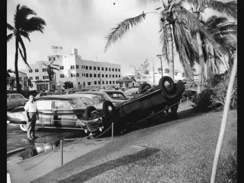
Matthew also remained a Category 4-5 hurricane for 102 hours, The Washington Post noted, which is the longest amount of time on record that a hurricane of that strength has persisted in the Atlantic basin during the month of October. 
While the Atlantic’s hurricane season officially runs June 1 to Nov. 30, the statistical peak is Sept.10, when ocean temperatures are high and wind shear ― a storm-mitigating factor ― is low. 
But as climate change increases the temperature during months that aren’t typically warm enough to support storms as strong as Matthew, hurricane season is beginning to last longer.
“The nearly unprecedented rapid intensification we saw with this storm is favored by warmer oceans and greater ocean heat content,” Michael E. Mann, a leading climate scientist and professor of meteorology at Penn State University, told The Huffington Post. As the “seasonal window during which sea surface temperatures are warm enough” to support storms increases, he said, “we can expect to see the season broaden.”
It’s important to note, Mann added, that scientists are still figuring out how wind shear factors into this. 
“There is quite a bit of uncertainty as to how wind shear in the Caribbean will change in the future as a result of climate change, therein lies a key uncertainty in future projections,” he wrote. “But we’re fairly certain that, whether we see more or fewer tropical cyclones, we will see more intense hurricanes and super-typhoons, like Katrina, and Sandy and Haiyan and Patricia and now Matthew.”
Clarification: A previous version of this article, in paraphrasing Klotzbach’s tweet embedded above, failed to include that he specified a landfall on Florida’s east coast.

Storms are Getting Stronger

Storms are Getting Stronger

What exactly does it mean for storms to get “stronger”? Does it mean faster winds? A larger wind field? Lower pressure at the center? More rain and snowfall? Higher storm surges?
“You have to remember that storms aren’t one-dimensional,” says Del Genio. “There are many types of storms, and sorting out how aspects of each type respond to warming is where the science really gets interesting.”
As Sandy was moving up the U.S. East Coast, unusually warm ocean temperatures allowed the storm to stay strong after it left tropical waters. (Map by Robert Simmon, using data from the NOAA Earth System Research Laboratory.)
Rising sea levels exacerbated Sandy’s storm surge, for example, a direct link between global warming and storm damage. And abnormally high sea surface temperatures in the Atlantic probably intensified the storm. But pinning all of Sandy’s fury—its hybrid nature, the scale of its winds, its unusual track—on global warming is premature, says Shepherd, the current president of the American Meteorological Society.
Weather forecasters use terms like snowstorms, derechos, hailstorms, rainstorms, blizzards, low-pressure systems, lightning storms, hurricanes, typhoons, nor‘easters, and twisters. Research meteorologists and climatologists have a simpler way of dividing up the world’s storms: thunderstorms, tropical cyclones, and extra-tropical cyclones. All are atmospheric disturbances that redistribute heat and produce some combination of clouds, precipitation, and wind.
Tropical cyclones, extra-tropical cyclones, and thunderstorms are the three fundamental types of storms studied by the climate change community. 
Thunderstorms are the smallest type, and they are often part of the larger storm systems (tropical and extra-tropical cyclones). All storms require moisture, energy, and certain wind conditions to develop, but the combination of ingredients varies depending on the type of storm and local meteorological conditions.
For example, thunderstorms form when a trigger—a cold front, converging near-surface winds, or rugged topography—destabilizes a mass of warm, humid air and causes it to rise. The air expands and cools as it ascends, increasing the humidity until the water vapor condenses into liquid droplets or ice crystals in precipitation-making clouds. The process of converting water vapor into liquid water or ice releases latent heat into the atmosphere. (If this doesn’t make sense, remember that the reverse—turning liquid water into water vapor by boiling it—requires heat).
Storms feed off of latent heat, which is why scientists think global warming is strengthening storms. Extra heat in the atmosphere or ocean nourishes storms; the more heat energy that goes in, the more vigorously a weather system can churn.
Thunderstorms derive their energy from the heat released by the condensation of water vapor. This “latent heat” energy drives thunderstorm clouds high into the atmosphere. Thunderstorms dissipate when the cold downdraft created by falling rain drops stifles rising warm air. (Image adapted from NOAA National Weather Service Life Cycle of a Thunderstorm.)
Already, there is evidence that the winds of some storms may be changing. A study based on more than two decades of satellite altimeter data (measuring sea surface height) showed that hurricanes intensify significantly faster now than they did 25 years ago. Specifically, researchers found that storms attain Category 3 wind speeds nearly nine hours faster than they did in the 1980s. Another satellite-based study found that global wind speeds had increased by an average of 5 percent over the past two decades.
There is also evidence that extra water vapor in the atmosphere is making storms wetter. During the past 25 years, satellites have measured a 4 percent rise in water vapor in the air column. In ground-based records, about 76 percent of weather stations in the United States have seen increases in extreme precipitation since 1948. One analysis found that extreme downpours are happening 30 percent more often. Another study found that the largest storms now produce 10 percent more precipitation.

Unusual storm pushes North Pole temperatures 40 F above average

Unusual storm pushes North Pole temperatures 40 F above average

Arctic winter temperatures have risen 1 to 2 degrees Celsius above freezing – an extremely rare occurrence

A storm system has carried unusually warm air into the Arctic, raising temperatures near the North Pole in the last two days to about 40 degrees Fahrenheit above average.
Recorded temperatures in the Arctic rose 1 to 2 degrees Celsius (1.8 to 3.6 degrees F) above freezing in recent days — a phenomenon that has occurred in winter only a few times before, according to Bob Henson, a meteorologist at Weather Underground, a weather forecast service.
“There’s been warm air for weeks over the eastern United States and parts of Europe … and it’s the warmest December on record,” he said. “It’s a sign of how much warm air was around when the storm system came, pulling that air to higher latitudes.”
The Arctic is warming about twice as fast as the rest of the world, scientists say. This year was the warmest on record in the region, according to data from the National Oceanic and Atmospheric Administration released earlier this month.
In the world’s northernmost permanent settlement, on the island of Svalbard, Norway, temperatures as high as 47.7 F were recorded at the airport on Wednesday.
“It’s the warmest temperature Svalbard has had in the last 40 years in the months from November to April,” Henson said.
The warm Arctic temperatures near the North Pole were all the more surprising, considering that it is dark 24 hours a day this time of year, Henson said.
But the strange weather won’t last long, and temperatures in the Arctic are already dropping in some parts. The area of warm air now at the top of the globe will gradually move to lower latitudes, Henson said.
While the unusually high Arctic temperatures were what meteorologists refer to as a day-to-day weather event, the conditions that fostered it are long term and ongoing — namely, El Niño and warming oceans — as a result of climate change, according to scientists.
Warmer ocean temperatures have supercharged weather events by providing extra energy to the atmosphere, making it warmer and moister. That has contributed to severe weather events witnessed in the southern U.S., which has experienced a spate of winter tornadoes, storms and flooding.
“And this is all happening in a year that is the warmest on record globally,” Henson said.

Weird weather: Dangerous fog, wildfire threat, lightning

Weird weather: Dangerous fog, wildfire threat, lightning

There’s plenty of weird weather in Southern California Monday.
While there’s dense fog along the coast making driving dangerous, the threat of wildfires hovered over the Southland because of gusty winds, low humidity, and the possibility of dry lightning, forecasters said.
At the same time, the region faces a 20 percent chance of showers and thunderstorms, according to the National weather service.
The fog was expected to burn off by mid-morning.
But a red flag warning indicating a risk of wildfire will be in force until noon in the San Gabriel Mountains and the forests they encapsulate — the Angeles National Forest in Los Angeles County and the Los Padres National Forest in Ventura County.
Weak Santa Ana winds gave way to onshore winds Sunday afternoon, but warm and dry condition nonetheless will persist through Monday, according to a National Weather Service statement.
Once the red flag warning expires, a less serious fire weather watch will go into effect through this evening because of the prospect of dry lightning — lightning strikes that occur when accompanying precipitation dissipates before hitting the ground.
The fire weather watch will apply not just to the San Gabriel mountains, but also to the Santa Monica Mountain Recreational Area, beach cities, metropolitan Los Angeles, and the San Fernando, Santa Clarita, San Gabriel and Antelope valleys.
Along with the onshore winds, which will produce 35-mile-per-hour gusts, the region will experience an influx of subtropical moisture this afternoon and evening, forecasters said. The moisture combined with a low-pressure system offshore will create a slight chance of thunderstorms through Tuesday evening, with another slight chance of thunderstorms cropping up in the San Gabriels Wednesday afternoon, they said.
“The initial surge of mid-level moisture and instability will bring the greatest threat of isolated dry lightning with gusty erratic winds on Monday afternoon and evening,” the NWS statement said, adding that dry lightning would increase the threat of fire, in part due to the presence of “extremely dry fuels.”
“If fire ignition occurs, conditions are favorable for extreme fire behavior and rapid spread of wildfire, which would threaten life and property.”
But beginning Monday night, any storm that develops should be a wet one, forecasters said.
The NWS forecast cloudy skies tMonday and highs of 79 in Avalon; 84 at LAX; 88 in Long Beach; 89 in downtown L.A. and on Mount Wilson; 91 in San Gabriel; 92 in Burbank; 93 in Saugus; 95 in Pasadena and Palmdale; and 97 in Woodland Hills and Lancaster. Highs will be a few degrees lower Tuesday and drop again starting Wednesday but start climbing again Saturday.
In Orange County, a dense fog advisory was in effect until 9 a.m., and cloudy skies were forecast, along with highs of 78 in San Clemente; 79 in Newport Beach; 80 in Laguna Beach; 96 in Anaheim, Irvine and Mission Viejo; 87 in Yorba Linda; and 90 in Yorba Linda. Orange County temperatures will decline slightly starting Tuesday but inch up again starting Saturday. By Sunday, they’ll generally be back at today’s levels.
—City News Service

Thunderstorms Soak Chile Desert in Years of Rain and Kill at Least 9

Thunderstorms Soak Chile Desert in Years of Rain and Kill at Least 9

By The Associated Press
Published Mar 27 2015 08:53 PM EDT
weather.com
Ad 1 of 1
Video starts in: 46 seconds

Heavy Rains Cause Flooding in Chile

Meteorologist Bonnie Schnieder talks about the the intense rain storms that followed dry, hot conditions in Chile, causing devastating flooding. 
Thunderstorms brought the equivalent of 7 years of rain to Chile's Atacama desert region and caused deadly flooding Thursday. 
Antofagasta, Chile, where the annual average precipitation is 0.13 inches, saw 0.9 inches of rain in 12 hours.
"The Atacama Desert is an extremely arid region and has been for millions of years. As a result, the terrain is hard and rocky because rainfall isn't frequent or abundant enough for either weathering rocks into sand or supporting the kind of ecosystem that would help turn rocks and minerals into soil. Without soil and plant cover to help absorb rainfall, it just runs off instantly as torrents of water," weather.com senior meteorologist Nick Wiltgen said. 
These torrential rains caused the Copiapo River in northern Chile to overflow and kill at least nine people, while simultaneously knocking out power, making roadways impassable and leaving 19 people missing. 
Thousands evacuated after officials warned of mudslides in the normally-parched region. 
Chile's Deputy Interior Minister Mahmud Aleuy called the flooding "the worst rain disaster to fall on the north in 80 years." 
TV images showed brown, muddy waters flooding the streets and reaching a hospital in Copiapo city. Some people living along the river had to be rescued by helicopter because roads were blocked by water and mud. TV footage showed several families waiting on the roofs of their homes, including a man who had punched a hole through his roof to save his toddler.
At least seven people have been killed and 19 people were listed as missing in three communities hit by flooding, officials said.
Desperate family members of the victims took to Twitter pleading for help in finding their loved ones.
The government declared a state of emergency, putting the region under military control, and President Michelle Bachelet flew to the area Wednesday evening to observe the problems first hand.
"We're living an extremely difficult situation," she said. "The previous forecast was that there was a huge drought here, so the rains were not necessarily seen as a catastrophe. Foreseeing was really difficult because no one knew."
Aleuy said that military helicopters were flying in supplies to areas cut off by the rains. 
The heavy rains came after several days of high temperatures and a drought that stoked raging wildfires in Chile's south-central regions. The fires have burned nearly 93,000 hectares in the 2014-2015 season, far above the annual average of 59,300 over the previous five years.
Earthquake-prone Chile is no stranger to the forces of nature. The national geological service Sernageomin said residents should be on alert due to increased activity at the Villarica Volcano in the country's south, which erupted on March 3, forcing evacuations and disrupting air traffic.
The storms prompted Chile's state-run copper giant Codelco to suspend work due to blocked roads, but the company said Thursday it was reopening sites in the north, including some of the world's largest copper mines.

Pilger, Nebraska Twin Tornadoes: How They Happened and How Unusual They Were

Pilger, Nebraska Twin Tornadoes: How They Happened and How Unusual They Were

By Jon Erdman
Published Mar 23 2016 12:41 PM EDT
weather.com

00:11

The supercell that simultaneously spawned a pair of large tornadoes in Pilger, Nebraska, on Monday was a frightening sight. Let's delve into the science behind this situation and how often it occurs.

One Supercell: A Family of Tornadoes

Below is a radar loop of Monday's storm from the National Weather Service Doppler radar near Omaha, Nebraska. At left, the storm is shown with conventional reflectivity, with areas of rain and hail, while storm-relative velocity is shown at right, with areas of strong rotation indicated by areas of green shading very close to areas of red shading.
Pilger, Nebraska twin tornadoes radar loop
Radar reflectivity (left) and storm-relative velocity (right) radar loop from 3:47 p.m. to 4:26 p.m. CDT of the Pilger, Nebraska supercell spawning twin tornadoes on June 16, 2014. (Gibson Ridge/NWS-Omaha) 
    From that loop, it appears there were three separate tornadoes:
    • Tornado A first formed west of Stanton, Nebraska, then soon weakened north of Stanton as it curled toward the north.
    • Tornado B then formed east of Stanton and appears to have been the one that hit Pilger, Nebraska.
    • Tornado C then formed just southeast of the Pilger tornado, then wrapped northward tracking close to, or interacting with, tornado B.
    All these tornadoes were rated EF4 by the National Weather Service. A fourth tornado occurring after the radar loop above touched down well northeast of Pilger.
    According to tornado warnings and statements from the National Weather Service near Omaha, tornadoes from this supercell were sighted for at least one hour and 10 minutes from 3:46 p.m until 4:56 p.m. Central time, and continued for 30 minutes after the end of the radar loop above.

    Schematic of a supercell's rear-flank downdraft and updraft.
    The process of tornadogenesis in a supercell remains an active area of research, with the supercell's forward-flank downdraft (rain-cooled air), rear-flank downdraft (a surge of less cool, dry air at the western edge of the supercell) and low-level mesocyclone/updraft all possibly playing roles.
    When the rear-flank downdraft surges and completely surrounds the updraft, cutting off warm, moist air, the first tornado will slowly fizzle and curl toward the left (for an east- or northeast-moving supercell). 
    However, just to the southeast of the weakening tornado, a second tornado may form where the two downdrafts and the updraft meet. In this manner, you can have multiple tornadoes simultaneously form from the same storm: one typically weakening, while the other is maturing or strengthening.
    This is like the evolution of a frontal system you'll see on weather maps on a much smaller scale.
    Namely, a cold front, warm front and intensifying surface low (the first tornado) transitions to an occluded front, with an intense low slowly weakening (like the rear-flank downdraft choking off the warm inflow to the first tornado), followed by a new area of low pressure forming at the junction of the cold and warm fronts, where the next tornado forms. 
    In this manner, a single, powerful supercell can produce multiple tornadoes over an hour or longer. These are known as tornado families.
    Massive double tornado near Dunlap, Indiana, on April 11, 1965. (Paul Huffman/Elkhart Truth via NOAA)

    What's Unusual About the Pilger Twins?

    Multiple tornadoes simultaneously from the same thunderstorm are not as unusual as they sound.
    Multi-vortex tornadoes contain so-called suction vortices rotating around the main tornado. These suction vortices are typically thinner than the main tornado, but don't be fooled by that. They can cause intense damage, because their winds combine with the forward speed of the parent tornado. 
    What was impressive and unusual about the Pilger tornadic supercell was the appearance of two distinct large, strong, long-lasting tornadoes at once, shown live on The Weather Channel.
    "In all other cases I have seen, one tornado may last for a little while fairly close to another, but nothing like what happened (Monday)," said The Weather Channel senior meteorologist and veteran storm chaser Matt Crowther. "This is unique in my experience."
    There is little doubt the research community will heavily examine this case.
    "The atmospheric parameters for instability and supercell potential were extreme," said Stu Ostro, senior meteorologist at The Weather Channel. "That doesn't always result in strong tornadoes, as it's just one factor, but it did Monday, and something about that supercell resulted in the remarkable twin twisters."
    Severe weather expert Dr. Greg Forbes has a hypothesis: incomplete cycling.
    "The rear-flank downdraft (RFD) surge probably eased off and didn't choke off the Pilger tornado, yet the next tornado of the cycle formed south of Pilger," says Forbes. "The lack of a surging cold RFD allowed the Pilger tornado to keep going strong in tandem with the new one of the cycle to its south."
    This brings to mind one of the most infamous tornado photos of all-time pictured above at right; the April 11, 1965 Palm Sunday double tornado, which was snapped by a photographer from The Elkhart Truth.
    One more recent example of a tornado family (or cyclical tornadogenesis) was the supercell spawning the Greensburg, Kansas EF5 tornado on May 4, 2007. The Greensburg tornado was only one of several that night in western Kansas.
    Other examples include a May 15, 2003 Texas Panhandle event sampled by the Center for Severe Weather Research, and the March 13, 1990 Hesston and Goessel, Kansas tornado event.
    Finally, did you know one supercell complex once produced seven tornadoes on one evening in one city? Coincidentally, this was also in the Cornhusker State, the "Night of the Twisters" in Grand Island, Nebraska on June 3, 1980.
    According to the Storm Prediction Center's FAQ page, tornadoes can merge, but only on very rare occasions, when a weaker circulation is absorbed and drawn in by the larger and more intense tornado.