There is a chance this week for a potentially major winter storm
to affect a long range of the Deep South this week – including places
better known for their beaches, balmy breezes and hurricanes. This will
include some of the areas affected by Winter Storm Kronos just last week – but it includes millions of people farther east as well.
This storm has the potential to disrupt travel and power. There is
uncertainty on the amount of wintry precipitation that will fall.
However, if ice accumulations reach the higher end of the range of
possibilities, there could be widespread power outages and road
blockages due to falling trees and tree limbs, not to mention the weight
of ice on power lines themselves.
Travel could become dangerous or even impossible in some areas due to heavy buildup of ice and/or snow. The storm can produce dangerous driving conditions and extended
power outages.
http://www.weather.com/news/weather-forecast/winter-storm-gulf-coast-carolinas-florida-snow-ice-20140126
Sunday, January 26, 2014
Relentless Surges of Arctic Air Continue
The blasts of Arctic air have been relentless so far this January for many cities east of the Rockies. A new surge of frigid air will pour southward from Canada behind an Alberta Clipper
that will bring snow to the Midwest and Northeast Sunday into Monday.
By Monday and Tuesday, temperatures in some cities may rival what we saw
in early January.
There's been some more chatter about the "polar vortex", which became a popular catchphrase to describe the blast of bitter cold air at the start of the month. However, just like in early January, this term is being used misleadingly from a meteorological perspective since the actual center of the Northern Hemisphere polar vortex never really moves through the atmosphere above the United States - rather, it remains anchored farther to the north.
There is nothing extremely unusual about this weather since the polar vortex is always present in the winter and there are always spokes and always surges of cold air during the winter in our hemisphere. In any given place or time, the surge of cold air can be more or less intense and travel a longer or shorter distance from the pole.
http://www.weather.com/news/weather-forecast/arctic-cold-finish-january-20140117
There's been some more chatter about the "polar vortex", which became a popular catchphrase to describe the blast of bitter cold air at the start of the month. However, just like in early January, this term is being used misleadingly from a meteorological perspective since the actual center of the Northern Hemisphere polar vortex never really moves through the atmosphere above the United States - rather, it remains anchored farther to the north.
There is nothing extremely unusual about this weather since the polar vortex is always present in the winter and there are always spokes and always surges of cold air during the winter in our hemisphere. In any given place or time, the surge of cold air can be more or less intense and travel a longer or shorter distance from the pole.
http://www.weather.com/news/weather-forecast/arctic-cold-finish-january-20140117
Saturday, January 25, 2014
2013 Tied For Fourth Warmest Year On Record, Says NOAA
Last year was tied for the fourth-warmest year on record around the world.
The National Oceanic and Atmospheric Administration on Tuesday released its global temperature figures for 2013. The average world temperature was 58.12F (14.52C) tying with 2003 for the fourth-warmest since 1880.
Nasa, which calculates records in a different manner, said Tuesday that 2013 was the seventh-warmest on record, with an average temperature of 58.3F (14.6C).
Both agencies said nine of the 10th warmest years on record have happened in the 21st century. The hottest year was 2010.
A global insurance firm says there were 41 billion-dollar weather disasters last year. Unlike 2012, most of the heat and disasters were outside the United States.
Philippines Attempting Recovery After Typhoon Haiyan
Emergency workers have evacuated thousands of people across the southern Philippines, including many already made homeless by a typhoon in November, after three days of rain flooded towns and farmland.
Hundreds of survivors of Typhoon Haiyan – one of the strongest storms ever to make landfall – were forced to flee by tropical depression Agaton after emergency shelters were damaged or destroyed on the eastern central island of Samar.
Tents collapsed under the weight of the rain and emergency plastic sheets have been torn away, Oxfam said.
An average of 20 typhoons hit the Philippines every year with Haiyanslamming into central islands on 8 November, killing more than 6,100 and wiping out entire coastal communities in Leyte and Samar.
More than 200,000 people have been taken to shelters over the past three days as flood waters rose, but hundreds were still marooned on the roofs of their houses on Tuesday, said Eduardo del Rosario, executive director of the National Disaster Risk Reduction and Management Council.
Del Rosario said 42 people had been killed, 65 had been injured and damage to property and farms had reached 367m pesos (£5m).
"Our troops are trying to reach them and bring them to safer ground," Del Rosario said.
Nenita Matuda, 45, and her children perched on their neighbours' roof as she watched the rampaging waters outside Butuan City in the north of Mindanao island.
"Thank God we are safe but we just lost our house," she said.
A state of calamity has been declared in Agusan del Norte and 15 other towns in the Davao del Norte, Surigao del Sur and Agusan del Sur areas of Mindanao even as the weather bureau lifted alert levels as the storm weakened.
Super Bowl Looking Cold But Clear
It appears the Denver Broncos and Seattle Seahawks will have manageable weather conditions for Super Bowl XLVIII.
According to weather.com, the Feb. 2 forecast for East Rutherford, N.J., calls for a high temperature of 35 degrees, a low of 25, and just a 30 percent chance of snow. Winds are expected to be at eight miles per hour. Accuweather.com calls for a high temperature of 36 and a low of 26 with the possibility of snow showers.
Grubman said the league would require 24 hours to move the game time and 36 hours to switch days.
The coldest temperature for a Super Bowl was 39 degrees at Tulane Stadium in New Orleans on Jan. 16, 1972.
Thursday, January 23, 2014
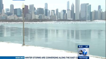
Chicago Weather: City, suburbs to face arctic blast once again
January 22, 2014 (CHICAGO) -- A days-long stretch of frigid, subzero wind chills is just beginning in the Chicago area.
The wind chill in Chicago was minus 8 degrees at 4 a.m. Wednesday, while the actual temperature stayed steady around 2 degrees, according to the National Weather Service.
To prepare for the extreme cold, the Illinois Tollway activated 11 Zero Weather Road Patrols Tuesday to help customers stranded in their cars. Seven Illinois Tollway oases also serve as warming centers.
This particular blast of cold air is not the polar vortex itself, but rather a byproduct of the system that regularly moves through Canada and into the United States, meteorologists said.
By Friday, highs in the area are expected to climb to 24 degrees, falling to 15 at night, forecasts show.
What's with this wacky weather? Hot is cold and cold is hot
(CNN) -- What's with this wacky weather?
It's so
cold in Florida that farmers joke the oranges are squeezing themselves to stay
warm.
But
Alaska is so warm that a ski resort's been forced to close.
Add to
this curious mix, giant waves in
Hawaii, a historic
drought in California, and bears coming out
of hibernation in Nevada, and you can't help but wonder: What is
going on with the weather?
"It's
not actually that unusual," says Roger Edwards, a meteorologist with the
Storm Prediction Center at the National Weather Service.
Usually a
few times each winter, the temperatures flip-flop where Tallahassee is colder
than Anchorage.
"But,"
he says, "this one is more persistent than we normally see."
On
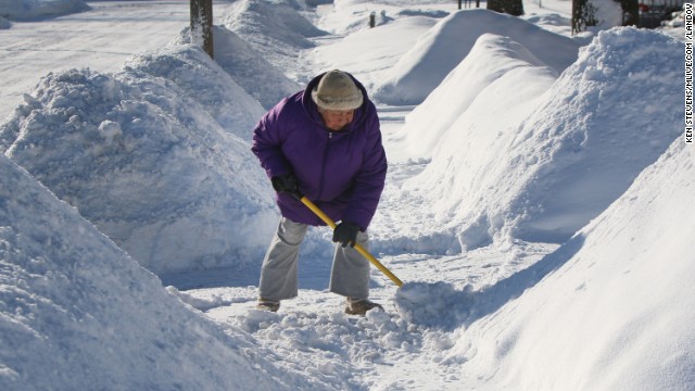
Tuesday, 10 inches of snow fell on MetLife Stadium, which hosts the Super Bowl
in 10 days.
Contrast
that with Anchorage, Alaska, where Thursday's forecast high will be around 45
degrees. A typical high would be in the low 20s.
Waves up to
50 feet high have been pounding the North Shore of Oahu -- the largest Hawaii's
seen since 2004.
What's
causing it? A large storm with hurricane-force winds that's sending a giant
swell toward the island. The surf peaked overnight, the weather service
said.
California's
facing perhaps its worst drought since record-keeping began a century ago,
California Gov. Jerry Brown proclaimed this month.
The
National Weather Service's forecast for Incline Village, Nevada, for instance,
calls for high temperatures heading to or well past 50 degrees for the next
week at least, with nary of snow flurry in sight.
Subscribe to:
Posts (Atom)