Showing posts with label Sara Schultz. Show all posts

Thursday, April 17, 2014

Former Cyclone Ita Brings Severe Weather to New Zealand; Floods and Power Cuts Hit Auckland


What remains of the former cyclone Ita has left New Zealand's Auckland flooded due to strong winds and torrential rain. The Easter weekend has begun, but some residents have to deal with power cuts and road closures.

Power service provider Vector Energy is still working to restore electricity to over 15,000 customers. The flooded Tamaki Drive was closed temporarily because of flooding.
According to the MetService, the winds at the Harbour Bridge as high as 100 km/h but has since died down to 70 km/h. Winds at the airport had reached 90 km/h before slowing to 70 km/h. The wild weather is on its way to North Island. Wellington residents are expected to prepare for the severe weather as it moves further south overnight, according to the MetService.
Earlier in the morning of April 17, Tamaki Drive was closed due to rising tides and severe flooding brought by heavy rain. Authorities had closed the road as the water rose with some residents still trapped inside their homes.
The MetService has previously issued severe weather warnings for Auckland, Northland, Coromandel, Nelson, Marlborough, Taranaki and Southland. Residents were warned that the latest weather system was similar to the remnants of Cyclone Lusi which hit New Zealand in March.
The worst-hit areas were the north and northeastern part of Auckland, including Kiapara and Helensville which was severely affected. Dozens of incoming and outgoing flights have been cancelled at Auckland Airport due to severe weather.

Weather service targets tornado warnings more narrowly


MONTGOMERY, Ala. — The National Weather Service is making an effort to issue fewer tornado warnings so the public will pay attention more, according to a meteorologist who deals with weather warnings.
The advance of technology in the past 10 years or so has made predicting severe weather easier, said John De Block, warning coordination meteorologist with the weather service's Birmingham, Ala., office. But the fallout may be complacency.
"There are studies that have some merit that show people become numb to hearing warning after warning," he said. "They hear a warning and nothing happens, so they don't pay attention the next time and the next time."
Weather radar now can show storms with circulation, the major indicator that a tornado may form. Those tornadoes on radar are the source of most warnings now.
"The technology is good," De Block said. "But it hasn't advanced enough yet to show us what's taking place closer to the ground. The radar may show circulation 8,000 feet above Montgomery, but we can't determine what's going on closer to the ground."
On April 7, warnings were issued at 3:01 a.m. CT for Perry and Bibb counties southwest of Birmingham, and 3:13 a.m. for Dallas County west of Montgomery. The storms were part of a powerful weather system that moved through the area spawning severe thunderstorms and torrential rains.
No confirmed touchdowns were associated with the warnings. That's a good thing for the people who live in the area, but in a way it's bad for meteorologists.
Since that date, the Birmingham office, which covers more than half of Alabama's 67 counties, has issued 723 tornado warnings with 320 confirmed tornado touchdowns, De Block said.
That's a detection rate of about 77%, but De Block also calls it a false alarm rate of about 74%. Since Oct. 1, 2007, the average lead time between a tornado warning and touchdown is 16.78 minutes, he said.
"We want the detection rate to be higher than the false alarm rate," De Block said. "Our position is that we would rather have the warning out there if conditions look favorable to tornadic development. We would rather have an informed public.

Thursday, April 10, 2014

Two Tornadoes Confirmed in Eastern North Carolina


Survey crews with the National Weather Service confirmed at least two tornadoes hit eastern North Carolina Monday.
NWS says the first twister, an EF2 on the Enhanced Fujita Scale, hit northwest of Belhaven and near Pantego in Beaufort County. The storm damaged homes, threw a vehicle 50 yards off the road, and left five people injured overall.
The second tornado hit about ten minutes later in Hyde County near Ponzer. The storm was rated an EF1 but did not cause any significant damage.
Investigators are still gathering information on a third possible tornado in the area, this time in the Pocosin Lakes National Wildlife Refuge in Hyde and Tyrrell Counties. 
The same storm system caused deadly flash flooding across parts of Mississippi, Alabama and Georgia earlier in the day.

Severe Weather North Texas: Tornadoes Spotted, Damage, Injuries Reported


Several rounds of severe weather, including reported tornadoes and monster hail, left damage across north Texas on Thursday, injuring at least four.
The storms were part of a multi-state severe weather outbreak, which stretched from the Southern Plains into the Midwest. St. Louis saw a few rounds of severe weather, including an EF1 tornado.
Texas also saw a few waves of severe weather. The National Weather Service office in Fort Worth reports homes were damaged near Highway 69 in Hunt County, including damaged roofs and downed utility poles. The extent of damage from a reported tornado near Farmersville, Texas was not immediately known, but at least four people were injured when a farmhouse and a mobile home were destroyed northeast of the area near the town of Merit. 
Denton, about 40 miles north of Dallas-Fort Worth, saw two rounds of monster hail drive through the town less than two hours apart Thursday evening.
The first storm pounded the area around 4 p.m. CT, dropping baseball-sized hail. Several pictures surfaced on Twitter showing damage to cars. 
The second round rolled through around 5:45 p.m. CT — this time, prompting a tornado warning for Denton County.
The National Weather Service says an 82 mph wind gust was recorded at the airport. Egg-sized hail was also reported with the second cell.

Monday, April 7, 2014

2014′s first significant severe weather outbreak targets Mid-South

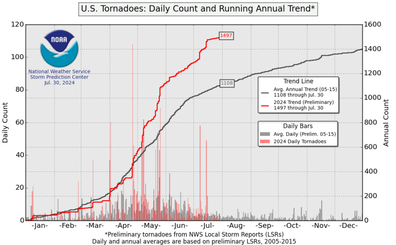
Tornado season across the U.S. is off to an extraordinarily slow start with just 73 tornadoes so far this year compared to an average of 256 (year-to-date) in recent years. But the atmosphere across the Mid-South and Ozark region is primed to potentially narrow the gap this afternoon and evening.
The National Weather Service (NWS) says over 52 million Americans are under an elevated risk of severe thunderstorms this afternoon and evening – spanning a broad region from east Texas northeastward into central Ohio.
The zone of greatest risk of severe storms covers much of Arkansas, southern Missouri, and the western part of the Tennessee Valley, including Little Rock, Springfield (Mo.), and Memphis.  Damaging straight-line winds and large hail are major threats in this area (assigned a 45 percent chance within 25 miles of a point), which is already blanketed by tornado watches through 5 p.m. CDT.
“Tornadoes –some strong with EF2 or worse damage– are … possible with the greatest risk of occurrence across central and southern Missouri southward through most of Arkansas,”  says the NWS Storm Prediction Center in its public severe weather outlook.
This same weather system fueling the developing severe thunderstorm outbreak is forecast to bring heavy snow to Minnesota.  Minneapolis is under a winter storm warning and expects 8 inches of snow tonight into Friday, and perhaps more north of town.

Mississippi Tornado in Covington County; Injuries and Damage Confirmed


An EF2 tornado hit Mississippi's Covington County early Monday morning, causing injuries and damage to homes.
Covington County Emergency Management Director Greg Sanford told News Mississippi that the tornado touched down north of Collins, a rural community of about 2,700 residents, in southern Mississippi, about 2 a.m. local time.
The National Weather Service survey crew determined the tornado was on the ground for 16 miles.
Sanford said damage and injuries were reported in the communities of Hot Coffee. Overall, eight people were injured in Covington County according to NWS.
To the southeast, Jackson had one of its rainiest days on record Sunday. With 5.97 inches of rainfall recorded, Sunday was the eighth-rainiest calendar day on record, according to the NWS.
Southern Pines Electric Company reported that 1,100 customers were without power in Covington, Jasper, Smith, Jefferson Davis and Simpson counties.

Saturday, March 29, 2014

Weekend nor'easter brings rain and some wind


The word nor’easter typically conjures up thoughts of a snowstorm. However, the reality is the term is used for any storm moving up the east coast and bringing a wind from the northeast with precipitation.

Meteorologists, when speaking about the wind, name the wind by the direction it comes from, not the direction it’s going. The convention is completely opposite of the way we name highway direction. If you are on the Mass Pike heading from Boston to Worcester, you are going west, but if you were the wind, we would name you an east wind because you’re coming from the east.

During a nor’easter, the wind comes from the northeast and mariners in particular, realized that wind direction often brought high seas and dangerous conditions.

We do have a nor’easter on the way for the weekend and it’s a slow moving one too. This means a prolonged period of rain once it begins accompanied by chilly air coming off the cold Atlantic.
Before we get to our weekend storm, we do have a mild but breezy/blustery sort of day today. A southwest wind (coming from the warm part of the country) will help boost temperatures above normal for a change. Highs this afternoon will reach the 50s.

Later today, a cold front will move through and this brings with it a chance of a few showers. I am not expecting much in the way of rainfall and any shower activity should hold off until late this afternoon and evening.

In the afternoon rain moves in from the south and becomes quite steady and even heavy by evening. There will be big puddles developing and some roads that normally flood could have issues. I am thinking those lower places along Storrow Drive or Route 9 in parts of Brookline and Natick might see some ponding of the water.

Winds will be gusty along the coast Saturday night and Sunday as the storm increases in strength and passes by the area. On Monday continues improve as high pressure moves back into the region and skies clear. It looks as though it’s going to remain seasonable much of next week so the snow banks still left lying around after the rain will continue shrinking.

http://www.boston.com/news/weather/weather_wisdom/2014/03/weekend_noreaster_brings_rain.html

Severe weather triggers tornado warnings in Central Fla.


ORLANDO, Fla. —A large area of showers and storms associated with a low-pressure system over the Southeast moved through Central Florida on Saturday and brought several weather warnings and reports of tornadoes to the region.

Firefighters in Orange and Seminole counties received numerous reports of lightning striking homes.Orange County firefighters battled one fire on Judy Court near Holden Avenue. No injuries were reported.There was also a report of lightning hitting a home in Oviedo, but Seminole County firefighters said there was no damage.Work crews in the southern sections of Orlando and Orange County also responded to reports of downed trees and power lines.
The showers and storms will continue moving through the area into the evening hours.A tornado watch remains in effect for Brevard and Osceola counties until 5 p.m. A severe thunderstorm warning was also in effect for those counties until 4:30 p.m.

http://www.wesh.com/weather/tornado-watch-issued-for-central-fla/25227282#!BSZpc

Friday, March 21, 2014

Spring is in the air? Cold temps will persist into new season

JOHNSTOWN — See you later winter, don’t let the door hit you on the way out.

Today marks the first day of spring, but with lingering cold temperatures, you have to wonder if Mother Nature failed to get the memo.

“I wish I had good news, but just because the calendar flips to spring doesn’t mean the atmosphere will be warm,” said Mark Paquette, a meteorologist with AccuWeather in State College. “We’ll have a mild weekend, but cold air from Canada will dip down into the area next week making it very chilly.”

Paquette said temperatures will be 10 to 20 degrees below normal, which should be in the mid-40s.

“We’ll have two days early next week that will struggle to get above freezing and, depending on the cloud cover, lows could be in the teens,” he said. “It wouldn’t be feeling very springlike.”

Looking down the road, Paquette thinks the area will continue to experience cold weather until mid-April.

The Farmer’s Almanac, a weather prognosticator that has been published continuously since 1818, predicted that the opening days of spring in the Northeast will be met with rain, snow and cold temperatures.

An unseasonably warm patch in mid-April will provide a taste of spring, but it will not last long due to a late-season snowstorm that will follow on its heels. Colder temperatures will remain through early May with frequent showers, warming up in time for Memorial Day.

http://www.tribune-democrat.com/latestnews/x787224287/Spring-is-in-the-air-Cold-temps-will-persist-into-new-season

Cyclonic, anti-cyclonic winds led to unusual weather in Nagpur, says Met expert


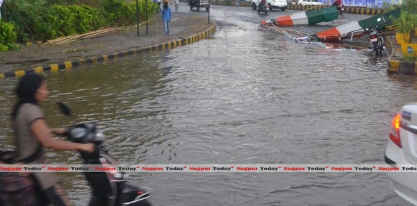
A pall of gloomy weather has been prevailing in the city’s atmosphere for over a week. Sudden rains, heavy downpour mixed with thunder showers and hailstorm and strong winds have sent the citizens shivering in cold. And the next moment it is sunny again. As the citizens were left wondering over this unusual weather pattern, the experts say it was the result of moisture accumulated out of cyclonic and anti-cyclonic system hovering over the city. This led to frequent change in weather – one moment it appears cold and cloudy while it becomes sunny on the other.
Shiraz Khan, Assistant Meteorologist at Met Office here told Nagpur today that cyclonic and anti-cyclonic systems from east and west directions, respectively have gathered enough moisture and the northerly winds made it cool, even forming hailstorms, resulting in downpour. He said the winds blowing from Bay of Bengal and Arabian Sea has resulted into the clockwise and anti-clockwise patterns being formed at much lower level of 1.5 kms above Nagpur. The northerly winds are causing the moisture to condense and moreover converting it into hailstorms. The recent lash of hailstorms was the outcome of such a formation, he added.
He informed the trough line (closed circle of system) has extended upto Marathwada and it is gradually diminishing which would result in normal weather in coming 2-3 days. “It will be completely dry in couple of days. Later there will be some fluctuations”, he said.

Thursday, March 6, 2014

Here comes El Nino; good news for US weather woes


WASHINGTON (AP) — Relief may be on the way for a weather-weary United States with the predicted warming of the central Pacific Ocean brewing this year that will likely change weather worldwide. But it won't be for the better everywhere.
The warming, called an El Nino, is expected to lead to fewer Atlantic hurricanes and more rain next winter for drought-stricken California and southern states, and even a milder winter for the nation's frigid northern tier next year, meteorologists say.
Globally, it can mean an even hotter year coming up and billions of dollars in losses for food crops.
The National Oceanic Atmospheric and Administration issued an official El Nino watch Thursday. An El Nino is a warming of the central Pacific once every few years, from a combination of wind and waves in the tropics. It shakes up climate around the world, changing rain and temperature patterns.
The flip side of El Nino is called a La Nina, which has a general cooling effect. It has been much more frequent than El Ninos lately, with five La Ninas and two small-to-moderate El Ninos in the past nine years. The last big El Nino was 1997-1998. Neither has appeared since mid-2012. El Ninos are usually strongest from December to April.
Halpert said it is too early to say how strong this El Nino will be. The last four have been weak or moderate and those have fewer effects on weather.
Scientific studies have tied El Ninos to farming and fishing problems and to upticks in insect-born disease, such as malaria. Commodity traders even track El Nino cycles. A study by Texas A&M University economics professor Bruce McCarl found the last big El Nino of 1997-1998 cost about $3 billion in agricultural damage.
After years of dryness and low reservoirs, an El Nino's wet weather would be welcome in places like California, Halpert said.

Severe Weather in Florida: Waterspouts Spotted Near Tampa; Storms Hit Miami, Ft. Lauderdale, West Palm Beach


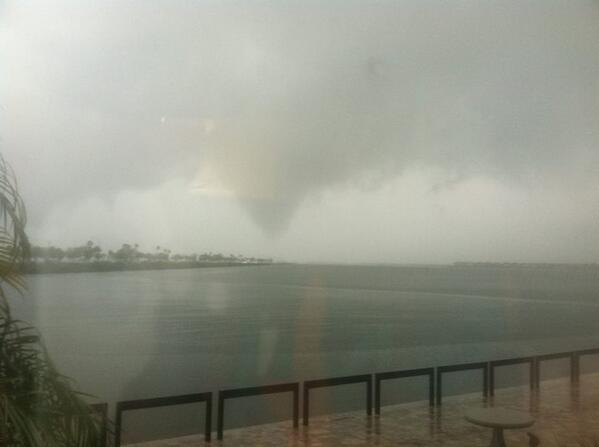
Severe storms have returned to Florida Thursday, bringing a flood threat and spawning waterspouts as waves of nasty weather hit the state.
"An intensifying low pressure system is sweeping across Florida this afternoon, bringing a large area of rain and thunderstorms," said weather.com meteorologist Chris Dolce. "The greatest threat of severe thunderstorms with localized damaging wind gusts and perhaps a tornado or two will be in central and southern sections of the state through late-afternoon. This threat could linger into early-evening in far southeast Florida."
A tornado watch was issued for areas south of Orlando and Sarasota. The watch will last through 7 p.m. EST. Lightning, hail and damaging winds are among the threats Thursday afternoon, but a few isolated tornadoes are also possible.
West of downtown Miami, the PGA Tour's World Golf Championships-Cadillac Championship was suspended Thursday afternoon with storms in the area. The Tour announced play would resume at 4:45 p.m. EST.
Major League Baseball spring training games have also been affected by the storms. At least five games have been canceled Thursday in Florida.

Thursday, February 27, 2014

World begins 2014 with unusual number of extreme weather events


There have been heatwaves in Slovenia and Australia, snow in Vietnam and the return of the polar vortex to North America. Britain has had its wettest winter in 250 years but temperatures in parts of Russia and the Arctic have been 10C above normal. Meanwhile, the southern hemisphere has had the warmest start to a year ever recorded, with millions of people sweltering in Brazilian and southern African cities.

According to the UN's World Meteorological Organisation (WMO), which monitors global weather, the first six weeks of 2014 have seen an unusual number of extremes of heat, cold and rain – not just in a few regions as might be expected in any winter, but right the way around the world at the same time, with costly disruptions to transport, power systems and food production.

Some climate scientists argue that there is nothing unusual in winter global temperature extremes but Omar Baddour, chief of the WMO data division, says the recent phenomena are almost certainly interlinked, with new computer models suggesting increased evidence of climate change.

"We are also seeing some unusual phenomenon, such as the polar vortex in North America, that is bringing unusually cold weather, which would not be automatically be considered to be due to climate change. However, there is some evidence that such unexpected surprises are also due to global warming."
But some scientists are cautious about linking extremes to climate change. "Looking for a signal of climate change in short-term weather does not make much scientific sense … There is however evidence for increasing heatwaves and in some measures, increasing precipitation," said Roger Pielke Jr, professor of environmental studies of the Centre for Science and Technology Policy Research at the University of Colorado.
"Human-caused climate change is real, poses risks and we should take action in terms of both mitigation and adaptation. [But] extreme events are a bad place to look for climate signals."

Is Weird Winter Weather Related to Climate Change?


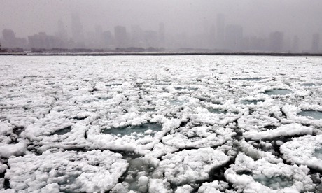
This winter’s weather has been weird across much of the Northern Hemisphere. Record storms in Europe; record drought in California; record heat in parts of the Arctic, including Alaska and parts of Scandinavia; but record freezes too, as polar air blew south over Canada and the U.S., causing near-record ice cover on the Great Lakes, sending the mercury as low as minus 50 degrees Celsius in Minnesota, and bringing sharp chills to Texas.

Everyone is blaming the jet stream, which drives most weather in mid-latitudes. That would be a significant development.For what happens to the jet stream in the coming decades looks likely to be the key link between the abstractions of climate change and real weather we all experience. So, is our recent strange weather a sign of things to come? Are we, as British opposition leader Ed Milliband put it this month while surveying a flooded nation, "sleepwalking to a climate crisis"? 

The polar jet stream is a narrow stream of fast wind circling the globe from west to east at the top of the troposphere from 7 to 12 kilometers up, and usually between 50 and 70 degrees north. It forms where cold, dense air from the Arctic meets warmer and less dense air from mid-latitudes. At the
boundary, winds rush in to equalize the pressure difference. The earth's rotation diverts these winds to travel eastward.So what is going on? The Met Office came to the conclusion that the real driver of the action in recent months was not in the Arctic or the Atlantic, but far away in the western Pacific Ocean. The jet stream, remember, is a global wind, circling the earth. This winter, the jet stream over the Pacific has been deflected much further north than usual. This, according to the Met Office, is likely a consequence of some combination of heavy rains over Indonesia, warm Pacific waters, and unusual pressure systems. 

http://e360.yale.edu/feature/is_weird_winter_weather_related_to_climate_change/2742/

Monday, February 24, 2014

Weather offering blizzards, twisters

(CNN) - Severe weather is battering much of the central U.S. including tornadoes in parts and blizzards in others.
The extreme conditions are part of a large front that will likely mean more severe weather for the weekend. It's a story of extremes.
Tornadoes and severe thunderstorms in parts of Illinois, Tennessee and states further south.
Up north, blizzards and whiteout conditions in Iowa and Minnesota.
It's all part of a fast-developing storm front sweeping across the central U.S.
Meteorologists say the mix of warm and cold air is to blame for the most severe conditions.
"Very hot air, very muggy air in the East, very much colder air behind it," said CNN meteorologist Chad Myers. "That cold air pushes the warm air up - that's the cold front - and we get the tornado possibilities."
More than possibilities: The National Weather Service had reports of as many as eight tornadoes in central Illinois late Thursday.
Seven outbuildings were destroyed in Mechanicsburg. And more than 24,000 people lost power in the state.
Several areas also saw flooding, which emergency officials say was fueled by heavy rain and melting snow.
Meanwhile in colder temperatures up north, blizzard warnings were in effect in Minnesota as rain turned to snow.
It's got some fed up with the seemingly never-ending cold.
And there's no end in sight.
A cold front on the tail of the current system will mean the story of extremes will likely continue into the weekend with plummeting temperatures in the North, and heavy downpours possible in the lower Midwest.
http://www.wdam.com/story/24784362/weather-offering-blizzards-twisters
So far, there have been no reports of injuries or death related to this round of severe weather.

Wet Weather Returns to the West Coast: Beneficial Rains to Soak California, Nevada, Oregon and Washington

After weeks of dry conditions and above average temperatures, wet weather is finally in the forecast for a region of the nation that needs it the most.

Throughout the next several days, a dip in the jet stream will set up over the eastern Pacific, allowing moisture to flow into California, Oregon and Washington.

In addition, two different storm systems are poised to develop over the Pacific and drench the West Coast later this week, providing the parched region with beneficial rainfall.

Periods of moderate to heavy rainfall can be expected with this round, especially late Wednesday into Wednesday night. Some locations in northern California, including Eureka andRedding, may see as much as an inch of rain from this first round.

This system will bring rain as far south as Los Angeles, which is already running 6 inches below normal rainfall this year, on top of an 11.33-inch deficit from 2013. For the combined 2013-14 period to date, only 18 percent of normal rainfall has fallen. While 2 to 4 inches of rain may fall in L.A. during this second storm system, it will still not be enough to get rid of the drought. The foothills in Southern California could see heavier rain amounts of up to 6 inches, making recent burn areas vulnerable to debris flows and mudslides.

As a result of the exceptional drought, watersheds and lakes are running low, not just because of the warm temperatures and dry weather conditions, but also due to the water needs commanded by agriculture and human activity.

http://www.weather.com/news/weather-forecast/beneficial-rain-west-coast-california-nevada-oregon-washington-20140222

Thursday, February 13, 2014

Sochi Olympics' warm weather adds challenging element to Games


SOCHI, Russia — temperatures soften snow at some venues, so some athletes must adjust their technique and officials must scramble to keep competitions running.

This has been a difficult week at a handful of venues in the Caucasus Mountains, where a sunny sky and unseasonably high temperatures have softened the snow and made ice on the sliding track something of a mystery. Athletes have been forced to adjust their technique and equipment while officials have activated contingency plans to keep the competitions on schedule.

Weather challenges are no surprise in Sochi or the adjacent mountains — this is one of Russia's few regions with a subtropical climate. Warm, rainy days forced the cancellation of several international test events last winter.

The Russians prepared for the Games by installing a massive snow-making system and stockpiling snowfall beneath thermal blankets over the summer. They also got lucky with early winter storms that provided ample coverage.

The surface temperature for the women's luge final on Tuesday was about three degrees higher than ideal and officials had to stop the race at one point to repair the ice.


National Weather Service: Ice Storm Is ‘An Event Of Historical Proportions’


ATLANTA (CBS Atlanta/AP) — An ice storm gripped the winter-weary South on Wednesday, knocking out power to a wide swath of the region as the outages nearly doubled by the hour, and forecasters warned the worst of the potentially “catastrophic” storm was yet to come.

From Texas to the Carolinas and the South’s business hub in Atlanta, roads were slick, businesses and schools were closed and people hunkered down. Just hours into it, sleet, snow and freezing rain had encased trees, sending them crashing into power lines. More than 200,000 homes and businesses across the region were without power and the number steadily increased. The storm came in waves of snow, sleet and freezing rain and forecasters warned relief with warmer temperatures wasn’t expected until Thursday at the earliest.

Officials and forecasters in several states used unusually dire language in warnings, and they agreed that the biggest concern was ice, which could knock out power for days. Winds, with gusts up to 30 mph in parts of Georgia, exacerbated problems.
In Atlanta, where a storm took the metro region by surprise and stranded thousands in vehicles just two weeks ago, tens of thousands of customers were reported without power. City roads and interstates were largely desolate, showing few vehicle tracks as most people heeded warnings to stay home.
The forecast drew comparisons to an ice storm in the Atlanta area in 2000 that left more than 500,000 homes and businesses without power and an epic storm in 1973 that caused an estimated 200,000 outages for several days. In 2000, damage estimates topped $35 million.

http://atlanta.cbslocal.com/2014/02/12/national-weather-service-atlanta-winter-storm-will-be-an-event-of-historical-proportions/

Thursday, February 6, 2014

Brutal cold: Is this really unusual or just a bout of winter weather?

Arctic air is once again sweeping the nation east of the Rockies, hitting the East and mid-Atlantic states with frigid weather, with temperatures on average 20 to 30 degrees below normal throughout the region, according to the National Weather Service.

In Chicago, a wind-chill warning shut down hundreds of schools Monday, commuters have been hit with public transit delays, and about 400 flights at Chicago O'Hare International Airport have been canceled, according to the Chicago Tribune.


Although this third round of Arctic chill this month may seem odd, it’s actually not unusual compared with past years. It probably will not go down as one of the 10 coolest Januaries on record.


The frigid systems that have swept through the region have been transient and there have been some breaks. While there have been some days of bitter cold, they are brief and haven’t lasted all month. So, while there have been days with below-average normal temperatures, the average monthly temperatures are not that unusual.

Why is it so cold now? A cold air system is moving from central Canada into the Central Plains and currently impacting the Northeast, mid-Atlantic states and the upper Midwest, including Louisiana and Texas.


http://www.latimes.com/nation/nationnow/la-na-nn-ff-brutal-cold-weather-winter-storm-20140127,0,5994574.story#axzz2saBhztop

No relief: More snow, cold for Midwest, Northeast


From the Midwest to New England, more than 120 million people are yet again bundling up against cold, ice, snow or all three, according to CNN meteorologists.

Who's getting hit the worst? For snow and ice, parts of the Midwest and Northeast in a band running from Illinois east all the way to Maine. For cold temperatures, it's the nation's midsection, from Montana east to Wisconsin all the way south to northern Texas.

Who's being affected?In New York, where heavy snows are taxing salt reserves, Gov. Andrew Cuomo declared an emergency for the entire state and shut down Interstate 84.

Why all the severe weather this winter? Boston is about 8 inches ahead of its normal snowfall pace for the year, the National Weather Service said. In New York, the number is 23 inches.

"If we look at winters in the past, we can get this kind of setup with a very wavy jet stream. Colder air spills into one side (while) the other side of the country has extremely warm weather," he said.

http://www.cnn.com/2014/02/05/us/weather/