Saturday, August 29, 2015

The Development of Hurricane Kilo


 The article discussed the development of Hurricane Kilo and the path it is taking across the central Pacific Ocean. While Hurricane Kilo was initially in route of hitting Hawaii, the storm's course has changed and is now headed northwest toward the International Dateline. While the hurricane is strengthening, it is believed that the storm will not pose a direct threat to land. Instead, the hurricane is continuing to move northwest over open waters. If the storm were to cross the International Dateline, it would be renamed "Typhoon Kilo."

The picture to the left shows a satellite image of the storm along with details regarding it's strength and location. The picture on the right shows the current intended path of the storm, confirming it is moving towards open waters.
  
While Hawaii has been cleared from the direct path of the storm, the islands are still suffering the effects from it. The state has experienced heavy rainfall and thunderstorms. The excessive rainfall has caused flooding and road closures throughout the area. The thunderstorms have produced over 10,000 cloud to ground lightening strikes in a 24 hour period. There is still currently a flood warning issued in the effected areas. 

Original article: http://www.wunderground.com/news/tropical-depression-three-c-tropical-storm-hurricane-kilo-pacific-hawaii-2015

Friday, August 28, 2015

Thunderstorms Soak Chile Desert in Years of Rain and Kill at Least 9 Thor Hicks II

Thunderstorms brought the equivalent of 7 years of rain to Chile's Atacama desert region and caused deadly flooding Thursday. 
Antofagasta, Chile, where the annual average precipitation is 0.13 inches, saw 0.9 inches of rain in 12 hours.
"The Atacama Desert is an extremely arid region and has been for millions of years. As a result, the terrain is hard and rocky because rainfall isn't frequent or abundant enough for either weathering rocks into sand or supporting the kind of ecosystem that would help turn rocks and minerals into soil. Without soil and plant cover to help absorb rainfall, it just runs off instantly as torrents of water," weather.com senior meteorologist Nick Wiltgen said. 
These torrential rains caused the Copiapo River in northern Chile to overflow and kill at least nine people, while simultaneously knocking out power, making roadways impassable and leaving 19 people missing. 
Thousands evacuated after officials warned of mudslides in the normally-parched region. 
Chile's Deputy Interior Minister Mahmud Aleuy called the flooding "the worst rain disaster to fall on the north in 80 years." 
TV images showed brown, muddy waters flooding the streets and reaching a hospital in Copiapo city. Some people living along the river had to be rescued by helicopter because roads were blocked by water and mud. TV footage showed several families waiting on the roofs of their homes, including a man who had punched a hole through his roof to save his toddler.
At least seven people have been killed and 19 people were listed as missing in three communities hit by flooding, officials said.
Desperate family members of the victims took to Twitter pleading for help in finding their loved ones.
The government declared a state of emergency, putting the region under military control, and President Michelle Bachelet flew to the area Wednesday evening to observe the problems first hand.
"We're living an extremely difficult situation," she said. "The previous forecast was that there was a huge drought here, so the rains were not necessarily seen as a catastrophe. Foreseeing was really difficult because no one knew."
Aleuy said that military helicopters were flying in supplies to areas cut off by the rains. 
The heavy rains came after several days of high temperatures and a drought that stoked raging wildfires in Chile's south-central regions. The fires have burned nearly 93,000 hectares in the 2014-2015 season, far above the annual average of 59,300 over the previous five years.
Earthquake-prone Chile is no stranger to the forces of nature. The national geological service Sernageomin said residents should be on alert due to increased activity at the Villarica Volcano in the country's south, which erupted on March 3, forcing evacuations and disrupting air traffic.
The storms prompted Chile's state-run copper giant Codelco to suspend work due to blocked roads, but the company said Thursday it was reopening sites in the north, including some of the world's largest copper mines


y The Associated Press

Four Tropical Cyclones At Once : How Rare Is It? Thor Hicks II

The strongest of these is Cyclone Pam, whose maximum sustained estimated winds had topped 165 mph as it slammed the Republic of Vanuatu Friday night and Saturday morning, local time.
Meanwhile, Cyclone Olwyn made landfall in far western Australia, Cyclone Nathan made a U-turn in the Coral Sea north of Cairns, Australia and, finally, Tropical Storm Bavi is spinning well east of Guam in the western Pacific Ocean.
Wind field analyses also picked out the four circulations well. You could trace wind streamlines coming from the western side of Tropical Storm Bavi eventually feeding into the eastern side of much stronger Cyclone Pam. The centers of Bavi and Pam were about 1,600 miles apart, at that time. (Remember winds flow clockwise around low-pressure systems, such as tropical cyclones, in the Southern Hemisphere).


By Jon Erdman
Published Aug 26 2015

Tropical Storm Erika causes major damage and at least 12 fatalities on the small island of Dominica.

About 20 others remain missing on the tiny Lesser Antilles island that's home to about 72,000, and many homes have been destroyed in the storm, the AP also reported.
"The situation is grim. It is dangerous," Ian Pinard, Dominica's communications minister, told the AP.
About 80 percent of the island was left without electricity, and the water supply was cut off. Trees and light poles were strewn across streets, and several buildings sustained damage, including torn off scaffolding. AP also reports the main airport was closed because of flooding, with water rushing over at least one small plane."The capital city is a wreck. It is a sight to behold. It's a disaster," policewoman Teesha Alfred told the AP about Roseau.

Main story: http://www.wunderground.com/news/tropical-storm-erika-preparations-caribbean-florida-impacts

Wednesday, August 26, 2015

Tropical Storm Ignacio Gets Stronger.

"Ignacio continues to gather strength in a favorable environment for intensification about half way between Los Cabos, Mexico and Hilo, Hawaii.

The airmass that the storm is moving through has relatively low wind shear, or the change in wind speed with height. When wind shear is too significant, it can effectively rip apart the structure of a tropical cyclone. With limited wind shear in the storm's path, Ignacio should continue to get better organized over the next few days as it eventually turns west-northwest."


map_tropinfo12_ltst_5nhpao_enus_485x273.jpg


http://www.wunderground.com/news/tropical-storm-ignacio-hurricane-eastern-pacific-hawaii-august-2015

Tuesday, August 25, 2015

Trouble In The Edens- Ivanna


Tropical Storm Erika Approaching the Leeward Islands; Potential Threat to Puerto Rico, Virgin Islands, Hispanola, Bahamas


Tropical Storm Erika is currently centered just under 500 miles east of the Lesser Antilles and is moving quickly westward at 18 mph. 
For the next couple of days, Erika will be moving into an environment with some vertical wind shear, some dry air, both general inhibitors for tropical cyclone intensification.
Erika may face a lower magnitude of wind shear and dry than did the former Hurricane Danny, but these negative factors, plus a potential future track over land in the Caribbean complicate both the intensity and track forecasts.
The tropical storm was clearly struggling Tuesday night as Air Force hurricane hunter data suggested that the low-level center of Erika remained exposed to the north of limited convection. Also, the central pressure rose to 1006mb at 11 p.m. EDT Tuesday, a sign that the storm is having difficulty better organizing.
http://www.weather.com/storms/hurricane/news/tropical-storm-hurricane-erika-atlantic-august-2015


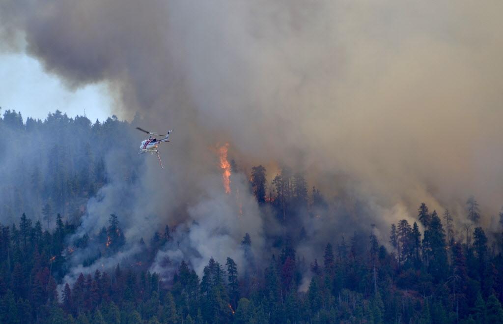
Western Wildfires

Currently in Washington state, there is a wildfire that has spread to about three times the size of Seattle. As of this evening, only ten percent of the fire has been contained. The fire is still spreading and is anticipated to burn for several more months. So far, three firefighters have lost their lives fighting this wildfire and four have been injured.

Most states in the west experiencing these wildfires are recruiting volunteers, former firefighters, and construction workers. This year alone, 7.5 million acres have burned as a result of wildfires; which is about 2 million acres more than the average for this decade. Most of the wildfires are occurring in Idaho, with 17 wildfires currently burning. In Oregon, a wildfire has destroyed more than 36 homes, burned about 114 square miles, and it has only been 30 percent contained.

I am wondering what impact these wildfires have on our environment, considering the smoke and fumes that they release and the vast number of environmental resources they consume?

Embedded image permalink
 (this is a photo of a wildfire that broke out on August 24, 2015, photo courtesy of Andrius Baskys)
Western Wildfire Article