Thursday, January 23, 2014

Climate Change: 2013 another unusually warm year

WASHINGTON, Jan 21, 2014 (AFP) - Last year was among a handful of the warmest on record since 1880, according to US government figures out Tuesday that provide more evidence that the planet is heating up.

Human-caused pollution and the burning of fossil fuels such as oil and coal have driven up greenhouse gas levels, leading to this long-term rise in temperatures, said the US space agency NASA. Carbon dioxide is at its highest level in the atmosphere in 800,000 years, having risen from 285 parts per million in 1880 to 400 parts per million last year, NASA said. Unless current trends change, scientists said the world should expect each of the coming decades to be warmer than the last, said NASA climatologist Gavin Schmidt. 


A key difference between last year and other top years of the past decade is that 2013 had no El Nino effect to warm the equatorial region, a weather phenomenon that would have been expected to cause an uptick in global temperatures.

Forecasters say El Nino could return in 2014, with the potential to make this coming year even hotter than last. Another concerning effect of global warming is the melting of sea ice in the Arctic, which is expected to cause sea level rises over time that will endanger coastal communities around the world. "Arctic sea ice is down considerably, especially over the past 10 to 11 years," said Tom Karl, director of NOAA's Climatic Data Center. Last year marked the sixth smallest sea ice extent in the Arctic on record, while the Antarctic saw the opposite trend, and sea ice was above average.

http://www.weatheronline.co.uk/cgi-app/reports?ARCHIV=0&LANG=en&MENU=207&FILE=b2.txt&DAY=20140122

Northeast locked in deep freeze and Texas expecting ice as winter tightens its grip

There’s no respite in sight from the worst of winter. Not even in Texas.
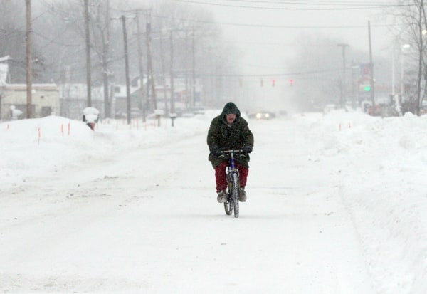
Forecasters say nuisance snowstorms — nothing like earlier this week, but enough to hamper cleanup efforts — will dust the Northeast over the coming days. High temperatures won’t climb out of the single digits in many places Friday, and a brief warmup on Saturday will be followed by another blast of arctic air next week.
Meanwhile, winter storm alerts were posted as far south as the Rio Grande on Thursday, and even Houston and San Antonio were expecting ice by night. Schools were closed in Minneapolis, which woke up to a temperature of 18 below and a wind chill of minus 38.
Crews have already struggled to clear the streets of New York after a storm dropped a foot of snow on Tuesday. Mayor Bill De Blasio said late Wednesday that “more could have been done” to clean, particularly on the Upper East Side, according to NBC New York. He warned New Yorkers about the extreme cold in a tweet. 
Forecasters’ only suggestion to the winter-weary Northeast was to bundle up. Temperatures will continue to be as much as 30 degrees below average, said Michael Palmer, a lead meteorologist at The Weather Channel.

Wednesday, January 22, 2014

Arctic Blast Underway


"There is nothing unusual about this since the polar vortex is always present and there are always spokes and always surges of cold air during the winter in our hemisphere. In any given place or time, the surge of cold air can be more or less intense and travel a longer or shorter distance from the pole."

However, the term 'polar vortex' is being used misleadingly. Due to the actual center of the vortex being in the northern hemisphere, it never moves through the atmosphere above the States. It just remains stationed farther north. 

http://www.weather.com/news/weather-forecast/arctic-cold-finish-january-20140117

50 Foot Monster Waves in Hawaii


There is a low pressure system to the north of Hawaii that will produce 40 to 50 foot waves, making it the largest surf in the last 10 years.

Even though this sounds like a surfers dream, monster waves also can produce debilitating aftermath. “Anyone approaching the shoreline could face significant injury or death. Significant coastal inundation and property damage is possible. Road closures are likely and breaking waves may make it impossible to enter or leave harbors.” 
They are keeping a close eye on this storm to make sure they are properly prepared for what may come. 


http://www.weather.com/news/50-foot-monster-waves-possible-hawaii-20140122

Tuesday, January 21, 2014

We’re Out of Propane and Propane Accessories


Eighteen states have declared energy emergencies due to propane shortages in the wake of the winter storm TWC have dubbed Winter Storm Janus. While other states rely on natural gas, propane is still used to fuel furnaces for more than fourteen million American families, meaning nearly half of the contiguous US will have to be regulated until further notice. With canisters becoming more and more scarce, residents with no where to go are relying on space heaters and other forms of heat to manager indoor temperatures as outdoor wind-chills decrease the average highs dramatically.

Ball Lightning; Very, Very Frightening


Farcical to the uninitiated and heinously rare to the physicist; scientists in China have observed a rare weather spectacle known as ball lightning in nature for the first time. A research team in the Quinhai region was monitoring a thunderstorm in 2012 with video camera and a spectrometer when they unwittingly recorded the St. Elmo’s Fire (ball lightning’s colloquialism). In layman’s terms, ball lightning is a large flash of light that looks circular from afar. It appears during a super cell and can sometimes emanate from objects like lightning rods or ship masts caught in the chaos. In a report published in The Journal of Physical Chemistry, researchers at the U.S. Air Force Academy in Colorado last  year figured out how to reproduce ball lightning in the lab. They used electrodes partially submerged in electrolyte solution to create the high-power electric sparks. The result was bright white plasmoid balls.

Define:Bombogenesis


Adding to the deluge of weather phenomenon terminology, the Northeast faces another category of atmospheric tumult known simply as ‘bombogenesis’. This firework of syllables is best described as a rapidly intensifying storm that is usually over the water. The thing that sets this particular genre of storm apart from, say, tropical storms – beyond its unseasonal presence is that it can only be cultivated when a warm air mass clashes against a frigid one. In this case, the cold air provider is none other than the dip in the polar vortex – the first meteorological term to enter common vernacular this year. While this scenario is not uncommon during the wintry months, in order to be classified as a bombogenesis – the central pressure of the storm must drop quickly down to 24 millibars in just a day. The impacts of a bombogenesis can include rapidly strengthening winds and high precipitation rates, as well as thundersnow.