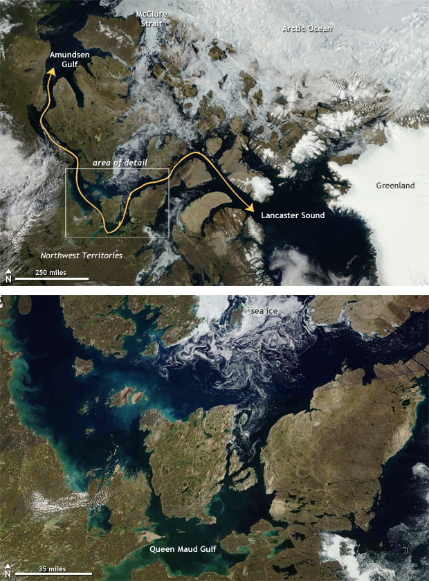
Cloudless skies across the Arctic on August 9 provided a clear view of open water conditions across the straits that make up the Canadian Arctic. Thinner ice and record-low sea ice extents leading up to the 2016 summer melt season plus warmer oceans during the summer led to well below-average amounts of sea ice across the Arctic. Strong storms during August helped break up and clear out the ice along the southern route of the passage. You can draw a line yourself through iceless seas to create your own path, like finishing a real-time geographic maze.
Both the northern and southern routes of the Northwest Passage have been open during occasional years in the past. According to records from Environment Canada, the southern route was "open" (no more than 60% ice covered) occasionally as far back as the 1970s, and the northern route was open in the summer of 1998—a record-warm year at that time. But since roughly 2006, the southern route has been navigable in the summer almost yearly. The northern route was open in 2007, 2008, 2010, 2011 (which was a record-low ice year), 2012, 2015, and now, in 2016 as well.
No comments:
Post a Comment