 Satellite image showing the strange path of the Aug. 2, 2015 Iowa tornado. (Credit: National Weather Service Des Moines, Iowa)
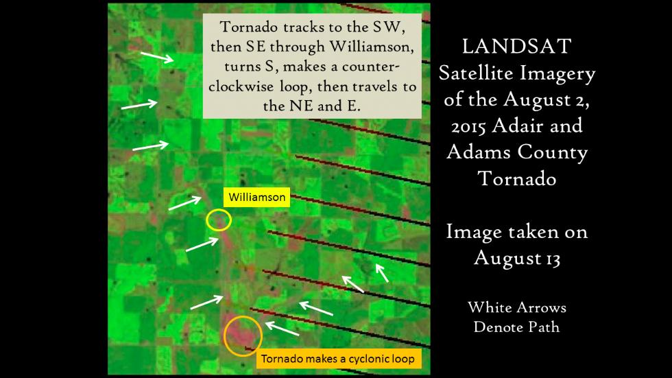
Storm survey illustration of the strange path the Aug. 2, 2015 tornado took. (National Weather Service Des Moines, Iowa)
The white arrows highlighting the tornado scar in the image show how it
moved south initially, then made a cyclonic loop, before eventually
heading back to the northeast. According to the NWS, the path of the
tornado was in mostly rural portions of Adams County and Adair County.
It was rated EF1, leaving some damage to silos and farm buildings about 8 miles north-northeast of Prescott, Iowa.
No comments:
Post a Comment