Thursday, January 29, 2015

Ice Halos form over New Mexico

http://news.nationalgeographic.com/news/2015/01/150114-ice-halo-weird-weather-phenomena-science/

It's not quite like finding diamonds in the sky, but a photographer in Red River, New Mexico, was lucky enough to catch rainbow-like arcs and pillars of light blazing over a snowy landscape last week. 
This example of sunlight run amok is caused by the collision of light and ice crystals high in Earth's atmosphere.
Those frozen specks of water bend or refract light in myriad ways to produce arcs, halos, and pillars of light. Air temperatures, as well as the shape and arrangement of ice crystals, fine-tune the phenomena that we see. (See "Pictures: The Story Behind Sun Dogs, Penitent Ice, and More.")
One of the most prominent features in the New Mexico picture—just above the tree line in the center of the image—is a bright, vertical mass called a sun pillar. Cooler air temperatures boost the brightness of phenomena like these.
The circle of light ringing the pillar is a 22-degree halo. These halos are fairly common and are so named because they occur at a 22-degree angle from the sun. They're created by six-sided, or hexagonal, ice crystals.
The glaring blob of light to the right of the pillar is called a sun dog, which is the result of ice crystals that are only partly aligned with each other. Sun dogs are also fairly common, says Christine Krause, a meteorologist at the National Weather Service in Amarillo, Texas. They posted the image to their Facebook page over the weekend, where it took off.
The delicate strands of light winging out from the top of the sun pillar are tangent arcs. They're formed when tube-shaped hexagonal ice crystals are oriented on their sides. (Learn about other weird structures ice can form.)
Krause is quick to point out that these halos and arcs aren't a harbinger of dangerous weather events. But they are certainly pretty to look at, she says.

Dense Fog in Victor Valley

                                                                  http://www.vvdailypress.com/article/20150128/NEWS/150129803/12982/NEWS


VICTOR VALLEY — A rare, dense fog covered the High Desert on Tuesday and Wednesday morning thanks to Monday rain that “saturated” the soil, Apple Valley-based National Weather Service weather spotter Darren Marlow said.


Marlow said the dense fog was definitely “rare” and that in his more than 20 years he has seen similar fog only “a handful of times.”
“It’s definitely dense, all the moisture from the ground, from the rain, it just settles in,” Marlow said. “Visibility was down a lot, especially over the (Mojave riverbed). It just creeps up on you.”
He said the dense fog requires the “right ingredients,” which he said were saturated soils and a light wind that would allow the moisture to evaporate from the soil and condense into fog.

Wednesday, January 28, 2015

Weather radicalization

http://www.naturalnews.com/040166_weather_radicalization_food_supply_freezing_temperatures.html


weather


Welcome to the weird world of weather radicalization. We're all watching it unfold right before our very eyes: extreme droughts, 500-year floods, fires and blizzards are all getting worse than anyone can remember. It's not just that we have more technology to detect and report on these storms today; the storms are actually getting worse and more frequent.

Simply put, when nature deviates from its normal cycles, it throws food production into chaos. A one-night drop below freezing, for example, can wipe out the entire citrus crop in Florida. A Midwest drought recently collapsed corn production there, and almost two years ago, a severe drought in Texas caused a collapse in grazing grasses, resulting in a mass slaughter of starving cows that could no longer be fed. The upshot of that was plummeting beef prices, followed by a spike the next year as herds had been thinned out far beyond normal.
The "latency" between the radical weather and resulting food prices is anywhere from one month (for fresh produce) to a full year (for processed, manufactured foods). This means that crazy weather patterns today might not spike food prices until next year, depending on the crops in question.
For food prices to drop, food production inputs must fall in price at the same time weather patterns become more predictable. This is extremely unlikely to occur any time in the foreseeable future, especially with fresh water, topsoil and fuel all becoming increasingly scarce and therefore more expensive.
Once you understand this relationship, you'll understand why rainfall and weather patterns are so crucial to the food supply. Just one inch of rainfall on just one acre of land delivers 6.2 million cubic inches of water to the land (and whatever is growing there). That's 27,000 gallons of water per acre with just a one-inch rain.


U.S Secretary of Defense Weather Weapons

http://www.naturalnews.com/040652_weather_weapons_chemtrails_HAARP.html


weather


(NaturalNews) The development of so-called "weather weapons" has been dismissed by many as paranoid hyperbole, the work of science fiction movie script writers and conspiracy theorists, but the fact is they have existed, at least in the laboratory, for decades.
None other than former U.S. Defense Secretary William Cohen, in fact, has talked about the development of weather-related weaponry - or, more specifically, techniques to create weather events to support offensive military operations. During a question-and-answer session at the Conference on Terrorism, Weapons of Mass Destruction, and U.S. Strategy at the Georgia Center in Athens, Ga., in 1997, Cohen addressed them:

In addition to contrails, other reports have mentioned the Air Force's HAARP initiative - High Altitude Auroral Research Project, located in Alaska in 1990. According to the project's website, "HAARP is a scientific endeavor aimed at studying the properties and behavior of the ionosphere, with particular emphasis on being able to understand and use it to enhance communications and surveillance systems for both civilian and defense purposes."

The Air Force has denied that the project aims to modify weather, but is instead primarily focused on research. And yet, links between HAARP and weather control continue to crop up.

Answers about HAARP's real purpose, and those of weather weapons in general, remain elusive, but with Cohen's admission more than 15 years ago that such technology exists is proof enough, even if we don't know all of the details.


Space weather eventually fry's all communication satellites

http://www.naturalnews.com/042182_space_weather_communications_satellites_solar_superstorms.html


weather


NaturalNews) Increasingly, because of hyperactivity, scientists believe that high-speed eruptions of super-charged particles from the sun may someday cause increasing problems and failures in the signals from satellites we rely on to watch TV, use the Internet and communicate.
Solar flares, coronal mass ejections and other space weather events generated by the sun, though some 93 million miles (150 km) away, can send highly energized particles speeding towards Earth. These "solar storms" have, in the past, been blamed for disrupting communications systems and damaging satellites.
Researchers believe the charged particles could have accumulated in the satellites over a period of time. And, despite the satellites' protective shielding, that buildup most likely caused some internal charging which, in turn, damaged the satellites' amplifiers, which are necessary in order to relay signals back to earth. Over the course of extended missions, the researchers warn this phenomenon could lead to a failure of the satellites' backup amplifiers as well.
The thing about space weather is that it often resembles weather on Earth - it's not very predictable. And, say researchers, space weather can be much more reactive than what is often predicted by models utilized by engineers who design satellites, according to Kerri Cahoy, one coauthor of the study and an assistant professor of aeronautics and astronautics at MIT.

The report about extreme space weather from the Royal Academy of Engineering in London said major solar super storms generally occur, on average, once every 150-200 years. The group went on to note that the last major solar storm took place in 1859, long before the establishment of modern electrical grids and a century before space travel and satellites.


Strokes related to weather changes

http://www.naturalnews.com/043999_stroke_weather_changes_death_rate.html


stroke


(NaturalNews) A new study finds that dying from a stroke could be linked to meteorological conditions at the time of affliction.
Scientists presented their findings at the American Stroke Association's recent International Stroke Conference, which was held in San Diego Feb. 12-14. There, researchers said data indicate that rates of hospitalization and death from a stroke correspond to the rise and fall of environmental temperatures and dew points
-- With each 1 degree Fahrenheit increase in average temperature, there was a 0.86 percent decrease in the chances of being hospitalized by stroke, along with a 1.1 percent decrease in the odds of dying in the hospital after suffering a stroke.

"This study suggests that meteorological factors such as daily fluctuations in temperature and increased humidity may be stressors that increase stroke hospitalizations," Lichtman said. "People at risk for stroke may want to avoid being exposed to significant temperature changes and high dew point and, as always, be prepared to act quickly if they or someone they know experiences stroke signs and symptoms.
Another way to reduce your risk of stroke is by changing what and how you eat. As Natural News has reported, there are seven "power foods" that you can add to your diet that will help abate your stroke risk, no matter the temperature:


Tuesday, January 27, 2015

Over 200 Chicago Flights Cancelled

http://wgntv.com/2015/01/26/noreaster-threatens-northeast-with-up-to-2-feet-of-snow/


About 190 flights from O'hare International Airport have been cancelled due to storms in the East.
At Midway Airport over 30 flights have been cancelled.

2-3 foot of snow have been reported in parts of New York and Boston.


Airlines have been saying that they are cancelling thousands of flights in and around that region.

Boston and New York are experiencing some of the worst storms in history.

Winter Storm in The Upper East Coast

A man walks out of an ocean front house covered in ice during a winter blizzard in Marshfield, Massachusetts January 27, 2015.    REUTERS-Brian Snyder

A U.S. blizzard swept past New York City and struck hardest at some 4.5 million people around Boston, dropping nearly three feet of snow in areas and triggering high tides that breached a seawall and forced residents to flee their coastal homes.

"There are drifts now of four, five and six feet in some places," Massachusetts Governor Charlie Baker told reporters. Boston-area subways would remain closed for at least the rest of the day, Baker said.

High tides breached a seawall in Marshfield, Massachusetts, about 30 miles (50 km) south of Boston, damaging 11 homes, several of which were condemned, police said. Waves were splashing over the damaged seawall by afternoon and local police urged residents of the area to evacuate before the next high tide, expected at 5 p.m. ET.

http://www.reuters.com/article/2015/01/27/us-usa-weather-idUSKBN0KW26Z20150127

Boston's Natural Gas Pipes Leaking High Levels of Heat-Trapping Methane Into Atmosphere

http://www.weather.com/science/environment/news/boston-natural-gas-pipes-methane-leaks
Boston is more than doubling the amount of Methane gas being entered into the air because of old pipes. They are leaving a larger carbon footprint than anyone previously thought. The article proceeds to discuss how almost 2.7% of all natural gas that is being delivered to the city is entering the atmosphere. The effect of this over time will be dramatic and only hurt the environment and globe.
One surprising thing is that some of the leakage is coming from inhabitants cooking. This brings forth the question of what we as a society can do to reduce this use and prevent leakage and the harm of the planet. Professionals said that the next step is to figure out a plan of what to do to prevent and reduce the leaking of these natural gases since we know where the bigger problems are.

Boston’s Natural Gas Pipes Leaking High Levels of Heat-Trapping Methane

By Bobby Magill, Climate Central
Published Jan 23 2015 10:29 AM EST
From our partners

alt

Boston's Back Bay neighborhood. (Wikipedia)

New England vs. Storm


New England faced an old enemy Tuesday: Mother Nature

She brought a blizzard with her, one that is hardly unprecedented for this often weather-weary region. While the storm didn't pummel places like New York and New Jersey as much as feared, others remained very much in the thick of it Tuesday.
Residents of Barnstable on Cape Cod, for instance, had drifts of up to 3 feet and whiteout conditions, said police Sgt. Mark Cabral. At 11:10 a.m. Tuesday, the National Weather Service reported that Framingham, Massachusetts, had 30 inches of snow, with more than 18 inches having fallen about 20 miles east in Boston.
It's not just Massachusetts, with nearly 16 inches reported in Portland, Maine; over 21 inches in Hudson, New Hampshire; and 28.5 inches in Orient on New York's Long Island.And, in some of these places, the end still isn't in sight.
That's particularly true for east-facing coastal areas now coping with early morning flooding, heavy snows and potent winds, while bracing for a new high tide -- and the storm surge expected with it -- around 5 p.m.

Nantucket and its 15,000 residents "lost power to the entire island," said police Chief William Pittman, a situation he attributed to sustained winds of roughly 50 mph, punctuated by gusts of around 80 mph.

On Massachusetts' South Shore, the ocean roared inland to flood the Brant Rock Esplanade lined with homes and businesses. The town's police posted a photo of what it called a "major seawall breach (that) caused structural damage" to a home, while authorities in neighboring Duxbury showed a deck blown yards away from a home. And not far away in Scituate, slushy ice, seawater and debris clogged streets.


http://www.cnn.com/2015/01/27/us/weather-storm/index.html
The Boston area got hit by a blizzard with wind gusts over 70 mph along with other areas of lower New England and Long Island on Tuesday. However, this storm was reportedly expected to hit Philadelphia and New York City which it didn't. The buses and subways were shut off momentarily in preparation for the storm which angered some residents preventing them from making their daily commutes to work and school. Other's were more sympathetic to the weathermen who reported a drastically severe storm headed their way it relation to the severe storm they have experienced in the past. But anyways, Boston has experienced snow plows working non-stop this morning and police officers driving nurses and doctors to hospitals to take precautionary measures. More than 7,700 flights were cancelled, along with

http://news.yahoo.com/millions-hunker-down-northeast-storm-totals-downgraded-071248336.html 

schools and businesses closed. 

Monday, January 26, 2015

Winter Storn Lola shows signs in the Northeast

The winter storm Lola is showing signs that there will be snow early next week. A widespread area of 1 to 3 inches of snow is likely from the Upper Midwest to the Ohio Valley, with some locally higher amounts. Temperatures will be very low in the 20s when it comes to this snowstorm. Some of the computer forecast models indicate that the low pressure system will deepen and then take a northward turn Monday night into Tuesday.

People tend to be concerned when they don't know how much snow is coming, because it can tend to really ruin your everyday plans. Roads can be closed or not salted causing major accidents and crashes. People also need to be cautious with the cold temperatures arising and to stay bundled up.

Link:http://www.wunderground.com/news/snow-clipper-midwest-mid-atlantic-northeast-storm-early-week


Los Angeles Battered by Santa Ana Winds

On Friday, January 23, 2015, Los Angeles was bothered by the Santa Ana winds. These winds tore down several power lines and caused many power outages. Wind gusts reached 89 mph is San Fernando, California. In other areas, the winds ranged from 50 to 70 mph. It is crazy to think about how much wind can really affect a town's surrounding areas.

Power lines were also brought down in the Los Angeles area. This resulted in 9,000 power outages in the San Fernando valley. In the early morning hours of Saturday a tree fell on a gas line in Rancho Cucamonga, California, leading to the evacuation of 24 apartments.

Link: http://www.weather.com/news/news/los-angeles-santa-ana-winds


Global Warming 'Doubles' risk of Extreme Weather

"Parts of the world will have weather patterns that switch between extremes of wet and dry, say scientists.
The US will see more droughts while flooding will become more common in the western Pacific, research suggests.
The study, in Nature Climate Change, adds to a growing body of evidence over climate change and extreme weather.
The latest data - based on detailed climate modelling work - suggests extreme La Nina events in the Pacific Ocean will almost double with global warming, from one in 23 years to one in 13 years.

Start Quote

Our previous research showed a doubling in frequency of extreme El Niño events, and this new study shows a similar fate for the cold phase of the cycle”
Prof Mat CollinsExeter University
Most will follow extreme El Nino events, meaning frequent swings between opposite extremes from one year to the next."

New research is showing that the old phase is now being doubled just as they had found for the warm phase and while individual events can not necessarily be attributed to global warming more weather patterns are arrising that are a cause for concern.

Chicago's benchmark blizzard of '67

Nor-easter bears down on Northeast on 48th anniversary of Chicago’s benchmark Blizzard of ’67


48 years ago today was the largest snowstorm in Chicago history. As the northeast bunkers down and prepares for a snow storm that could bring up to three feet of snow to the region. This storm just barely nicked Chicago and the Chicagoland area, but will gain strength as it moves farther east. The storm of '67 stranded over a thousand cars and 1100 CTA buses. By the time the snow stopped falling, 23' of precipitation had fallen.  

http://chicagoweathercenter.com/blog/nor-easter-bears-down-on-northeast-on-48th-anniversary-of-chicagos-benchmark-blizzard-of-67

Global warming making blizzards worse?

"We’re on the verge of another historic blizzard, with as much as two or three feet of snow expected in parts of the Northeast. Already, the press is throwing around terms like “Snowmageddon” to describe what’s coming. Next comes politics: Whenever the East Coast sees an extreme snow event, the weather is perfect for snow trolling – e.g., trying to use one cold event to refute a warming climate trend.
In this case that’s particularly inappropriate, though, because if anything, extreme snowfall may actually be enhanced by global warming. I know it sounds counterintuitive, but remember that even in a warming world, our hemisphere will still spend part of the year tilted away from the sun, with shorter days and colder temperatures — and winter storms.
The question scientifically, then, is what happens to those storms in a warmer world. So let’s examine what science can say about that question.
Technically, the storm about to slam the Northeast is called — that’s right — a nor’easter. What’s special about these storms is that they draw their energy from a temperature clash between freezing Arctic air on the one hand, and warmer Gulf Stream waters on the other."

http://www.washingtonpost.com/news/energy-environment/wp/2015/01/26/global-warming-could-make-blizzards-worse/

Massive pileup in Michigan blamed on bad weather

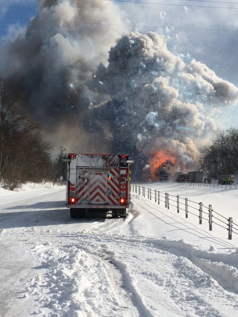
"DETROIT – Michigan officials on Friday briefly evacuated the area of a fatal pileup of 150 vehicles on an icy interstate, including a trailer transporting formic acid and another one carrying fireworks, which both caught on fire.
A three-mile area around the crash in southern Michigan, about 10 miles east of Kalamazoo, was ordered evacuated out of caution because formic acid is a hazardous material, state police said.
But it was lifted because the formic acid had burned off, Michigan State Police spokesman Lt. Rick Pazder told Reuters.
Icy conditions and low visibility contributed to the crash that happened some 10 miles east of Kalamazoo on Interstate 94, near the border of Kalamazoo and Calhoun Counties."

http://www.torontosun.com/2015/01/09/massive-pileup-in-michigan-blamed-on-bad-weather
View image on Twitter

Dangerous Fire Conditions

"Dangerous wildfire conditions will be prevalent until this evening for all of northeast and central Oklahoma, the National Weather Service said.
Forecasters issued a Red Flag warning for much of the state, meaning that "a dangerous combination of weather conditions and dry vegetation is expected ... favoring rapid growth and spread of any wildfires.
"Any fires will quickly spread and may become out of control and endanger lives and property," forecasters said.
Strong winds of 25 to 35 mph will be common this afternoon with low relative humidity and near-record highs in the upper 60s to low 70s, forecasters said.
"The resultant fire weather conditions will support aggressive wildfire behavior through the late afternoon ... before wind speeds gradually decrease around sunset," the weather service said.

"Dispose of cigarettes properly and avoid activities that could start fires," forecasters said."

http://www.tulsaworld.com/news/weather/forecasters-dangerous-fire-weather-conditions-today/article_2979ea3d-f570-5a4c-978a-8865d2d29f2c.html

Seattle sets weather record

"Boston-area blizzard was expected to bring “up to 24 hours of white-out conditions" with up to 3 feet of snow in some areas, Fox25 Meteorologist Sarah Wroblewski said."
"Meanwhile in Seattle, the Emerald City was the same temperature as Miami -- 63 degrees -- at 4 p.m. Pacific time."
"12s who lined the 1.1-mile route from the Seahawks’ practice facility in Renton to Sea-Tac International Airport had a rain-free Sunday morning on a day that had record-setting temperatures. The 63-degree high temperature at Sea-Tac shattered the previous high mark of 58 degrees."
http://www.kirotv.com/news/news/seattle-sets-weather-record-boston-prepares-massiv/njw6m/
Seattle-Boston weather

Green Bay's January Remains Gentle

"While Snow Armageddon supposedly descends on the Eastern Seaboard Monday night and Tuesday, the Frozen Tundra may not get enough snow in the period to cover the exposed grass and sketchy sledding hills and ski trails.
So what's up with that?
"The weather pattern we're in is just not good for a lot of snow," said Rich Mamrosh of the National Weather Service in Ashwaubenon.
Flurries that began in the Green Bay area right around the lunch hour Monday are expected to keep up intermittently overnight and into Tuesday morning, leaving maybe an inch of snow on the ground, Mamrosh said. The same thing might happen Wednesday night into Thursday and again this weekend, but total accumulation isn't expected to be much. Daytime high temperatures should remain in the upper 20s to near freezing until the weekend.
Meanwhile, governors out east are declaring states of emergency in anticipation of Winter Storm Juno, which is expected to dump several feet of snow. Public transit shutdowns already are under way, store shelves are being cleaned out by hoarders and residents are being urged to check on elderly neighbors."

http://www.greenbaypressgazette.com/story/weather/2015/01/26/january-weather-remains-gentle-green-bay-area/22360079/
NEW YORK, NY - JANUARY 24: People participate in a

NYC, Boston ban road travel due to superstorm

"A historic snowstorm blasted its way through the Northeast on Monday, bringing with it havoc, flight cancellations, school closings and worry that up to 3 feet of snow and hurricane-force winds might be on the horizon.
Both New York City and Boston took the rare step of banning all forms of travel due to the storm.
"It's dangerous out there now. It's only going to become more dangerous,'' New York Gov. Andrew Cuomo said Monday evening as he announced a total ban on travel on any road after 11 p.m. in 13 counties including the city, suburbs and Long Island.
A blizzard warning was issued for both metro areas and more than 6,100 flights had been canceled before the storm cranked up. The storm will impact more than 40 million people, the National Weather Service reported.
As of late afternoon, Central Park had recorded more than 4 inches of snow."
The treacherous, 24-hour-plus snow odyssey was expected to be most severe late Monday and deep into Tuesday. AccuWeather senior meteorologist Tom Kines said Philadelphia, New York City and much of New England could see 1-2 feet of snow. Parts of central Massachusetts and central Connecticut could be in the 2-3 foot range, he said.
Wind gusts could reach 40-55 mph in many areas, with 60 mph or more possible along the coast, Kines said.
"Travel will be impossible. Forget about it on Tuesday," Kines told USA TODAY. "The sun will come out Wednesday, and they all can start digging out."
New York City Mayor Bill de Blasio said city streets will be closed to non-emergency traffic as of 11 p.m. Monday. Schools will be closed Tuesday, he added.
"Recognize this as an emergency, this is not business as usual," de Blasio said. "This is going to hit very hard and very fast."
http://www.usatoday.com/story/weather/2015/01/26/northeast-blizzard-monday/22335029/
XXX JL012615LOHUDSNOW01.JPG MET NONE NONE STANDALONE USA NY


Northeast Storm


That's the message government officials across the Northeast offered residents Monday ahead of what could be a blizzard of historic proportions bearing down on the region.
Roads are already dangerous, said Cuomo, who has already declared a state of emergency and called out the National Guard. And it's going to get worse.
The National Weather Service, which isn't prone to exaggeration, is using terms like "life-threatening" and "historic" to describe the weather system taking aim at the Northeast, with the worst expected to hit Monday night into Tuesday.
http://edition.cnn.com/2015/01/26/us/weather-storm/

Grand Canyon Phenomenon

Grand Canyon visitors were treated to a rare weather phenomenon Thursday when a dense layer of clouds filled up the 6,000-foot-deep canyon like a bathtub. 
The phenomenon, known as a total cloud inversion, occurs when warm air aloft traps clouds closer to the surface of the ground. This time around the inversion trapped colder clouds lower in the atmosphere, just below the rim of the canyon, creating billowy white views for miles in all directions in the expanse below. 
http://www.weather.com/news/news/grand-canyon-clouds

Death Toll From Typhoon Hagupit Climbs


http://www.huffingtonpost.com/2014/12/08/typhoon-hagupit_n_6286446.html?utm_hp_ref=extreme-weather


Typhoon Hagupit weakened to a tropical storm as it churned close to the Philippine capital on Monday, after killing 27 people on the eastern island of Samar island where it flattened homes, toppled trees and cut power and communications.
Manila shut down as Hagupit, which means "lash" in Filipino, took aim at the tip of the main island Luzon, just south of the capital city of 12 million people.
"We now have a total of 27 dead, most of them in Borongan, Eastern Samar," said Richard Gordon, chairman of the Philippine Red Cross, adding most of the dead drowned in floodwaters.
But despite the rising death toll, there was relief that Hagupit had not brought destruction on the scale of super typhoon Haiyan, which last year killed thousands of people in the same areas of the central Philippines.
Hagupit roared in from the Pacific as a Category 3 typhoon on Saturday night, churning across Samar island and on to the smaller island of Masbate. Its effects were felt across the central Philippines, including Leyte island and southern Luzon.

Brazil Faces Worse Drought In History


The taps have run dry and the lights have gone out across swathes of Brazil this week as the worst drought in history spreads from São Paulo to Rio de Janeiro and beyond.
More than four million people have been affected by rationing and rolling power cuts as this tropical nation discovers it can no longer rely on once abundant water supplies in a period of rising temperatures and diminishing rainfall.
The political and economic fallout for the world’s seventh biggest economy is increasingly apparent. Protesters in dry neighbourhoods have taken to the streets, coffee crops have been hit, businesses have been forced to close and peddle-boat operators have had to cease operations because lakes have dried up.
In São Paulo – the most populous city in South America and the worst hit by the drought – a year of shortages has cut water use in the city by a quarter since last January, but Jerson Kelman, the head of the main water company Sabesp, urged consumers to do more in helping the utility to “prepare for the worst”.
http://www.theguardian.com/world/2015/jan/23/brazil-worst-drought-history

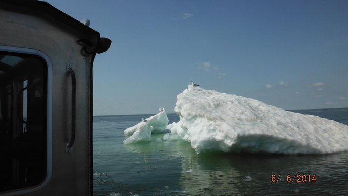
Great Lakes Ice Free, At Last, in June!


View image on Twitter    http://www.weather.com/news/news/great-lakes-ice-free-june-20140613

Lingering patches of ice in parts of southern Lake Superior in late May and early June were the most widespread on record for that time of year dating to at least the early 1980s.
June daytime air temperatures predominantly in the 60s and 70s, along with a handful of wet June days helped melt remaining chunks of floating ice.
Despite this, Lake Superior water temperatures continue to be quite cold, generally in the upper 30s and 40s.
One of the coldest winters on record, followed by a persistently chilly spring, were the culprits for this persistent lake ice.
December through March was the coldest such period on record in Marquette and Hancock, Michigan. High temperatures at the National Weather Service near Marquette failed to rise above freezing from Dec. 6-Feb. 18, a record 75-day streak. There were a record 65 days of subzero cold lows at NWS-Marquette, including a record latest subzero cold low on April 16 (-5 degrees).

Unusual Winter Wildfires in Northwest Oregon


http://www.weather.com/news/news/oregon-wildfire-winter-january-20140125

A pair of fires flared up along in the Oregon coastal range east of the town of Arch Cape, about 70 miles west-northwest of Portland on January 23. Fanned by winds estimated at 70 mph, the flames had burned around 120 acres as of January 24, according to a story by KGW News Channel 8 in Portland.

Wet Winter? Not in 2013-2014!

The coastal ranges of northwest Oregon are among the most reliably wet locations in the Lower 48 states during the winter months.
The graph at left shows average January precipitation and days with measurable precipitation at nearby Seaside, Ore. As you can see, two-thirds of January days typically have at least measurable precipitation. At least one inch of precipitation typically drenches the area 3-4 days each January.
By contrast, January 2014's precipitation is a small fraction of the monthly average. This precipitation deficit stretches back to fall, as well.

Record Highs Continue Across West and Plains; Death Valley Ties January Heat Record

The most remarkable record thus far happened in a place famous for recording the world's official record high temperature back in July 1913. Death Valley, California, reached 87 degrees on Sunday, tying its all-time record high for the month of January.
That record was originally set January 8, 1962. That's notable because around the same time, a massive arctic high pressure bubble began plunging south into Montana and the Northern Plains, bringing temperatures in the 40s below zero as far south as New Mexico and eventually supplying enough cold air for snow to fall along the Gulf Coast.

http://www.weather.com/forecast/national/news/mild-midwest-warm-west-record-highs#/1 
UK storms a result of climate change say nearly half of poll respondents
Survey for Avaaz suggests support for Ed Miliband's call for action with only 27% denying climate change linked to floods


Nearly half of people believe that the floods and storms that have ravaged Britain for the past three months are a result of climate change, compared with just over a quarter who do not, according to a new poll.
The Labour leader Ed Miliband's statement at the weekend that Britain was "sleepwalking into a national security disaster" appears to have struck a chord, with 38% of respondents saying the government needs to take more action on climate change. Just 22% of people agreed that the government is taking strong enough action.
More than one in three people said that political leadership on climate change and extreme weather events would affect how they voted in future.
Young people are overwhelmingly sure that climate change will pose a threat to their way of life. Two-thirds of people under 24 questioned by ICM said they thought that climate change would affect them, compared with 29% of over-65s. In total, 57% of the people asked thought climate change threatened the UK way of life.
Iain Keith, the Avaaz campaign director, said: "David Cameron has said that he will spend whatever's necessary to help people hit by the floods. But dealing with the consequences of climate change is not just about dams and dredging; it's about backing a long-term plan to cut emissions by half by 2030, which 50,000 people have urged him to do today."

http://www.theguardian.com/uk-news/2014/feb/18/floods-storms-climate-change-poll

Sunday, January 25, 2015

Severe weather in Africa

The storms across South Africa have lead to the death of at least eight people and damaged roads and properties [EPA]
South Africa has been pounded by some hazardous weather over the past few days.
The weather first turned severe on Thursday in the southwest of the country. 32 hikers had to be rescued after being trapped by heavy rain on the Whale Trail near Bredasdorp.
The worst of the weather struck in the southeast of the country. According to provincial disaster management officials, eight people, including a five-year-old boy, died in the severe weather in the Eastern Cape.
The deaths occurred whilst people were attempting to cross streams or when their vehicles were washed away.
The flooding was so severe, that it even washed away a section of the main N2 highway, which links Grahamstown to Port Elizabeth.
As well as torrential rain, the weather system also delivered large hailstones. Some reports say that the hail was as big as tennis balls in some parts of Johannesburg.
The ice smashed into cars and broke windows of many homes and businesses, and caused a number of traffic accidents.
The severe weather is due to a low pressure which is still delivering widespread thunderstorms across many parts of the country. The treacherous conditions are expected to continue across southern parts of the Western and Eastern Cape during Monday, before clearing away from the southern regions on Tuesday.

tsunami of 2011 in Japan

http://worldnews.about.com/od/centralandeasterna3/ig/Japan-Earthquake-Tsunami-2011/Inundated-by-Tsunami.htm#step-heading

I could not copy the picture into the post, but this was the devastation that took place in Japan. When you look at what mother nature can do in one storm or tsunami, it is scary and amazing at the same time. I can only imagine what I would do if I saw something like this threatening where I live and what I would do to protect my family even though there is not enough time to do much if there isn't much warning.

Friday the 13th severe weather

Map of the Approximate Tornado Tracks for the April 13-14, 2012 Severe Weather Event
 
 
http://www.srh.noaa.gov/oun/?n=events-20120413A severe weather event began during the early afternoon hours of Friday, April 13, 2012, and lasted through the early morning hours of Saturday, April 14, 2012. Around a dozen tornadoes, as well as large hail, and strong wind gusts were produced by the numerous thunderstorms that occurred during this event. Much of the severe weather occurred in parts of southwestern and central Oklahoma. However, thunderstorms did develop in other portions of Oklahoma as well during the event.
A moist airmass had been in place over much of the region for several days prior to April 13th, and several rounds of showers and thunderstorms had occurred during this period. On Friday, April 13th, a dryline and weak frontal boundary moved into the area extending from near southwestern and west central Oklahoma then northeast into north central Oklahoma by the early afternoon hours. The first storms developed in parts of southwestern Oklahoma and west Texas. However, it was several hours before the first tornado occurred. In fact, the potential for tornadoes increased during the early evening hours of April 13th as the low level jet (strong winds just above the surface) became stronger.

Saturday, January 24, 2015

Los Angeles Area Battered by Santa Ana Winds


Strong winds created  change in pressure battered the Los Angeles area Friday, Saturday and following through to Sunday morning. Meteorologist Ari Sarsalari says these winds could be a hurricane force wind and he is reminded of the Santa Ana wind even in Southern California from 2011, which left a lot of damage behind.


Sarsalari says fire weather is a definite concern for the next few days. 
"Sustained winds will be in the 25 to 40 mph range and gusts up to 80 mph remain possible through Saturday. Winds will become less widespread and weaken Saturday night but will remain strong into Sunday morning."
Power lines were brought down in the greater Los Angeles area which resulted in power outages (over 9,000). On Saturday morning, people from 24 apartments were evacuated after a tree fell on a gas line in Rancho Cucamonga, California.

http://www.weather.com/news/news/los-angeles-santa-ana-winds

Jan 24: Snow Storm Detected!

Saturday, January 24, 2015


euro

Up until today, models have been advertising another clipper for Monday with just light accumulations from a few passing showers. Today’s guidance has trended towards a possible major snow storm in the Sunday night-Tuesday time-frame.
A clipper that dives in from the NW and then bombs out near the benchmark. A bomb out is a meteorological term called bombogenesis: a 24mb drop in pressure within a 24-hour period. When this happens, in just the right location (near the benchmark), explosive snow is possible for the mid-Atlantic and Northeast US.
The European model and the Canadian one both indicate a similar storms throughout New Jersey but with less snowfall. Either way, the meteorologist CJ recommends everyone should prepare for anything from significant to major snowfall.

http://www.weathernj.com/jan-24-snow-storm-detected/


Friday, January 23, 2015

Antarctica Contributes to Global Warming

http://www.weather.com/science/environment/news/iceberg-antarctica-alex-cornell


Filmmaker Alex Cornell sighted an iceberg that was flipped over while in Antarctica. Cornell shot the photos at Cierva Cove on the Antarctic Peninsula last December on an expedition through the Drake Passage. Apparently the sighting is very rare claimed the glacial scientist aboard the ship Cornell was on. 


This led to further inquiry on Antarctic Sea ice reaching new high temperatures due to the continent's warming. “Antarctic sea ice in 2014 is going to set a record for sure,” said Ted Scambos, a senior scientist with the National Snow and Ice Data Center in Boulder, Colorado. The melting of this Arctic ice is connected with the overall warming of the planet. With the loss of the reflective white ice, and more darker ocean space, the earth is experiencing warmer temperatures.