First the cold, then the snow.
A
widespread cold snap that will encompass nearly the entire U.S. this
week will be followed by a potentially disruptive snowstorm in the South
and East by the weekend.
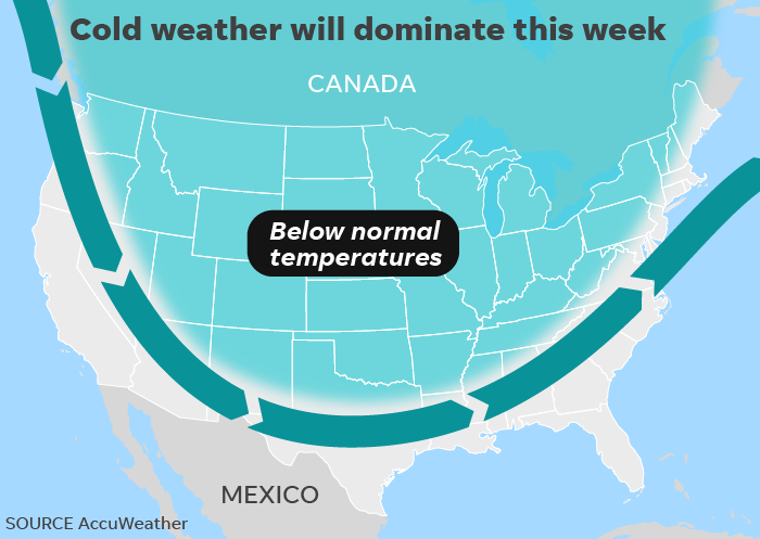
"On Wednesday,
temperatures will be near to below average from coast to coast," the
National Weather Service said, with some of the most unusual
cold expected across the eastern U.S.
How cold?
Early Wednesday and/or Thursday morning, temperatures are forecast to
drop below freezing in portions of all 50 states, even in normally
mild Florida and Hawaii. (In Florida, only the Panhandle should reach 32
degrees, while in Hawaii, the sub-freezing temps will be atop the Mauna
Kea volcano.)
Overall, temperatures will be some
10 to 20 degrees below average for much of the week, the National
Weather Service said. By week's end, cities such as Minneapolis and
Chicago will only see high temperatures in the teens and 20s.
The cold air comes directly from the Canadian Arctic, the weather service said.
Then,
the snow: A storm "is expected to bring a widespread wintry mess of
snow, sleet and freezing rain through parts of the nation's southern
tier and possibly the East Coast late this week into next weekend," the Weather Channel warned.
More
specifically, "a weather system will develop and gain strength from
Texas into the Southeast U.S. heading into the weekend," weather.us meteorologist Ryan Maue said. "This southern track means the cold air to the north will allow for frozen precipitation, including snow."
Although
it will be too warm to snow in much of Texas, Louisiana and Arkansas,
the state will instead have to deal with severe storms and potential
flooding, AccuWeather said.
By
Saturday or Saturday night. Snow, sleet or freezing rain could affect
travel from portions of northeast Georgia into the Carolinas and
southern Virginia, the Weather Channel warned.
https://www.usatoday.com/story/news/nation/2018/12/03/cold-snap-then-snow-first-week-december/2193896002/
No comments:
Post a Comment