Thursday, February 27, 2014

Top Snowiest Cities As of Today


Without doubt, this has been a very snowy winter for the enitre United States. But, which city has been the snowiest? As of February 26th, 2014 at 7:00pm, when the last statistics for the snowiest cities were updated, the number one city is Erie, Pennsylvania. Erie, Pennsylvania is located in the northeastern part of the United States. Erie has a population of 101,786 people. For the 2013-2014 snow fall season Erie is the number one snowiest city because they have had, as of 2-26-14, 83.4 inches of snow and a total of 120.6 total snow falls. The least snowiest city is Bridgeport, Connecticut, with only 21.3 inches of snow and 56.2 snowfalls. Surprisingly, Chicago is the 13th snowiest city, so we are just in the middle. Accoring to the Golden Snow Globe, Chicago has had 29.3 inches of snow and 68.3 total snowfalls. Who will end up being the snowiest city of this winter?

http://goldensnowglobe.com/current-top-10-snowiest-cities/

More Snow?


According to The Weather Channel, a winter storm, with the name of Titan, is approacing. The Waether Channel states that this Titan will begin some time on Thursday (2-28-14) night and Friday. It will develop heavy rain and mountain snow across California. Titan would be more significant through Sunday and Monday, due to its precipitation getting heavier. There is a significant ice threat, The Weather channels predicts: on Sunday, there will be ice accumulation across the Ohio Valley and most likely parts of the mid-Mississippi Valley and Ozarks. On Sunday, Titan is also predicted to strike some northern and southern cities. There is also snow threat, of more than a foot of snow, in the Sierra Nevada, Wyoming, Idaho and Montana. The storm will move into the Northeast Sunday night into Monday and depending on the track Titan takes it will determine if it will snow in Pennsylvania, New Jersey and perhaps across Virginia. Buffalo, New York City and Boston can also expect snow accumulation of 6 inches to over one foot. 


http://www.weather.com/news/weather-forecast/winter-storm-titan-ice-storm-snowstorm-west-midwest-northeast-20140226

World begins 2014 with unusual number of extreme weather events


There have been heatwaves in Slovenia and Australia, snow in Vietnam and the return of the polar vortex to North America. Britain has had its wettest winter in 250 years but temperatures in parts of Russia and the Arctic have been 10C above normal. Meanwhile, the southern hemisphere has had the warmest start to a year ever recorded, with millions of people sweltering in Brazilian and southern African cities.

According to the UN's World Meteorological Organisation (WMO), which monitors global weather, the first six weeks of 2014 have seen an unusual number of extremes of heat, cold and rain – not just in a few regions as might be expected in any winter, but right the way around the world at the same time, with costly disruptions to transport, power systems and food production.

Some climate scientists argue that there is nothing unusual in winter global temperature extremes but Omar Baddour, chief of the WMO data division, says the recent phenomena are almost certainly interlinked, with new computer models suggesting increased evidence of climate change.

"We are also seeing some unusual phenomenon, such as the polar vortex in North America, that is bringing unusually cold weather, which would not be automatically be considered to be due to climate change. However, there is some evidence that such unexpected surprises are also due to global warming."
But some scientists are cautious about linking extremes to climate change. "Looking for a signal of climate change in short-term weather does not make much scientific sense … There is however evidence for increasing heatwaves and in some measures, increasing precipitation," said Roger Pielke Jr, professor of environmental studies of the Centre for Science and Technology Policy Research at the University of Colorado.
"Human-caused climate change is real, poses risks and we should take action in terms of both mitigation and adaptation. [But] extreme events are a bad place to look for climate signals."

Is Weird Winter Weather Related to Climate Change?


This winter’s weather has been weird across much of the Northern Hemisphere. Record storms in Europe; record drought in California; record heat in parts of the Arctic, including Alaska and parts of Scandinavia; but record freezes too, as polar air blew south over Canada and the U.S., causing near-record ice cover on the Great Lakes, sending the mercury as low as minus 50 degrees Celsius in Minnesota, and bringing sharp chills to Texas.

Everyone is blaming the jet stream, which drives most weather in mid-latitudes. That would be a significant development.For what happens to the jet stream in the coming decades looks likely to be the key link between the abstractions of climate change and real weather we all experience. So, is our recent strange weather a sign of things to come? Are we, as British opposition leader Ed Milliband put it this month while surveying a flooded nation, "sleepwalking to a climate crisis"? 

The polar jet stream is a narrow stream of fast wind circling the globe from west to east at the top of the troposphere from 7 to 12 kilometers up, and usually between 50 and 70 degrees north. It forms where cold, dense air from the Arctic meets warmer and less dense air from mid-latitudes. At the
boundary, winds rush in to equalize the pressure difference. The earth's rotation diverts these winds to travel eastward.So what is going on? The Met Office came to the conclusion that the real driver of the action in recent months was not in the Arctic or the Atlantic, but far away in the western Pacific Ocean. The jet stream, remember, is a global wind, circling the earth. This winter, the jet stream over the Pacific has been deflected much further north than usual. This, according to the Met Office, is likely a consequence of some combination of heavy rains over Indonesia, warm Pacific waters, and unusual pressure systems. 

http://e360.yale.edu/feature/is_weird_winter_weather_related_to_climate_change/2742/

Wednesday, February 26, 2014

Severe storm limited through Friday/ Severe Storms to Hit Friday From Atlantic City, NJ to Jacksonville

http://www.weather.com/news/tornado-central/severe-weather-tracker-page

Thunderstorm Forecast

A few strong to locally severe thunderstorms are possible Wednesday ahead of a cold front from South Texas to the northern Gulf Coast to parts of north and central Florida. A brief damaging wind gust is the only threat with any isolated severe storms in parts of the Sunshine State.

http://www.accuweather.com/en/weather-news/severe-thunderstorms-to-arrive-1/23537266


After severe thunderstorms caused damage over the Central states Thursday night, the next stop will be the East Coast from Atlantic City, N.J., to Jacksonville, Fla., on Friday.
The storms over the Central states on Thursday were responsible for more than 300 initial reports of severe weather, including more than a dozen possible tornadoes and hundreds of high wind or wind damage incidents.

Tuesday, February 25, 2014

Why Is Great Lakes Ice Nearing a Record High, While Arctic Ice Hits a Record Low?

Overlay

This winter in the Arctic has been dramatically different from the season we've experienced so far much of the central and eastern U.S., and it's fueling an equally dramatic debate within the scientific community about climate change and whether global warming is playing a role – or not.
Across the Great Lakes, striking images have been captured of near-record amounts of ice covering the lakes' surface, especially in places like Lake Superior's Apostle Islands National Lakeshore, whose majestic shoreline ice caves opened recently for the first time in five years.
Nearly 90 percent of the Great Lakes has been covered in ice thanks to this year's bitterly cold winter, a number that's up dramatically from last year's ice cover maximum of 38.4 percent and way up from 2012's cover, which reached a maximum of just 12.9 percent.
But in the Arctic, ice amounts have followed the opposite trajectory as this winter has brought record low amounts of sea ice, the kind that grows and retreats seasonally every year in response to warming (or cooling) air and ocean temperatures.
On Feb. 18 – during the month when it normally reaches its highest amount for the year – Arctic sea extent measured about 8.93 million square miles, down roughly 7,000 square miles from the previous record low for the same date since satellite measurements began in the late 1970s.
Much warmer-than-normal Arctic temperatures are believed to be the main cause, as temperatures during the first half of February ranged from 7.2 to 14.4°F above average across the polar region.
read more at: http://www.weather.com/news/science/environment/why-arctic-sea-ice-record-low-great-lakes-ice-record-high-20140223

Ice Jams Close Bridge in Illinois, Prompt Flooding Concerns in Ohio and Pennsylvania

Overlay

As rivers and lakes in the Midwest temporarily began to thaw from a long, frosty winter, some residents have been asked to evacuate as ice jams encroach on their lives.
According to NOAA, an ice jam occurs when pieces of floating ice are carried downstream and build up behind any obstruction. Water gets held back by the impediment, and if the ice jam suddenly breaks free, the rush of water can lead to flooding downstream.
Illinois Ice Jam
Late last week, mild temperatures allowed ice to wriggle free and flow downstream in multiple states. Southwest of Chicago, ice jams on the Kankakee River forced water over the river banks, NBC Chicago reports. Along this river, ice jams are an annual occurrence, but conditions have gotten so bad this year that a bridge near Kankakee River State Park had to be closed after ice jams piled up and may have caused structural damage to the bridge.
The swollen river drew dozens of onlookers who stood on bridges to take pictures of the massive ice chunks, according to a WGN-TV report. There's little that can be done about these ice jams, the U.S. Army Corps of Engineers told WGN, but last week, warm water was pumped from a Will County nuclear plant to melt some of the ice chunks.
Not every Northern town threatened by flooding has that option, and there's plenty more ice jams on the way as temperatures rise on the long trek toward spring. In Vermilion, Ohio, the Vermilion River, which flows into nearby Lake Erie, is so jammed with ice that some residents had to be evacuated, according to a Cleveland.com report. To the east, an ice jam along Rocky River broke free, providing good news for nearby towns on edge.
In western Pennsylvania, flood warnings have been issued for Armstrong and Clarion counties due to an ice jam that is blocking the Allegheny River, creating a backflow of water into Parker, according to an Associated Press report. State Route 268 has been flooded and at least two people have been rescued from the floodwaters in Parker.
View image on Twitter
find this story at: http://www.weather.com/news/commuter-conditions/ice-jams-midwest-20140224

Winter Won't Give Up: Bitterly Cold Finish to February

Overlay

The start of March is just a few days away, so visions of shedding your heavy coat and placing it into storage might be entering your mind.
Unfortunately, the weather pattern for the final days of February and the start of March won't cooperate with that thought process, particularly if you live along the northern tier of the United States.

Winter's Frigid Temperatures Hang On

It's a weather pattern that residents of the central and eastern states are very familiar with this winter, and also probably frustrated with. 
Once again the polar jet stream is plunging southward, tapping bitter cold air directly from the Arctic Ocean. This latest frigid plunge will engulf the nation's northern tier into the weekend. For the middle of the week, much of the South will join in on the shivering. 
Let's step through the details of the forecast.
  • Where: After oozing across the Midwest and Northeast the past few days, below-average temperatures will make a more dramatic southward plunge Tuesday through Thursday. Temperatures will be 10 to 30 degrees colder than late-February averages across most of the Midwest and parts of the Northeast into this weekend. At times, portions of the Upper Midwest and northern Plains could be up to 35 or 40 degrees below average. Some daily record low temperatures will be threatened in the Midwest each morning from Wednesday through Friday.
  • Midwest Region Details: High temperatures in the single digits and teens will dominate from eastern Montana through the Upper Midwest to parts of the Great Lakes; subzero highs will return to parts of the Upper Midwest at times, especially Thursday. Lows will be in the single digits and teens below zero from the northern Plains to the Upper Mississippi Valley and western Great Lakes. Some 20s below zero are possible near the Canadian border (North Dakota, northern Minnesota and northern Wisconsin). Wind chills at times this week will be in the teens, 20s and 30s below zero from the northern Plains to the Upper Mississippi Valley and Great Lakes.
  • Northeast Region Details: Highs will be in the 20s and 30s along the I-95 corridor from Boston to Philadelphia much of this week, though the Baltimore-Washington area will get occasional milder reprieves. Lows may fall into the teens by late week. Elsewhere, highs in the teens and 20s will take over locations from northern New England to western New York and western Pennsylvania.
  • South Region Details: Highs in the 40s and 50s will take over a large part of the South by Wednesday. Some 30s are possible in the Mid-South and southern Appalachians. Widespread lows in the 20s and 30s building into the Mid-South and Southern Plains Wednesday morning, then spreading into the Deep South and Carolinas by Thursday morning, lingering into Friday morning. Below-freezing low temperatures may reach the Gulf Coast of Mississippi and Alabama Thursday morning. Temperatures 10 to 15 degrees below average will briefly dip as far south as central Florida Thursday, bringing highs in the low to mid 60s.
As we enter the first week of March, the latest long-range outlook from NOAA's Climate Prediction Center shows that below-average temperatures may continue across much of the country east of the Rockies.

find this story at: http://www.weather.com/news/weather-winter/bitter-cold-finish-february-20140221

Light Snow Expected in the East

In just over a month's time, The Weather Channel has named ten winter storms, which averages out to one every three to four days.
The Northeast has been impacted by seven of these, while five storms have impacted — and in some cases, crippled — parts of the South.
Fortunately, what once appeared to be another major snow threat now appears to be a bit of a dud as the next East Coast disturbance will quickly scoot offshore, keeping snowfall totals low. Let's break down the forecast.
Overlay

Any South Snow, Ice?

  • Threat: Light sleet, freezing rain, or snow (in some cases mixed with light rain) on the northern fringe of the precipitation shield from parts of southern Arkansas into the Mid-South, Tennessee Valley, southern Appalachians and northern North Carolina.
  • Timing: Tuesday night and early Wednesday
  • Impact: Low. Most of these areas will see too little snow or sleet to accumulate. Even minor amounts of freezing rain can cause slick spots, but we don't expect widespread areas of freezing rain or drizzle to develop.

East Coast Snow

  • Threat: An initial disturbance may bring some light snow or flurries from parts of New York into the Middle Atlantic on Tuesday. Tuesday night into Wednesday, light snow is possible from the central Appalachians and Virginia northeastward along the I-95 corridor to southern New England; also some very light snow in the interior Northeast Wednesday from a separate low-pressure center.
  • Timing: Tuesday into Wednesday morning from New York City southward; mainly Wednesday into Wednesday evening for southern New England.
  • How Much Snow? Amounts of around 1 inch possible around Chesapeake Bay and the Delmarva Peninsula, as well as southeastern Massachusetts. Also 1 to perhaps 2 inches in the mountains of eastern West Virginia. The major cities of the I-95 corridor can expect less than 1 inch, and in some cases, not even enough snow to accumulate at all.
Few low pressure systems this winter have swept out to sea without spinning up close to the coast, which wrung out at least some snow over the East.
to read more go to: http://www.weather.com/news/weather-winter/winter-storm-east-threat-snow-new-york-philadelphia-boston-washington-dc-20140222

10 Cities Where February Could Rank as a Top 10 Coldest

With the month closing out on a shivering note, several cities in the Midwest will likely clinch a top 10 coldest February.

Two of these cities include:


Chicago

  • Current Ranking (through Feb. 24): 11th coldest February with a monthly average temperature of 18 degrees (tie with 2007).
  • Final February Ranking Projection: Below-average temperatures will ensure a top 10 coldest February ranking. There is some chance the month could rank in the top five if the monthly average temperature finishes at 17 degrees or lower.

Green Bay

  • Current Ranking (through Feb. 24): 5th coldest February with a monthly average temperature of 9.4 degrees.
  • Final February Ranking Projection: With more frigid temperatures expected, the month will likely close out as a top 5 coldest February. 
Find out the other 8 cities at: http://www.weather.com/news/weather-winter/top-10-coldest-february-20140224?pageno=1 

NASA Captures Massive Alaska Landslide; Could Be World's Largest Since 2010


An enormous landslide near Mount La Perouse in southeastern Alaska has been captured in a pair of before-and-after photos by NASA, which can be viewed in the animated image above.
According to a NASA report, preliminary estimates suggest the landslide moved more than 68 million metric tons of material, which would make it the biggest landslide on Earth since 2010.
The sediment stretched more than four miles down the mountain, and the slide was triggered on a near-vertical mountain face 9,200 feet high, Columbia University seismologist Colin Stark told NASA's Earth Observatory.
Because earthquake monitors often can't detect landslides, Stark used the Global Centroid-Moment-Tensor Project to identify the waves produced by the slide and start looking for exactly where it occurred. The Global CMT tool narrowed the location down to a 10-square-mile area in southeastern Alaska, NASA reported, and a helicopter pilot spotted the landslide a few days later.
Landsat 8 passed over the affected area on Feb. 23 to get the follow-up shot of the post-slide landscape from space.
find this story at: http://www.weather.com/news/alaska-landslide-images-20140225

Monday, February 24, 2014

Weather offering blizzards, twisters

(CNN) - Severe weather is battering much of the central U.S. including tornadoes in parts and blizzards in others.
The extreme conditions are part of a large front that will likely mean more severe weather for the weekend. It's a story of extremes.
Tornadoes and severe thunderstorms in parts of Illinois, Tennessee and states further south.
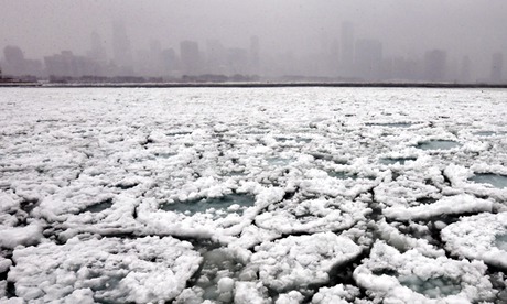
Up north, blizzards and whiteout conditions in Iowa and Minnesota.
It's all part of a fast-developing storm front sweeping across the central U.S.
Meteorologists say the mix of warm and cold air is to blame for the most severe conditions.
"Very hot air, very muggy air in the East, very much colder air behind it," said CNN meteorologist Chad Myers. "That cold air pushes the warm air up - that's the cold front - and we get the tornado possibilities."
More than possibilities: The National Weather Service had reports of as many as eight tornadoes in central Illinois late Thursday.
Seven outbuildings were destroyed in Mechanicsburg. And more than 24,000 people lost power in the state.
Several areas also saw flooding, which emergency officials say was fueled by heavy rain and melting snow.
Meanwhile in colder temperatures up north, blizzard warnings were in effect in Minnesota as rain turned to snow.
It's got some fed up with the seemingly never-ending cold.
And there's no end in sight.
A cold front on the tail of the current system will mean the story of extremes will likely continue into the weekend with plummeting temperatures in the North, and heavy downpours possible in the lower Midwest.
http://www.wdam.com/story/24784362/weather-offering-blizzards-twisters
So far, there have been no reports of injuries or death related to this round of severe weather.

Wet Weather Returns to the West Coast: Beneficial Rains to Soak California, Nevada, Oregon and Washington

After weeks of dry conditions and above average temperatures, wet weather is finally in the forecast for a region of the nation that needs it the most.

Throughout the next several days, a dip in the jet stream will set up over the eastern Pacific, allowing moisture to flow into California, Oregon and Washington.

In addition, two different storm systems are poised to develop over the Pacific and drench the West Coast later this week, providing the parched region with beneficial rainfall.

Periods of moderate to heavy rainfall can be expected with this round, especially late Wednesday into Wednesday night. Some locations in northern California, including Eureka andRedding, may see as much as an inch of rain from this first round.

This system will bring rain as far south as Los Angeles, which is already running 6 inches below normal rainfall this year, on top of an 11.33-inch deficit from 2013. For the combined 2013-14 period to date, only 18 percent of normal rainfall has fallen. While 2 to 4 inches of rain may fall in L.A. during this second storm system, it will still not be enough to get rid of the drought. The foothills in Southern California could see heavier rain amounts of up to 6 inches, making recent burn areas vulnerable to debris flows and mudslides.

As a result of the exceptional drought, watersheds and lakes are running low, not just because of the warm temperatures and dry weather conditions, but also due to the water needs commanded by agriculture and human activity.

http://www.weather.com/news/weather-forecast/beneficial-rain-west-coast-california-nevada-oregon-washington-20140222

In like a Lion and, Hopefully, Out like a Lamb

The old adage goes, "March comes in like a lion and goes out like a lamb."

That's not always true, but in 2014 it will be for millions of Americans. The reasons will vary by region, but for many Midwesterners the March lion will bear an icy breath – keeping temperatures well below zero locked in for much of the north-central U.S.

Read more…

http://www.weather.com/news/weather-winter/march-lion-frozen-subzero-record-cold-midwest-20140224?pageno=1

Global Warming Case to Land in the Supreme Court

An Obama administration program which hopes to limit pollution from power plants and factories is being discussed by Supreme Court justices, and the nine-judge court appears divided. The program would force companies to evaluate the pollution they're creating and curb carbon emissions before expanding facilities or building new ones, according to an Associated Press report. Obama hopes the program will curb carbon dioxide, the chief greenhouse gas, the report added.

Read more…

Praise the Rain: Precipitation Returns to the West

After weeks of dry conditions and above average temperatures, wet weather is finally in the forecast for a region of the nation that needs it the most. Throughout the next several days, a dip in the jet stream will set up over the eastern Pacific, allowing moisture to flow into California, Oregon and Washington. In addition, two different storm systems are poised to develop over the Pacific and drench the West Coast later this week, providing the parched region with beneficial rainfall.

Read more…