Sunday, September 30, 2018

Heavy rain to cause flash flood threat on Monday

Heavy rain to cause flash flood threat on Monday
https://wkow.com/weather/weather-now/2018/09/30/heavy-rain-to-cause-flash-flood-threat-on-monday/
Weather Prediction Center outlook for flash flooding threat Monday 
MADISON (WKOW) – After a gloomy, cool, misty Sunday, heavier showers will redevelop later this evening.
The Weather Prediction Center has southern Wisconsin under a “slight” level 2 risk for flash flooding on Monday.
An area of low pressure developing over the Plains will move along a stationary boundary draped into northern Illinois. This is allowing the active weather to stick around.
Rain will develop from southwest to northeast around 8 pm to midnight, with heavier showers anticipated after midnight. Temps will only get to the upper 40s.
Expect occasional showers through Monday with temps only in the 50s again. The main cold front will move through in the afternoon and evening allowing for some lightning and heavier bursts of rain.
1 to 3 inches of new rain is forecasted widespread. Isolated, low-lying areas may experience flash flooding. If you see standing water on the road, make sure to find an alternate route.
We have multiple more rain chances through next weekend. Because of this, minor flooding will continue on the Fox and Rock Rivers.
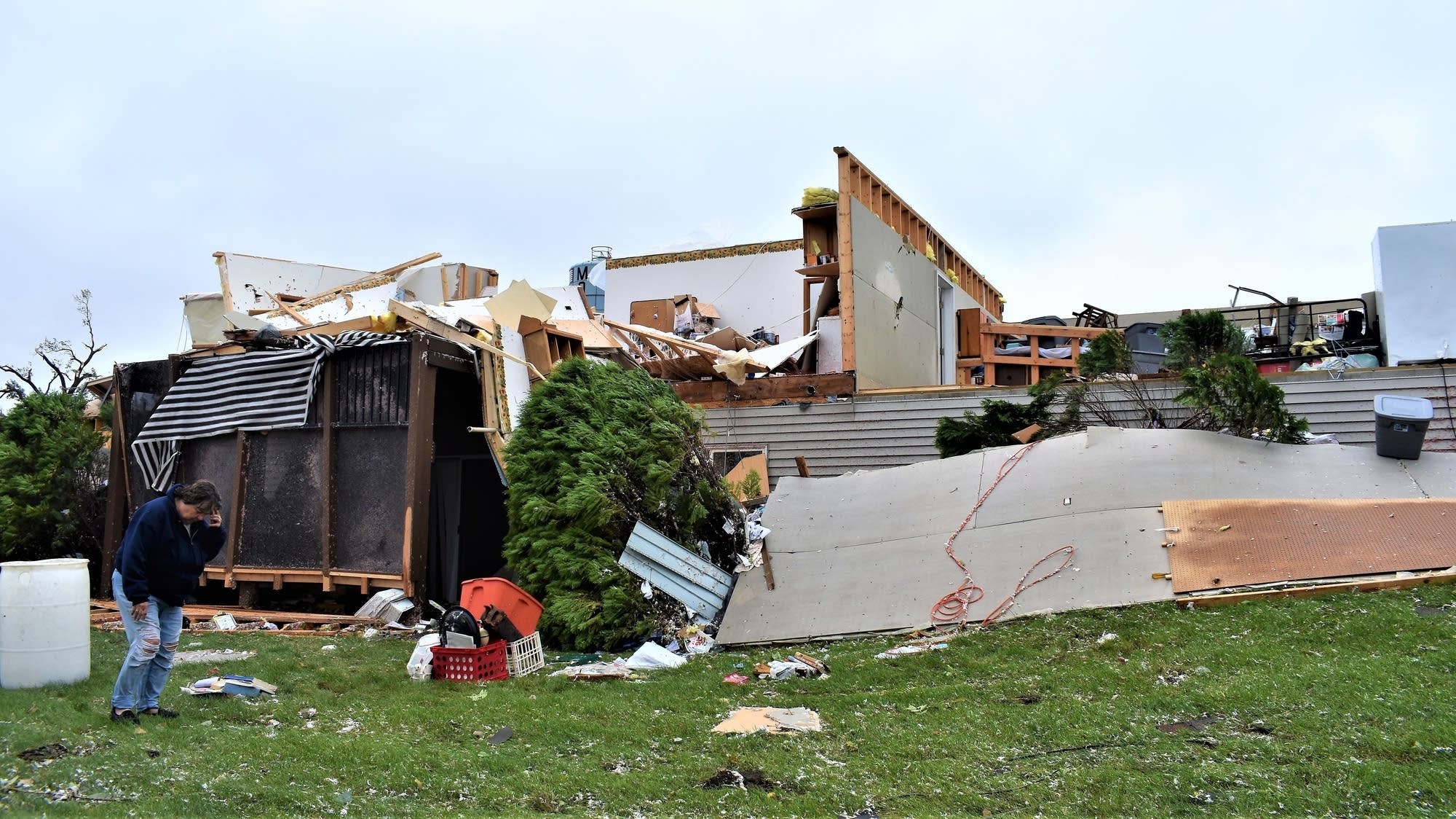
First measurable rain since May to follow Rosa into California

First measurable rain since May to follow Rosa into California
https://www.accuweather.com/en/weather-news/first-measurable-rain-since-may-to-follow-rosa-into-california/70006215
Rough surf Sep 30


While most of California will miss out on Rosa's soaking, a storm on its heels will bring the first measurable rain since May to San Francisco, Los Angeles and other cities Tuesday into Wednesday.
In California, the rain and flood risk associated with Rosa is expected to remain confined to the state’s southeastern corner early this week.
Rough seas stirred up by Rosa will still continue to plague Southern California through Monday. Rip currents can endanger surfers or anyone who attempts to enter the water, and minor coastal flooding may occur at high tide.
Residents, including fishermen, who climb onto jetties or rock walls will be at risk of being knocked down and swept into the ocean when sneaker waves (random larger waves) overtop these barriers.
The communities missing out on Rosa's rain will not have to wait too much longer for the typical dry spell that unfolds each summer to end.
A new storm sweeping in from the Pacific Ocean is anticipated to spread rain over Northern and central California on Tuesday before dropping into Southern California at midweek.


Wintry weather creating hazardous driving conditions in Glacier National Park (Montana)

https://krtv.com/news/montana-and-regional-news/2018/09/29/wintry-weather-creating-hazardous-driving-conditions-in-glacier-national-park/

(GREAT FALLS) Going-to-the-Sun Road is temporarily closed between Avalanche Creek on the west side of the park and Jackson Glacier Overlook on the east side of the park.

Park officials said in a press release on Saturday afternoon that winter weather in high elevation areas of the road has created hazardous driving conditions, including freezing temperatures, black ice, accumulating snow, and decreased visibility.

The National Weather Service has issued a winter weather advisory in effect from 9 pm tonight until 3 pm on Sunday for the west side of the park. A winter weather advisory is already in effect for the east side of the park. Up to six inches of snow is likely above 4,500 feet west of the Continental Divide. Three to six inches of snow are expected east of the Continental Divide, with localized amounts over 12 inches possible.

Logan Pass - East View (GNP webcam on Saturday, September 29, 2018)

Weather to remain mild through early October

http://www.chicagotribune.com/news/weather/ct-wea-summary-0930-20180929-story.html

After a chilly start to the last weekend of September, temperatures are set to rebound. Readings on Sunday are forecast to undergo a modest rise to near seasonable levels despite considerable cloud cover. The warming trend is expected to persist during the opening days of October as winds aloft turn southwesterly, limiting any intrusions of early season polar air to brief, moderate encounters.

Some day-to-day temperature fluctuations are likely, but readings from Sunday through Friday are forecast to average about nine degrees above normal. Temperatures are to peak Wednesday, when a surge of summerlike warmth and humidity is expected to bring 80-degree readings to the area. Nighttime temperatures will exhibit a particularly large deviation from normal. Lows across most of the metro area may not drop below 50 degrees through the upcoming week. Longer-range forecasts do suggest some cooling later in the month.

Saturday, September 29, 2018

Indonesia tsunami and earthquake kill 384, leave hundreds injured

   A 7.5 magnitude earthquake hit the island of Sulawesi in Indonesia, causing a tsunami, resulting in 384 casualties and hundreds of residents being injured. The first set of tremors were felt at 3 p.m on Friday, September 28, 2018, 35 miles north of Palu.

   A series of aftershock quakes were reported in the aftermath; including a 5.8 magnitude tremor just 12 minutes after the first quake. Rescue workers are searching for survivors amongst the damage and rubbish that was caused by the storm. 29 people have been reported missing, homes have been swept away, and more than 540 people have been treated in several local hospitals for injuries.

   Electricity and communications have been cut off, making it difficult for people to reach their loved ones in both large urban areas and remote communities as well. Most of the airports in Palu are closed, so emergency relief workers have to travel by road to get to survivors in need of help; with the drive from Sulawesi to Palu being around a 10-12 hour drive.

In a video posted on Twitter by Dr. Komang Adi Sujendra, Director of Undata Hospital in Palu, "At the moment, in our hospital, electricity is out all over Palu, roads are cracked, the phone network doesn't work. We are hoping for help."  


Photos:


Source: https://apple.news/Ah0f6enA_Q4SbI1GrsnYyaQ

Friday, September 28, 2018

Rare ‘medicane’ weather phenomenon to batter Greek islands

A tropical cyclone known as a medicane is forecast to hit Greece this weekend and could bring torrential rain and heavy winds. Meteorologists have warned that the rare weather phenomenon – which combines the words Mediterranean and hurricane – could form on Friday in the Ionian Sea south west of the Greek mainland. 

Teh medicane, dubbed Zorbas, is caused by a deep area of low pressure developing in the Mediterranean Sea and is expected to affect parts of Greece and Western Turkey.


https://metro.co.uk/2018/09/27/rare-medicane-weather-phenomenon-to-batter-greek-islands-7985234/

Severe weather moving into Northeast as rain also falls in Carolinas

A cold front will be moving into the Northeast with severe storms that could produce damaging winds, hail and a few tornadoes. A day after flash flooding was seen across the region more is possible.

As the cold front slows down in the South and stalls, heavy rain is expected for several days from New Orleans to the Carolinas and southern Virginia.
Some areas could see 2 to 4 inches or more of rain through Friday.
The river flooding will continue in the Carolinas, and will be slow to recede in the coming days because of all the rain on the way.
PHOTO: Flash flood watches and flood warnings are in place across the Carolinas and parts of the Midwest on Wednesday.
https://abcnews.go.com/US/severe-weather-moving-northeast-rain-falls-carolinas/story?id=58090041

Powerful storm rolls across south Greece, outages reported

A car drives through seawater from crashing waves on the road during bad weather at the port of Rafina, east of Athens, on Thursday, Sept. 27, 2018. Severe weather warnings remain in effect around Greece, halting ferry services and prompting school closures. (AP Photo/Thanassis Stavrakis)
ATHENS, Greece — Toppled trees hit power lines and caused outages in parts of Athens as a powerful storm rolls across southern Greece.
Schools in the Greek capital and several other parts of the country were closed Friday, and civil protection services were on alert through the weekend. Winds were expected to reach up to 100 kph (62 mph).
Some ferry services from ports near Athens resumed Friday after being mostly halted for the previous two days, while the bad weather conditions also caused flight delays.
The national weather service EMY said conditions were expected to worsen Friday, affecting the island of Crete, the Cyclades islands and parts of the southern and western mainland.

Tsunami hits small Indonesian city at dusk, casualties unknown

A resident is seen beside the collapsed brick wall of her house at Tobadak village in Central Mamuju, western Sulawesi province, on September 28, 2018, after a strong earthquake hit the area. - Indonesia was rocked by a powerful 7.5 magnitude earthquake on September 28, just hours after at least one person was killed by a collapsing building in the same part of the country. (Photo by NURPADILA / AFP)        (Photo credit should read NURPADILA/AFP/Getty Images)
JAKARTA, Sept 28 (Reuters) - A tsunami up to two meters high hit a small city on the Indonesian island of Sulawesi on Friday after a major 7.5 quake struck offshore, collapsing buildings and washing a vessel ashore, but officials could provide no information on casualties.

Officials hope to be able to gauge the scale of the damage at daybreak after the strongest of a series of earthquakes that continued late into the evening.More than 600,000 people live in Palu and Donggala.
Indonesia sits on the Pacific Ring of Fire and is regularly hit by earthquakes.

Thursday, September 27, 2018

Ashley Amezcua blog 9/27

Despite Erratic Monsoon, Crop Record Expected


Paddy Harvesting at Dharwad, Karnataka (Sarangib / CC0 / Pixabay)

https://weather.com/en-IN/india/news/news/2018-09-27-despite-erratic-monsoon-record-crop-output-expected
  • The Ministry of Agriculture estimates that this season’s food grain production will touch a historic high.
  • IMD was stated that India received just below 10% below-average monsoon rainfall this year.
  • So if the farm output is rising contrary to the erratic monsoon, does that mean we are less dependent on the whims of the monsoon?

Wednesday, September 26, 2018

Weather and AI For Brands

According to an article on adage.com, Brands are starting to use artificial intelligence regarding weather to better predict which ads will do better and certain times of the year. According to the article,"Fluctuations in weather can determine the frequency and timing of everything from doctors visits to shopping trips to attendance at entertainment and sporting events" (Kinzler). Recently IBM Watson Advertising merged its WEATHERfx platform with Truven MarketScan database to create WEATHERfx Health. This database helps predict which certain weather patterns are associated with different health conditions. For example, those with frequent migraines may be more prone to getting one in dry or humid climates. With information like this, retailers and manufacturers can better determine when their ads will be more effective. A cough drop brand recently used the database to do just that and as a result their ads were more effective in generated revenue. It is very interesting to see how weather databases are beneficial to the market and how this will affect marketing in the future.
https://adage.com/article/ibm-watson-advertising/ai-unlocking-a-sixth-sense-brands/311552/

NASA Shrinks Satellites

According to an article on cnet.com, NASA is testing smaller satellites to get a better look inside storms. Recently, NASA has tested a satellite about the size of a shoebox and have been receiving promising results. NASA's department Jet Propulsion Laboratory is testing RainCube to see if the smaller satellites can produce more information in a shorter amount of time. These satellites would be more cost-effective than those being currently used. These smaller satellites would fly together (the article gives the examples of a flock of geese) and track real time information on things like rain, hail, snow, and sleet. The RainCube only weighs 26 pounds, and signals from its antenna bounces off raindrops and sends back information. NASA, although excited about this new device, does mention that these will not provide a global view of storms but is definitely better at understanding specific storms.

The RainCube

https://www.cnet.com/news/nasa-shrinks-weather-satellites-way-down-to-better-see-inside-storms/

typhoon slams Japan with wind, rain this week

https://www.accuweather.com/en/weather-news/trami-to-remain-a-powerful-typhoon-as-it-slams-japan-with-wind-rain-this-week/70006150

A sharp turn toward the north and northeast will follow causing Trami to pass near or just west of Okinawa, Amami, Tokara and Osumi over the weekend.
All of these islands should all prepare for damaging winds, torrential rainfall and the potential for prolonged power outages beginning as early as Friday or Friday night.
Trami Satellite 9/25

6 tornadoes hit Ottawa-Gatineau region

Environment Canada has confirmed that three additional tornadoes touched down in western Quebec on Friday — bringing the day's total number of twisters in the Ottawa-Gatineau area to six.
At around 3:30 p.m. ET, a tornado touched down about 30 kilometres from Mont-Laurier, Que., near the Baskatong reservoir, the weather agency said Tuesday.
It likely travelled about 10 kilometres through the wooded area, snapping trees and downing power poles as it went, Environment Canada said.
About 90 minutes later, another touched down near the Val-des-Bois, Que, area, about 90 kilometres north of Ottawa.

Super Typhoon Trami: Images show storm from space as it heads for Japan

Gerst wrote that, from space, the storm looks "as if somebody pulled the planet's gigantic plug."
Current forecasts suggest the typhoon will affect northern and central Taiwan, as well as Japan's Ryukyu Islands. 
    However, CNN meteorologist Tom Sater said the storm's progress had stalled and meteorologists were still waiting to see where the system may go. 
    "Models earlier in the week wanted to take it toward Taipei, northern Taiwan, others toward Okinawa, a little bit more toward the east -- probably going to see it split the eye here and kinda snake on through the Ryukyu Islands making its way toward western Japan and Kyushu," the country's southernmost island, Sater said.
    The storm still packs sustained winds of around 140 kilometers per hour (87 mph), and Sater says that a "cone of uncertainty" continues to keep the southern Japanese island prefecture of Okinawa "in its eyesight."
    The storm is expected to lose some strength before making landfall in southern Japan in about four days, if it continues to track in that direction. 
    Even after losing power, it's likely to be the equivalent in strength to a category 4 hurricane, adding to the summer of extreme weather that has plagued the Asian nation, Sater said.
    "Pre-typhoon rainfall could cause a threat of landslides; once the system moves in it'll enhance that rain," Sater said.

    Chicago weather: NW suburbs clean up after strong storms leave thousands without power

    HUNTLEY, Ill. (WLS) --
    The damage was so severe in Huntley, that people in one neighborhood compared it to a war zone.
    The winds here in Huntley clocked in at 70 miles-per-hour. Police, fire and building inspectors worked through the night to try to keep residents safe.


    Not only are downed trees and branches now lying in people's yards, but they were blocking several roadways Tuesday night. The high winds stripped trees and tore live power lines right from the poles, sparking a small fire.


    Drivers caught in the storm said they were terrified and homeowners with extensive damage opted to stay with friends and neighbors.


    "As soon as I got just before the railroad tracks, the lines fell, tree split, and it was just insane," said Sandi Altergott, who was caught in the storm.


    Powerful storms Tuesday night knocked down trees and left some people without power, especially in the northwest suburbs.

    Severe weather moving into Northeast as rain also falls in Carolinas

    Rain pounded the Northeast on Tuesday with over 8.5 inches in New Haven County, Connecticut, and close to 7.5 inches in Passaic County, New Jersey.

    The story on Wednesday will be severe weather in many of the same areas.
    A cold front will be moving into the Northeast with severe storms that could produce damaging winds, hail and a few tornadoes. A day after flash flooding was seen across the region more is possible.
    Flash flood watches and warnings continue from Tennessee to Ohio and down to the already-soaked Carolinas as more rain is forecast with the cold front.
    PHOTO: Severe weather is moving into the Northeast on Wednesday.

    Tuesday, September 25, 2018

    Six Tornadoes Hit Ottawa

    This past weekend Ottawa, Canada, was hit with multiple tornadoes as the result of extreme weather. According to an article on ctvnews.ca, six tornadoes touched down and caused severe damage and power outages throughout the area. The strongest tornado was an EF-3, which tore through a rural part of Ottawa, and the others have been classified as EF-2's and EF-1's. Combined, these tornadoes damaged around fifty homes and around 200 buildings. The storms left 3500 people without power for a period of time, though most of it has been restored by now. As of today, most of the areas affected are now back to business, with schools and federal buildings reopening. Those that are still without power should have it restored by Thursday morning. It will be interesting to see how much money the damages will cost and if any more severe weather happens to those regions in the coming weeks.
    https://www.ctvnews.ca/canada/environment-canada-6-tornadoes-hit-ottawa-area-last-friday-1.4108217

    Hurricane Season and Farmworkers

    A article recently posted on The Atlantic details how hurricane season tends to be extra devastating for farmers in areas affected by hurricanes. Farmworkers livelihood depend on crops to pick and because of their legal status, they are often fearful about contacting the government when their crops are ruined in the storm. According to the article, in North Carolina 75 percent of cash crops are grown in the eastern part of the state which tends to be the most affected areas when it comes to hurricane flooding. Farmworkers, whose employment is already uncertain because most of them are migrant workers, have especially hard times during hurricane season since the storms often damage large amounts of crops. This leaves workers without jobs and without an income to support their families. The article also details how most farmworkers are pulled a week before the storm hits, further depleting their income.
    The situation gets worse for farmworkers living in "campos", which are shoddily built trailers in labor camps near the farms. Most of these trailers were completely destroyed, and many of the workers living in these conditions were made to work during the storm. I think that this article was very interesting since it shows another side of how severe weather can cause distress among people in the community it affects.
    https://www.theatlantic.com/family/archive/2018/09/hurricane-seasons-new-normal/571159/

    Monday, September 24, 2018

    Typhoon Becomes Threat to Taiwan

    According to an article on weather.com, a category five typhoon names Trami could potentially hit parts of Taiwan and Japans Ryukyu Islands. Over the weekend, the typhoon went under massive intensification, starting with winds around 35 mph, gaining winds up to 65 mph, which put it in a category 4 intensity. Because of warm waters low wind shear, the typhoon is expected to intensify even more within the next few days, ultimately turning it into a category 5 storm before it hits land later this week. The path of the storm is still hard to determine at this point since it could take many directions, but at the moment, the areas that should be closely watched include Taiwan, China, and Japan. Typhoons often cause a lot of flooding, damaging winds, and sometimes landslides. Asia has been getting hit with many typhoons recently, including one in the Philippines last week and another one in Japan earlier this month. It will be interesting to see how this storm develops over the week and what damage it causes.
    https://weather.com/storms/typhoon/news/2018-09-23-typhoon-trami-forecast-taiwan-japan

    Severe Weather and Heavy Rains expected for Midwest and Northeast

    According to an article posted on ABC, the midwest and northeast are suppose to be hit with a lot of rainfall in the beginning of this week. Northwestern Texas received almost 15 inches of rainfall over the weekend, while Tennessee and Kentucky received around 4-6 inches of rain. The rain has caused flash flooding in some areas. A cold front is suppose to move up to the midwest in the middle of this week, which may bring severe weather to from Illinois to Ohio and Michigan. This may include hail, strong winds, and even the possibility of some tornadoes.

    Severe alerts will be in place across the Midwest on Tuesday.

    As the week goes on, the cold front with move further east and cause severe weather in Boston, Philadelphia, D.C., and New York. A tornado may also occur in these areas, although it will most likely be isolated. It will be interesting to see what type of severe weather occurs this week in result of this cold front.
    https://abcnews.go.com/US/severe-weather-bears-midwest-northeast/story?id=58036550

    Hurricane Florence helped spin up new storms in the Atlantic

    a map shows growing storms in the atlantic

    Hurricane Florence is long gone, but certainly not forgotten in the atmosphere. The storm's remnant energy and moisture are partially responsible for two tropical systems in the Atlantic Ocean right now. They don’t pose any threat to land at the moment, but the mere presence of a storm anywhere in the ocean is disconcerting for residents still dealing with fallout from Florence’s landfall and historic flooding.

    The National Hurricane Center is monitoring the two tropical systems distantly related to Florence. Subtropical Storm Leslie formed in the north-central Atlantic Ocean on Sunday morning. A subtropical storm is a storm that’s partially tropical—the system doesn’t have all-tropical characteristics, but its structure is close enoughfor the NHC to name it and issue forecasts as if it were tropical through and through. Leslie is expected to be short-lived and shouldn’t affect anyone but ships and planes traversing the ocean.
    The second system, located near Bermuda, may become a tropical depression or storm this week as it slowly recurves out to sea. Its proximity to the United States—and North Carolina in particular—is unsettling, but while there’s a chance it may bring some rain to the already-inundated coastal Carolinas, the system shouldn’t be too big of a deal otherwise.

    Hurricane Florence isn’t done with the Carolinas just yet

    South Carolina Flooding Continues Over A Week After Florence Made LandfallSouth Carolina Flooding Continues Over A Week After Florence Made LandfallSouth Carolina Flooding Continues Over A Week After Florence Made LandfallSouth Carolina Flooding Continues Over A Week After Florence Made Landfallflooding from Hurricane Florence in South Carolina

    BLADENBORO, N.C. — Hurricane Florence is by no means done with the Carolinas, where some rivers are still rising and thousands of people were told to plan to leave their homes on Monday before rivers reach their crest.
    About 6,000 to 8,000 people in Georgetown County, South Carolina, were alerted to be prepared to evacuate potential flood zones ahead of a “record event” of up to 10 feet (3 meters) of flooding, which is expected to begin Tuesday near parts of the Pee Dee and Waccamaw rivers, county spokeswoman Jackie Broach-Akers said.
    The county’s emergency management director, Sam Hodge, said in a video message posted online that authorities are closely watching river gauges, and law enforcement would be going door to door in any threatened areas.

    Tornado count now 10 from last week's storms in southern Minnesota

    Minnesota storms

    The National Weather Service continues to survey damage from last week's severe storms in southern Minnesota.

    As of Saturday night crews had confirmed 10 tornadoes touched down last Thursday, though that total may be revised as more information comes in. The Weather Service said additional tornadoes may be added to the list, and separate tornadoes on the list may be combined into single, longer tracks.

    The strongest of the tornadoes surveyed so far appears to be the one that caused major damage to homes in Morristown, in Rice County. That tornado rated an EF2 on the 1-5 Enhanced Fujita scale, meaning winds of up to 135 mph.

    Rare tornado rips through Quebec

    Rare tornado rips through Quebec neighborhood in dramatic video

    Storm has caused politicians to suspend a political campaign

    A rare tornado has been filmed ripping through a neighbourhood in QuebecCanada.
    The footage, captured by local resident FĆ©lix Charette, depicts a frighting scene with debris flying through the air and trees violently swaying in the wind.
    "Holy s***!" he can be heard screaming in the viral clip.
    "Oh my god!", he continues.
    The tornado has left more than 50,000 residents of the Quebec city of Gatineau without power and half-a-dozen people have been taken to hospital with injuries caused by the freak storm.

    Sunday, September 23, 2018

    Ashley Amezcua - Texas

    Record Rainfall in Texas Responsible for 1 Death, Flooded Homes


    Water floods out of the banks of White Rock Creek onto the Flagpole Hill Trail in Dallas, Saturday, Sept. 22, 2018. A storm system has dumped record amounts of rain in parts of Oklahoma and caused flooding in Texas, including in the Dallas area, where floodwaters swept a man from a bridge to his death. (Brian Elledge/The Dallas Morning News via AP)
    - water floods white rock creek
    -wettest September since 1932
    -10.8 inches of rain throughout the month.
    https://weather.com/news/news/2018-09-23-texas-dallas-flooding-death

    Tropical Storm Kirk gaining speed in Atlantic

    Forecast track for Tropical Storm Kirk.
    Keeping an eye on Tropical Storm Kirk in the Atlantic.
    Kirk reached tropical storm-strength Saturday and was cruising west at about 21 mph, the National Hurricane Center said Sunday at 11 a.m.
    The storm was about 545 miles southwest of the Cabo Verde Islands and posed no threat to land, according to the latest advisory.
    Kirk was packing sustained winds of almost 40 mph and its westward motion was expected to accelerate through Tuesday.
      Kirk should strengthen but remain a Tropical Storm through midweek, when it's likely to run into strong wind shear, causing the storm to weaken as it approaches the Lesser Antilles, the Hurricane Center said.

      Power returning after Environment Canada confirms two Ottawa tornadoes

      Damage from a tornado is seen in Dunrobin, Ont., west of Ottawa on Sept. 22.

      OTTAWA—Hydro crews were at work this morning trying to untangle and repair fallen power lines, some of which snapped like twigs in the Friday tornadoes that hit the Ottawa area.  

      The national weather agency says a powerful EF-3 category twister — with winds that reached 265 kilometres per hour — ripped through the Ottawa neighbourhood of Dunrobin, Ont., about 35 kilometres west of the downtown area, before moving on to devastate a densely populated area of Gatineau, Que.