Tuesday, October 31, 2017

Six Things Coming in November


November weather is usually hard to predict because of the varying seasons.  Despite this, meteorologists are warning families of the possibility of severe storms and heavy rain.  Here is a list of things to come in November:

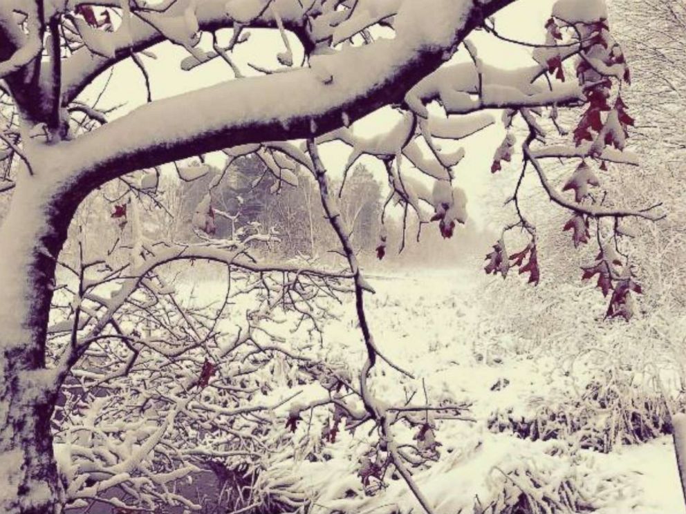
1) The Midwest is said to have snow in November and the lower Midwest will lean towards December snow.

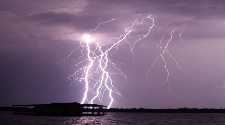
2) Low Pressure Systems are likely to produce Witch Storms

3) The Lake effect snow season is going to be even stronger for those regions near lakes.

4)  There will be a second Tornado Season in the lower right hand corner of the United States.

5) Hurricane Season will be over but it is important to keep watch at all times.  With such an unusual year of Hurricanes, many meteorologists will keep tabs on hurricane patterns.

6) An intense wet season will push atmospheric rivers to begin their flow to the West Coast.

Image result for november snow
https://weather.com/science/weather-explainers/news/2017-11-01-november-weather-what-to-expect-united-states

Halloween Weather


Happy Halloween! With trick or treating all throughout the US, many families are wondering I they should be dressing warmly or sticking with their Halloween costumes.  For the East Coast and Midwest, forecasters are predicting a dry week.  Southern Texas and Oklahoma are expecting scattered showers throughout the festivities.

Many people were shocked to hear about the possibility of snow flurries around the Great Lakes.  This is definitely a sign of a cold winter ahead. The coldest temperatures are in the Northern Plains at around 30 degrees.  Stay Warm!

Children in Cape Costumes Trick-or-Treating on Halloween
https://www.usatoday.com/story/weather/2017/10/30/halloween-weather-forecast-most-see-cool-but-clear-weather/813560001/

Relampago del Catatumbo

In Venezuela, where the Catatumbo River meets Lake Maracaibo, there is a perpetual lightning storm. Anywhere from 140 to 160 nights out of the year, for up to 10 hours at a time, the sky over the river is covered by a lightning storm. It is known to produce up to 280 lightning strikes per hour and is nearly soundless.

Called the “Relampago del Catatumbo” (which literally means “The lightning of the Catatumbo”) it was first referenced in 1597 in a poem by Lope de Vega. The poem talks about Francis Drake’s attempt to take the city of Maracaibo in the middle of the night in 1595, only to have his position given away to the city’s defenders by the constant lightning.

The lightning is so regular that it is often used as a navigation aid to many ships and is known among sailors as the “Maracaibo Beacon”. Although there has been many theories for the lightning in the past, scientists are now able to attribute the lightning to a regular, low lying air current that comes from the Caribbean.


Image result for Relampago del Catatumbo

Monday, October 30, 2017

Where Thunderstorm Activity is the Highest

If you are afraid of thunderstorms then you should settle in the Northern German city of Kiel, as it has the lowest average of thunderstorm activity in the world. But, if you enjoy the booming, bright magnificence of storms then your home would be in Garmish-Partenkirchen, the highest city in Bavaria. Scientists of Karlsruhe Institute of Technology (KIT) evaluated data on occurrences of thunderstorms and came to these conclusions.

While these storms tend to rattle some nerves, they also burden people's wallets. Factors like strong winds, heavy rain, large hailstones, and even lightening damage can cause considerable damage to homes, cars, and agriculture. Garmish-Partenkirchen must have to deal with their insurance companies quite a lot.

Thunderstorm activity is highest in the Prealps.
Credit: Michael Kunz, KIT

David Piper of KIT's Institute for Meteorology and Climate Research (IMK) says that thunderstorm activity relies heavily on the region. In the Bavarian Prealps, up to 15 thunderstorms occur on a daily basis with other high activities found between the Neckar River and Swabian Jura, in the Ore Mountains and Bavarian Forest. Piper goes on to state that the lowest activites happen along the coasts of the North and Baltic Seas. These storms tend to develop in the afternoon or early evening when temperatures are highest.

Thunderstorm activity is determined by three factors: distance from the sea, local landscape, and the amount of humidity close to the ground. The sea influences storms due to water cooling which stabilizes the bottom layers of air in the summer. Then the mountains force the air to ascend and facilitate the development of storms

Original Article by David Piper and Michael Kunz found here: https://www.sciencedaily.com/releases/2017/10/171012123919.htm

Inside Salt Lake City's Dangerous Smog Dome

Winter weather in Salt Lake City, Utah is a strange event. The reasoning behind this is because snowstorms in the area tend to invert the typical trend of air getting colder with high altitudes. As the altitude gets higher the ground gets cooler, leaving a layer of toasty warm air high above the city. One could compare this to a roof while the mountains are like walls. This "living room"-esque setup caused a smog dome, trapping pollution in place until warm air comes and blows it away. The average the smog tends to sit seems to be around four days but others have lingered about for three weeks.


These domes are as dangerous as they are dreary. Acting as a lid over the metropolis area means that this smog is trapped in. The inversion effect traps fine particulates, known as PM2.5, in the air. These particles are produced by car engines, bonfires, and industrial emissions. The lid over the city traps these in, forcing citizens to be exposed to them much more than the typical period. They also reduce visibility, increase acidity of water, and deplete soil nutrients.

The affect these particulates have on humans is far from positive. Inhaling these particulates can cause asthma and congestive heart failure. Emergency-room visits have even been reported to spike when Salt Lake City has an inversion period. When it gets too bad students stay home and adults ecommute. Though, the city is working to cut down on emissions that fill the dome, aiming to increase car-efficiency standards and reduce traffic by implementing more public-transit. With these measures, officials hope to lighten the dome by 2040.

Original Article by Eleanor Cummins found here: https://www.popsci.com/salt-lake-city-smog-dome

Sunday, October 29, 2017

2018 Winter Weather Forecast El Nino or La Nina?

Weather 2018 Forecast / Outlook / Prediction

2017 -2018 Winter Weather Forecast / Outlook

The Climate Prediction Center is issuing some initial information on their official winter weather outlook for the 2017 – 2018 season. NOAA models are currently calling for mostly equal chances for average precipitation with above average temperatures for the months of December, January, February and March.
One of the biggest factors affects how much snow we get is the development of an El NiƱo or La NiƱa event across North America.
The El NiƱo-Southern Oscillation (ENSO) is a recurring climate pattern involving changes in water temperature near the central and eastern tropical Pacific Ocean. On periods ranging from about three to seven years, the surface waters across a large swath of the tropical Pacific Ocean warm or cool by anywhere from 1°C – 3°C, compared to normal. This change in temperature can have a massive impact on the jet stream and thus your winter weather patterns.
Also Read: Top 10 Signs From Nature of a Snowy Winter Ahead

Currently the Climate Prediction Center is calling for a ENSO-neutral (neither a El NiƱo or La NiƱa event) through the remainder of 2017 and into 2018.
Some models predict the onset of El NiƱo (3-month average NiƱo-3.4 index at or greater than 0.5°C) during the Northern Hemisphere summer (Fig. 6). However, more than half of the models favor ENSO-neutral through the remainder of 2017. These predictions, along with the near-average atmospheric conditions over the Pacific, lead forecasters to favor ENSO-neutral into the winter (~50 to 55% chance). However, chances for El NiƱo remain elevated (~35-45%) relative to the long-term average. In summary, ENSO-neutral is favored (~50 to 55% chance) into the Northern Hemisphere winter 2017-18 (click CPC/IRI consensus forecast for the chance of each outcome for each 3-month period).
Still, some models are predicting the onset of a weak El NiƱo by the time winter puts its foot on our snowy doorstep. While those chances for an El NiƱo event remain slim NOAA says they’re far from calling it. “We still have a fair number of models forecasting at least a weak El NiƱo through the upcoming winter,” says ENSO blogger Nat Johnson.

 http://unofficialnetworks.com/2017/07/31/2018-winter-weather-forecast-el-nino-or-la-nina/

Snow blows through Minnesota in 1st Winter Storm of the Season

The first winter storm of the season is blowing through the upper Midwest and western Great Lakes, bringing blizzard-like conditions and several inches of snow.

PHOTO: Shawn Hartung posted this photo to Instagram of snow in Minnesota, Oct. 27, 2017.Shawn Hartung/Instagram
Shawn Hartung posted this photo to Instagram of snow in Minnesota, Oct. 27, 2017.

Gusty winds of up to 60 mph produced whiteout conditions Thursday in northwestern Minnesota and eastern North Dakota.
The National Weather Service in Duluth, Minnesota, said this morning that so far today 5 inches of snow have fallen -- breaking the record daily snowfall for Oct. 27. 

The storm will begin to move east today, spreading snow into the Twin Cities, which hasn't seen snow in October in eight years.

PHOTO: A commuter braves the first snow of the season on a scooter in the West Bank, in Minneapolis, Oct. 27, 2017. Leila Navidi/Star Tribune via AP
A commuter braves the first snow of the season on a scooter in the West Bank, in Minneapolis, Oct. 27, 2017. more +

The snow will spread into northern Wisconsin and the Upper Peninsula of Michigan later today, where 8 inches of snow may fall by Saturday morning.
 http://abcnews.go.com/US/snow-blows-minnesota-1st-winter-storm-season/story?id=50757268

Wednesday, October 25, 2017

Snow Rollers, Nature's Natural Snowballs

Snow Rollers are rare and weird weather phenomenon that occur during the winter in many areas but are most commonly seen in hilly or mountainous areas. Often referred to as "nature's natural snowballs", these barrel-sized snowballs occur when strong winds pick up wet snow and blow it along the ground, resulting in a cylinder of snow that it hollow in the middle. When the snow roller becomes too big for the wind to move it, it stops.

According to the National Weather Service, the optimal conditions for snow rollers to form is a layer of ice, then a layer of loose, wet snow accompanied by strong winds and a slope to the ground.

Image result for snow rollers


https://weather.com/tv/shows/strangest-weather/video/snow-rollers

https://weather.com/news/weather/news/snow-rollers-idaho

Death Star


Tethys
An an image just released by NASA, Saturn's moon bears a striking but totally-not-disconcerting resemblance to a famous piece of sci-fi weaponry: The Death Star, a planet-killing behemoth recently brought back to life in "The Force Awakens". Insert your Star Wars joke of choice here. Rinse. Repeat.
 
This "that's no moon!" moon is Tethys, a 660-mile-wide satellite of Saturn made mostly of water ice. Its icy composition is what gives it such a spacecraft-like sheen (the only brighter moon in Saturn's orbit is Enceladus, which is covered in an ocean topped with pristine ice, and it's one of the most reflective objects in the solar system).

But the feature that makes Tethys really Death-Star-y is the huge honking crater on its surface. Dubbed Odysseus, the pock mark is one of the largest craters in the entire solar system. The rebound of whatever large object formed Odysseus produced some high mountains in the crater's center, and they just happen to correspond to that little nubbin in the center of the Death Star's, um, laser-y bit. Anyway, it's uncanny! Alderaan better watch out.
 https://www.popsci.com/tethys-saturn-moon-death-star

Tuesday, October 24, 2017

Hottest Playoff Game Ever


In the midwest and central parts of the US, people have been experiencing chilly wind and rain.  But this isn't the case for the Southwest.  Feeling like July in the middle October may seem like a good thing for the Astros-Dodger's game, but this may not be the case.  The city has issued a heat warning at 8:00 pm, right around the start of the game.  With current averages around 99 degrees, meteorologists believe the temperature will rise to 102 on the day of the opening game.

weather1.jpg
https://www.cbssports.com/mlb/news/astros-dodgers-world-series-game-1-l-a-weather-excessive-heat-warning-for-possibly-hottest-playoff-game-ever/

Wine Crops to Have Bad Year


Internationally, Wine crops for the 2017 season have been relatively low.  In Europe, the world's leader in wine production, extreme weather events damaged the vineyards.  These events were both drought and frost.  According to the Intergovernmental wine organization, this is the lowest it has been in over 50 years.

Additionally, farmers have to harvest grapes earlier and earlier due to climate change.  In the US, Napa valley was plagued with the California wildfires and 47 vinyards were damaged. 


http://www.npr.org/sections/thetwo-way/2017/10/24/559780704/wine-organization-forecasts-historically-bad-year-due-to-weather-events

Light Pillars and How They Form

Light pillars are a weird weather phenomena that can be seen all over the world. The conditions have to be just right for them to form, extremely calm and cold with no wind, temperatures usually 10 or 20 degrees below zero. The pillars are caused by light, usually from sources such as street lamps, reflecting off of the ice crystals in the air but only if the ice crystals are close to the ground.

Light pillars are not synonymous with storms, if a storm were to form at the same time that light pillars were evident, the storm system would disrupt the ice crystals and the pillar of light would disappear. Although it's simple to predict when conditions are going to be cold and without wind, it is difficult to predict when ice crystals are going to present in the air and close to the ground, making light pillars relatively hard to predict. These spectacles of light are most commonly seen in the northern US and Canada.

https://www.accuweather.com/en/weather-news/photos-what-are-light-pillars/70000673

Image result for light pillar

Monday, October 23, 2017

How Coral Disease Outbreaks Fluctuate with El NiƱo Years

The Florida Institute of Technology's research associate Carly Randall and biology professor Rob van Woesik published their findings from an 18 year analysis of coral-disease. Over 2,100 sites had data collected from them. These data findings were then compared with the coinciding data of climate data to see if the disease cycles matched with the climate cycles.

It was found that three coral diseases--white-band disease, yellow-band disease, and dark-spot syndrome--seemed to peak every 2-4 years, corresponding with El NiƱo cycles. The potential increase with intensity of El NiƱo weather patterns due to climate change suggest that diseases in coral will be adding up even more in the coming decades.


Black-Band Diseased Coral
 Image Source: https://camillengarcia.files.wordpress.com/2014/06/blackbanddisease.jpg


This was spurred because disease outbreaks in corals have followed El NiƱo-fueled coral bleachings in past years. Climate-driven patterns of disease do not just reside in the oceans. Malaria and Dengue Fever seem to also track climate cycles on land.

Original article found here: https://www.sciencedaily.com/releases/2017/07/170731134126.htm

How Changing Weather Traps Pollution Over Chinese Cities

China may be a leader in the fight against our changing climate yet a severe amount of winter pollution seems to be worsening this battle. This is a result of a changing circulation in the atmosphere caused by climate change itself.

China's emissions are decreasing but it seems that there is no improvement. This is because of rapid changes in polar regions; sea ice is melting rapidly and snowfall is increasing. This is keeping colder air from reaching the eastern areas of China where it would usually flush out the air pollution.


In 2013 scientists used instruments that measured high levels of particulate pollution. These particles are in the air and reduce visibility, hence the smog commonly known to be in Beijing. Exposure to this can cause eye, nose, throat, and lung irritation, coughing, sneezing, and more serious conditions such as asthma and heart disease. The scientists studying air pollution in China state that tighter air quality controls can prevent up to 3 million deaths each year.

It is believed that impact of global climate change may be unique to China due to its geography and sensitive reactions towards atmospheric changes. This, more than anything, should encourage China to continue the fight against climate change with more vigor than ever. This includes reductions of air pollutants and greenhouse gases alike.

Original Article by Marlene Cimons found here: https://www.popsci.com/china-smog-changing-weather-patterns

Friday, October 20, 2017

What Happens When Lightning Doesn't Hit the Ground?

Lightning shows are a spectacular phenomenon to witness, lighting up the dark sky in seconds, trailing along the clouds like an untraveled path on a map. While we think we are seeing the most stunning show around, we are actually missing an entirely different display held above the clouds.

In 2001, researches at Puerto Rico's Arecibo Observatory managed to pick up on something never known before: Lightning shooting from a cloud's top only to reach straight for space. This trajectory pattern baffled researchers. When a lightning bolt forms it is with a negative electrical charge building up near the bottom of a cloud. Once enough energy is stored up, it breaks free, bolting towards earth in the fashion we typically believe it would. Though, more electrons seem to be staying in the clouds, shooting upward to the top where the cloud is positively charged, cancelling out.

But that's not the end of the show, in some cases it seems that the positive charges are being pushed out, causing a flash on the topside of clouds. Climatologists are calling these reverse bolts "gigantic jets". They seem to travel until they hit the atmosphere's nearest proton-filled object: the ionosphere, which is about 50 miles up, sitting right at the edge of space.

These gigantic jets seem to happen most often in the tropics, believed to be because storms there are taller with much stronger winds.

Original Article by Claire Maldarelli found here: https://www.popsci.com/what-happens-when-lightning-doesnt-hit-ground

How Bacteria in the Sky may Help Make it Rain

It all starts with microbes: bacteria in our gut, our skin, and even the clouds we see sitting in the sky. A strange think to think about when we tend to just imagine clouds as water vapor, dust, and other particles. Living bacteria within clouds are airborne species, working to turn water into ice. Frozen granules form around bits of dust, debris, and even these tiny organisms, falling as rain or snow. So, they play a part in rainfall, but how much?

The University of Florida's Brent Christner, a specialist in atmospheric bacteria, states that "If a cloud was stuffed with these microbes, it would create freezing and the processes that lead to precipitation... The unknown factor is, are there enough of them up there to matter?". To figure this out Christner and other researchers are sending weather balloons on sampling missions to help find an answer.

Do these airborne creatures get anything out of the deal? Do they use clouds to travel to new areas? Or are they just adrenaline junkies who enjoy falling from the sky?

Original Article by Veronique Greenwood found here: https://www.popsci.com/bacteria-rainfall-weather

Drought expanding through Maine communities


PORTLAND (WGME) – Some people may be loving our recent weather, but while they're soaking up the sun, others are probably wish their wells and farms were soaking up some rain.
The U.S. Drought Monitor was updated Thursday. Hydrologists analyze multiple factors to assess our status. Rainfall deficits, stream flow, and rainfall deficits all get taken into account when determining drought conditions.
Moderate drought conditions have been expanded down through coastal Maine into York County, while abnormally dry conditions expanded to nearly cover the entire state.
http://wgme.com/news/local/drought-expanding-through-maine-communities

Snowstorms & Extreme Cold


A winter storm occurs when there is significant precipitation and the temperature is low enough that precipitation forms as sleet or snow, or when rain turns to ice. A winter storm can range from freezing rain and ice, to moderate snowfall over a few hours, to a blizzard that lasts for several days. Many winter storms are accompanied by dangerously low temperatures.
Winter storms can cause power outages that last for days. They can make roads and walkways extremely dangerous or impassable and close or limit critical community services such as public transportation, child care, health programs and schools. Injuries and deaths may occur from exposure, dangerous road conditions, and carbon monoxide poisoning and other conditions.
Winter storms and colder than normal temperatures can happen in every region of the country.

Winter storms can occur from early autumn to late spring depending on the region.


https://www.ready.gov/winter-weather


Weekend rain, severe weather risk to end mild weather in central US


Residents of the central United States will once again have to contend with rain and a threat for severe weather this weekend.
Aside from gusty winds, the warm weather through Friday across the Plains and Midwest will be virtually perfect for pumpkin picking, sporting events or any other outdoor plans.

Friday's gusty winds and an increase in thunderstorm activity around Texas will be signs that the mild stretch of weather will be ending this weekend.
The same push of cool air set to bring some welcome rain to Northern Californialate this week will sweep across the central U.S. this weekend with a band of rain and thunderstorms. The entire weekend will not be a washout in any one given location, but outdoor plans will be in jeopardy on at least one day.
The weekend will start with showers spreading across the Plains with thunderstorms becoming more numerous on Saturday afternoon and evening.

https://www.accuweather.com/en/weather-news/central-us-mild-week-to-fade-to-weekend-rain-severe-weather-risk/70003035


Thursday, October 19, 2017

Solar Evaportation Ponds


An astronaut aboard the International Space Station took this photograph of solar evaporation ponds outside the city of Moab, Utah. There are 23 colorful ponds spread across 400 acres. They are part of a large operation to mine potassium chloride—more commonly referred to as muriate of potash (MOP)—from ore buried underground. MOP is in high demand as fertilizer because there are no easy substitutes for potassium, an essential nutrient for plant growth.
Each pond color indicates a different state of evaporation. The deep, royal blue color is due to a dye that is added to a full pond of potash brine and water in order to speed up the rate of heat absorption. The seafoam green colors indicate shallower waters (with less dye) that are well into the evaporation process. The tan colored ponds are nearly dry; salt crystals (the final product) are left over in the pond and ready for collection.
Shadows cast on the landscape show the depth and dimension of the surrounding Utah desert. The Colorado Plateau stands at an average elevation of 1600 meters (5200 feet) above mean sea level, in contrast with the Colorado River Valley, with an average elevation of 1200 meters (3900 feet). The darker areas along the river bank are rich in green desert vegetation. Hatch Point Road leads to a scenic overlook for viewing the Cane Creek Anticline
 Photograph from orbit of terrain in Utah with small brightly-colored pond just left of center
 https://www.nasa.gov/image-feature/solar-evaporation-ponds-near-moab-utah