Saturday, November 30, 2019

Powerful Storm Interrupts Nation's Busiest Travel Weekend

A powerful storm making its way east from California is causing major disruptions during the year's busiest travel weekend, as forecasters warned that intensifying snow and ice could thwart millions of people across the country hoping to get home after Thanksgiving.

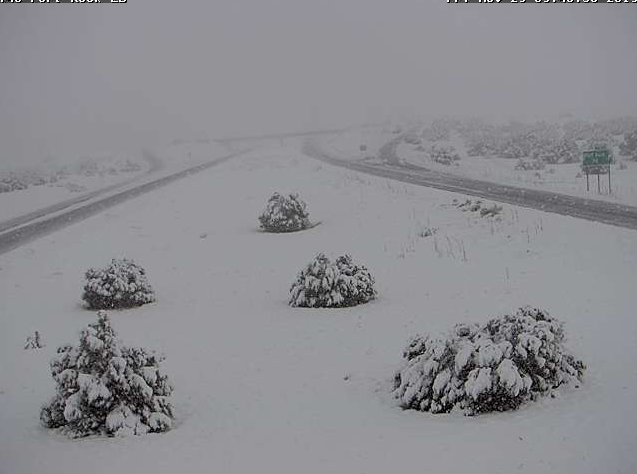
The storm caused the death of at least one person in South Dakota and shut down highways in the western U.S., stranding drivers in California and prompting authorities in Arizona to plead with travelers to wait out the weather before attempting to travel.

The storm was tracking into the Plains Friday and expected to track east through the weekend - into the Midwest by Saturday and the Northeast on Sunday - pummeling a huge portion of the country with snow, ice or flash flooding.

The National Weather Service said travel could become impossible in some places.

Airlines for America, the airline industry's trade group, expects 3.1 million passengers during what could be the busiest day ever recorded for American air travel.

The weather service issued storm warnings Friday for a swath of the country stretching from Montana to Nebraska to Wisconsin, with heavy snow anticipated in parts of Utah, Colorado, Montana, and Wyoming.

One hopeful traveler asked the weather service Friday on Twitter whether it would be advisable to drive to Duluth, Minnesota, over the weekend.


https://www.nbcwashington.com/news/national-international/Powerful-Storm-Interrupts-Nations-Busiest-Travel-Weekend-565635212.html

Winter storm to hit millions of travelers returning from Thanksgiving trips

The millions of U.S. travelers who battled a nightmarish mix of winter weather en route to their Thanksgiving holiday destinations can expect more of the same for the trip home as a coast-to-coast winter storm system brings snow, rain and heavy winds to major travel hubs across the country, weather experts say.

The storm, which originated on the West Coast, was headed to the upper Midwest and Northeast, with Chicago, Philadelphia, Boston and New York expected to experience the worst of the wintry precipitation early Sunday - just as the return leg of the busiest travel holiday of the year hits its peak.

Hurley called the expanse of the storm "Impressive": What started as a deep cyclone off the West Coast has become a "Coast-to-coast storm."

The heaviest of the anticipated winter weather, including snow or ice, will generally be north of Interstate 80, which stretches east and west in the upper third of the country, while the heaviest snow accumulation will be the eight to 16 inches that could fall on portions of Minnesota, the northern two-thirds of Wisconsin and upper Michigan, Hurley said.

As the storm system moves eastward, Pennsylvania, much of New York state and New England are forecast to see snow accumulation by early Sunday near the north-south I-95 corridor toward Massachusetts, Hurley said.

"Airports along the coast will be looking at lower visibility, and that will make for tougher travel coming out of the Northeast," Hurley added.

The West Coast isn't being spared from inclement weather: Another storm system hanging off the coast of California is forecast to bring heavy rains in Northern California, especially in the mountains and foothills of San Francisco, Oakland and across the Sierra, Hurley said.

https://www.washingtonpost.com/weather/2019/11/30/winter-storm-hit-millions-travelers-returning-thanksgiving-trips/

8 Things We'll Remember from the 2019 Atlantic Hurricane Season

The 2019 hurricane season was tied for the fourth most active on record by the number of tropical storms, getting to the "S" name for the first time since 2012.

The season had a total of 18 tropical storms and six hurricanes, three of which strengthened to at least Category 3 intensity.

Rapidly developing tropical storms and hurricanes occur at least once per hurricane season, and there have been several close to home that have gone on to be destructive.

Storm names are retired when tropical storms or hurricanes bearing that name cause catastrophic damage or loss of life, such that future use may be considered insensitive or confusing.

National Hurricane Center forecaster Eric Blake noted Lorenzo became a Category 5 hurricane almost 650 miles farther east than the previous easternmost Category 5 hurricane, Hugo, in 1989.

As previously mentioned, Hurricane Lorenzo became the easternmost Category 5 hurricane on record by a landslide, but that wasn't the only longitudinally-challenged record that Lorenzo set.

The French Navy Falcon 50, along with the Hurricane Hunters, which were en route to investigate and gather data on Hurricane Lorenzo, are credited with finding the lifeboat with three people aboard.


https://weather.com/storms/hurricane/news/2019-11-21-atlantic-hurricane-season-recap-barry-dorian-lorenzo-imelda

Severe Thunderstorms Threaten Parts of the South Saturday

Severe thunderstorms could develop in parts of the South Saturday from a powerhouse storm system moving through the Plains states.

Southerly winds ahead of the storm will help draw moisture northward from the Gulf of Mexico into the lower Mississippi Valley That moisture, in tandem with strong winds in the upper atmosphere, will help trigger the development of numerous showers and thunderstorms.

The threat of severe thunderstorms increases through Saturday evening along the tail end of the cold front.

The greatest chance of severe thunderstorms stretches from near Lufkin, Texas, into western Tennessee.

Tornado warnings were issued Tuesday night in association with severe thunderstorms in Arkansas, Louisiana and MIssissippi.

Two people were reportedly injured just north of Baskin, Louisiana, when a trailer rolled in high winds caused by an EF2 tornado around 6 p.m. CST. Several other homes in the area were damaged, according to a preliminary report from NOAA's Storm Prediction Center.


https://weather.com/safety/tornado/news/2019-11-26-thanksgiving-severe-thunderstorm-threat-south-midwest-plains

Intense Winter Storm Snarls Traffic Along Highways in Plains, Western U.S.; 1 Dead in South Dakota

At a GlanceParts of Interstate 80 in Nebraska are closed due to blowing snow.

Parts of Interstate 17 and 40 were closed late Thursday into early Friday in northern Arizona due to heavy snow.

Parts of Interstate 40 and Interstate 17 were closed south of Flagstaff, Arizona, in both directions early Friday due to heavy snow in the higher elevations, according to the Arizona Department of Transportation.

In California, a portion of Interstate 5 from Grapevine to Castaic through Tejon Pass closed Thursday morning as heavy snow sweeps through the higher elevations.

About 100 miles of Interstate 5 between Yreka and Redding near the Oregon border was closed Tuesday night and into early Wednesday morning due to multiple vehicle spinouts, according to the California Department of Transportation.

The westbound lanes of Interstate 80 between Truckee and Nyack were also closed Wednesday morning due to multiple spinouts, the California Highway Patrol said.

Highway 20 in Nevada County was closed near the intersection of I-80 due to whiteout conditions and excessive snow, and Highway 49 was closed between Downieville and Sattley in Sierra County.


https://weather.com/safety/winter/news/2019-11-29-winter-storm-california-west-thanksgiving-travel-roads-airports

An intense cyclone brings severe storms into SE USA while heavy snow blizzard develops on its wake across the Great Plains

Besides the very deep trough and a powerful cyclone along the Pacific NW coast, another deep cyclone developed further east across the central United States.

A cyclone formed in the Lee of the Rockies and is expected to cross the Great Plains while deepening towards the Great Lakes.

Severe weather outbreak seems likely along the main cold front over the Dixie Alley and SE USA tonight.

On cyclone's wake, heavy snow blizzard is developing as well and should bring some good amounts of snow from E Colorado across Nebraska into Iowa and S Minnesota tonight and tomorrow.

Cyclone travels NE tonight and arrives over the Great Lakes tomorrow afternoon local time, while gradually deepening along its track.

Behind the front, an intense cold air mass advection develops over the Rockies and spreads across the Great Plains and towards the Ohio Valley tomorrow.

Graphics: SPC Heavy snow blizzard will develop in the wake of the cyclone, as the parent upper-level trough becomes increasingly negatively tilted and the warm conveyor branches off and begins to wrap around the deepening upper low.


https://www.severe-weather.eu/global-weather/intense-cyclone-severe-storms-blizzard-great-plains-mk/

Global CO2 levels have reached new record values, despite all the efforts and policies! It means more impact on the climate and also our wallets via new taxes!


Global carbon dioxide values have reached record high values yet another year, now being at highest levels in at least the past few million years!

The graph data ends at November 25th, so it is quite obvious that 2019 will also reach new record CO2 values with ease.

The absorption of CO2 by land and oceans is a natural process, and can mitigate some of the CO2 increase.

The net difference is the yearly increase of global CO2 levels.

What does this mean for our daily lives? Besides the usual effects of CO2 on rising global temperatures and climate, it might also hit our wallets more directly.

Despite all the efforts and agreements in many climate panels and meetings so far, there is no noticeable slowdown of CO2 increase.

This likely means that even more severe policies and legislation will be put in place to try and limit the global CO2 production and emissions.


https://www.severe-weather.eu/global-weather/global-co2-record-high-2019-fa/

*Drought* After record spring droughts, with raging wildfires, Australia is on the verge of a record hot and dry summer, extending the ongoing crisis! And the Indian Ocean is to blame!

Australia is on the verge of a record drought! Abnormally warm and very dry spring over the eastern and northern parts has already caused water shortage and widespread bushfires.

Spring in Australia was marked by heatwaves, record low precipitation, and bushfires.

The latest seasonal forecasts show an abnormally hot summer, and dry in the eastern half of the country is about to start.

Who or what is to blame for all of this? Forest fires and droughts are not uncommon in Australia, and happen every year, but with different intensity.

The main culprit this season is the record strong Indian Ocean Dipole.

The IOD event this year was unusually strong, actually strongest on record, and is expected to prolong its influence into the summer season, so severe drought conditions will extend into next year.

The sea surface temperature analysis for the Indian Ocean where clearly shows the two dipoles of IOD. The analysis of previous positive IOD events shows its main influence on the climate of Australia, so mostly warmer and drier conditions are expected.


https://www.severe-weather.eu/global-weather/australia-drought-fire-spring-summer-iod-fa/

An extreme warmth develops across the North Atlantic, Greenland and Iceland this weekend

The pattern flip this week leads into some extreme anomalies in some parts of Europe and North Atlantic through early December.

While a cold outbreak develops over E-CNTRL Europe, a very warm airmass spreads into the North Atlantic and the Arctic region.

A broad area of more than 15 °C warmer temperatures expands across a few days period and delivers unusually warm weather into Greenland and Iceland.

An upper ridge builds up across the North Atlantic in the wake of a large long-wave trough across the N Europe and NW Russia.

A surface cyclone forms near Newfoundland tomorrow, Saturday, Nov 30th, with a powerful advection of very warm airmass across the Labrador Sea.

As the cyclone drifts further northeast and the gradient towards the ridge to its east strengthens, 12 to more than 15 °C warmer airmass than normal spreads into the N Atlantic, Iceland and Greenland on Sunday and continues through Monday and Tuesday next week.

Thursday, Nov 28th *update* on the developing outbreak of cold airmass across much of Europe in the next days.

https://www.severe-weather.eu/mcd/extreme-warmth-north-atlantic-greenland-mk/

Nov 29th update on the tropics – typhoon #KAMMURI continues towards Philippines

Kammuri is now on its gradually accelerating west movement and continues strengthening, packing 75 knots sustained winds with a central pressure around 973 mbar - the latest model guidance suggests it my potentially reach at least a Category 3 strength by Monday, just before landfall on Philippines.

Satellite imagery indicating again an incredible amount of extremely deep convection, pushing cloud tops temperature towards -90 °C. The first daylight of local morning, Nov 30th, is just revealing the system in visible spectrum - an impressive wide-open upper-level outflow with textbook explosive deep convection within the broad area around typhoon's virtual center.

The future track will bring KAMMURI due west towards the Philippines with the potential landfall on late Monday / early Tuesday.

It is increasingly likely the typhoon will travel directly towards the capital Manila on Wednesday.

One of the concerns could be the large area of very warm sea waters just to the east of the Philippines where typhoon could start a more significant intensification prior to landfall.

Typhoon #Kammuri is headed directly for the Philippines after the weekend, potentially as a super typhoon, just as the SEA Games kick off.

KAMMURI has been upgraded to a Category 1 typhoon - models are consistent it will soon begin rapid intensification and head towards the Philippines.


https://www.severe-weather.eu/tropical-weather/nov-29th-update-typhoon-kammuri-philippines-mk/

Full 365-day animation of Atlantic ocean currents cooling and warming, seasonal temperature changes, and tropical systems leaving trails in the ocean!

Every year the Atlantic ocean undergoes many changes in surface temperatures, both up and down! We decided to do a high-resolution animation of these yearly changes.

Below is a temperature analysis for September 4th, when Dorian moved out of the Bahamas, leaving behind a trail of noticeably cooler waters.

Another tropical system leaving a trail in the east Atlantic was hurricane Lorenzo.

Also noticed in the animation are fast waves of warming and cooling water, especially in the North Atlantic.

Most noticeable are warmings, as the strong south winds pull warmer air and water from south up towards Europe as it passes the Atlantic ocean.

The first graphic shows the low-pressure system in the North Atlantic on June 1st. The second graphic shows the temperature change after the passing of this system, as it pulled warmer air from the south towards Europe.

We will keep you updated on any important further development regarding the changes in global ocean temperatures and currents.


https://www.severe-weather.eu/global-weather/atlantic-ocean-currents-animation-temperature-fa/

An intense cyclone will develop a powerful winter storm with severe blizzard conditions across the Northern Plains, US on Nov 30th


The end of November brings a very powerful cyclone across the northern parts of the United States, technically a perfect textbook explosive surface cyclogenesis / bombogenesis cyclone with sharp frontal boundaries and severe weather.

While strong pressure / temperature gradient will result in severe winds and together with heavy snowfall, also dangerous severe blizzard conditions!

A very intense core will develop over northern parts of CONUS and deepening even more while drifting across the Northern Plains towards the Great Lakes.

A 3-hour sequence of mean sea-level pressure and precipitation type indicate around 992 mbar Lee cyclone developing in the NE Colorado by Saturday, Nov 30th 06 UTC, beginning the rapid intensification / bombogenesis phase overnight to Saturday.

As of 12 UTC Saturday, cyclone moves into W Nebraska with already around 981 mbar central pressure and intense winter precipitation banding with the occluding from in its wake.

As it can be seen on the maps, a very intense snow blizzard conditions will develop around the cyclone to its north and northwest, very likely bringing whiteout conditions and significantly reduced driving conditions.

Stay alert for extremely dangerous conditions developing, both with severe winds and blizzard conditions!
https://www.severe-weather.eu/global-weather/intense-cyclone-winter-storm-usa-mk/