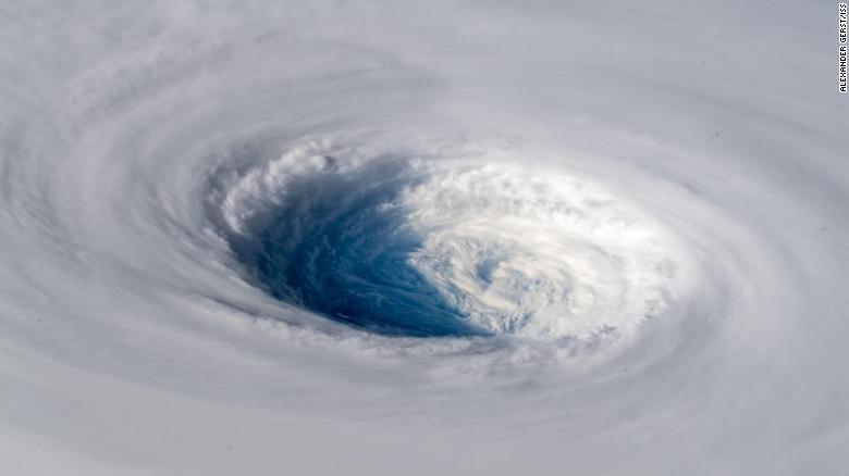
Current forecasts suggest the typhoon will affect northern and central Taiwan, as well as Japan's Ryukyu Islands.
However, CNN meteorologist Tom Sater said the storm's progress had stalled and meteorologists were still waiting to see where the system may go.
"Models earlier in the week wanted to take it toward Taipei, northern Taiwan, others toward Okinawa, a little bit more toward the east -- probably going to see it split the eye here and kinda snake on through the Ryukyu Islands making its way toward western Japan and Kyushu," the country's southernmost island, Sater said.
The storm still packs sustained winds of around 140 kilometers per hour (87 mph), and Sater says that a "cone of uncertainty" continues to keep the southern Japanese island prefecture of Okinawa "in its eyesight."
The storm is expected to lose some strength before making landfall in southern Japan in about four days, if it continues to track in that direction.
Even after losing power, it's likely to be the equivalent in strength to a category 4 hurricane, adding to the summer of extreme weather that has plagued the Asian nation, Sater said.
"Pre-typhoon rainfall could cause a threat of landslides; once the system moves in it'll enhance that rain," Sater said.
No comments:
Post a Comment