On March 25th at least 8 tornadoes struck Northwest Arkansas and Northeastern Oklahoma. This post will explain the science behind these disastrous tornadoes.
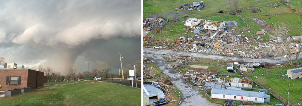
A stalled front over Oklahoma and Arkansas was forecast to move southward as a cold front and provide the focus for thunderstorm formation. Ample instability existed along and south of this front, with values ranging from 2000 to over 3000 J/kg. Deep-layer vertical wind shear – defined as the change in wind speed or direction within the lowest 6 km or 3.5 miles of the atmosphere – was also more than sufficient for storm organization and rotation.
This meant that all of the ingredients for severe weather – instability, vertical wind shear, and a trigger – were in place for severe weather, and the SPC in Norman, OK, issued a moderate risk for severe thunderstorms.
http://www.ustornadoes.com/2015/03/27/the-science-behind-the-oklahoma-and-arkansas-tornadoes-of-march-25-2015/
No comments:
Post a Comment