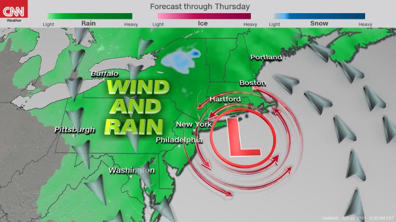
"The system will have the equivalent low pressure of a Category 1 hurricane," said CNN meteorologist Dave Hennen. Generally, a bomb cyclone is defined by a pressure drop of 24 millibars (a unit of pressure) within 24 hours. Although it is not likely the storm will meet the criterion of a classic nor'easter, it will be just as strong as the storm that impacted the mid-Atlantic and Northeast last week, if not a little stronger. Winds could reach tropical-storm force (39 mph+) with even higher gusts by Wednesday and Thursday for places such as New York City, Boston and Portland, Maine.
Many locations in the Northeast will receive 2-4 inches of rain, with isolated areas receiving up to 6 inches. The rain will taper off throughout the day on Thursday, then completely lift out of northern New England by Friday.
The storm will not be a major snow-maker for most of the region, except for a small portion of upstate New York.
This is the second coastal storm to impact New England in a week. Last week's storm sat off the coast of the mid-Atlantic, churning up seas and bringing a strong onshore wind that shredded beaches up and down the East Coast. It caused costly damage along the coast due to beach erosion and coastal flooding.
No comments:
Post a Comment