Whether or not it's dubbed a polar vortex, icy cold will spread across much of the central and eastern USA by next week, bringing temperatures more typical of January than November.
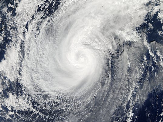
The onslaught will be fueled in part by remnants of Typhoon Nuri, which will wallop Alaska's Aleutian Islands with furious, hurricane-force winds and mammoth 50-foot waves over the weekend.
The system is expected to push cold air into much of the continental USA next week, said Bob Oravec, National Weather Service forecaster.
"In brief, when a typhoon curves away from Asia, it causes the jet stream farther to the east across the Pacific and into North America to buckle days later," said Brett Anderson, an AccuWeather meteorologist.
That contorted jet stream can lead to storms and outbreaks of cold air, as well as surges of warmth, throughout the nation.
Snow will accompany the frigid air in areas including the northern Rockies, northern Plains and upper Midwest. Milwaukee and Grand Rapids, Mich., could be the cities that see the most snow, the Weather Channel predicts.
"It looks like winter's starting early," Oravec said.
The Plains, western Great Lakes and Upper and mid-Mississippi Valleys will see high temperatures 10 to 30 degrees below average by Monday and Tuesday, the Weather Channel predicts.
Cities such as Minneapolis, Chicago and St. Louis will endure the worst cold as high temperatures reach only the 30s, said Alex Sosnowski, AccuWeather meteorologist.
Highs may struggle to top the freezing mark in the Twin Cities for several days, and strong winds will add to the wintry feel.
No comments:
Post a Comment