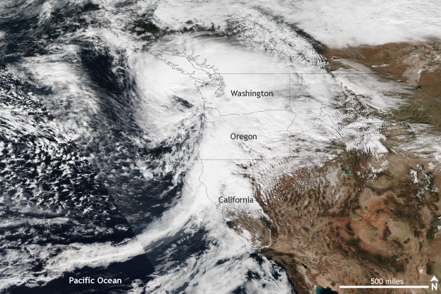
While the forecast for a potentially historic windstorm across the Pacific Northwest over the weekend of October 15-16 did not come to fruition, a strong storm did pass by. Gusty winds and heavy rains caused power outages and fallen trees, but things could have been much worse.

A strong extra-tropical cyclone with strong winds and heavy rains impacts the Pacific Northwest on October 15, 2016. Gusty winds toppled trees and knocked out power to thousands. NASA/NOAA image from the Suomi-NPP Satellite provided by the NOAA Environmental Visualization Laboratory.
It wasn’t the worst-case scenario, but how windy was it?
In the end, the storm tracked slightly farther northwest and offshore than expected, while maintaining roughly the same expected strength – a storm pressure of 969mb. Instead of moving directly inland over Washington, as forecasters initially feared, the storm ended up 30 to 40 miles off the coast. This deviation in track did not mean that the Pacific Northwest was spared completely; it meant that the worst of the storm was offshore.
However, even though the region didn’t face the brunt of the storm as it passed by on October 15, many sites across Washington and Oregon measured strong wind gusts. Along the coast, 70-80mph winds were recorded, and 45-55mph winds were even seen across the Portland Metro area. The highest wind gust observed was a 102mph report at Mary’s Peak at an elevation of four thousand feet. In general, inland areas saw winds between 30 and 40 mph. As a result, tens of thousands lost power as trees fell and powerlines were knocked down.
No comments:
Post a Comment