A haboob is a type of intense dust storm carried on an atmospheric gravity current. Haboobs occur regularly in arid regions throughout the world.
They have been observed in the Sahara desert (typically Sudan, where they were named and described), as well as across the Arabian Peninsula, throughout Kuwait, and in the most arid regions of Iraq. African haboobs result from the northward summer shift of the inter-tropical front into North Africa, bringing moisture from the Gulf of Guinea. Haboob winds in the Arabian Peninsula, Iraq, Kuwait, and North America are frequently created by the collapse of a thunderstorm, while haboobs in Australia may be frequently associated with cold fronts. The deserts of Central Australia, especially near Alice Springs, are particularly prone to haboobs, with sand and debris reaching several kilometers into the sky and leaving up to a foot of sand in the haboob’s path.
The arid and semiarid regions of North America—in fact, any dry region—may experience haboobs. The term haboob is not commonly used in the arid regions of the United States where these events occur. In North America the most common terms for these events is either dust storm or sandstorm. In the U.S., they frequently occur in the deserts of Arizona, including around the cities of Yuma and Phoenix—and in New Mexico and Texas.
During thunderstorm formation, winds move in a direction opposite to the storm’s travel, and they move from all directions into the thunderstorm. When the storm collapses and begins to release precipitation, wind directions reverse, gusting outward from the storm and generally gusting the strongest in the direction of the storm’s travel. When this downdraft, or downburst, reaches the ground, it blows dry, loose silt and clay (collectively, dust) up from the desert, creating a wall of sediment that precedes the storm cloud.
This wall of dust can be up to 100 km (62 mi) wide and several kilometers in elevation. At their strongest, haboob winds often travel at 35–100 km/h (~20–60 mph), and they may approach with little or no warning. Often rain does not appear at ground level as it evaporates in the hot, dry air (a phenomenon known as virga). [Source: Wikipedia]
1. Phoenix, Arizona, 2012

Photograph by Andrew Pielage | apizm.com
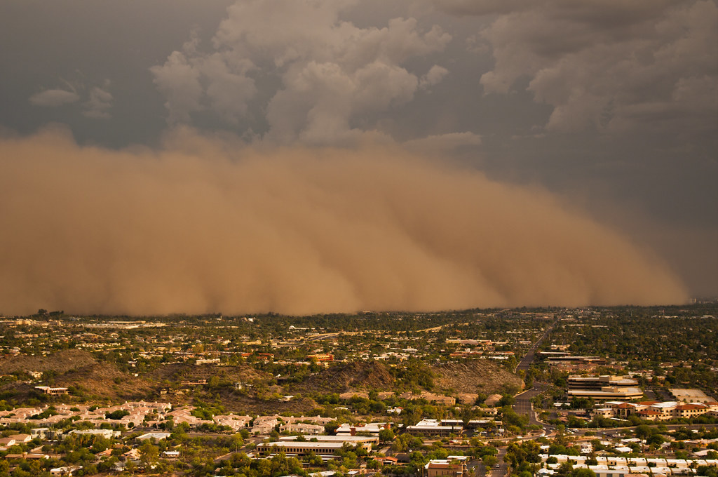
2. Phoenix, Arizona, 2011
Photograph by Daniel Bryant | Prints available
3. Indian Ocean near Onslow, Australia, 2013

Photograph by Brett Martin @ fishwrecked.com
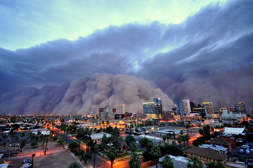
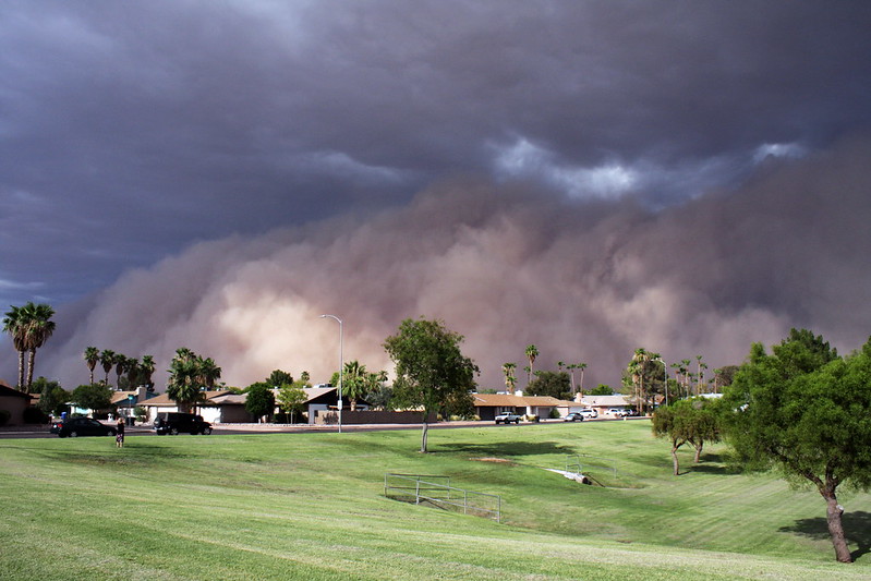
4. Phoenix, Arizona, 2012
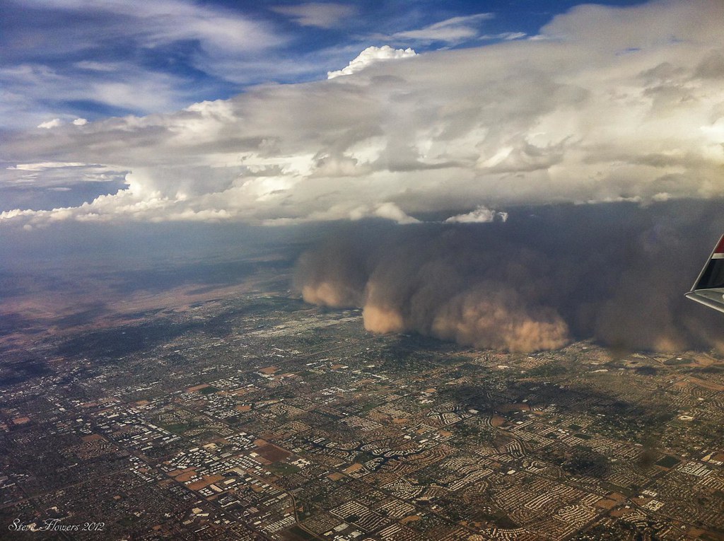
Photograph by Steve Flowers on Flickr
5. Khartoum, Sudan, 2007
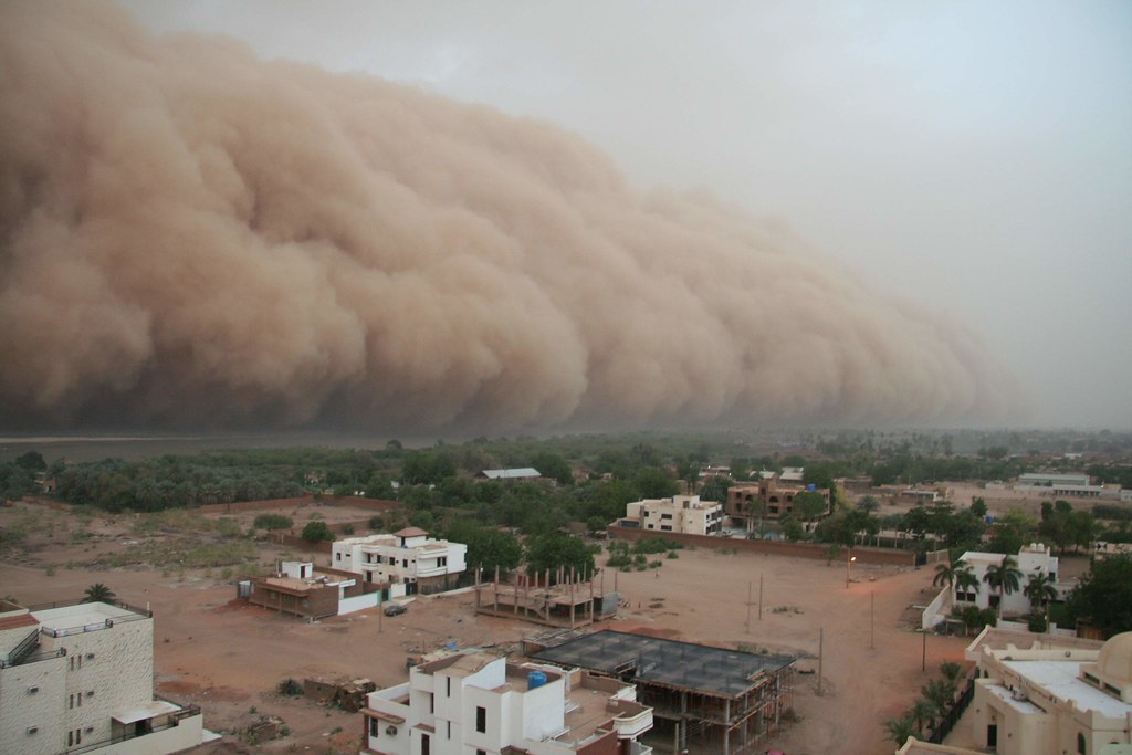
Photograph via Paul Currion on Flickr
6. Phoenix, Arizona, 2012

Photograph by Jasper Nance on Flickr
7. Broken Hill, New South Wales, Australia, 2010
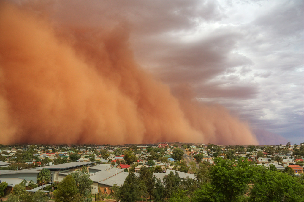
Photograph by Tim Gimbert on Flickr
8. Khartoum, Sudan

Photograph via fyrverkerida
9. Al Asad, Iraq, 2005

Photograph by Corporal Alicia M. Garcia, U.S. Marine Corps
10. Phoenix, Arizona, 2011

Photograph by Stephen Mellentine on Flickr
11. Phoenix, Arizona, 2011

Photograph by shannonsl on Flickr
12. Al Asad, Iraq, 2007

Photograph by James Gordon
13. Phoenix, Arizona, 2012
Photograph by Matt Falk on Flickr
14. Phoenix, Arizona, 2011
Photograph by Brian Burgess on Flickr
15. Phoenix, Arizona, 2011

Photograph by Michael Zysman on Flickr
If you enjoyed this post, the Sifter
highly recommends:


No comments:
Post a Comment