Now that the calendar says December, we've entered a stretch of months that typically bring the coldest temperatures of the year for many locations across the United States. That said, with a strong El Nino in play this winter, the severity of the cold that we see during winter 2015-16 could be tempered a bit for some areas in the northern states.
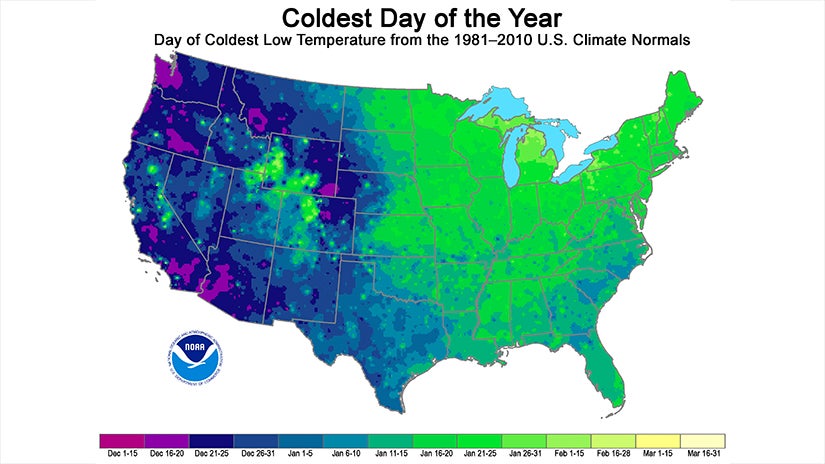
But historically speaking, perhaps you are curious about when the coldest time of year is where you live? These maps from NOAA's National Centers for Environmental Information (NCEI) provide the answer, showing the time frame for when the coldest day of the year, on average, occurs across the U.S.
Residents in pockets of the Pacific Northwest, southern California and southwestern Arizona get their coldest day of the year in mid-December.
The eastern half of the country, as well as the higher elevations of the Rocky Mountains, typically see the coldest day in mid-to-late January.
NOAA says the reason for this temporal discrepancy is due to the increased snow cover in the East as well as the Rockies. Increased snow cover reflects sunlight, which keeps ground temperatures colder.
http://www.weather.com/storms/winter/news/coldest-day-year-average-map-noaa-20141112

No comments:
Post a Comment