
Sunlight illuminates Hurricane Irma as the storm approaches Cuba and Florida in this geocolor image from GOES-16 taken on Sept. 8. (NOAA via AP)
Between the hurricanes raging through the Caribbean and the Gulf of Mexico and the massive wildfires roaring out West, 2017 has been quite a year for inclement weather in the United States. By some measures, it's been historically intense.
And watching it all unfold is a new, next-generation, multimillion-dollar satellite. Launched from Cape Canaveral at the end of 2016, the National Oceanic and Atmospheric Administration's GOES-16 arrived in orbit just in time to capture a string of weather events matched this year in tumultuousness only by the political situation on the ground in Washington.
GOES-16 is equipped with two weather-related instruments: The first is a lightning mapper designed to continuously record all the lightning strikes across and around North America. Fed into weather models, this lightning data will help forecasters more quickly predict flash floods and tornadoes that often occur alongside lightning bursts. Below, the satellite's tool captured the string of lightning strikes during Hurricane Harvey:

The second piece of weather equipment is a camera called the Advanced Baseline Imager (ABI). Capable of scanning an entire hemisphere in just five minutes, the ABI offers twice the resolution of any other NOAA satellite in orbit. Here GOES-16 stared into the eye of Hurricane Irma as it spun:
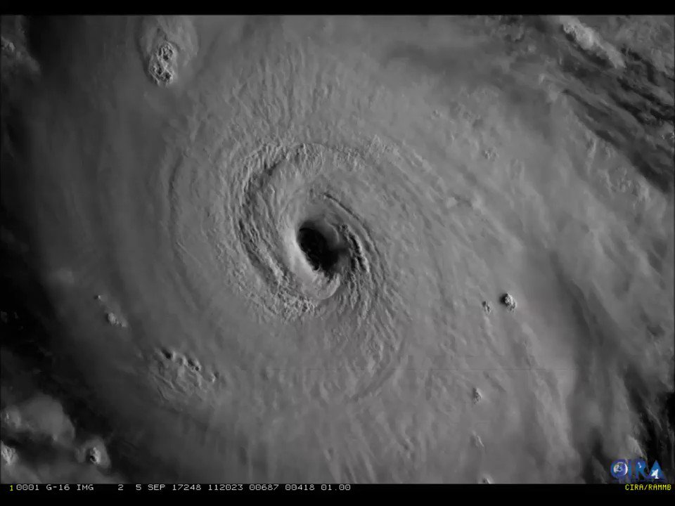
#GOES16 captured this visible imagery of Hurricane #Irma's eye earlier today. For the latest on Irma, go to nhc.noaa.gov.
And here the satellite is capturimg the smoke billowing from the wildfires around the Bay Area in California:
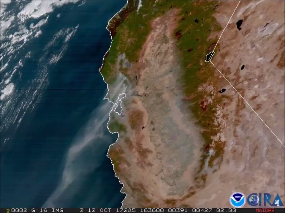
#GOES16 keeping watch on #California #wildfires. @CALFIRE_PIO reporting over 170,000 acres burned. More imagery: goo.gl/eEwncX
Though GOES-16 will not be fully operational until next month and "its data are preliminary and undergoing testing," NOAA has whetted the appetite of meteorologists and amateur weather enthusiasts with the satellite's high-quality images from space during a series of catastrophic weather events.
The new satellite transmitted its first images back to Earth in January, and they are stunning. In the Jan. 15 image below, the moon hangs over the Pacific Northwest:

(NOAA/NASA)
As the name suggests, GOES-16 is one in a series of weather satellites used by NOAA. The three members of the GOES (standing for Geostationary Operational Environmental Satellite) series monitoring U.S. weather are nearing the end of their life span. New generation satellites are in production and the events of this past summer should only help bolster their case for deployment and funding. It feels as though the destruction of California wine country and the Texas coast demands the best documentation possible.
And, boy, does GOES-16 deliver. As a demonstration of imaging capabilities of the next-generation satellites, compare these images of the Western Hemisphere taken by GOES-16 (left) and GOES-13 (right):

The next-gen satellite was there for the more pleasant moments of 2017 too, capturing the shadow of the moon as it traced its way across the continential United States during the eclipse:

NEW: An geocolor animation of the total #SolarEclipse2017leaving the continental U.S., as captured by NOAA's #GOES16.
https://www.washingtonpost.com/news/powerpost/paloma/the-energy-202/2017/10/16/the-energy-202-2017-is-a-crazy-weather-year-we-launched-the-best-eye-in-the-sky-just-in-time/59e3efb230fb041a74e75d93/?utm_term=.4e917d88d3b2
No comments:
Post a Comment