Portions of Alaska's Aleutian Islands experienced near-hurricane level winds from remnants of Typhoon Nuri Friday.
Eareckson Air Station sustained minor damage after winds bent back the corners of a roof and dumpsters moved around, Tommie Baker, Alaskan Command public affairs officer, stated.
During the storm, workers barricaded themselves indoors.
Workers had yet to conduct a full assessment of damage around the entire island, Baker said. But workers there are accustomed to extreme weather, including 100-mile winds. The community averages six weather-related lockdowns a year.
The storm surpassed the intensity of 2012's Superstorm Sandy as measured by pressure, but a lack of measuring stations in the remote region means meteorologists didn't have much more data. Sandy caused at least 182 deaths and $65 billion in damage on the East Coast. Nuri, in contrast, hit a sparsely populated region with just a few small communities where people are accustomed to severe weather
Showing posts with label Liz Epley. Show all posts
Showing posts with label Liz Epley. Show all posts
Monday, November 10, 2014

Saturday, November 1, 2014
Arctic Blast Will Bring First Freeze, Record Cold to Parts of the East
An arctic blast has arrived this weekend with the first freeze of the season for many, and record low temperatures are possible as well.
High temperatures early this week were above average from the Northeast to the South. Savannah, Georgia, set a record high of 90 degrees on Monday, which was the latest 90 degree temperature recorded there (the previous record was October 21). Record high temperatures were also tied on Monday in Nashville, Tennessee, (84), Tuscaloosa, Alabama, (85) and Alma, Georgia (89).
On Tuesday, record high temperatures were set once again, including Rochester, New York, (80), Morgantown, West Virginia, (79), New Bern, North Carolina, (86) and Youngstown, Ohio (77).
The warmth of earlier this week is coming to an end, and the areas that saw record highs on Monday and Tuesday have seen temperatures nosedive.
It will feel chilly and raw from the Midwest into the Southeast and it will be windy behind the cold front, too. Wind gusts could be strong enough to cause some power outages and tree damage.
Record lows were set Saturday morning in Springfield, Missouri (22) and tied in St. Joseph, Missouri (20). Twenties were felt as far south as northeast Oklahoma and northern Arkansas, while lows in the 30s were seen as far south as Mobile, Alabama, Slidell, Louisiana, and parts of the western Florida Panhandle.
Afternoon temperatures Saturday plunged or held in the 40s in much of the Tennessee Valley, and as far south as the Lowcountry of South Carolina. The strong north to northwest winds made it feel even colder.
It will be even colder Sunday morning in the Southeast. Another widespread freeze is likely, as diminishing winds and clear skies settle in behind the cold front, from central Mississippi, Alabama to the piedmont of the Carolinas.
Record low temperatures are in jeopardy in Florida on Sunday, including Miami (54), Orlando (46), West Palm Beach (51) and Fort Myers (49). Other records will be approached in parts of the Buckeye State, including Cincinnati (23) and Toledo, Ohio (22).
Temperatures will begin to moderate on Monday, but the day will start off chilly from the Northeast to the Southeast where lows will generally be in the 30s. This quick shot of winter will just be a memory for most of the East by Tuesday.
High temperatures early this week were above average from the Northeast to the South. Savannah, Georgia, set a record high of 90 degrees on Monday, which was the latest 90 degree temperature recorded there (the previous record was October 21). Record high temperatures were also tied on Monday in Nashville, Tennessee, (84), Tuscaloosa, Alabama, (85) and Alma, Georgia (89).
On Tuesday, record high temperatures were set once again, including Rochester, New York, (80), Morgantown, West Virginia, (79), New Bern, North Carolina, (86) and Youngstown, Ohio (77).
The warmth of earlier this week is coming to an end, and the areas that saw record highs on Monday and Tuesday have seen temperatures nosedive.
It will feel chilly and raw from the Midwest into the Southeast and it will be windy behind the cold front, too. Wind gusts could be strong enough to cause some power outages and tree damage.
Record lows were set Saturday morning in Springfield, Missouri (22) and tied in St. Joseph, Missouri (20). Twenties were felt as far south as northeast Oklahoma and northern Arkansas, while lows in the 30s were seen as far south as Mobile, Alabama, Slidell, Louisiana, and parts of the western Florida Panhandle.
Afternoon temperatures Saturday plunged or held in the 40s in much of the Tennessee Valley, and as far south as the Lowcountry of South Carolina. The strong north to northwest winds made it feel even colder.
It will be even colder Sunday morning in the Southeast. Another widespread freeze is likely, as diminishing winds and clear skies settle in behind the cold front, from central Mississippi, Alabama to the piedmont of the Carolinas.
Record low temperatures are in jeopardy in Florida on Sunday, including Miami (54), Orlando (46), West Palm Beach (51) and Fort Myers (49). Other records will be approached in parts of the Buckeye State, including Cincinnati (23) and Toledo, Ohio (22).
Temperatures will begin to moderate on Monday, but the day will start off chilly from the Northeast to the Southeast where lows will generally be in the 30s. This quick shot of winter will just be a memory for most of the East by Tuesday.
Monday, October 20, 2014
September 2014 Breaks Global Heat Record
September 2014 is now the hottest month recorded since 1880.
In a statement released Monday, the National Oceanic and Atmospheric Administration (NOAA) announced that last month broke the global heat record by clocking in at an average of 60.3 degrees Fahrenheit.
This announcement comes after NASA, which uses different measurements, .
Last May, June, and August all broke the global heat record as well, and 2014 is now on track to become the warmest year since record keeping began 135 years ago.
The first nine months of 2014 have a global average temperature of 58.72 degrees (14.78 degrees Celsius), tying with 1998 for the warmest first nine months on record, according to NOAA's National Climatic Data Center in Asheville, North Carolina.
"It's pretty likely" that 2014 will break the record for hottest year, said NOAA climate scientist Jessica Blunden.
The reason involves El Nino, a warming of the tropical Pacific Ocean that affects weather worldwide. In 1998, the year started off super-hot because of an El Nino. But then that El Nino disappeared and temperatures moderated slightly toward the end of the year.
This year has no El Nino yet, but forecasts for the rest of the year show a strong chance that one will show up, and that weather will be warmer than normal, Blunden said.
If 2014 breaks the record for hottest year, that also should sound familiar: 1995, 1997, 1998, 2005 and 2010 all broke NOAA records for the hottest years since records started being kept in 1880.
"This is one of many indicators that climate change has not stopped and that it continues to be one of the most important issues facing humanity," said University of Illinois climate scientist Donald Wuebbles.
Some non-scientists who are skeptical of man-made climate change have been claiming that the world has not warmed in 18 years, but "no one's told the globe that," Blunden said. She said NOAA records show no pause in warming.
The record-breaking heat goes back to the end of last year - November 2013 broke a record. So the 12 months from October 2013 to September 2014 are the hottest 12-month period on record, Blunden said. Earth hasn't set a monthly record for cold since December 1916, but all monthly heat record have been set after 1997.
September also marks the third month in a row that Earth's oceans broke monthly heat records, but these are all-time records for how much hotter than normal they were, Blunden said.
The U.S. as a whole was warmer than normal for September, but the month was only the 25th warmest on record.
While parts of the U.S. Midwest, Russia and central Africa were slightly cool in September, it was especially hotter than normal in the U.S. West, Australia, Europe, northwestern Africa, central South America and parts of Asia. California and Nevada set records for the hottest September.
, said Jeff Masters, meteorology director for the private firm Weather Underground. If there is an El Nino, Masters said, "next year could well bring Earth's hottest year on record, accompanied by unprecedented regional heat waves and droughts."
In a statement released Monday, the National Oceanic and Atmospheric Administration (NOAA) announced that last month broke the global heat record by clocking in at an average of 60.3 degrees Fahrenheit.
This announcement comes after NASA, which uses different measurements, .
Last May, June, and August all broke the global heat record as well, and 2014 is now on track to become the warmest year since record keeping began 135 years ago.
The first nine months of 2014 have a global average temperature of 58.72 degrees (14.78 degrees Celsius), tying with 1998 for the warmest first nine months on record, according to NOAA's National Climatic Data Center in Asheville, North Carolina.
"It's pretty likely" that 2014 will break the record for hottest year, said NOAA climate scientist Jessica Blunden.
The reason involves El Nino, a warming of the tropical Pacific Ocean that affects weather worldwide. In 1998, the year started off super-hot because of an El Nino. But then that El Nino disappeared and temperatures moderated slightly toward the end of the year.
This year has no El Nino yet, but forecasts for the rest of the year show a strong chance that one will show up, and that weather will be warmer than normal, Blunden said.
If 2014 breaks the record for hottest year, that also should sound familiar: 1995, 1997, 1998, 2005 and 2010 all broke NOAA records for the hottest years since records started being kept in 1880.
"This is one of many indicators that climate change has not stopped and that it continues to be one of the most important issues facing humanity," said University of Illinois climate scientist Donald Wuebbles.
Some non-scientists who are skeptical of man-made climate change have been claiming that the world has not warmed in 18 years, but "no one's told the globe that," Blunden said. She said NOAA records show no pause in warming.
The record-breaking heat goes back to the end of last year - November 2013 broke a record. So the 12 months from October 2013 to September 2014 are the hottest 12-month period on record, Blunden said. Earth hasn't set a monthly record for cold since December 1916, but all monthly heat record have been set after 1997.
September also marks the third month in a row that Earth's oceans broke monthly heat records, but these are all-time records for how much hotter than normal they were, Blunden said.
The U.S. as a whole was warmer than normal for September, but the month was only the 25th warmest on record.
While parts of the U.S. Midwest, Russia and central Africa were slightly cool in September, it was especially hotter than normal in the U.S. West, Australia, Europe, northwestern Africa, central South America and parts of Asia. California and Nevada set records for the hottest September.
, said Jeff Masters, meteorology director for the private firm Weather Underground. If there is an El Nino, Masters said, "next year could well bring Earth's hottest year on record, accompanied by unprecedented regional heat waves and droughts."
Nor'easter Expected To Bring Heavy Rain, Strong Winds, Beach Erosion To The Northeast, Mid-Atlantic
Nor'easter Setup
An upper-level area of low pressure will slide southeast from the Great Lakes and develop a surface low off the Mid-Atlantic coast Tuesday night. This low will then remain off the New England coast through at least Thursday. The low will also deepen as it meanders off the Eastern Seaboard.

![Rainfall Forecast]()

![Wednesday's Forecast]()
 This low will combine with a strong surface high pressure system in eastern Canada to create a tight pressure gradient which will bring strong easterly to northeasterly winds into parts of the Northeast. This is an onshore wind for parts of New England, raising concerns for coastal flooding and beach erosion due to the prolonged duration and of these winds.
The subtropical jet stream will also move north which will bring tropical moisture northward, enhancing the rainfall across the region.
Anywhere from the northern Mid-Atlantic to New England will likely be affected by heavy rain and strong winds. The exact track of the low will determine the timing and location of the heaviest rain and strongest winds.
The strongest winds and heaviest rain will most likely occur on Wednesday and Thursday, with over five inches of rain possible in some areas of Maine and New Hampshire.
Excessive rainfall and localized flooding, especially near rivers and streams, are likely. The good news is that the cold air will stay locked up in Canada, so the only chance for snow during this event is Tuesday night into Wednesday in the central Appalachians where a few snow showers are possible above 2500 feet.
With that said, the Mid-Atlantic and Northeast needs to ready for localized flooding, high surf and beach erosion starting midweek and continuing through Friday.
Nor'easters usually develop where cold air from Canada meets warm air from the Gulf of Mexico and Atlantic. The Gulf Stream remains relatively warm during the fall and winter, which helps warm the colder air over the water. This temperature difference then fuels the storms.
are not always associated with snow, though wintry conditions do occur during these events. Typical nor'easters do bring heavy rain, strong winds, coastal flooding and beach erosion to the eastern coast of the U.S.
An upper-level area of low pressure will slide southeast from the Great Lakes and develop a surface low off the Mid-Atlantic coast Tuesday night. This low will then remain off the New England coast through at least Thursday. The low will also deepen as it meanders off the Eastern Seaboard.
Rainfall Forecast
Rainfall Forecast

Wednesday's Forecast
Wednesday's Forecast

Thursday's Forecast
Thursday's Forecast
The subtropical jet stream will also move north which will bring tropical moisture northward, enhancing the rainfall across the region.
Anywhere from the northern Mid-Atlantic to New England will likely be affected by heavy rain and strong winds. The exact track of the low will determine the timing and location of the heaviest rain and strongest winds.
The strongest winds and heaviest rain will most likely occur on Wednesday and Thursday, with over five inches of rain possible in some areas of Maine and New Hampshire.
Excessive rainfall and localized flooding, especially near rivers and streams, are likely. The good news is that the cold air will stay locked up in Canada, so the only chance for snow during this event is Tuesday night into Wednesday in the central Appalachians where a few snow showers are possible above 2500 feet.
With that said, the Mid-Atlantic and Northeast needs to ready for localized flooding, high surf and beach erosion starting midweek and continuing through Friday.

What is a Nor'easter?
A gets its name from the strong northeasterly winds blowing over coastal areas. They are most common between September and April and form off the East Coast of the U.S.Nor'easters usually develop where cold air from Canada meets warm air from the Gulf of Mexico and Atlantic. The Gulf Stream remains relatively warm during the fall and winter, which helps warm the colder air over the water. This temperature difference then fuels the storms.
are not always associated with snow, though wintry conditions do occur during these events. Typical nor'easters do bring heavy rain, strong winds, coastal flooding and beach erosion to the eastern coast of the U.S.
Wednesday, October 15, 2014
Two Tropical Cyclones In Less Than A Week? How Rare Is That?
Back-to-back tropical cyclones may pass very near or over Bermuda in less than a week's time.

 Think about that for a moment.
Two or more tropical storm or hurricane strikes in one location during any single season is quite unusual outside of western Pacific hot spots such as the northern Philippines, southeast China, Japan or Guam.
, may experience this in a span of roughly five days this week.
Sunday morning, Oct. 12, battered the archipelago with wind gusts up to 120 mph, downing trees, power lines, knocking out power to roughly half of Bermuda and damaging the terminal roof at L.F. Wade International Airport.
"Huge piles of debris are showing up everywhere as residents clear their property," says Dr. Peter Neilley, vice president of Global Forecasting Services for The Weather Company, who was in Bermuda when Fay hit. "This debris may be hazardous if Gonzalo hits."
is now targeting Bermuda. Depending on the exact track, Gonzalo could deliver an even harsher strike on Bermuda late this week.
(FORECASTS: Hurricane Gonzalo | Bermuda)

A search of the found one other time dating to the mid 1850s in which back-to-back tropical cyclones tracked within 75 miles of Hamilton, Bermuda.
, which later became a hurricane, made its closest approach just northwest Bermuda the evening of Sept. 1, . Less than seven days later, passed just south of Hamilton on the morning of Sept. 8.
Neither Emily nor Floyd produced any significant damage in Bermuda. The same certainly cannot be said of , and potentially .
Fay and Gonzalo would be the closest-in-time, back-to-back tropical cyclones to track within 75 miles of Bermuda on record.
Prior to 2014, two or more tropical storms or hurricanes hadn't tracked that close to Bermuda in any season, never mind within one week, since .
In fact, only 10 Atlantic hurricane seasons have featured multiple tropical storms or hurricanes within 75 miles of Bermuda dating to the mid 1850s.
Recurving Atlantic tropical cyclones, those curling north then northeast into the open north Atlantic Ocean steered by either the western edge of the Bermuda-Azores high and/or a southward dip in the jet stream near or off the U.S. East Coast, are quite common.
However, Bermuda occupies a footprint of only 21 square miles, a pretty small target for tropical cyclones.
Apparently, it may not be small enough for and in mid October 2014.
Fay's high winds downed trees in Bermuda on Oct. 12, 2014. (Dr. Peter Neilley/The Weather Company)
Hurricane Gonzalo Forecast Path
Hurricane Gonzalo Forecast Path
Two or more tropical storm or hurricane strikes in one location during any single season is quite unusual outside of western Pacific hot spots such as the northern Philippines, southeast China, Japan or Guam.
, may experience this in a span of roughly five days this week.
Sunday morning, Oct. 12, battered the archipelago with wind gusts up to 120 mph, downing trees, power lines, knocking out power to roughly half of Bermuda and damaging the terminal roof at L.F. Wade International Airport.
"Huge piles of debris are showing up everywhere as residents clear their property," says Dr. Peter Neilley, vice president of Global Forecasting Services for The Weather Company, who was in Bermuda when Fay hit. "This debris may be hazardous if Gonzalo hits."
is now targeting Bermuda. Depending on the exact track, Gonzalo could deliver an even harsher strike on Bermuda late this week.
(FORECASTS: Hurricane Gonzalo | Bermuda)
Tracks of Emily and Floyd near Bermuda in early September 1981.
It's Happened Before
While it seems bizarre to have two tropical cyclones in a week (or less) in Bermuda, it has happened before.A search of the found one other time dating to the mid 1850s in which back-to-back tropical cyclones tracked within 75 miles of Hamilton, Bermuda.
, which later became a hurricane, made its closest approach just northwest Bermuda the evening of Sept. 1, . Less than seven days later, passed just south of Hamilton on the morning of Sept. 8.
Neither Emily nor Floyd produced any significant damage in Bermuda. The same certainly cannot be said of , and potentially .
Fay and Gonzalo would be the closest-in-time, back-to-back tropical cyclones to track within 75 miles of Bermuda on record.
Prior to 2014, two or more tropical storms or hurricanes hadn't tracked that close to Bermuda in any season, never mind within one week, since .
In fact, only 10 Atlantic hurricane seasons have featured multiple tropical storms or hurricanes within 75 miles of Bermuda dating to the mid 1850s.
Recurving Atlantic tropical cyclones, those curling north then northeast into the open north Atlantic Ocean steered by either the western edge of the Bermuda-Azores high and/or a southward dip in the jet stream near or off the U.S. East Coast, are quite common.
However, Bermuda occupies a footprint of only 21 square miles, a pretty small target for tropical cyclones.
Apparently, it may not be small enough for and in mid October 2014.
Friday, October 10, 2014
Subtropical Depression Seven Forms in the Atlantic
Subtropical Depression Seven has formed in the Atlantic 590 miles south of Bermuda.
Subtropical Depression Seven is moving northwestward and is expected to turn northward than northeastward over the next few days. It forecast to strengthen into a subtropical storm and would be named Fay.
A tropical storm watch has been issued by the Bermuda Weather Service where it may bring rain and tropical storm force winds as it passes to the east this weekend, but it is not a threat to the East Coast of the United States.

So, where exactly is the cyclone's center located now? If you're plotting the storm along with us, the information depicted in the map above provides the latitude/longitude coordinates, distance away from the nearest land location, maximum sustained winds and central pressure (measured in millibars).

Subtropical Depression Seven is moving northwestward and is expected to turn northward than northeastward over the next few days. It forecast to strengthen into a subtropical storm and would be named Fay.
A tropical storm watch has been issued by the Bermuda Weather Service where it may bring rain and tropical storm force winds as it passes to the east this weekend, but it is not a threat to the East Coast of the United States.
So, where exactly is the cyclone's center located now? If you're plotting the storm along with us, the information depicted in the map above provides the latitude/longitude coordinates, distance away from the nearest land location, maximum sustained winds and central pressure (measured in millibars).
Wednesday, October 8, 2014
Flash Flood Threat Targets Plains, Ozarks, Mississippi Valley, Ohio Valley Into Next Week
Flash flooding will return to center stage in parts of the nation's mid-section in two rounds: wrapping up this week and also kicking off next week.
Yes, former Hurricane Simon will have a role to play, but not the lead role in most areas.
Some areas will get soaked with heavy rain from both phases. Therefore, these areas are where the flash flood threat is greatest.
If this sounds like a familiar story, you're right. The same areas recently dealt with flooding from the remnants of Hurricane Odile and Hurricane Norbert. In addition, there have been a number of other flash flood events this summer in the Desert Southwest.
(FLOOD RECAPS: Phoenix/Moapa, Nevada Early Sept. | Odile's Remnants Spawn Flooding)
Meanwhile, a frontal boundary will stall in a roughly east-west fashion from the central Plains to the Ohio Valley. Moisture from the Gulf of Mexico flowing into the boundary, along with lift from the jet stream flowing parallel to the quasi-stationary front, will help ignite clusters of thunderstorms with heavy rain near the front Thursday through late Saturday.
The map above at right depicts the area of concern for heavy rain over the next 48 hours. Keep in mind locally heavier amounts may fall where thunderstorms repeatedly track over the same areas.
Soil moisture remains high across the northern half of Missouri into central Illinois, so the threat of flooding from this first round appears greatest there. Rainfall rates less than 2 inches per hour would trigger flash flooding there, according to National Weather Service flash flood guidance.
While the soil is not as wet as areas farther north, repeated bands of rain and thunderstorm clusters may also trigger flash flooding in the flood-prone Ozarks.
A deep southward dip in the jet stream, or trough, will dive into the Plains later Sunday, then swing east though mid-week.
Tapping deep moisture ahead of its attendant cold front, bands of thunderstorms with locally heavy rainfall will lead the front's advance from the southern Plains, Ozarks and Mississippi Valley late Sunday and Monday to the East Coast by Wednesday.
Given the first round's rainfall location, the threat of additional, worsening flooding may rise by Sunday night into Monday in parts of Kansas, Oklahoma, Missouri and Arkansas, then Monday night into Tuesday for parts of the Ohio Valley to the Mid-South regions.
There remains uncertainty regarding how quickly the frontal system sweeps east next week. If it moves slowly, then heavy rain may persist in parts of the Appalachians, Ohio Valley, and East into Wednesday or Thursday.
The map below shows a five-day rainfall forecast from one of our computer models, indicating which areas could see the most rain from both rounds.
Yes, former Hurricane Simon will have a role to play, but not the lead role in most areas.
Some areas will get soaked with heavy rain from both phases. Therefore, these areas are where the flash flood threat is greatest.
Round One: Into This Weekend
First up, moisture from former Hurricane Simon, as well as lift from its leftover mid-level circulation, will spread clusters of slow-moving thunderstorms into parts of Arizona, New Mexico and Colorado through Friday.If this sounds like a familiar story, you're right. The same areas recently dealt with flooding from the remnants of Hurricane Odile and Hurricane Norbert. In addition, there have been a number of other flash flood events this summer in the Desert Southwest.
(FLOOD RECAPS: Phoenix/Moapa, Nevada Early Sept. | Odile's Remnants Spawn Flooding)
Meanwhile, a frontal boundary will stall in a roughly east-west fashion from the central Plains to the Ohio Valley. Moisture from the Gulf of Mexico flowing into the boundary, along with lift from the jet stream flowing parallel to the quasi-stationary front, will help ignite clusters of thunderstorms with heavy rain near the front Thursday through late Saturday.
The map above at right depicts the area of concern for heavy rain over the next 48 hours. Keep in mind locally heavier amounts may fall where thunderstorms repeatedly track over the same areas.
Soil moisture remains high across the northern half of Missouri into central Illinois, so the threat of flooding from this first round appears greatest there. Rainfall rates less than 2 inches per hour would trigger flash flooding there, according to National Weather Service flash flood guidance.
While the soil is not as wet as areas farther north, repeated bands of rain and thunderstorm clusters may also trigger flash flooding in the flood-prone Ozarks.
Round Two: Next Week
If that wasn't enough rain, another soaking is on the way for some of same areas early next week.A deep southward dip in the jet stream, or trough, will dive into the Plains later Sunday, then swing east though mid-week.
Tapping deep moisture ahead of its attendant cold front, bands of thunderstorms with locally heavy rainfall will lead the front's advance from the southern Plains, Ozarks and Mississippi Valley late Sunday and Monday to the East Coast by Wednesday.
Given the first round's rainfall location, the threat of additional, worsening flooding may rise by Sunday night into Monday in parts of Kansas, Oklahoma, Missouri and Arkansas, then Monday night into Tuesday for parts of the Ohio Valley to the Mid-South regions.
There remains uncertainty regarding how quickly the frontal system sweeps east next week. If it moves slowly, then heavy rain may persist in parts of the Appalachians, Ohio Valley, and East into Wednesday or Thursday.
The map below shows a five-day rainfall forecast from one of our computer models, indicating which areas could see the most rain from both rounds.
Tropical Cyclone Hudhud Strengthening, Moving Toward India
Millions of people in India are in the path of Tropical Cyclone Hudhud, which is strengthening as it churns over the Bay of Bengal in the northern Indian Ocean basin.
Hudhud, also known by its alphanumeric designation 03B, formed Tuesday evening U.S. time near the Andaman Islands, about 400 miles southwest of Yangon, Myanmar. The developing cyclone dumped torrential rainfall on those islands, with Port Blair reporting 248 millimeters (9.76 inches) in the 48-hour period ending at 0300 GMT Wednesday (11 p.m. EDT Tuesday).
Hudhud is now moving west-northwest and strengthening. The U.S. military's Joint Typhoon Warning Center forecasts it to become the equivalent of a Category 3 hurricane as it approaches the east-central coast of India this weekend.
It was exactly a year ago that Cyclone Phailin moved over roughly the same stretch of water, making landfall in India's Odisha state on Oct. 12. The storm claimed 44 lives, but was considered an overwhelming success in India's attempts to implement emergency preparedness plans. Over one million people were evacuated ahead of the storm, and the death toll was far smaller than that of a similar tropical cyclone in 1999, which claimed some 10,000 lives.


Hudhud, also known by its alphanumeric designation 03B, formed Tuesday evening U.S. time near the Andaman Islands, about 400 miles southwest of Yangon, Myanmar. The developing cyclone dumped torrential rainfall on those islands, with Port Blair reporting 248 millimeters (9.76 inches) in the 48-hour period ending at 0300 GMT Wednesday (11 p.m. EDT Tuesday).
Hudhud is now moving west-northwest and strengthening. The U.S. military's Joint Typhoon Warning Center forecasts it to become the equivalent of a Category 3 hurricane as it approaches the east-central coast of India this weekend.
It was exactly a year ago that Cyclone Phailin moved over roughly the same stretch of water, making landfall in India's Odisha state on Oct. 12. The storm claimed 44 lives, but was considered an overwhelming success in India's attempts to implement emergency preparedness plans. Over one million people were evacuated ahead of the storm, and the death toll was far smaller than that of a similar tropical cyclone in 1999, which claimed some 10,000 lives.
Kalapana, Hawaii Burning: The History of Kilauea's Catastrophic Lava Flow
For nearly five months now, lava from Hawaii's Kilauea Volcano has crept toward communities on the Big Island, threatening to incinerate any and all structures in its path. Luckily, that hasn't happened, but if history is any indication, residents in Pahoe village and other communities directly in the path of the encroaching lava should be very worried.
Lava first started erupting from Kilauea in January 1983 and hasn't stopped since. For the first three years thick lava known as ʻAʻā spewed from one of Kilauea's vents, known as Pu‘u ‘Ō‘ō, and flowed to the southeast, accelerating down some of the area's steepest terrain. Residents of the tiny community of Royal Gardens, which lay just under four miles to the southeast of the active vent were directly in the path of lava flows. And, in 1983, lava destroyed 16 homes there.
Activity at Kilauea would only get worse in the next four years. Lava eruptions shifted to the east and out of a new vent, known as Kupaianaha, putting three larger communities at risk: Waha`ula, Kapa`ahu and Kalapana furthest to the east. Smoother, less viscous lava known as pāhoehoe oozed slowly out of the vent and into lava tubes, slowly moving to the south and east. First, lava cut through Kapa`ahu in 1986, then it shifted slightly to the east, smothering another 14 homes, this time on the outer limits of the larger, historic fishing village of Kalapana.
 But for the next three years the lava largely ran out to sea. Residents of Kalapana thought that they had dodged the worst possible scenario. But they'd soon realize that the previous seven years of activity at Kilauea were nothing compared to what would happen next.
Eventually, in 1990, blockages formed in the lava tubes that carried lava out to sea. Lava backed-up and spilled out of the tubes and onto the surface, pushing lava further and further east, closer to Kalapana.
Soon, the lava was flowing through Kalapana and cutting a course through the heart of town. From April 3, 1990, to February of 1991 lava poured into the streets of Kalapana, igniting homes and cars and burying parks, streets and other infrastructure in a layer of volcanic rock up to 85 feet deep. Lava pushed straight through Kalapana and out into the sea, consuming the famous black sand beach at Kaimu, and creating a new coastline that extended nearly 1,000 feet further into the Pacific Ocean.
Thanks to the slow-moving nature of lava, no lives were lost, but more than 150 homes destroyed.
Now, more than two decades later, nothing remains of the old Kalapana but waves of black rock, a poignant reminder of the unpredictable and destructive power of Kilauea's lava. Incredibly, a new subdivision of 30 plus homes known as Kalapana Gardens was erected on top of buried Kalapana, Honolulu Magazine reports.
But as recently as 2011, lava from Kilauea once again flowed into the area, destroying a home in the new neighborhood.
Lava first started erupting from Kilauea in January 1983 and hasn't stopped since. For the first three years thick lava known as ʻAʻā spewed from one of Kilauea's vents, known as Pu‘u ‘Ō‘ō, and flowed to the southeast, accelerating down some of the area's steepest terrain. Residents of the tiny community of Royal Gardens, which lay just under four miles to the southeast of the active vent were directly in the path of lava flows. And, in 1983, lava destroyed 16 homes there.
Activity at Kilauea would only get worse in the next four years. Lava eruptions shifted to the east and out of a new vent, known as Kupaianaha, putting three larger communities at risk: Waha`ula, Kapa`ahu and Kalapana furthest to the east. Smoother, less viscous lava known as pāhoehoe oozed slowly out of the vent and into lava tubes, slowly moving to the south and east. First, lava cut through Kapa`ahu in 1986, then it shifted slightly to the east, smothering another 14 homes, this time on the outer limits of the larger, historic fishing village of Kalapana.
USGS
Eventually, in 1990, blockages formed in the lava tubes that carried lava out to sea. Lava backed-up and spilled out of the tubes and onto the surface, pushing lava further and further east, closer to Kalapana.
Soon, the lava was flowing through Kalapana and cutting a course through the heart of town. From April 3, 1990, to February of 1991 lava poured into the streets of Kalapana, igniting homes and cars and burying parks, streets and other infrastructure in a layer of volcanic rock up to 85 feet deep. Lava pushed straight through Kalapana and out into the sea, consuming the famous black sand beach at Kaimu, and creating a new coastline that extended nearly 1,000 feet further into the Pacific Ocean.
Thanks to the slow-moving nature of lava, no lives were lost, but more than 150 homes destroyed.
Now, more than two decades later, nothing remains of the old Kalapana but waves of black rock, a poignant reminder of the unpredictable and destructive power of Kilauea's lava. Incredibly, a new subdivision of 30 plus homes known as Kalapana Gardens was erected on top of buried Kalapana, Honolulu Magazine reports.
But as recently as 2011, lava from Kilauea once again flowed into the area, destroying a home in the new neighborhood.
Saturday, October 4, 2014
October Chill Targets the East, Summer Returns in the West
Just in time for the first weekend in October, a plunge of chilly air is driving south and providing a crisp taste of fall in the Midwest and East. Meanwhile, the West coast will be heating back up.
This past Sunday, Caribou, Maine basked in 84-degree warmth, the hottest temperature on record so late in the season, there. Daily record highs were also set Sunday in at least a dozen other northern cities, including Newark (87), Providence (86), Sault Ste. Marie (80) and Duluth (81).
Changes, however, are in the wind, and they will continue into the weekend. An upper-atmospheric trough is carving southward into the East and Midwest, while a corresponding upper-atmospheric ridge builds into the West (previously, we had had a ridge in the East and a trough in the West).
Already, the heat is building along the West Coast. San Francisco had the hottest day of the year Friday when thermometers hit 95 degrees at the airport, setting a new daily record high temperature. Further south, thermometers reached the triple digits in Santa Maria, California and set a record high of 100 degrees on Friday.
This pattern change will bring temperatures that are 20-30 degrees colder for some locations in the northern Plains. Temperatures will also be cooler in parts of the Midwest and Northeast, where highs will go from the 70s and 80s this past weekend, to the 50s and 60s, with a few locations in the Midwest even staying in the 40s, this weekend.
With this fresh plunge of cold air, expect some frost and even freeze conditions from parts of the Tennessee Valley and into the Appalachian Mountains Sunday morning.Cooler temperatures will reach as far south as the Gulf Coast and Florida, where some locations will see highs only in the 70s this weekend. Low temperatures will even drop into the 40s for parts of the South, especially on Sunday morning. Record low temperatures are even possible, including Daytona Beach, Florida (58), Pensacola, Florida (49) and Huntsville, Alabama (37).
As temperatures cool down in the East, the warmth will make a comeback along the West coast, with highs 15-20 degrees warmer by this weekend. Los Angeles will go from highs in the 70s to highs in the 90s or triple digits in some inland locations. The forecast for hot weather, very low humidity and offshore winds has prompted red flag warnings for parts of California, including the Los Angeles area.
Heat advisories have also been issued for southern California, as well as the San Francisco area.
In addition to the changes in temperature, many locations will go from wet to dry and vice versa.
The West will see dry conditions return, as a cold front has pushed eastward. Rain and thunderstorms will linger in the Northeast on Saturday.
Over the weekend, we can't rule out a few wet snowflakes mixing in with a cold, wind-driven light rain from Minnesota and Iowa into Illinois and Michigan.
In fact, there should be bands of lake-enhanced rain, and yes, perhaps some wet flakes in the hills away from the lakes, overnight through at least early Sunday from Upper Michigan to central and Upstate New York. Quite a calling card for fall, eh?
So fall conditions will likely return to the Midwest and Northeast this weekend, while summer won't let go of the West coast yet. Fall is definitely a season of change and this will be apparent to many as we head through early October.
This past Sunday, Caribou, Maine basked in 84-degree warmth, the hottest temperature on record so late in the season, there. Daily record highs were also set Sunday in at least a dozen other northern cities, including Newark (87), Providence (86), Sault Ste. Marie (80) and Duluth (81).
Changes, however, are in the wind, and they will continue into the weekend. An upper-atmospheric trough is carving southward into the East and Midwest, while a corresponding upper-atmospheric ridge builds into the West (previously, we had had a ridge in the East and a trough in the West).
Already, the heat is building along the West Coast. San Francisco had the hottest day of the year Friday when thermometers hit 95 degrees at the airport, setting a new daily record high temperature. Further south, thermometers reached the triple digits in Santa Maria, California and set a record high of 100 degrees on Friday.
This pattern change will bring temperatures that are 20-30 degrees colder for some locations in the northern Plains. Temperatures will also be cooler in parts of the Midwest and Northeast, where highs will go from the 70s and 80s this past weekend, to the 50s and 60s, with a few locations in the Midwest even staying in the 40s, this weekend.
With this fresh plunge of cold air, expect some frost and even freeze conditions from parts of the Tennessee Valley and into the Appalachian Mountains Sunday morning.Cooler temperatures will reach as far south as the Gulf Coast and Florida, where some locations will see highs only in the 70s this weekend. Low temperatures will even drop into the 40s for parts of the South, especially on Sunday morning. Record low temperatures are even possible, including Daytona Beach, Florida (58), Pensacola, Florida (49) and Huntsville, Alabama (37).
As temperatures cool down in the East, the warmth will make a comeback along the West coast, with highs 15-20 degrees warmer by this weekend. Los Angeles will go from highs in the 70s to highs in the 90s or triple digits in some inland locations. The forecast for hot weather, very low humidity and offshore winds has prompted red flag warnings for parts of California, including the Los Angeles area.
Heat advisories have also been issued for southern California, as well as the San Francisco area.
In addition to the changes in temperature, many locations will go from wet to dry and vice versa.
The West will see dry conditions return, as a cold front has pushed eastward. Rain and thunderstorms will linger in the Northeast on Saturday.
Over the weekend, we can't rule out a few wet snowflakes mixing in with a cold, wind-driven light rain from Minnesota and Iowa into Illinois and Michigan.
In fact, there should be bands of lake-enhanced rain, and yes, perhaps some wet flakes in the hills away from the lakes, overnight through at least early Sunday from Upper Michigan to central and Upstate New York. Quite a calling card for fall, eh?
So fall conditions will likely return to the Midwest and Northeast this weekend, while summer won't let go of the West coast yet. Fall is definitely a season of change and this will be apparent to many as we head through early October.
Typhoon Vongfong: Guam, Japan Threat?
Vongfong may follow closely in the footsteps of Typhoon Phanfone, potentially threatening Guam and Japan in the days ahead. Vongfong was first designated a tropical depression early Thursday, local time, and is slowly gaining strength over 800 miles east-southeast of Guam. By Saturday, Vonfong strengthened into a typhoon, with wind speeds similar to a Category 1 equivalent hurricane (75 mph estimated max winds).
Vongfong will maintain a northwest track through the weekend under the steering influence of a subtropical high pressure aloft to its north.
With low vertical wind shear (change in wind speed and/or direction with height), impressive outflow (winds in the upper levels spreading apart from the center, favoring upward motion and thunderstorms) and warm western Pacific water, Vongfong will continue to intensify over the next several days.
On its present track, the center of Vongfong would reach the longitude of Guam and the Mariana Islands sometime Monday. While the most likely forecast track of the center places it near the islands of Saipan and Tinian Monday, inherent uncertainty, as always, exists in track forecasts several days out. Furthermore, tropical cyclones are not points, but have broad wind fields extending from the center of circulation.
Any southward deviation of Vongfong's track may bring stronger winds, possibly to typhoon-force, over Guam Monday. Bands of heavy rain, some surge flooding and high surf are also threats with Vongfong Monday.
Interests in Guam and the Mariana Islands should monitor closely the progress of Vongfong. Tropical storm and/or typhoon watches and warnings may be issued by the National Weather Service.
It seems a good bet Vongfong will intensify into another formidable typhoon before potentially threatening parts of Japan late next week.
Once again it may come down to how sharp and soon a turn to the north and northeast occurs to determine if and how much of a strike Japan has to bear from this latest system late next week.
It is far too soon to speculate on potential impacts to Japan from Vongfong. Stay with The Weather Channel and weather.com for more on this potentially dangerous system.
Vongfong will maintain a northwest track through the weekend under the steering influence of a subtropical high pressure aloft to its north.
With low vertical wind shear (change in wind speed and/or direction with height), impressive outflow (winds in the upper levels spreading apart from the center, favoring upward motion and thunderstorms) and warm western Pacific water, Vongfong will continue to intensify over the next several days.
Guam Impact
On its present track, the center of Vongfong would reach the longitude of Guam and the Mariana Islands sometime Monday. While the most likely forecast track of the center places it near the islands of Saipan and Tinian Monday, inherent uncertainty, as always, exists in track forecasts several days out. Furthermore, tropical cyclones are not points, but have broad wind fields extending from the center of circulation.
Any southward deviation of Vongfong's track may bring stronger winds, possibly to typhoon-force, over Guam Monday. Bands of heavy rain, some surge flooding and high surf are also threats with Vongfong Monday.
Interests in Guam and the Mariana Islands should monitor closely the progress of Vongfong. Tropical storm and/or typhoon watches and warnings may be issued by the National Weather Service.
Japan Again?
After passing the Mariana Islands, Vongfong will then track over roughly the same patch of western Pacific water Typhoon Phanfone churned up.It seems a good bet Vongfong will intensify into another formidable typhoon before potentially threatening parts of Japan late next week.
Once again it may come down to how sharp and soon a turn to the north and northeast occurs to determine if and how much of a strike Japan has to bear from this latest system late next week.
It is far too soon to speculate on potential impacts to Japan from Vongfong. Stay with The Weather Channel and weather.com for more on this potentially dangerous system.
Typhoon Phanfone Heads Towards Japan This Weekend
Typhoon Phanfone continues to be a formidable typhoon poised to at least brush Japan this weekend.
At one point on Saturday, the Joint Typhoon Warning Center analyzed 150 mph winds within Phanfone, designating it super typhoon. The JTWC has since designated Phanfone a typhoon with wind speeds below 150 mph.As of Saturday afternoon (local time), high winds are already being felt in the Daito Islands, which are part of Okinawa Prefecture, where a wind gust of 101 mph was reported before the wind observations were knocked offline. As of this writing, most of the strongest winds are being observed on the Daito Islands as well as parts of the Amami Islands farther north, where sustained winds are in the 40 to 45 mph range. Phanfone has been moving to the north-northwest, and soon it will soon curve to the north before moving north-northeast. However, there are still some key uncertainties about Phanfone's track, which will ultimately determine impacts for millions.
Although Phanfone is moving into an area of increasing vertical wind shear (changes in wind speed and direction with height) as well as cooler ocean waters, the storm will be slow to weaken and will still be a very intense system as it approaches the larger islands of Japan.
Phanfone has reached the western edge of a bubble of high pressure aloft -- and tropical cyclones often turn northward in those situations before eventually being forced northeastward by the prevailing upper-level westerlies, usually becoming post-tropical systems in the process.
The question remains exactly how sharp a turn Phanfone makes, and, therefore, what the exact track of the core circulation is.
Given Phanfone's large wind field and the latest forecast trends, it appears Phanfone won't curve sharply enough to avoid at least some impacts from high winds over at least parts of central and eastern Honshu, and possibly western Honshu, Kyushu, Shikoku and the northern Ryuku Islands.
Uncertainty remains, however, regarding Phanfone's intensity once it tracks near the Japanese mainland. Increased wind shear will induce weakening, but the longer the typhoon keeps its current intensity, the stronger it may still be once it tracks over Japan.
As a result, damaging winds may rake (downed trees, power outages, some structural damage) at least part of those areas this weekend, along with the threat of storm surge flooding in surge-prone areas.
These areas (the Kansai, Chubu and Kanto regions) including Kyoto, Kobe, Osaka, Nagoya and Tokyo, have a combined population of 85 million.
Regardless of the exact path of Phanfone, there's increasing concern about the threat of heavy rainfall from this storm.
The map above shows a computer model forecast for rainfall through Tuesday. The map gives a general idea of where heavy rainfall may fall, but it's important to bear in mind that the official track forecast may differ from the forecast from any individual computer forecast model.
Additionally, Japan's steep terrain often leads to large variations in local rainfall that often aren't captured by the global models, so the above map is only a general idea of where the heaviest rain may fall.
Some of the areas in Phanfone's path saw historic rainfall from the one-two punch of Tropical Storm Nakri and Typhoon Halong in August. The city of Kochi had over 61 inches of rain in August, its wettest month in records dating back to 1886. The rural hamlet of Shigeto in the mountains of Kochi Prefecture picked up 94.41 inches of rain, crushing its previous all-time record for any calendar month by nearly 40 inches.
Phanfone strengthened from a Category 1 equivalent typhoon (75 mph estimated max winds) early on the evening of October 1, local time (Japan is 13 hours ahead of U.S. EDT) to a Category 4 equivalent typhoon (130 mph estimated max winds) just 24 hours later, a jump of 55 mph (or 50 knots) in 24 hours.
"Phanfone had the dreaded pinhole eye rarely seen in tropical cyclones," said The Weather Channel hurricane specialist Michael Lowry. "The eye was so small even our best microwave satellites had trouble seeing it."
Stay with The Weather Channel and weather.com for more on this potentially dangerous typhoon.
At one point on Saturday, the Joint Typhoon Warning Center analyzed 150 mph winds within Phanfone, designating it super typhoon. The JTWC has since designated Phanfone a typhoon with wind speeds below 150 mph.As of Saturday afternoon (local time), high winds are already being felt in the Daito Islands, which are part of Okinawa Prefecture, where a wind gust of 101 mph was reported before the wind observations were knocked offline. As of this writing, most of the strongest winds are being observed on the Daito Islands as well as parts of the Amami Islands farther north, where sustained winds are in the 40 to 45 mph range. Phanfone has been moving to the north-northwest, and soon it will soon curve to the north before moving north-northeast. However, there are still some key uncertainties about Phanfone's track, which will ultimately determine impacts for millions.
Although Phanfone is moving into an area of increasing vertical wind shear (changes in wind speed and direction with height) as well as cooler ocean waters, the storm will be slow to weaken and will still be a very intense system as it approaches the larger islands of Japan.
Potential Japan Impact
Phanfone has reached the western edge of a bubble of high pressure aloft -- and tropical cyclones often turn northward in those situations before eventually being forced northeastward by the prevailing upper-level westerlies, usually becoming post-tropical systems in the process.
The question remains exactly how sharp a turn Phanfone makes, and, therefore, what the exact track of the core circulation is.
Given Phanfone's large wind field and the latest forecast trends, it appears Phanfone won't curve sharply enough to avoid at least some impacts from high winds over at least parts of central and eastern Honshu, and possibly western Honshu, Kyushu, Shikoku and the northern Ryuku Islands.
Uncertainty remains, however, regarding Phanfone's intensity once it tracks near the Japanese mainland. Increased wind shear will induce weakening, but the longer the typhoon keeps its current intensity, the stronger it may still be once it tracks over Japan.
As a result, damaging winds may rake (downed trees, power outages, some structural damage) at least part of those areas this weekend, along with the threat of storm surge flooding in surge-prone areas.
These areas (the Kansai, Chubu and Kanto regions) including Kyoto, Kobe, Osaka, Nagoya and Tokyo, have a combined population of 85 million.
Rainfall Threat
Regardless of the exact path of Phanfone, there's increasing concern about the threat of heavy rainfall from this storm.
The map above shows a computer model forecast for rainfall through Tuesday. The map gives a general idea of where heavy rainfall may fall, but it's important to bear in mind that the official track forecast may differ from the forecast from any individual computer forecast model.
Additionally, Japan's steep terrain often leads to large variations in local rainfall that often aren't captured by the global models, so the above map is only a general idea of where the heaviest rain may fall.
Some of the areas in Phanfone's path saw historic rainfall from the one-two punch of Tropical Storm Nakri and Typhoon Halong in August. The city of Kochi had over 61 inches of rain in August, its wettest month in records dating back to 1886. The rural hamlet of Shigeto in the mountains of Kochi Prefecture picked up 94.41 inches of rain, crushing its previous all-time record for any calendar month by nearly 40 inches.
Track History
Phanfone was first declared a tropical depression early on September 29, local time, several hundred miles to the east of Guam, then tracked northwestward through the northern Mariana Islands, bringing locally heavy rain, gusty winds and high surf.Phanfone strengthened from a Category 1 equivalent typhoon (75 mph estimated max winds) early on the evening of October 1, local time (Japan is 13 hours ahead of U.S. EDT) to a Category 4 equivalent typhoon (130 mph estimated max winds) just 24 hours later, a jump of 55 mph (or 50 knots) in 24 hours.
"Phanfone had the dreaded pinhole eye rarely seen in tropical cyclones," said The Weather Channel hurricane specialist Michael Lowry. "The eye was so small even our best microwave satellites had trouble seeing it."
Stay with The Weather Channel and weather.com for more on this potentially dangerous typhoon.
Tire Dump Creates Huge Environmental Hazard in Seseña, Spain
Since the 1990s, over 75,000 tons of car tires have piled up in a landfill in Seseña, a sparsely-populated suburb 20 miles south of Madrid, CBS New reports.
The tires were originally supposed to be recycled, but started to pile up when the company operating the site, Disfilt SA, failed to dispose of them, according to Spanish-language news site El Pais. Now, the mountain of rubber spans a whopping 25 acres.
"Tires were being brought here but no tires were leaving, so a dump developed,” Seseña mayor Carlos Velazquez told Phys.org.
In 2003, the site was declared illegal, but Disfilt SA fled after the owner was sentenced to prison and the company was slapped with steep fines for environmental crimes. Since then, the arduous task of recycling the tires has been left to the local government.
It doesn’t help that Seseña itself is somewhat of a controversy: Sprawling developments built during Spain’s housing boom never drew many buyers, leaving the city looking more like a ghost town, according to the New York Times.
And the tire dump is a huge environmental hazard that could further deter future growth. Already, residents live in constant fear that the heap of rubber might catch on fire, according to Yahoo.
“A fire would be very difficult to put out because tire combustion is very slow," Vicente Garcia de Paredes, an activist with the environmental group Ecologists in Action, told El Pais. "Besides cutting off air traffic, the smoke would be so toxic that the 11,000 homes in El Quiñón de Seseña would have to be evacuated."
Aside from the fire risk, discarded tires leach oil and chemicals into groundwater and the stagnant water they collect becomes a breeding grounds for pests, according to the New York Times.
The town now has a three-year plan to grind down and truck out the tires to recycling plants, according to Phys.org. The Seseña tires will likely find a second life as building materials: the floor mats, rubberized asphalt and rubber bumpers that surface roads, sports tracks and kid’s playgrounds.
But until the tires are cleared, Seseña has an unwanted neighbor that could keep the town from ever reaching its intended potential.
"The visual impact is dreadful. The countryside is totally spoiled by this black mark," Garcia de Paredes told Phys.org. "This is an area of great views. Drivers on the highway to Andalucia will have this view stuck in their minds."
The tires were originally supposed to be recycled, but started to pile up when the company operating the site, Disfilt SA, failed to dispose of them, according to Spanish-language news site El Pais. Now, the mountain of rubber spans a whopping 25 acres.
"Tires were being brought here but no tires were leaving, so a dump developed,” Seseña mayor Carlos Velazquez told Phys.org.
In 2003, the site was declared illegal, but Disfilt SA fled after the owner was sentenced to prison and the company was slapped with steep fines for environmental crimes. Since then, the arduous task of recycling the tires has been left to the local government.
It doesn’t help that Seseña itself is somewhat of a controversy: Sprawling developments built during Spain’s housing boom never drew many buyers, leaving the city looking more like a ghost town, according to the New York Times.
And the tire dump is a huge environmental hazard that could further deter future growth. Already, residents live in constant fear that the heap of rubber might catch on fire, according to Yahoo.
“A fire would be very difficult to put out because tire combustion is very slow," Vicente Garcia de Paredes, an activist with the environmental group Ecologists in Action, told El Pais. "Besides cutting off air traffic, the smoke would be so toxic that the 11,000 homes in El Quiñón de Seseña would have to be evacuated."
Aside from the fire risk, discarded tires leach oil and chemicals into groundwater and the stagnant water they collect becomes a breeding grounds for pests, according to the New York Times.
The town now has a three-year plan to grind down and truck out the tires to recycling plants, according to Phys.org. The Seseña tires will likely find a second life as building materials: the floor mats, rubberized asphalt and rubber bumpers that surface roads, sports tracks and kid’s playgrounds.
But until the tires are cleared, Seseña has an unwanted neighbor that could keep the town from ever reaching its intended potential.
"The visual impact is dreadful. The countryside is totally spoiled by this black mark," Garcia de Paredes told Phys.org. "This is an area of great views. Drivers on the highway to Andalucia will have this view stuck in their minds."
Crunch Time for California Drought
The most dangerous month of the year for wild fires is underway in California and starting off with a significant heat wave. Last week’s rainfall had little impact on the overall drought conditions but was a welcome respite nevertheless and hopefully a harbinger of some drought relief as the rainy season approaches.
Welcome rainfall of 0.30” to over 3” brought relief to the northern half of California on September 24-26 and helped squelch the massive King Wild Fire but, unfortunately, they hardly made a dent to the state’s overall drought situation and ground moisture conditions, let alone reservoir levels.
To make matters worse, a significant heat wave has now engulfed the state and raised the specter of more wild fires to come. Temperatures on Thursday, October 2nd, broke records in southwestern California where Santee, Ventura, and Fullerton all hit 102°F (38.9°C), the warmest places in the nation. Santa Maria, on the normally cool coastline hit 100°F (37.8°C) breaking its previous daily record of 96°F (35.6°C) set in 1945. Long Beach (in the Los Angeles area) had a record 98°F (36.7°C) beating out the former record for the date of 96°F (35.6°C) also set in 1945. The San Francisco Bay Area was also hot, but not in record territory. Salinas was the warm spot reaching 97°F (36.1°C) and San Francisco (airport location) reached 91°F (32.8°C), its 2nd hottest day of the year so far (following a 92°F/33.3°C reading on May 13th). Although impressive, October often registers the hottest temperatures of the year for coastal locations in the state. Monterey’s hottest temperature on record occurred on October 5, 1987 when a scorching 104°F (40°C) was observed. Eureka’s all-time heat record happened even later in the month, on October 26, 1993 with an 87°F (30.6°C) reading. San Francisco has seen several occasions of 100°F+ temperatures during October. UPDATE: On Friday, October 3rd, record temperatures continued. San Francisco Airport reached 95°F and San Francisco Downtown 92°F, both figures represent the warmest temperatures observed so far this year. Pacifica, right on the coast, reached 96°F. A little further south, Gilroy peaked at 105°F, the hottest place in the nation on Friday. Monterey measured a daily record high of 96°F. Santa Cruz was 99°F.
The cause for the October warmth is when the first outbreaks of cold air from Canada invade the Rocky Mountain states which causes a high pressure ridge to build over California and strong offshore flow winds to form at the surface. These are the same winds (known as the Santa Ana and Diablo winds) that have caused some of California’s worst wild fires on record. Fortunately, during the current heat wave, very strong offshore winds are not forecast to develop. In any case, the heat wave is expected to last through the weekend with even hotter temperatures expected at most locations on Friday and Saturday (I will update the numbers and new records this weekend).
Needless to say, the hot dry conditions have completely eliminated the beneficial effects of the September rainfall, and conditions have set the stage for a critical month, both in terms of the drought and potential wild fires. Reservoir capacities continue to shrink: Lake Oroville, one of the state’s most important water storage facilities, is now down to 30% capacity, approaching its all-time record low of 26% set in 1977 during the state’s worst drought on record.
Welcome rainfall of 0.30” to over 3” brought relief to the northern half of California on September 24-26 and helped squelch the massive King Wild Fire but, unfortunately, they hardly made a dent to the state’s overall drought situation and ground moisture conditions, let alone reservoir levels.
To make matters worse, a significant heat wave has now engulfed the state and raised the specter of more wild fires to come. Temperatures on Thursday, October 2nd, broke records in southwestern California where Santee, Ventura, and Fullerton all hit 102°F (38.9°C), the warmest places in the nation. Santa Maria, on the normally cool coastline hit 100°F (37.8°C) breaking its previous daily record of 96°F (35.6°C) set in 1945. Long Beach (in the Los Angeles area) had a record 98°F (36.7°C) beating out the former record for the date of 96°F (35.6°C) also set in 1945. The San Francisco Bay Area was also hot, but not in record territory. Salinas was the warm spot reaching 97°F (36.1°C) and San Francisco (airport location) reached 91°F (32.8°C), its 2nd hottest day of the year so far (following a 92°F/33.3°C reading on May 13th). Although impressive, October often registers the hottest temperatures of the year for coastal locations in the state. Monterey’s hottest temperature on record occurred on October 5, 1987 when a scorching 104°F (40°C) was observed. Eureka’s all-time heat record happened even later in the month, on October 26, 1993 with an 87°F (30.6°C) reading. San Francisco has seen several occasions of 100°F+ temperatures during October. UPDATE: On Friday, October 3rd, record temperatures continued. San Francisco Airport reached 95°F and San Francisco Downtown 92°F, both figures represent the warmest temperatures observed so far this year. Pacifica, right on the coast, reached 96°F. A little further south, Gilroy peaked at 105°F, the hottest place in the nation on Friday. Monterey measured a daily record high of 96°F. Santa Cruz was 99°F.
The cause for the October warmth is when the first outbreaks of cold air from Canada invade the Rocky Mountain states which causes a high pressure ridge to build over California and strong offshore flow winds to form at the surface. These are the same winds (known as the Santa Ana and Diablo winds) that have caused some of California’s worst wild fires on record. Fortunately, during the current heat wave, very strong offshore winds are not forecast to develop. In any case, the heat wave is expected to last through the weekend with even hotter temperatures expected at most locations on Friday and Saturday (I will update the numbers and new records this weekend).
Needless to say, the hot dry conditions have completely eliminated the beneficial effects of the September rainfall, and conditions have set the stage for a critical month, both in terms of the drought and potential wild fires. Reservoir capacities continue to shrink: Lake Oroville, one of the state’s most important water storage facilities, is now down to 30% capacity, approaching its all-time record low of 26% set in 1977 during the state’s worst drought on record.
Hurricane Simon Becomes Season's Eighth Major Hurricane Off Baja California Coast
Hurricane Simon has become the eighth major hurricane of the 2014 Eastern Pacific hurricane season, according to data from U.S. Air Force Hurricane Hunters flying inside the storm. The flight crew determined that Simon had maximum sustained winds of 115 mph as of 11 a.m. PDT Saturday, making it a Category 3 on the Saffir-Simpson Hurricane Wind Scale.
Simon became the eighteenth named Eastern Pacific tropical storm of the season off the coast of Mexico on October 2. By late October 3, Simon strengthened into the thirteenth hurricane of the season.
Hurricane Simon is embedded in an environment of relatively low wind shear (changing wind direction and/or speed with height typically hostile to developing or mature tropical cyclones), moist air, and warm sea-surface temperatures which has supported a burst of rapid intensification. This strengthening should level off and Simon should peak in intensity late Saturday or Saturday night.
Simon is expected to track toward the west-northwest over the next several days, with its center likely to remain offshore of the Mexican Pacific coast.
With that said, outer rainbands on the periphery of Simon's circulation will continue to wring out locally heavy rain, which could trigger flash flooding and mudslides across the middle and southern extent of Baja California. As much as 5 to 10 inches of rain, as well as locally higher amounts of 15 inches, are expected to fall within Baja. Rain of this intensity would cause dangerous flash flooding and mudslides, including the Los Cabos area, which was hard hit by Category 3 Hurricane Odile last month and is still cleaning up from the damage.
In addition, large swells and rough surf will create dangerous rip tides and ocean currents along the coast of Baja.
At this time, it appears this system is not a major wind threat to the storm-weary Baja Peninsula. Any possible north to northeast curve in track early next week will take Simon over cooler water and into an environment of increasing wind shear and more stable air, inducing weakening.
Simon became the eighteenth named Eastern Pacific tropical storm of the season off the coast of Mexico on October 2. By late October 3, Simon strengthened into the thirteenth hurricane of the season.
Hurricane Simon is embedded in an environment of relatively low wind shear (changing wind direction and/or speed with height typically hostile to developing or mature tropical cyclones), moist air, and warm sea-surface temperatures which has supported a burst of rapid intensification. This strengthening should level off and Simon should peak in intensity late Saturday or Saturday night.
Simon is expected to track toward the west-northwest over the next several days, with its center likely to remain offshore of the Mexican Pacific coast.
With that said, outer rainbands on the periphery of Simon's circulation will continue to wring out locally heavy rain, which could trigger flash flooding and mudslides across the middle and southern extent of Baja California. As much as 5 to 10 inches of rain, as well as locally higher amounts of 15 inches, are expected to fall within Baja. Rain of this intensity would cause dangerous flash flooding and mudslides, including the Los Cabos area, which was hard hit by Category 3 Hurricane Odile last month and is still cleaning up from the damage.
In addition, large swells and rough surf will create dangerous rip tides and ocean currents along the coast of Baja.
At this time, it appears this system is not a major wind threat to the storm-weary Baja Peninsula. Any possible north to northeast curve in track early next week will take Simon over cooler water and into an environment of increasing wind shear and more stable air, inducing weakening.
Monday, September 29, 2014
October Chill Targets the Midwest, East This Weekend
By Linda Lam
Published: September 29, 2014
As the calendar shifts to October, expect a plunge of chilly air to arrive in time for the month's first weekend in the Midwest and East.
If you long for summer's return in these areas, we hope you enjoy the next few days.
Parts of the northern Plains and southern Canada saw record hot temperatures so late in the season at the end of this past week. Williston, North Dakota and Miles City, Montana both saw temperatures soar to 97 degrees this past Thursday.
Sunday, Caribou, Maine basked in 84-degree warmth, the hottest temperature on record so late in the season, there. Daily record highs were also set Sunday in at least a dozen other northern cities, including Newark (87), Providence (86), Sault Ste. Marie (80) and Duluth (81).
Changes, however, are on the way late this week into the weekend. An upper-atmospheric trough will carve southward into the East and Midwest, while a corresponding upper-atmospheric ridge builds into the West. The past few days we have had a ridge in the East and a trough in the West.
This pattern change will bring temperatures that are 20-30 degrees colder for some locations in the northern Plains. Temperatures will also be cooler in parts of the Midwest and Northeast, where highs will go from the 70s and 80s this past weekend, to the 50s and 60s next weekend.
With this fresh plunge of cold air, expect some frost and even freeze conditions from parts of the northern Plains into the Upper Midwest, Great Lakes and Ohio Valley during the morning this weekend.
As it cools down in the East, the warmth will make a comeback along the West coast, with highs 15-20 degrees warmer by next weekend. Los Angeles will go from highs in the 70s to highs in the 90s or triple digits in some inland locations. Also, the Deep South will remain quite pleasant for early October, with highs remaining generally in the 80s.
In addition to the changes in temperature, many locations will go from wet to dry and vice versa.
A cold front will drive eastward late this week, with rain and thunderstorms sweeping from the Mississippi Valley and Great Lakes Thursday into the East Friday, and lingering in New England Saturday.
From Thursday night through Saturday, we can't rule out a few wet snowflakes mixing in with a cold, wind-driven light rain from northern North Dakota into northern Minnesota, northern Wisconsin and northern Michigan.
In fact, there should be bands of lake-enhanced rain, and yes, perhaps some wet flakes in the hills away from the lakes, Friday through at least early Sunday from Upper Michigan to central and Upstate New York. Quite a calling card for fall, eh?
So fall conditions will likely return to the Midwest and Northeast next weekend, while summer won't let go of the West coast yet. Fall is definitely a season of change and this will be apparent to many as we head through early October.
Published: September 29, 2014
As the calendar shifts to October, expect a plunge of chilly air to arrive in time for the month's first weekend in the Midwest and East.
If you long for summer's return in these areas, we hope you enjoy the next few days.
Parts of the northern Plains and southern Canada saw record hot temperatures so late in the season at the end of this past week. Williston, North Dakota and Miles City, Montana both saw temperatures soar to 97 degrees this past Thursday.
Sunday, Caribou, Maine basked in 84-degree warmth, the hottest temperature on record so late in the season, there. Daily record highs were also set Sunday in at least a dozen other northern cities, including Newark (87), Providence (86), Sault Ste. Marie (80) and Duluth (81).
Changes, however, are on the way late this week into the weekend. An upper-atmospheric trough will carve southward into the East and Midwest, while a corresponding upper-atmospheric ridge builds into the West. The past few days we have had a ridge in the East and a trough in the West.
This pattern change will bring temperatures that are 20-30 degrees colder for some locations in the northern Plains. Temperatures will also be cooler in parts of the Midwest and Northeast, where highs will go from the 70s and 80s this past weekend, to the 50s and 60s next weekend.
With this fresh plunge of cold air, expect some frost and even freeze conditions from parts of the northern Plains into the Upper Midwest, Great Lakes and Ohio Valley during the morning this weekend.
As it cools down in the East, the warmth will make a comeback along the West coast, with highs 15-20 degrees warmer by next weekend. Los Angeles will go from highs in the 70s to highs in the 90s or triple digits in some inland locations. Also, the Deep South will remain quite pleasant for early October, with highs remaining generally in the 80s.
In addition to the changes in temperature, many locations will go from wet to dry and vice versa.
A cold front will drive eastward late this week, with rain and thunderstorms sweeping from the Mississippi Valley and Great Lakes Thursday into the East Friday, and lingering in New England Saturday.
From Thursday night through Saturday, we can't rule out a few wet snowflakes mixing in with a cold, wind-driven light rain from northern North Dakota into northern Minnesota, northern Wisconsin and northern Michigan.
In fact, there should be bands of lake-enhanced rain, and yes, perhaps some wet flakes in the hills away from the lakes, Friday through at least early Sunday from Upper Michigan to central and Upstate New York. Quite a calling card for fall, eh?
So fall conditions will likely return to the Midwest and Northeast next weekend, while summer won't let go of the West coast yet. Fall is definitely a season of change and this will be apparent to many as we head through early October.
Aral Sea's Eastern Basin Has Gone Dry
Zain Haidar
Published: September 29, 2014
In a landmark moment that will go without celebration, the eastern basin of the South Aral Sea has completely dried for the first time in modern history.
According to NASA, the Central Asian lake has been shrinking since the 1960s, when the Soviet government began diverting water in the area for agriculture. However, the lake hasn’t dried to such an extent until this summer.
"This is the first time the eastern basin has completely dried in modern times," Philip Micklin, a geographer emeritus from Western Michigan University and an Aral Sea expert, told NASA. "And it is likely the first time it has completely dried in 600 years, since Medieval desiccation associated with diversion of Amu Darya to the Caspian Sea."
More than 60 million people now live in the Aral Region, and inflows to the lake have dropped likely due to climate change.
This most recent desiccation is a result of dwindling snow and rain that typically feeds the lake, Micklin said. In addition to dwindling inflows, massive irrigation efforts of the regions two major rivers, the Amu Darya and the Syr Darya, depleted nearby water levels, according to New Scientist.
What was once the world’s fourth-largest lake is now split into several pieces: the Northern and Southern Aral Seas, and further, the eastern and western lobes of the larger Southern Aral Sea.
As Slate reports, the lake’s gradual disappearance is making the region’s seasons more extreme.
The South Aral’s eastern lobe almost completely dried in 2009 but made a comeback in 2010, according to NASA.
Published: September 29, 2014
In a landmark moment that will go without celebration, the eastern basin of the South Aral Sea has completely dried for the first time in modern history.
According to NASA, the Central Asian lake has been shrinking since the 1960s, when the Soviet government began diverting water in the area for agriculture. However, the lake hasn’t dried to such an extent until this summer.
"This is the first time the eastern basin has completely dried in modern times," Philip Micklin, a geographer emeritus from Western Michigan University and an Aral Sea expert, told NASA. "And it is likely the first time it has completely dried in 600 years, since Medieval desiccation associated with diversion of Amu Darya to the Caspian Sea."
More than 60 million people now live in the Aral Region, and inflows to the lake have dropped likely due to climate change.
This most recent desiccation is a result of dwindling snow and rain that typically feeds the lake, Micklin said. In addition to dwindling inflows, massive irrigation efforts of the regions two major rivers, the Amu Darya and the Syr Darya, depleted nearby water levels, according to New Scientist.
What was once the world’s fourth-largest lake is now split into several pieces: the Northern and Southern Aral Seas, and further, the eastern and western lobes of the larger Southern Aral Sea.
As Slate reports, the lake’s gradual disappearance is making the region’s seasons more extreme.
The South Aral’s eastern lobe almost completely dried in 2009 but made a comeback in 2010, according to NASA.
Human-Caused Climate Change Contributed to Weather Extremes
By Eric Zerkel
Published: September 29, 2014
Scientists announced Monday that human-caused climate change contributed to and/or amplified nine of 2013's most extreme weather events, making one of the most definitive statements yet on the direct link between individual weather extremes and human-induced climate change.
In a new report released in the Bulletin of the American Meteorological Society (BAMS) and organized by the National Oceanic Atmospheric Administration (NOAA), 20 different groups of scientists studied how 16 extreme weather events came to fruition in 2013. In their analyses, the different groups conducted independent peer-reviewed scientific studies on the same events with the hope of sorting out human influences from natural variation in climate and weather.
The report found strong evidence that human-caused climate change -- particularly the burning of fossil fuels -- amplified temperature related events, including five heat waves across the globe. Less compelling evidence linked humans to the drought in California. On the other hand, the report found no link between humans and Winter Storm Atlas, which dumped up to 55 inches of snow on South Dakota last October, heavy rain in Colorado that flooded more than a dozen cities in and around the Denver metro area and heavy rain and flooding events in Europe.
The scientists hope that the report will help bridge the gap between the public, which sometimes incorrectly correlates weather events with climate change, and the science community, which looks to provide a scientific foundation to the link between the two.
Here are some notable highlights for some of the extreme events:
"The findings indicate that human-caused climate change greatly increased the risk for the extreme heat waves assessed in this report," the report's authors said in part.
For instance, Australia experienced the hottest year on record in more than a century, prompting the country's meteorological bureau to adjust the color scale on its maps to incorporate more extreme temperatures, Mashable reports. All three independent studies on Australia linked the event to human-induced climate change.
Speaking on the event, Peter Stott of the U.K.'s meteorology office, one of the study's editors, told the Associated Press that "it's almost impossible" to explain the event without human-induced climate change.
Other examples took the human link a step further, hinting at the future of more extreme temperature highs in the decades to come. That example came from Korea, which experienced one of its hottest summers on record in 2013. Temperatures there were the warmest in more than 50 years, sparking a massive energy demand that crippled the country's power supply, the Wall Street Journal notes.
The team of scientists that studied the Korean heat wave not only linked the warm temperatures directly to emissions from human sources, but also said that extremely warm summers are now 10 times more likely in Korea than they were before humans entered the fold.
"We find that a strong long-term increasing trend in the observed SST [Sea Surface Temperatures] near northern East Asia during the past 60 years cannot be explained without the inclusion of recent human-induced greenhouse gas forcing," the study concluded in part.
Published: September 29, 2014
Scientists announced Monday that human-caused climate change contributed to and/or amplified nine of 2013's most extreme weather events, making one of the most definitive statements yet on the direct link between individual weather extremes and human-induced climate change.
In a new report released in the Bulletin of the American Meteorological Society (BAMS) and organized by the National Oceanic Atmospheric Administration (NOAA), 20 different groups of scientists studied how 16 extreme weather events came to fruition in 2013. In their analyses, the different groups conducted independent peer-reviewed scientific studies on the same events with the hope of sorting out human influences from natural variation in climate and weather.
The report found strong evidence that human-caused climate change -- particularly the burning of fossil fuels -- amplified temperature related events, including five heat waves across the globe. Less compelling evidence linked humans to the drought in California. On the other hand, the report found no link between humans and Winter Storm Atlas, which dumped up to 55 inches of snow on South Dakota last October, heavy rain in Colorado that flooded more than a dozen cities in and around the Denver metro area and heavy rain and flooding events in Europe.
The scientists hope that the report will help bridge the gap between the public, which sometimes incorrectly correlates weather events with climate change, and the science community, which looks to provide a scientific foundation to the link between the two.
Here are some notable highlights for some of the extreme events:
Australia, Japan, China and Korea's Heat Waves
Of all the events the various studies analyzed in the report, scientists were the most adamant about the link between human-caused climate change and a rash of extreme heat waves in 2013."The findings indicate that human-caused climate change greatly increased the risk for the extreme heat waves assessed in this report," the report's authors said in part.
For instance, Australia experienced the hottest year on record in more than a century, prompting the country's meteorological bureau to adjust the color scale on its maps to incorporate more extreme temperatures, Mashable reports. All three independent studies on Australia linked the event to human-induced climate change.
Speaking on the event, Peter Stott of the U.K.'s meteorology office, one of the study's editors, told the Associated Press that "it's almost impossible" to explain the event without human-induced climate change.
Other examples took the human link a step further, hinting at the future of more extreme temperature highs in the decades to come. That example came from Korea, which experienced one of its hottest summers on record in 2013. Temperatures there were the warmest in more than 50 years, sparking a massive energy demand that crippled the country's power supply, the Wall Street Journal notes.
The team of scientists that studied the Korean heat wave not only linked the warm temperatures directly to emissions from human sources, but also said that extremely warm summers are now 10 times more likely in Korea than they were before humans entered the fold.
"We find that a strong long-term increasing trend in the observed SST [Sea Surface Temperatures] near northern East Asia during the past 60 years cannot be explained without the inclusion of recent human-induced greenhouse gas forcing," the study concluded in part.
California's Drought
Three separate studies analyzed California's ongoing worst drought on record and two of them found no evidence directly linking humans to the event. However, the first study, led by Daniel Swain of Stanford University, did find that the same atmospheric conditions -- namely an exceptional ridge of high pressure that parked over the Northern Pacific starting in January 2013 and was dubbed the "Ridiculously Resilient Ridge" -- that led to California's drought "occur much more frequently in the present climate than in the absence of human emissions."Winter Storm Atlas and South Dakota/Colorado's Extreme Rainfall
While authors of the individual studies analayzing both of these events didn't directly link humans to their occurrence, the studies did find that human-induced climate change would actually make extreme precipitation events like these less likely in both areas in the coming years. However, the authors of the study on Colorado's rain and flooding were quick to note that though an area like Colorado is less likely to see extreme rainfall like 2013's event, the globe as a whole is forecast to experience more extreme rainfall events by the end of the century.Hail slams Detroit, Tornado watch for Colorado, Kansas, Nebraska, and Wyoming
Severe storms bring the threat of heavy rain, large hail and even the possibility of tornadoes into the High Plains Monday evening.
Denver has already seen impacts, as an impressive hail storm slammed into the metro area around 2 p.m., dropping hail as large as golf balls.
Photos posted to social media show what looks like snow, but it's actually a thick sheet of hail covering highways and grassy areas. Denver's 9 News reports Cherry Creek schools delayed dismissing students because of the weather.
No major damage was reported, but the threat isn’t over. A tornado watch stretches from the Denver metro north and east into extreme southern Wyoming, western Nebraska and extreme western Kansas. The watch is set to expire at 9 p.m. local time.
A severe thunderstorm watch is also posted for 9 p.m. for portions of southern Colorado and eastern New Mexico into the extreme western Oklahoma and Texas panhandles.
Denver has already seen impacts, as an impressive hail storm slammed into the metro area around 2 p.m., dropping hail as large as golf balls.
Photos posted to social media show what looks like snow, but it's actually a thick sheet of hail covering highways and grassy areas. Denver's 9 News reports Cherry Creek schools delayed dismissing students because of the weather.
No major damage was reported, but the threat isn’t over. A tornado watch stretches from the Denver metro north and east into extreme southern Wyoming, western Nebraska and extreme western Kansas. The watch is set to expire at 9 p.m. local time.
A severe thunderstorm watch is also posted for 9 p.m. for portions of southern Colorado and eastern New Mexico into the extreme western Oklahoma and Texas panhandles.
Tuesday, September 16, 2014
Northern California Wildfires
http://www.accuweather.com/en/weather-news/breaking-northern-california-w/34086177
A raging wildfire, which erupted Monday afternoon, has damaged or destroyed more than 100 structures and has forced the evacuation of hundreds of residents in Northern California, near Weed.
The Boles Fire has scorched 375 acres, and prompted the closure of Interstate 5, according to CalFire.
As of Tuesday evening, the fire is 20 percent contained.
Evacuation orders were issued for residents in Weed, Carrick and Lake Shastina, CalFire reported. An evacuation center has been opened at the Siskiyou County Fairgrounds in Yreka. Three injuries were reported.
In the afternoon hours, as the blaze continue to spread, wind gusts were reported to be up to 30 mph with highs around 98 F, AccuWeather.com Meteorologist Brian Edwards said.
The area has seen only nine percent of its normal rainfall since April, he added.
Relative humidity was also low at about 10-15 percent Monday afternoon.
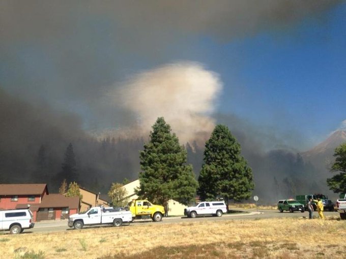
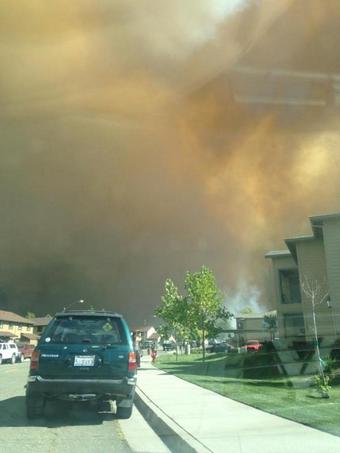
A raging wildfire, which erupted Monday afternoon, has damaged or destroyed more than 100 structures and has forced the evacuation of hundreds of residents in Northern California, near Weed.
The Boles Fire has scorched 375 acres, and prompted the closure of Interstate 5, according to CalFire.
As of Tuesday evening, the fire is 20 percent contained.
Evacuation orders were issued for residents in Weed, Carrick and Lake Shastina, CalFire reported. An evacuation center has been opened at the Siskiyou County Fairgrounds in Yreka. Three injuries were reported.
In the afternoon hours, as the blaze continue to spread, wind gusts were reported to be up to 30 mph with highs around 98 F, AccuWeather.com Meteorologist Brian Edwards said.
The area has seen only nine percent of its normal rainfall since April, he added.
Relative humidity was also low at about 10-15 percent Monday afternoon.
Subscribe to:
Posts (Atom)