Showing posts with label Marcela Rodriguez. Show all posts

Monday, December 19, 2016

Cyclone His Southern India, Killing 2, Forcing Evacuations

http://abcnews.go.com/International/wireStory/thousands-evacuated-cyclone-nears-southern-india-44135585

A cyclone slammed into India's southeastern coast on Monday, killing at least two people and causing authorities to evacuate thousands of people from low-lying areas.
Schools and offices were closed and state authorities were on alert in Tamil Nadu and Andhra Pradesh states as Cyclone Vardah hit the coast.
Police and disaster management teams evacuated more than 15,000 people from low-lying areas, moving them to safer places as heavy rains and strong winds lashed the region. In many places, trees and electrical poles were uprooted by the rain and wind.
Police in Chennai said two people were killed in the storm in the city, but it was not immediately clear how they died.
K. G. Ramesh, director-general of the meteorological department, said the cyclone had made landfall with heavy rain and winds of up to 120 kilometers (75 miles) an hour. "It was a severe cyclone," Ramesh said.

Snow, Ice, Brutal Temperatures to Grip the Midwest and Northeast

http://abcnews.go.com/US/snow-ice-brutal-temperatures-grip-midwest-northeast/story?id=44211322


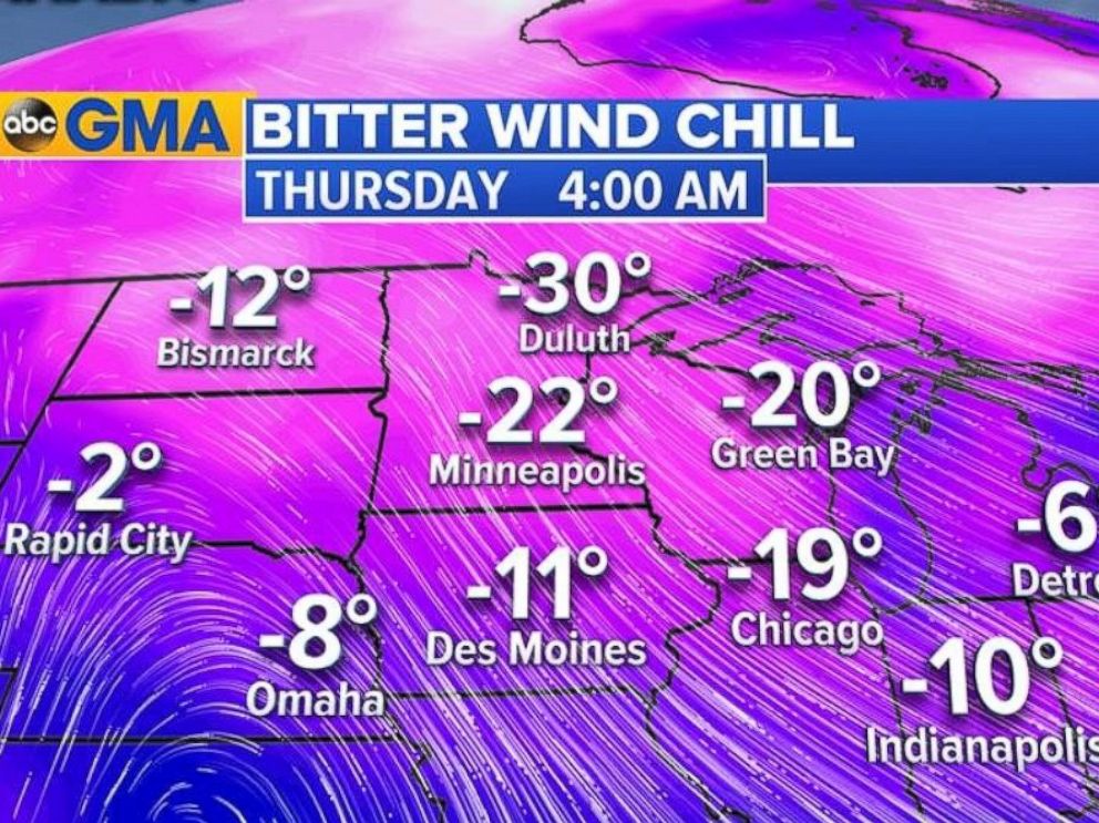
Thirty U.S. states, from California to Maine, were under winter weather alerts this morning, and temperatures are expected to drop throughout the day and hit the teens in some northeastern cities by Friday morning. The wind chill, or "feels like" temperature, will make it feel 20 to 30 degrees colder, according to forecasters.
ABC News meteorologists are also monitoring a winter storm coming from the west that is expected to bring rain, snow or ice to much of the country. The storm pummeled Portland, Oregon, today with snow and ice and triggered two avalanches near the Hoodo ski resort.
“The snow is over in Portland, but icy conditions could cause a messy morning commute,” said ABC News senior meteorologist Max Golembo.


PHOTO: Residents in the Midwest woke up this morning to brutal cold and bitter wind chills.

PM Forecast: Hottest Day of the Week Monday

http://www.nbclosangeles.com/weather/PM-Forecast-Hottest-Day-of-the-Week-Monday_Los-Angeles-401059455.html

The hottest day of the week is coming Monday and the warmer temperatures are bringing elevated fire concerns to SoCal. Anthony Yanez has your First Alert forecast for Sunday, Nov. 13, 2016.

Video link....

November 29-30, 2016 Severe Weather Recap: Tornadoes Tear Through the Southeast


https://weather.com/storms/severe/news/severe-weather-forecast-south-late-november-2016
Severe thunderstorms spawned tornadoes from Louisiana to the Carolinas over a two-day period wrapping up November 2016.
So far, 38 tornadoes have been confirmed either by National Weather Service storm surveys, photos and video, or by dual-polarimetric radar from around midday on November 29 through sunset the following day.
This is the most number of tornadoes in any U.S. outbreak since a late May siege of tornadoes and flooding in the Plains and Midwest.

50 States' Biggest Snow Days

https://weather.com/sports-recreation/ski/news/50-states-biggest-snow-days-20130112#/1

A man and a woman stroll down a snow-covered street in the Beacon Hill neighborhood of Boston, Saturday, Feb. 9, 2013. (AP Photo/Charles Krupa)
The snowiest day on record for each state in the country covers a wide range from less than six inches to more than five feet.


On the following pages, you will find the highest single-day snowfall totals for all the states in the country starting with the lowest total in Florida and ending with the highest totals in the western states. The description under each image shows the exact location and date of each single-day snowfall record.

All of this information is from the National Climatic Data Center (NCDC) division of the National Oceanic Atmospheric Administration (NOAA), which has analyzed various snowfall records for the country in each state.

Southern Side of Winter Storm Decima Will Host Severe Weather Through Early Sunday in South

https://weather.com/storms/severe/news/severe-forecast-south-mid-december-2016

The cold front associated with Winter Storm Decima is expected to swing southward through the South with a chance of severe weather into Sunday morning. A broken squall line continues develop ahead of an arctic blast of cold air. 
Conditions for severe weather will be favorable for isolated severe storms through the early morning hours of Sunday. 
Below is our latest forecast thinking on the timing and magnitude of the severe threats through early Sunday.

Severe Weather Forecast

Saturday into Sunday
  • Forecast: Isolated severe storms are possible in parts of central Tennessee, northern Mississippi, Northern Alabama and northeastern Louisiana through the overnight hours into Sunday morning. Thunder is a possibility early Sunday as the line of showers and storms reaches central Alabama, southern Mississippi and southeastern Louisiana. 
  • Threats: Damaging winds will be the main threat, but a few tornadoes and damaging large hail will also be possible.
  • Note that after this squall line and front pass your area, temperatures will rapidly tumble 20 to 30 degrees. Some areas could see some wintry precip on the backside of the rain. 

Tuesday, November 15, 2016

Brisbane and south-east Queensland battered by hailstones in huge storm

https://www.theguardian.com/australia-news/2016/nov/08/brisbane-and-south-east-queensland-battered-by-hailstones-in-huge-storm


More than 1,000 people lose power in Ipswich, with northern and western New South Wales also warned to expect high winds and hail
More than 1,000 residents in Ipswich were without power after a huge storm hit south-east Queensland on Tuesday afternoon.
Large hailstones were reported in Anstead, Mogill and other suburbs in western Brisbane.
Residents in the Brisbane, Ipswich, Somerset and Scenic Rim regions were warned to prepare for damaging winds as lightning and heavy rain threatened the CBD.
The Bureau of Meteorology warned of a severe storm approaching the CBD shortly after 5pm.

Brisbane

Natural disasters push 26m into poverty each year, says World Bank

https://www.theguardian.com/business/2016/nov/14/natural-disasters-poverty-world-bank-climate-change

Floods, earthquakes, tsunamis and other extreme natural disasters push 26 million people into poverty each year and cost the global economy more than half a trillion dollars in lost consumption, the World Bank has said.
A bank study of 117 countries concluded that the full cost of natural disasters was $520bn (£416bn) a year – 60% higher than any previous estimate – once the impact on poor people was taken into account.
The World Bank published its findings at the COP22 climate change conference in Marrakech and said the report underlined the need to protect the most vulnerable against the effects of global warming.
Jim Kim, the World Bank’s president, said: “Severe climate shocks threaten to roll back decades of progress against poverty. Storms, floods, and droughts have dire human and economic consequences, with poor people often paying the heaviest price. Building resilience to disasters not only makes economic sense, it is a moral imperative.”
The report cited evidence from the impact of Tropical Storm Agatha in 2010, which led to consumption per head falling by 5.5% and increased poverty by 14%.

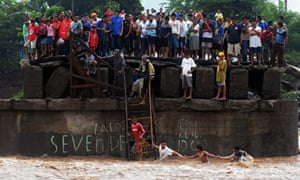
People try to cross a river as others look from a damaged bridge in El Salvador in the wake of Tropical Storm Agatha, which led to consumption per head falling by 5.5% and increased poverty by 14%.

Surviving in Waiau: the forgotten town closest to the NZ quake epicentre

https://www.theguardian.com/world/2016/nov/15/surviving-in-waiau-the-forgotten-town-closest-to-the-nz-quake-epicentre

As rescue helicopters fly overhead, Brenda Smith sits outside her ruined Waiau tea shop smoking a cigarette, nodding at locals who drive past in battered cars to homes that are no longer habitable.
Since Monday, Smith has had no electricity, no phone and little sleep. She has lost NZ$50,000 (£28,000) worth of stock and is rapidly running out of patience.
“Even though we were closest to the epicentre it has never been about Waiau; it is all about Kaikoura,” said Smith, who has operated her tea shop for almost a decade.
“Kaikoura is a destination, people know Kaikoura. Just because we aren’t known doesn’t mean we shouldn’t be. It is just frustrating … the prime minister could have visited us. [The former All Blacks captain] Richie McCaw did.”
The closed bridge on the approach to Waiau, which suffered severe damage in the earthquake.

Weirdest Tropical Storm' Forms Over Florida


(NEWSER) – Julia, the tropical storm expected to soak Georgia and South Carolina over the next few days, is probably the strangest storm of the year, forecasters say. Julia strengthened from a tropical system into a tropical storm a few miles west of Jacksonville, Fla., around midnight on Tuesday, marking the first time meteorologists have seen a tropical storm form over land in the state instead of offshore, NBC News reports. The last tropical storm to develop over land anywhere in the US was Beryl, which formed over southeast Louisiana in 1988, USA Today reports.
Tropical storms usually weaken, not strengthen over land, but Florida apparently only loosely meets the definition of "land": The state "is essentially one big swamp without mountains," and surface conditions 25 miles inland can be very similar to those 25 miles offshore, with plenty of moisture-rich air to power the storm, says meteorologist Eric Snitil at WSFA, giving Julia the award for "weirdest tropical storm of the year." Julia is expected to meander up the Atlantic coast over Thursday and Friday, bringing heavy rains and possibly flash floods to coastal areas drenched by Hermine two weeks ago, the AP reports.


http://www.newser.com/story/231126/weirdest-tropical-storm-forms-over-florida.html

Monday, October 31, 2016

Halloween Surprise: Rare Tropical Storm Forms in Mediterranean Sea

https://www.wunderground.com/news/medicane-tropical-storm-mediterranean-sea-31oct2016

A tropical storm formed Halloween weekend, not in the typical Atlantic or Pacific, but in the Mediterranean Sea.
This rather strange sequence of events began as an area of low-pressure dropped southward from southern Europe and became temporarily left behind by the jet stream over the central Mediterranean Sea south of the Italian coast.
By Saturday, Oct. 29, a non-tropical low pressure center formed east of Malta, a group of islands between Sicily and the coast of Libya over the weekend. 
RGB composite satellite image of the Mediterranean storm as it was making the transition to a subtropical storm on October 30, 2016, at 12:00 UTC.
(NERC Satellite Receiving Station, University of Dundee)
The next day, thunderstorms became more clustered near the low-pressure center to warm the mid levels of the atmosphere sufficiently to morph the system into a subtropical storm. 
A subtropical storm displays features of both tropical and non-tropical systems, including a broad wind field, no cold or warm fronts, and generally low-topped thunderstorms displaced from the center of the system. 

After El Niño, what weird weather could La Niña bring?

https://www.theguardian.com/news/2016/oct/23/el-nino-la-nina-drought-flood-weatherwatch

The strongest El Niño on record: flood waters in Chennai, India, in December last year.

This time last year the world’s weather was being dominated by one of the strongest El Niño events on record. As surface waters in the equatorial Eastern Pacific warmed by more than 2°C, a chain reaction of extreme weather events was set in motion. From torrential rains in Peru and huge storms pounding the coast of California, to drought and bushfire in Australia and Indonesia and catastrophic floods in south-east India (submerging parts of Chennai under eight metres of water), this El Niño really packed some punch. ByMay 2016 the El Niño conditions had gone, but the big question now is whether El Niño’s opposite phase – La Niña – is waiting in the wings?
La Niña, which is associated with abnormal cooling of equatorial Eastern Pacific waters, usually does follow El Niño, and in this case we’d expect to see La Niña emerge by the end of this year or in early 2017. And like El Niño, La Niña also tends to whip up some weird weather, often bringing cooler temperatures to many regions, drier conditions to East Africa and wetter weather over south-east Asia.
So far scientists have measured cooler than average sea surface temperatures in the Central Pacific, but this hasn’t spread further, and right now most climate models are predicting a return to average conditions for the Pacific, or at most a weak La Niña event. If La Niña does arrive then its cooling influence might cause a break in the string of global record-breaking warm months we’ve seen since March 2015, but without La Niña the world’s thermostat is likely to continue inching upwards.

'The atmosphere is being radicalized' by climate change

https://www.theguardian.com/environment/climate-consensus-97-per-cent/2016/oct/24/the-atmosphere-is-being-radicalized-by-climate-change

Climate change’s impacts on extreme weather and society are becoming increasingly clear and undeniable. While we are making progress in solving the problem, we’re still moving too slowly, and one of the two political parties governing the world’s strongest superpower continues to deny the science. This led astrophysicist Katie Mack to make the following suggestion, related to a common refrain from Donald Trump and Republican Party leaders:

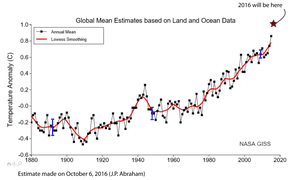
Average global surface temperatures.

Global warming intensified Hurricane Matthew

Hurricane Matthew set a number of records. Its record-breaking rainfall and storm surge caused historic flooding and destructive winds along the coasts of Florida, Georgia, the Carolinas, and Virginia. Hillary Clinton touched upon the science linking global warming and hurricane impacts in a recent speech in Florida:
At Climate Progress, Joe Romm summarized the various ways in which global warming makes hurricanes like Matthew more intense:
  • Hotter sea surface and upper ocean temperatures fuel hurricanes, leading to more of the strongest (Category 4 and 5) storms.
  • Hotter ocean temperatures also cause more rapid intensification of hurricanes, and the most intense storms are those that undergo rapid intensification.
  • Global warming causes sea level rise, which creates larger storm surges and thus worse flooding.
  • Global warming also adds more water vapor to the atmosphere, which causes more intense rainfall and exacerbates flooding.
In short, global warming made Hurricane Matthew and its impacts more severe, and will lead to more such devastating hurricanes in the future.


Landfalling Typhoons Have Become More Intense Over Last 40 Years

https://weather.com/news/climate/news/climate-central-landfalling-typhoons-more-intense

In the Northwest Pacific, already a hotspot for tropical cyclones, the storms that strike East and Southeast Asia have been intensifying more than those that stay out at sea over the last four decades, a new study finds.
The proportion of landfalling storms that reach Category 4 or 5 strength — the storms that wreak the most damage, as recent examples like 2013’s devastating Super Typhoon Haiyan show — has doubled and even tripled in some areas of the basin, researchers found. The increases seem to be the result of faster intensification linked to warmer ocean waters in coastal areas.
Super Typhoon Haiyan as it headed toward landfall in the Philippines, where it caused enormous destruction in November 2013. (NASA)
The findings, detailed Monday in the journal Nature Geoscience, are in line with the broader increase in the most intense tropical cyclones expected with rising global temperatures, though these trends have not yet specifically been linked to human-caused climate change.

‘Little Doubt’ Typhoons Intensifying

The Northwest Pacific normally sees the most tropical cyclone activity of any ocean basin because of the deep well of ocean heat available to fuel typhoons, as such storms are called there.
The new work is an outgrowth of a previous study by the same researchers that found that typhoon intensity had increasedbasin-wide since the late 1970s and suggested that another 14 percent increase in intensity could be expected by the end of the century, as the ocean takes up most of the excess heat trapped by greenhouse gasses.
Wei Mei, a tropical cyclone and climate researcher at the University of North Carolina at Chapel Hill, said that he and his colleagues were curious if typhoons in some parts of the basin were intensifying more than others. To investigate this, they grouped the typhoons into clusters based on where they formed and the paths they followed.
They found that the clusters that had the most landfalling hurricanes showed much clearer increases in intensity than those where most storms stayed out at sea. The cluster with the biggest trend had a 15 percent increase in intensity and, as part of that trend, saw the number of Category 4 and 5 storms increase from about one per year in the late 1970s to more than four per year recently.

Arctic's Melting Permafrost Problem Is Slowly Destroying Russian Cities

https://weather.com/news/climate/news/melting-permafrost-arctic-russia-buildings-destroyed

All over the world, climate change is altering our world in ways that are both obvious and subtle. Some effects of global warming change rapidly, while others are slow-moving disasters.
But in northern Russia, where the permafrost zone is shrinking as a side effect of climate change, towns are watching helplessly as their buildings are being deformed and even destroyed by the moving ground. In Norilsk, a town of 177,000 known for its nickel production, about 60 percent of the buildings have been deformed, according to a local report earlier this year.
The permafrost melt has forced more than 100 Norilsk homes to be abandoned, the Guardian also reported. It's the most polluted town in Russia, the report added, but despite the pollution and other issues, experts agree that the changing climate is as much to blame for the permafrost melt as anything else.
"In most cases, the effect of climate change was not accounted for properly or at all, so the story is not about one building falling, even though there are examples of that, but about thousands of people living in buildings which have the potential to fall," Dmitry Streletskiy, an assistant professor of geography at George Washington University, told the Guardian.


Fall Heat Wave Will Smash Records Into the First Days of November

https://weather.com/forecast/national/news/record-warmth-west-central-south-late-october
Record warmth will continue to give a summer feel into the first days of November this week, with hundreds of daily record highs and warm lows likely to be set, along with some monthly record highs in parts of the heat-weary South and Plains states.
Dozens of daily record highs were broken Monday, making it the hottest Halloween on record in those cities.
Halloween's record highs included Dodge City, Kansas (90 degrees), Garden City, Kansas (90 degrees), Asheville, North Carolina (81 degrees), Huntsville, Alabama (88 degrees), Tallahassee, Florida (90 degrees), Pensacola, Florida (89 degrees), and Fort Smith, Arkansas (89 degrees).
Atlanta also set a new record high Monday at 86 degrees, which is the latest on record that it has been that warm.
Denver finished the month of October with no measurable snow for the third-consecutive October, which is the first time this happened in Denver weather history, according to the National Weather Service in Boulder, Colorado.
Current Temperatures
    Some southern cities could set a new daily record high each day through much of this week.

    Monday, October 10, 2016

    Climate change leading to larger and longer western fire seasons


    Over the past three decades, human-caused climate change has nearly doubled the amount of area burned by western U.S. forest fires, according to a new study from the University of Idaho and Columbia University.

    The researchers found that a combination of higher temperatures and lower humidity caused an additional 16,000 square miles of western forest to burn between 1984 and 2015, which is equivalent to an area slightly larger than the size of Massachusetts and Connecticut combined.
    "No matter how hard we try, the fires are going to keep getting bigger, and the reason is really clear," said study coauthor Park Williams, a bioclimatologist at Columbia University's Lamont-Doherty Earth Observatory. "Climate is really running the show in terms of what burns. We should be getting ready for bigger fire years than those familiar to previous generations." (via Eurekalert)
    "We're no longer waiting for human-caused climate change to leave its fingerprint on wildfire across the western U.S. It's already here," said John Abatzoglou, the study's lead author and an associate professor of geography in UI's College of Science. "Over the last several decades we've seen longer fire seasons, larger fires and more area burned - and those observations led us to ask, ‘Why?' What we found was that human-caused climate change played a resounding role in observed increases in forest fire activity."


    http://www.accuweather.com/en/weather-blogs/climatechange/climate-change-leading-to-larg/60619969

    The effect of thermal history on the susceptibility of reef-building corals to thermal stress

    The mutualistic relationship between corals and their unicellular dinoflagellate symbionts (Symbiodinium sp.) is a fundamental component within the ecology of coral reefs. Thermal stress causes the breakdown of the relationship between corals and their symbionts (bleaching). As with other organisms, this symbiosis may acclimate to changes in the environment, thereby potentially modifying the environmental threshold at which they bleach. While a few studies have examined the acclimation capacity of reef-building corals, our understanding of the underlying mechanism is still in its infancy. The present study focused on the role of recent thermal history in influencing the response of both corals and symbionts to thermal stress, using the reef-building coral Acropora aspera. The symbionts of corals that were exposed to 31°C for 48 h (pre-stress treatment) 1 or 2 weeks prior to a 6-day simulated bleaching event (when corals were exposed to 34°C) were found to have more effective photoprotective mechanisms. These mechanisms included changes in non-photochemical quenching and xanthophyll cycling. These differences in photoprotection were correlated with decreased loss of symbionts, with those corals that were not prestressed performing significantly worse, losing over 40% of their symbionts and having a greater reduction in photosynthetic efficiency. These results are important in that they show that thermal history, in addition to light history, can influence the response of reef-building corals to thermal stress and therefore have implications for the modeling of bleaching events. However, whether acclimation is capable of modifying the thermal threshold of corals sufficiently to cope as sea temperatures increase in response to global warming has not been fully explored. Clearly increases in sea temperatures that extend beyond 1–2°C will exhaust the extent to which acclimation can modify the thermal threshold of corals.

    http://jeb.biologists.org/content/211/7/1050.long?trendmd-shared=1

    Fig. 2.

    OneNWS Network: A Stronger and Faster National Weather Service

    A major upgrade in technology is taking the National Weather Service (NWS) from separate operating platforms across the country to a “family plan,” called the OneNWS Network! OneNWS Network enhances the efficiencies of local, regional, and national level offices and centers with:
    • Faster download/upload speeds and higher bandwidth, allowing for more data and quicker software updates
    • More circuits to reduce lapses in network operations
    • Single point of contact for network monitoring and support
    All national centers, the Alaska Region, and the Pacific Region are already upgraded to OneNWS. By the end of 2017, all offices and centers will operate under the OneNWS Network.
    The new GOES-R satellite will launch in November 2016, providing 3x more data, 4x better resolution, and 5x faster coverage than the satellites currently in orbit. Can you imagine how much extra data will cross the National Weather Service’s fiber-optic lines? Thankfully, the OneNWS Network ensures that the NWS is more than capable of handling the masses of information. Most importantly, forecasters will be able to translate this rich information into actionable forecasts that motivate communities to maximize their safety in the face of dangerous weather conditions.


    http://www.nws.noaa.gov/com/weatherreadynation/one_nws_network.html

    Hurricane Matthew Kills at Least 26 in U.S.; Dangerous Flooding Situation Unfolding in North Carolina

    After tearing through the Caribbean, leaving more than 1,000 dead in Haiti, Hurricane Matthew hammered the coast of the southeastern United States, leaving behind a trail of coastal destruction, wind damage and freshwater flooding that claimed an additional 26 lives.

    The confirmed deaths include 10 in North Carolina; nine in Florida; three in South Carolina; three in Georgia; and one in Virginia.
    Although Hurricane Matthew is long gone, communities from central Florida up through Virginia have been dealt problems ranging from substantial beach erosion and blackouts to uninhabitable homes and major flooding.

    North Carolina

    After Hurricane Matthew pulled away from North Carolina Sunday, the state was coping with historic flooding that has killed at least 11 people and prompted thousands of water rescues. In the town of Princeville, floodwaters from the Tar River forced the evacuation of the entire town Sunday afternoon.
    According to North Carolina Governor Pat McCrory, 1,500 people became stranded in Lumberton Monday as the Lumber river rose. People are reportedly stranded on roofs and rescues are underway, the governor said during a press conference Monday morning.
    Edgecombe County announced on its Facebook page that buses were being brought in to evacuate 2,000 residents from Princeville, which was destroyed by flooding from Hurricane Floyd in 1999.

    https://weather.com/news/news/hurricane-matthew-southeast-updates