Showing posts with label Rachel Worley. Show all posts

Tuesday, April 28, 2015

Storms, Power Outages in Louisiana

Severe Storms Clobber Baton Rouge, New Orleans

Louisiana Gov. Bobby Jindal declared a state of emergency in a handful of parishes after strong storms brought on flooding, and also left thousands of people without power.
Gov. Jindal said Assumption and Lafourche parishes have declared emergencies to help open response for storm cleanup; more counties could be brought under the declaration.
The rain started early in the day, knocking out power to as many as 200,000 homes and businesses at the height of the storm, according to The Associated Press.
Local storm reports showed winds gusting as high as 71 mph at Louis Armstrong New Orleans International Airport as the storms passed through, just before 10:30 a.m. local time.
Around the same time is when six to eight freight containers fell off the Huey P. Long Bridge outside New Orleans. A WGNO TV crew recorded it as it happened. No one was hurt and the containers weren't carrying anything hazardous.
A tornado was reported by spotters in the Belle Chasse area, local storm reports said.
The National Weather Service said New Orleans saw 1.74 inches of rain, setting a new record for April 27.
Earlier in the morning, the westbound lanes of Interstate 10 were closed at Exit 127 due to a fallen tree brought down by the wind, according to the Department of Transportation.

California Drought and Climate Change

As California settles into its fourth year of scant rainfall and record-breaking high temperatures, the state’s snowpack accumulation is record low at 5 percent of the historical average, according to the April 1 measurement when snowpack is normally at its peak, around 28 inches. Snowpack accumulations in 2014 — the state’s hottest and third driest year on record — also stood at, or near record lows, and by June 1, there was virtually no snowpack to replenish state reservoirs. Already in 2015, 93 percent of the state is experiencing drought conditions ranked “severe” or worse — conditions that 100 percent of the state experienced in 2014. The official water allocation dictated by the state’s water management authority for 2015-16 will only meet 20 percent of the water requests from cities and agriculture, and the big reservoirs that provide the bulk of the state’s water remain much lower than normal
Altogether, the drought stands as the worst to hit the state in 1,200 years.
Climate change is linked to California’s drought by two mechanisms: rising temperatures and changing atmospheric patterns conducive to diminishing rains.  The first link is firmly established, and there is a considerable and growing body of evidence supporting the second.
Climate change intensified the California drought by fueling record-breaking temperatures that evaporated critically important snowpack, converted snow to rain, and dried out soils. This past winter in California (December 2014 to February 2015) was officially the warmest on record by a wide margin. February 2015 was California’s singularly warmest February on record. All of this falls on the heels of the 2014 calendar year — which was the warmest in California in 119 years of record keeping, smashing the prior records by an unprecedented margin. 
Weather records tend to be broken when the trend driven by natural changes and the trend driven by climate change run in the same direction, in this case toward warmer temperatures. Drought in California has increased significantly during the past 100 years, driven by rising temperatures.
In addition to fueling hot extremes, there is now considerable evidence that climate change was at least partly responsible for the dramatic fall-off in precipitation during the drought. The unprecedented high-pressure weather pattern known as the “ridiculously resilient ridge” that blocked storms from the state has been linked to climate change by researchers at Stanford University, while other researchers have also identified the fingerprint of global warming in the emergent high-pressure pattern.
http://www.usnews.com/news/blogs/at-the-edge/2015/04/14/climate-change-and-the-california-drought

Tuesday, April 21, 2015

Earth Hits New Milestone: 2015 Marks Warmest January to March On

The first three months of 2015 have been the warmest January-March on record for the globe, according to three separate analyses released this week.
NOAA's state of the climate report released Friday says January-March 2015 topped the previous record warm first quarter of any year set in 2002.
January - March 2015 global temperature anomalies in degrees Celsius, compared to the 1981-2010 averages.
(NOAA/NCDC)
NASA's Goddard Institute for Space Studies also found January-March to be record warm for the globe, with a surface temperature anomaly of 7.9 degrees Celsius, relative to the 1951-1980 average, topping the previous record from 2002 of 7.7 degrees Celsius. Both NOAA and NASA's global temperature records date to 1880. 
March 2015 was the warmest March globally, as well, according to NOAA. Eight of the past 12 months -- March, December, October, September, August, June, May and April -- have either tied or set new global warm records for their respective months.
NOAA said only two other months -- February 1998 and January 2007 -- had higher global temperature anomalies for their respective months than March 2015.
An analysis from the Japan Meteorological Agency found March 2015 to be the warmest in their dataset dating to 1891. Four of the five warmest Marches in JMA records have occurred this century, including 2010 (second warmest), 2002 (third warmest) and 2014 (fifth warmest). 
March monthly global temperature anomalies (departures from 1981-2010 average) from 1891-2015. March 2015 highlighted by red box. Long-term March trend shown by red line. 
The first three months of 2015 were much warmer than average over a vast extent of Europe and Asia, particularly from Scandinavia and eastern Europe across much of Russia, as well as a swath of western Canada and the western United States, including Alaska. 
Seven western U.S. states set their record warmest January-March periods, according to NOAA.
(MORE: Nine U.S. States With Extreme Jan-Mar Temps)
One of the few consistently cold spots has been eastern Canada and the northeastern quarter of the United States. New York and Vermont shivered through their coldest January-March on record in 2015. 
One contributor to this is a persistently warm body of water in the northern Pacific Ocean known by scientists as "the blob," which is now pushed closer to the West Coast of the U.S. and Alaska, including the Aleutians.
Sea-surface temperature anomalies in degrees Celsius on April 15, 2015. Note the large area of warm sea-surface temperatures in the eastern and equatorial Pacific Ocean.
(NOAA/ESRL)
Also, with the potential for El Nino to strengthen in the months ahead, it is possible 2015 will go down as the globe's warmest year on record.
(MORE: Effect on Atlantic Hurricane Season 2015? | El Nino Facts & Myths)
Without El Nino's warmer ocean water, 2014 still set a record warm year for the globe.


http://www.wunderground.com/news/record-warmest-january-march-global-temperatures-2015

El Nino is Hanging On: What That Means For Hurricanes

Over the next few months, the globe might see an uptick in tropical cyclone activity thanks to an El Niño that is showing signs of asserting itself more forcefully.
That doesn’t mean more hurricanes everywhere, though: While El Niño tends to boost activity in the Pacific Ocean, it clamps down on storm formation in the tropical Atlantic. That link has at least one hurricane forecaster calling for a very quiet Atlantic hurricane season this year — possibly the quietest since the mid-20th century.
While El Niño is a cyclical climate phenomenon in the Pacific Ocean — marked by warmer ocean temperatures in the tropics and a weakening of the usual easterly trade winds — it can impact weather around the globe.
During an El Niño, a domino of atmospheric effects causes a large area of stable, subsiding air to form over the tropical Atlantic. Exactly the opposite of what a fledgling tropical cyclone, which thrives on instability, needs to grow and strengthen. El Niño also tends to bring more wind shear to the region, meaning the speed and direction of the wind changes more between different altitudes, putting the kibosh on a burgeoning storm.
(MORE: 2015 Hurricane Season Outlook)
In the Pacific, it’s a different story: There, tropical cyclone activity ramps up during El Niño events. That doesn’t necessarily mean more storms, said Philip Klotzbach, a hurricane researcher at Colorado State University; instead, it might just mean storms form in areas that leave them with plenty of ocean to traverse before they peter out (and can shift the areas more likely to be hit by storms). Such longer-lasting storms are something frequently seen in the Pacific during an El Niño, Klotzbach said.
Forecasters combine the strength of a storm and its duration into a measure called Accumulated Cyclone Energy, or ACE, which can be used to gauge the impact of a single storm or a season’s worth of them. Stronger, longer-lasting storms have higher ACE values.
In an El Niño year, fewer Atlantic storms mean a lower ACE for that basin, while in the eastern and northwest Pacific, longer-lasting storms raise the ACE value. But the changes aren’t equal: The increase in Pacific activity is larger than the decrease in the Atlantic, so “your global activity actually increases in El Niño years,” Klotzbach said.
In particular, activity in the northwest Pacific is a big determinant of global ACE for a given year. There, the tropical cyclone (or typhoon, to use the regional term) season lasts virtually all year, and so there is more opportunity for storms to form.
“The northwestern Pacific drives the bus,” as Klotzbach put it.
(MORE: Hurricane Central)
Through April 6 of this year, the northwest Pacific’s ACE value was the second highest ACE to date on record, Klotzbach said.
Even though the El Niño didn’t fully emerge until February (by the reckoning of U.S. government forecasters), it is playing a part in this amped-up early season activity, which saw the formation of Category-5 Super Typhoon Maysak, one of only three storms of similar strength to form prior to April 1 in the records.
The tendency towards El Niño-like conditions last year still boosted Pacific activity and tamped down on the Atlantic. Several storms reached Hawaii, while Japan saw several landfalls — other signatures of El Niño-year activity. The global ACE value was also higher than in the previous two years, when neutral conditions were in place.
The most recent El Niño observations and climate model projections suggest the current event is looking a little more textbook and could last through summer, possibly even strengthening. Because of this, Klotzbach thinks that ACE “should actually be high this year,” though he expects only seven tropical storms to form in the Atlantic, compared to the average of about 12. Of those, his forecast calls for only three to become hurricanes, compared to an average of six.
Of course, El Niño activity is notoriously difficult to predict in the springtime, and signs around this time last year of a strong El Niño in the works didn’t pan out. So forecasters are cautious.
Even if activity is below normal in the Atlantic, forecasters are quick to caution, there is still potential for a pocket to open up and bring the right ingredients together to form a devastating storm.
The best example of this is Hurricane Andrew, which barreled into Florida as a Category 5 storm in 1992, during what was otherwise a remarkably quiet year in the Atlantic. The considerable damage from that storm marked it as the costliest Atlantic hurricane on record until Katrina.

http://www.wunderground.com/news/el-nino-strength-what-that-means-for-hurricanes

Tuesday, April 14, 2015

Earth to Face Unprecedented Heat Wave 2015

NASA experts believe that in 2015, planet Earth will have to deal with an unprecedented heatwave. The forecast is based on temperature trends of recent years.

Since the start of permanent climate observations in 1880, the frequency of temperature anomalies has been growing. Occurrences of high average temperatures follow each other: in 1995, 1997, 1998, 2005 and 2010. 

This September, average global temperature was 15.7 degrees Celsius, which is a new record for the past 135 years. During the first nine months of this year, average global temperature made up 14.7 degrees Celsius.

NASA experts say that the current year can be regarded the hottest since 1998. However, in the summer of 2015, different regions of the world will experience an unprecedented heatwave and drought, Rosbalt reports. 

VIDEO: https://youtu.be/ylRcC9H0MMs

http://english.pravda.ru/news/science/30-10-2014/128932-earth_heatwave-0/

US Drought Outlook


United States Seasonal Drought Outlook Graphic - click on image to enlarge
(Click on image to enlarge)
 
PDF Version of Seasonal Drought Outlook Graphic Adobe PDF Reader
 
Latest Seasonal Assessment - With the gradual winding down of the wet season in the West, prospects for drought relief during the spring are low. Persistence and/or intensification of drought conditions is anticipated across the West, with drought development favored in western sections of both Washington and Oregon. In Arizona, Utah, and western portions of both Colorado and New Mexico, drought persistence/intensification is deemed most likely, as spring tends to be a relatively dry time of year, in advance of the summer Monsoon. For much of the southern Rockies and south-central Plains, drought improvement and/or removal is predicted, based on the latest precipitation outlooks from CPC for April and April-June, and on spring climatology. Persistence and/or intensification of drought is forecast for the core drought areas of the south-central Plains, however, which are currently experiencing extreme or exceptional drought conditions. These core drought areas will need significant amounts of rain to offset the long duration and severity of present drought conditions. In the Upper Midwest, the areal coverage of moderate drought has expanded in the past week, and a sizable region of drought development is anticipated around it. With a relatively dry antecedent autumn and winter, soils in the region have become very dry, and a lack of snowpack has likely contributed to the record warm temperatures that occurred during the last 1-2 weeks. The CPC monthly and seasonal precipitation outlooks favor the continuation of below-median precipitation across the Upper Midwest, which would lead to further expansion of drought. In contrast, the CPC precipitation outlooks anticipate enhanced odds of above-median precipitation across the lower Mississippi Valley and central Gulf Coast region, prompting a forecast for removal of drought in those areas. For the Florida Everglades, the climatological onset of the rainy season in late May warrants the removal of drought conditions. In Hawaii, though above-median rainfall is expected during April and AMJ by CPC, it will be difficult to get a one-category improvement. Therefore, areas of drought persistence and/or intensification and drought development are indicated.

http://www.cpc.ncep.noaa.gov/products/expert_assessment/sdo_summary.html

Spring Forecast Warns of Severe Thunderstorms


Spring Forecast Warns of Severe Thunderstorms, Hail, Tornadoes

By Brian K. Sullivan | April 8, 2015
Stormy
It’s again the time of year when a mix of cool air from Canada, warm moist air from the Gulf of Mexico and a touch of energy off the Pacific can all wrap together to unleash storms across the U.S. Midwest and South.
From Tuesday into the weekend, the potential for severe thunderstorms is on the map for the Midwest through the Atlantic coast, according to the U.S. Storm Prediction Center in Norman, Oklahoma.
“Thursday is probably the big day, primarily because it’s going to include the Chicago, St. Louis and Springfield, Missouri, corridor,” said Tom Kines, a meteorologist with AccuWeather Inc. in State College, Pennsylvania.
About 22.2 million people are in the path of potentially severe storms as the bulls-eye for the worst weather shifts from Oklahoma, Kansas and Missouri on Wednesday into Illinois and parts of Iowa and Indiana on Thursday, the U.S. Storm Prediction Center said Tuesday. The entire region has a 30 percent chance of severe thunderstorms and the host of troubles they can bring, including large hail, straight-line winds and, of course, tornadoes.
‘‘Straight-line winds are probably the highest threat,’’ Kines said by telephone. “That’s not to say there won’t be tornadoes, because there probably will be; nevertheless, it’s something to be very concerned about.”
Slow Start
This year has been a slow one for the systems.
Only 41 tornadoes were reported in the U.S. from January to March, according to the Storm Prediction Center. That’s fewer than the three-year average for any one of those months.
Last year got off to a relatively slow start as well but managed to make up for lost ground in April, May and June.
April is the one of the peak months for strong and violent tornadoes, primarily across the South, said Greg Carbin, a warning coordination meteorologist at the center. May and June then become active across the Great Plains and Midwest.
“We are on the really steep slope of increasing severe weather activity right now,” Carbin said by telephone.
The current round of severe weather is a classic pattern of cool air dropping in from Canada meeting warm air from the Gulf with dew points reaching into the 60s, said Kines. Meanwhile, a storm system is moving in from the Pacific.
Masses Clash
“The clashes of the air masses to begin with, then a pretty good system coming from the West Coast, that’s going to set the stage for severe weather into Thursday,” Kines said. “Even on Friday, it’s not out of the question that as this system moves to the East Coast, there could be severe weather from Philly to D.C. to Richmond on down to Charlotte.”
The Storm Prediction Center gives the mid-Atlantic from about Philadelphia to Georgia a 15 percent chance of severe storms, although Carbin said storms are possible from New York to New Orleans.
“It will be a pretty extensive line of storms,” Carbin said.
It’s that time of year again, and another sure sign spring is here.
http://www.insurancejournal.com/news/national/2015/04/08/363620.htm

Pacific Warmth to Blame for Bizarre Weather?

A blob of warm water in the Pacific Ocean may be to blame for some of the bizarre weather in the United States this year, a new study suggests.
From the dry spell in the West to the East Coast's endless snow season, the country has seen its share of weird weather so far in 2015. For that, scientists say, you can thank (or curse) a long, skinny blob in the Pacific Ocean about 1,000 miles (1,600 kilometers) off the West Coast, stretching all the way from Mexico to Alaska.
"In the fall of 2013 and early 2014, we started to notice a big, almost-circular mass of water that just didn't cool off as much as it usually did. So by spring of 2014, it was warmer than we had ever seen it for that time of year," study co-author Nick Bond, a climate scientist at the University of Washington

This warm blob, which is about 2 to 7 degrees Fahrenheit (1 to 4 degrees Celsius) warmer than the usual temperature for this region, means the winter air that crosses over the Pacific Ocean wasn't cooled as much as it normally would be. That, in turn, spelled warmer, dryer conditions for the West Coast. [Fishy Rain to Fire Whirlwinds: The World's Weirdest Weather]
The blob
Scientists first observed the patch of warm water in June 2014, when Bond noticed that Washington state had experienced a milder winter than usual. At that point, the warm patch stretched about 1,000 miles (1,600 km) in each direction and was 300 feet (91 meters) deep.
Since then, the warm blob has persisted, though it has become a long, skinny finger of water instead. In a study published Monday (April 6) in the journal Geophysical Research Letters, Bond and his colleagues argue that a high-pressure ridge above the Pacific Ocean over the past two winters had led to calmer seas. Without roiling waters to transfer heat to the cold air above it, the ocean remained warmer than usual, the team concluded.
People can also thank the blob (in part) for the drought conditions experienced in California, Oregon and Washington this year. As the air cycles over the warmer water, it heats up and brings less snow, translating into drier conditions inland.
What's more, this warm blob has been disrupting ocean ecosystems, the researchers said. For instance, fish have been spotted in new waters, in part because they lack the normally nutrient-rich, cold waters that upwell from deep in the ocean. Skinny and dying sea lion pups and seabirds have been washing ashore off California's coast, according to the "Annual State of the California Current Ecosystem Report."   
Larger pattern
East Coasters can blame wonky ocean temperatures off the Pacific for all those weeks spent shoveling snow, according to another study published March 19 in the journal Geophysical Research Letters. A decadal pattern called the North Pacific Mode, a pattern of higher-than-average sea-surface temperatures that snakes from the tropical Pacific to the waters off coastal California to the northern Pacific, caused the weird weather. The pattern sent rivers of cold, wet air into the Midwestern and East Coast states, while forcing hot dry air across the American West, the study found.
"Lately, this mode seems to have emerged as second to the El NiñoSouthern Oscillation in terms of driving the long-term variability, especially over North America," said study author Dennis Hartmann.
This same climate variability helped create the warm blob, and has been getting progressively more influential on global weather patterns since 1980, the study found.

Tuesday, March 24, 2015

How QPF Ranges over Hours

24 Hour Precipitation Total - Day 1

Day 1 QPF
Day 1 QPF
[contours only]

6 Hourly Precipitation Amounts - Day 1

Update (00-06 hr QPF)Update (00-06 hr)
[contours only]
06-12 hr QPF06-12 hr.
[contours only]
12-18 hr QPF12-18 hr.
[contours only]


18-24 hr QPF
18-24 hr.
[contours only]
24-30 hr QPF
24-30 hr.
[contours only]
http://www.hpc.ncep.noaa.gov/qpf/qpf2.shtml

Deep Freeze: Americans Becoming Wimps Who Forgot What Cold Weather Was Like

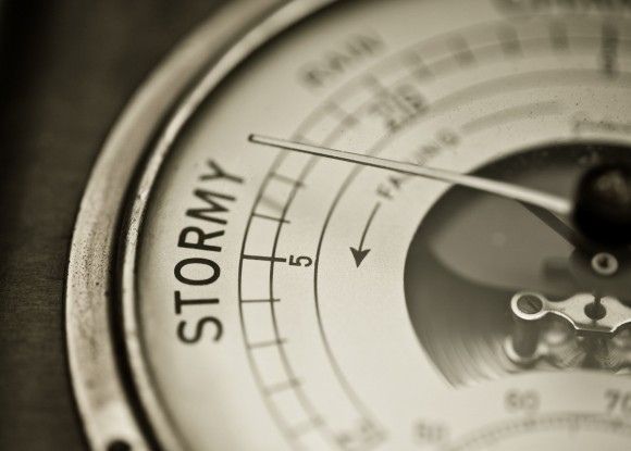
WASHINGTON -- We've become weather wimps.
As the world warms, the United States is getting fewer bitter cold spells like the one that gripped much of the nation this week. So when a deep freeze strikes, scientists say, it seems more unprecedented than it really is. An Associated Press analysis of the daily national winter temperature shows that cold extremes have happened about once every four years since 1900.
Until recently.
When computer models estimated that the national average daily temperature for the Lower 48 states dropped to 17.9 degrees on Monday, it was the first deep freeze of that magnitude in 17 years, according to Greg Carbin, warning meteorologist for the National Oceanic and Atmospheric Administration.
That stretch - from Jan. 13, 1997 to Monday - is by far the longest the U.S. has gone without the national average plunging below 18 degrees, according to a database of daytime winter temperatures starting in January 1900.
In the past 115 years, there have been 58 days when the national average temperature dropped below 18. Carbin said those occurrences often happen in periods that last several days so it makes more sense to talk about cold outbreaks instead of cold days. There have been 27 distinct cold snaps.
Between 1970 and 1989, a dozen such events occurred, but there were only two in the 1990s and then none until Monday.
"These types of events have actually become more infrequent than they were in the past," said Carbin, who works at the Storm Prediction Center in Norman, Okla. "This is why there was such a big buzz because people have such short memories."
Said Jeff Masters, meteorology director of the private firm Weather Underground: "It's become a lot harder to get these extreme (cold) outbreaks in a planet that's warming."
And Monday's breathtaking chill? It was merely the 55th coldest day - averaged for the continental United States - since 1900.
The coldest day for the Lower 48 since 1900 - as calculated by the computer models - was 12 degrees on Christmas Eve 1983, nearly 6 degrees chillier than Monday.
The average daytime winter temperature is about 33 degrees, according to Carbin's database.
There have been far more unusually warm winter days in the U.S. than unusually cold ones.
Since Jan. 1, 2000, only two days have ranked in the top 100 coldest: Monday and Tuesday. But there have been 13 in the top 100 warmest winter days, including the warmest since 1900: Dec. 3, 2012. And that pattern is exactly what climate scientists have been saying for years, that the world will get more warm extremes and fewer cold extremes.
Nine of 11 outside climate scientists and meteorologists who reviewed the data for the AP said it showed that as the world warms from heat-trapping gas spewed by the burning of fossil fuels, winters are becoming milder. The world is getting more warm extremes and fewer cold extremes, they said.
"We expect to see a lengthening of time between cold air outbreaks due to a warming climate, but 17 years between outbreaks is probably partially due to an unusual amount of natural variability," or luck, Masters said in an email. "I expect we'll go far fewer than 17 years before seeing the next cold air outbreak of this intensity.
And the scientists dismiss global warming skeptics who claim one or two cold days somehow disproves climate change.
"When your hands are freezing off trying to scrape the ice off your car, it can be all too tempting to say, `Where's global warming now? I could use a little of that!' But you know what? It's not as cold as it used to be anymore," Texas Tech University climate scientist Katharine Hayhoe said in an email.
The recent cold spell, which was triggered by a frigid air mass known as the polar vortex that wandered way south of normal, could also be related to a relatively new theory that may prove a weather wild card, said Rutgers University climate scientist Jennifer Francis. Her theory, which has divided mainstream climate scientists, says that melting Arctic sea ice is changing polar weather, moving the jet stream and causing "more weirdness."
Ryan Maue, a meteorologist with the private firm Weather Bell Analytics who is skeptical about blaming global warming for weather extremes, dismisses Francis' theory and said he has concerns about the accuracy of Carbin's database. Maue has his own daily U.S. average temperature showing that Monday was colder than Carbin's calculations.
Still, he acknowledged that cold nationwide temperatures "occurred with more regularity in the past."
Many climate scientists say Americans are weather weenies who forgot what a truly cold winter is like.
"I think that people's memory about climate is really terrible," Texas A&M University climate scientist Andrew Dessler wrote in an email. "So I think this cold event feels more extreme than it actually is because we're just not used to really cold winters anymore."
http://www.weather.com/science/environment/news/deep-freeze-weather-wimps-20140110

Spring Snow Storms

The first week of spring is bringing a taste of winter to parts of the northern Plains, Upper Midwest, northern Rockies and Pacific Northwest from two separate snowmakers.
The first system, an Alberta clipper, moved through the Midwest, southern Great Lakes and Ohio Valley Sunday and Monday, spreading a swath of snow from Minnesota and Wisconsin through northern Illinois, Indiana, Ohio and southwestern Pennsylvania before fizzling over the Appalachians.
Some locations picked up a foot or more of snow:
  • 15 inches in Fennimore and Woodman, Wisconsin
  • 12 inches in Marquette and Waukon, Iowa
  • 11.5 inches near Zumbrota, Minnesota
  • 7.9 inches in Rochester, Minnesota
  • 5.8 inches at Chicago O'Hare Aiport
  • 4.5 inches near Radnor, Ohio
  • 3.6 inches at Minneapolis/St. Paul International Airport
  • 3 inches at Madison - Dane County Regional Airport

System #2: Through Wednesday

The next system moved into the Pacific Northwest and northern Rockies on Monday.
As it continues to move east through the northern Plains the system will strengthen and an area of low pressure will develop. Many areas will see a mix of rain and snow as there is a lack of deep cold air in the northern Plains.
This system will then move into the Upper Midwest and Great Lakes region by Wednesday.
(MORE: Temperature Roller Coaster for the East)
Moisture will stream northward and where it meets cold air, with temperatures near to below freezing, snow may develop.
Early in the week, accumulating snow will coat the higher elevations of the northern Rockies, including the Cascades, Bitterroots, and the Tetons, a welcome sight for the snow-starved Northwest. Accumulating snow is also likely Tuesday and Wednesday in North Dakota, northern Minnesota, northern Wisconsin and northern Michigan.
The cold front associated with this area of low pressure will stretch through the mid-Mississippi Valley and into the southern Plains. Showers and thunderstorms are expected to develop along the cold front as moisture from the Gulf of Mexico is drawn northward and a few thunderstorms will likely be strong to severe, especially in portions of the Plains and Midwest through Wednesday. 
(MORE: Severe Weather Forecast)
Below you will find our current forecast.
http://www.wunderground.com/news/spring-snow-northern-plains-upper-midwest