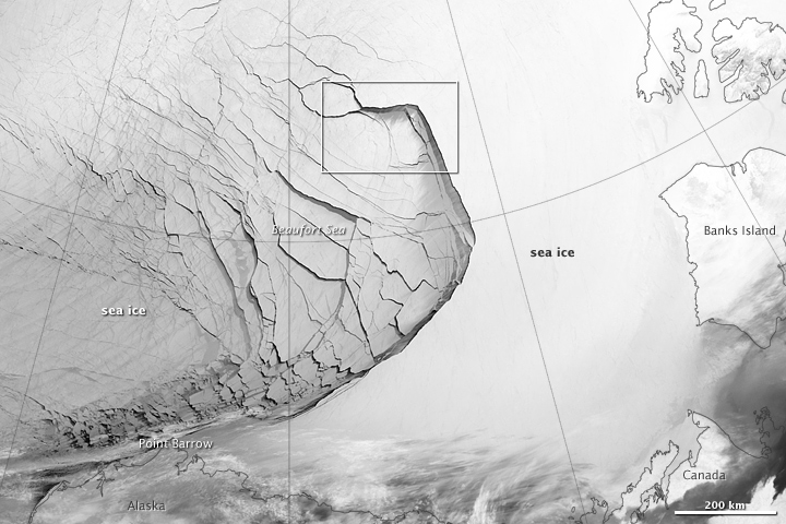
Satellite image of the large fracture in Arctic sea ice in the Beaufort Sea (north of Alaska). Image from NASA, acquired February 23, 2013.
New images of 2013's Arctic sea ice mega-fracture have been posted on NASA's website. Sea ice fractures are not uncommon, though, according to NASA, the extent of this one is. Two things have combined this year to create the mega-fracture:
Arctic sea ice is not what it used to be. It is becoming thin and fragile, whereas thick, multi-year ice (ice that is around for many years and is much more stable) has declined. Arctic sea ice extent has plummeted since 1979, and reached an all-time low in September 2012. According to the National Snow and Ice Data Center, through 2013, February sea ice extent has declined at a rate of 2.9% per decade compared to the long-term average. This represents an overall reduction of more than 606,000 square miles from 1979 to 2013, which is equivalent to more than twice the area of the state of Texas. Scientific consensus points to global warming from fossil fuel emissions as the culprit of the Arctic's decline.
No comments:
Post a Comment