Showing posts with label Kendall Walczynski. Show all posts

Tuesday, December 8, 2015

Pacific Storm Parade


Pacific Storm Parade to Lash Northwest With Heavy Rain, Mountain Snow Through This Weekend

Western Radar
A parade of Pacific storms that began last week will continue to impact the Northwest into the coming weekend.
This additional heavy rainfall will, and already has, triggered localized urban flooding and will push rivers above flood stage in parts of western Washington and western Oregon. Since the beginning of this wet weather pattern nearly a foot of rain has fallen in at least one location near Washington's Olympic Mountains. Feet of snow will also pile up in the Cascades, and other mountain chains from this Pacific onslaught.
Record rainfall has already brought flooding to the Portland, Oregon area to start the work week and the risk of flooding will continue into Thursday.
A classic November-December setup featuring a powerful jet stream stretching from eastern Asia across the Pacific for 5,000 miles to the Pacific Northwest is acting as the conductor for this storm parade. The persistent pipeline of moisture is being supplied by what meteorologists sometimes refer to as an atmospheric river. In this case, the plume of moisture impacting the Northwest extends all the way into the western Pacific Ocean near the Philippines. See below for more details on atmospheric river events along the West Coast.

Monday, December 7, 2015

Animals Extinct due to climate change

This is evidence that we’re pushing the earth to a place where it has either never been or hasn’t been for a very, very long time. Australia, New Zealand, and South America are among the hardest hit as rising temperatures could drive the extinction of one in six species worldwide


One in six species could disappear as the climate warms over the next century, with animals and plants in South America particularly hard hit while those in North America  would face the lowest risk, according to a major new analysis published Thursday, .
With naturally small populations of native species in its tropical rainforests and mountains, South America could see extinction rates more than four times higher than those in the United States and Canada, according to the study published in the journal Science.

Heavy Rain Threat From Multiple Northwest Storms


A parade of Pacific storms that begun Last week will continue to impact the northwest into the coming weekend. The combined affect of heavy rain and Saturated ground mat trigger localizted flooding in parts of western Washington Oregon, and feet of snow will pile up in the Cascades, and other mountain chains from the Pacific Onslaught.

Record rainfall has already brought flooding to the Portland area, to start the work week an the risk of the flooding will continue into Thursday.

Storm Desmond brings flooding and disruption to parts of UK

http://www.bbc.com/news/uk-35014745 

High-speed winds and heavy rain are causing severe disruption as Storm Desmond continues to batter the UK.
People were evacuated from their homes as flash flooding swept through parts of Cumbria, and police in the area declared a "major incident".
Dozens of train routes have been cancelled, and roads have been closed in Scotland, England and Wales.
Scores of severe flood warnings are in place in England, with two more issued in south-west Scotland.
Severe warnings - the highest level of alert - indicate there may be "danger to life".
BBC weather expert Chris Fawkes said the "epicentre" of the storm was likely to hit Cumbria, with the worst yet to come.
Adrian Holme, from Cumbria Fire and Rescue Service, said flooding was "unprecedented".
Rescue centres have been opened in the county, sandbags are being handed out and there is an appeal for doctors to volunteer overnight.
Meanwhile, the Royal National Lifeboat Institution's (RNLI) flood rescue team has been deployed to the area.
The Environment Agency warned further flooding in Cumbria was likely over the weekend, with flood levels not expected to reach their peak until 12:00 GMT on Sunday.

Will This Strong El Niño Take Away Your White Christmas?

The El Niño of 2015 is one of the strongest on record, dating to 1950, and, by some metrics, may already be stronger than the previous strongest El Niño of 1997-1998.
This periodic warming of the equatorial eastern Pacific Ocean can have a number of effects on weather around the world, from heavy rain to extreme drought, persistent warmth to stubborn cold, and inactive versus hyperactive tropical cyclone seasons.
Given its strength, will this El Niño factor into your chances of seeing a White Christmas?
First, it's worth noting that meteorologists define a White Christmas as one in which at least one inch of snow is on the ground on Christmas morning – and they aren't as common as you think, even in colder climates.
Based on 30-year average data from 1981-2010, the chance of at least one inch of Christmas snow cover is less than 50 percent in these traditionally snowy cities:
  • Boston: 21 percent
  • Pittsburgh: 30 percent
  • Chicago: 42 percent
  • Cleveland: 45 percent
  • Detroit: 46 percent
  • Milwaukee: 48 percent
The chance of a White Christmas in any year, based on 1981-2010 data. (Climate.gov)
Even in areas you expect a White Christmas to be a slam dunk, the chances aren't 100 percent, such as Minneapolis/St. Paul (77 percent) and Burlington, Vermont (72 percent).
With that context, let's first examine what happened in December during the previous five strong El Niño events.

2015 Hurricane Season in Review: 11 Things We Will Remember

The 2015 hurricane season has officially come to a close in both the Atlantic and eastern/central Pacific basins. November 30 is the final day of the season each year, though occasionally a named storm may occur beyond that date.
Here are 11 things we'll remember from the 2015 hurricane season.

1.) Another Hyperactive Pacific Season; Atlantic Slightly Below Average

Tracks of all the Atlantic tropical cyclones in 2015.
Tracks of all the central and eastern Pacific tropical cyclones in 2015.
For the second year in a row, the Pacific was much more active than the Atlantic.
The eastern Pacific had 18 named storms plus four additional tropical depressions for a total of 22 tropical cyclones. In the Atlantic, we saw 11 named storms and one additional tropical depression, bringing the number of tropical cyclones in that basin this season to 12.
Though several of them were short-lived, the 11 named storms in the Atlantic was just short of the 30-year average (1981-2010) of 12 named storms per season. Four of those named storms became hurricanes, which is below the average of six hurricanes during the same 30-year period.
Meanwhile, the eastern Pacific's 18 named storms was above the 30-year average of 15 per season. Of those 18 named storms, 13 went on to become hurricanes, which is well above the average of 8 per season.
The central Pacific was also unusually active in 2015 with a record eight tropical cyclones forming in the basin. An additional seven originated in the eastern Pacific, later crossing into the central Pacific for a total of 15 tropical cyclones in the central Pacific basin this season.
The previous record for the number of cyclones passing through the central Pacific basin in one year was 11 tropical cyclones in 1992 and 1994. The previous record number of cyclones originating in the central Pacific was just four in 1982 – which like 2015 was the beginning of a strong El Niño.

Weather for 2016 area

 Two month weather forcast

DECEMBER 2015: temperature 31.5° (3° below avg. east, 2° above west); precipitation 2.5" (0.5" below avg.); Dec 1-3: Rain and snow showers; Dec 4-8: Snowstorm, then flurries cold; Dec 9-13: Snow east, rain west, then rain and snow showers, mild; Dec 14-22: Lake snows and snow showers, cold; Dec 23-26: Flurries, cold east; sunny, mild west; Dec 27-31: Snowstorm, then flurries, cold.
JANUARY 2016: temperature 24° (3° below avg.); precipitation 2" (0.5" below avg.); Jan 1-7: Lake snows, cold east; sunny, mild west; Jan 8-13: Lake snows, bitter cold; Jan 14-18: Rain and snow showers, mild; Jan 19-26: Lake snows, very cold; Jan 27-31: Rain, then snow showers.
Map showing long range weather region

Weather related deaths 2015

At least 23 people died across U.S. this week due to winter weather


(CNN)At least 23 people have died this week in the United States due to winter weather, CNN has confirmed.
A majority of the deaths --18 -- occurred in Tennessee.
Three of those people died in a fire in Knox County, Tennessee emergency management officials said.
Family members said a man, woman and their adult son died in the fire, according to CNN affiliate WATE. Firefighters said they had difficulty reaching them because the second level of the house collapsed onto the lower level, WATE reported.
Other people in Tennessee died from hypothermia and in auto accidents, WATE said, and a dialysis patient died after he was unable to get treatment because of weather.
More than 2,700 people are without power as more severe cold, freezing rain and snow are predicted for the next few days, Tennessee officials said.
Frozen Niagara Falls creates huge misty ice cloud

Frozen Niagara Falls creates huge misty ice cloud 01:28
Dangerously cold conditions continue to grip a large part of the Eastern United States, CNN meteorologists said, with more than 125 million Americans under a wind chill warning or advisory.
Wind chills will go as low as 40 below zero in some places.
Snow, sleet, and freezing rain will spread over the mid-South and into the mid-Atlantic over the next couple of days.
Ice storm warnings are in effect for Nashville, where heavy ice accumulation could again cause widespread power outages.
Winter storm warnings again cover much of Kentucky, which saw as much as 15 inches from the last storm.
More heavy snow is predicted for Louisville and Cincinnati.
The storm will spread up the East Coast this weekend.

Hurricane Blanca roars in Pacific, could affect Mexico's Baja Peninsula


Hurricane Blanca, a Category-4 storm with 140 mph winds, is spinning in the eastern Pacific Ocean. As of 5 p.m. ET Wednesday, it was located 465 miles south of Manzanillo, Mexico, according to the National Hurricane Center.
Blanca is nearly stationary, but will begin moving northwestward Thursday, the Weather Channel said. There is increasing confidence in a track toward southern Baja California, though it is expected to weaken as comes closer to land.
"Swells generated by Blanca will begin affecting portions of the coast of southwestern Mexico during the next couple of days," the hurricane center said.
"These swells are likely to cause life-threatening surf and rip current conditions."
The hurricane would impact the Baja by the weekend.
Blanca is the second major hurricane to form in eastern Pacific this year. A major hurricane is one that's a Category 3, 4 or 5 on the Saffir-Simpson Scale of Hurricane Intensity.
Tropical Storm Andres, which had been a major hurricane a few days ago, decreased to near 60 mph with continued weakening expected. The storm is centered about 1,015 miles west-southwest of the southern tip of Mexico's Baja California peninsula. It's no threat to land.

EL Nino high records

The current El Niño set a monthly record in November, and may eventually become the strongest El Niño on record this winter, according to data just released from NOAA.
Water temperatures near the ocean surface reached their highest positive anomalies on record in the zone of the equatorial Pacific Ocean defining either El Niño or its opposite, La Niña, in November. This means the sea-surface water temperature was farther above average for the time of year than any previous month in reliable records dating to 1950.
Specifically, the water temperature in this region was about 2.35 degrees Celsius above average in November 2015, topping the previous record monthly anomaly from November 1997 by 0.02 degrees Celsius, in reliable records dating to 1950


Rescue crews respond to severe flooding in Milwaukie area

AIR 12 was over the scene Monday afternoon as Clackamas Fire District #1 crews used boats to reach people stuck in their homes in the area of Southeast Rusk Road and Highway 224.
Firefighters said they received reports of a bed-ridden person as well as someone in a wheelchair who could not escape their homes before the flood waters rolled in.
The Clackamas County Fire rescue crews have performed 13 boat rescues Monday, with eight happening at a care facility off of Rusk Road and five more at a business on Southeast Johnson Road.
Crews also notified almost 50 residents of an apartment complex on Southeast Lake to evacuate. The fire department is advising residents to stay away for at least a day to let the water recede before returning.

Sunday, December 6, 2015

2015 U.S. Lightning Deaths


2015 U.S. Lightning Deaths

 NOAA says that during the 10-year period of 2004-2013, 33 people were killed and 234 were injured by lightning strikes annually.
On average, lightning strikes are fatal to about 10 percent of people who are struck. The remaining 90 percent survive, however they often suffer from an array of long-term, often debilitating symptoms.
No place outside is safe when thunderstorms are in the area. If you hear thunder, lightning is close enough to strike you. Immediately move to safe shelter, a substantial building or inside an enclosed metal-topped vehicle.
2015 Lightning Deaths:
  • Florida: One death in Bonita Springs on May 13 and another in Port Orange on June 26.
  • Iowa: One death in Moscow on May 4 and another near Palo on June 20.
  • North Carolina: Two deaths total on April 9. One in Cary and another in Anderson Creek.
  • New Mexico: One death in Carrizozo on May 15.
  • West Virginia: One death in Fayetteville on  June 1.
  • Arkansas: One death in Benton County on June 13.
  • Florida: One death in Largo on June 19.
  • Alabama: Two deaths total on June 23 in Opp. 
  • Arizona: One death on June 27 in Mogollon Rim, Northern Arizona and another in Benson on June 30 
  • Texas: One death on July 2, victim initially struck May 21 in Port Lavaca 
  • Alabama: 12-year-oil girl passed away July 7, after being struck by lightning on July 5.
  • South Dakota: One death on Juy 12 on a disc golf course in Spearfish.

Climate Change, Tax Pledge Among Issues to Watch for 2016 (POLL)

PHOTO: Climate change is among the issues to watch in 2016.
http://abcnews.go.com/Politics/climate-change-tax-pledge-issues-watch-2016-poll/story?id=30067623 
Overall, Americans by 59-31 percent say they want the next president to be someone who favors government action to address climate change, and 58 percent call it an important issue. Again there’s a sharp difference in importance depending on one’s position: Among those who favor federal action, 68 percent call it an important issue. Among those who oppose action, far fewer say it’s important to them, 39 percent.
On a third issue to emerge as potentiallyTwo issue positions show potential to carry unexpected clout in the 2016 presidential election-- support for action to address climate change and opposition to a no-tax pledge, a new ABC News/Washington Post poll finds.
Openness to political compromise also has the support, and the priority, to carry weight in the national conversation that lies ahead.
All three emerge from an approach that combines public preferences on these and other issues with the level of importance Americans ascribe to them. They’re combined in a PxP score -- preference times priority -- assessing the interplay of these two factors in political attitudes.
The poll, produced for ABC News by Langer Research Associates, finds that opposing a no-tax pledge has the broadest base: Seventy-two percent of Americans hold this view, including big majorities across party lines. Only about half in this group overall call the issue an important one, but their views on it are so lopsided that it wins a high score, nonetheless.
Supporters of a tax pledge, by contrast, are much more likely to call it an important issue -- but there are few of them. influential, Americans by 58-37 percent say they’d rather have a president who mainly tries to compromise than one who mainly stands up for his or her side, and 72 percent overall say it’s important to them. Both those who favor compromise and those who prefer a more partisan approach say it’s an important issue, with preference for taking partisan sides, and calling this important, peaking among Republicans.
Other issues are contentious, but with no clear advantage in preference or priority for one side or the other. Obamacare is an example. Americans divide 49-45 percent on whether the next president should be someone who wants to keep the federal health care law or wants to repeal it, and those on both sides call the issue highly important. The partisan divisions are vast.

Weather Predictions

2015 Weather Predictions For Northeast

Hello readers, in this article you can get information about 2015 Weather Predictions For Northeast. Here we will discuss about Daily operations briefing govdelivery. 1/4 current situation: • fire began september 12, 2015 around 4:30 pm edt • burning in lake and napa valley (pop: 204,186) • very rapid growth ongoing. Http://spaceweathercom/ past 24 hours current next 24 hours space weather activity: none none none • geomagnetic storms none none none. Http://spaceweathercom/ past 24 hours current next 24 hours space weather activity: moderate none moderate • geomagnetic storms g2 none g2.


The Old Farmer's Almanac 2015 Weather Predictions - Arrows and Minnows

Chennai, India: Downpours to Lessen Late Week After Historic Rainfall

Flood-weary Chennai and the rest of southeastern India will welcome a reduction in downpours later this week with even drier weather to then follow.
A reduction in the tropical moisture streaming in from the Bay of Bengal is expected later this week. While that does not mean an end to a showers or thunderstorm from occurring in Chennai, there will be fewer downpours.

Less downpours will give flood waters a chance to recede and will lower the potential for renewed or worsening flooding, a danger that will exist early this week across southern India.
Chennai will lie on the northern fringe of the locally drenching showers and thunderstorms targeting southern India early this week.
RELATED:
India Weather Center
Detailed Forecast for Chennai
Chennai, India, Records Wettest December Day in Over 100 Years

The heaviest downpours could produce 25-50 mm (1-2 inches) each day. New flash flooding problems are a serious concern, especially where the ground is already saturated or where downpours set up repeatedly over the same communities.
In Chennai, it will not take much rain to cause more problems.
"Along the east coast of Tamil Nadu, the storminess this week can occur at anytime," stated AccuWeather Meteorologist Adam Douty. "Starting on Tuesday, the shower and thunderstorm activity toward the southwestern coast of India will mainly develop each afternoon before moving offshore at night."

The World is Halfway to 2°C

It’s all but certain that 2015 will end up as the hottest year on record. And in setting that mark, the world is on track to finish the year 1°C above pre-industrial levels, a dubious milestone.
That would make 2015 the first year to crack the halfway mark of 2°C warming, the benchmark that’s been targeted as “safe” climate change and what nations are working toward meeting ahead of climate talks in Paris in December. But Monday’s announcement by the U.K. Met Office hints at how difficult achieving that target will be.
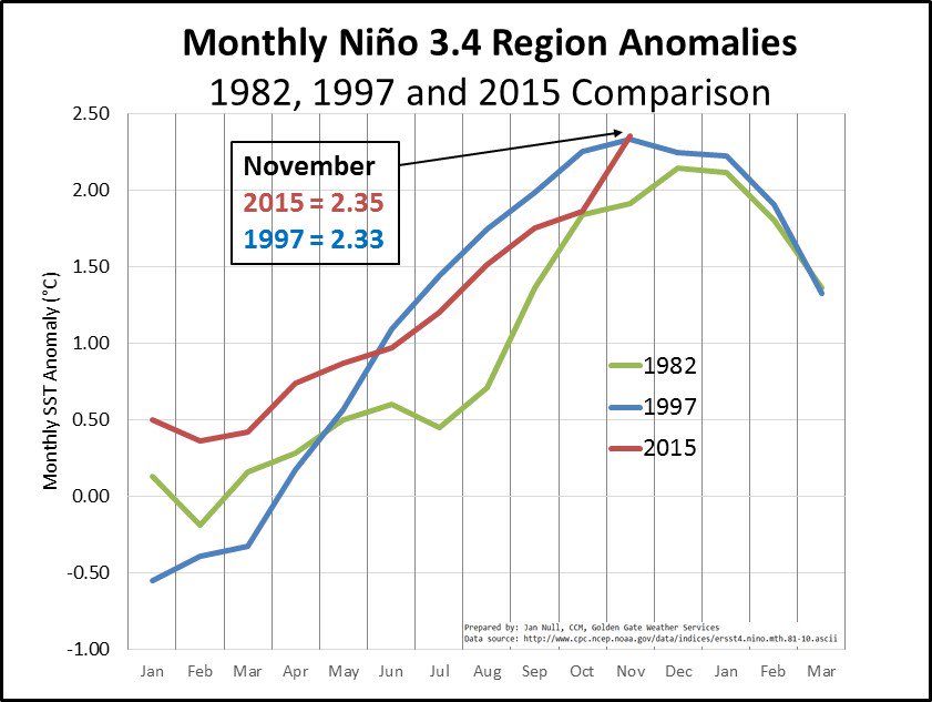
Global temperature data for September 2015.
Credit: U.K. Met Office

Unlike carbon dioxide, which has risen steadily like a drumbeat every year since the Industrial Revolution due to human activities, the temperature is likely to fluctuate annually and could dip slightly in the coming years (though signs already point to 2016 being even hotter). But the 1°C of warming shows how humans are reshaping the climate in the here and now and not some distant future.
The Met Office maintains one of the four major global temperature records. It shows that through September, the planet is running 1.8°F (1.02°C) above normal. El Niño, the warming of waters in the eastern tropical Pacific, is a contributing factor. But it’s being layered on top of a long-term climate change signal, which has seen the world get hotter and hotter since record keeping began in the late 1800s.

“We've had similar natural events in the past, yet this is the first time we're set to reach the 1°C marker and it's clear that it is human influence driving our modern climate into uncharted territory," Stephen Belcher, the director of the Met Office Hadley Center, said in a statement.
In a separate announcement on Monday, the World Meteorological Organization (WMO) announced that greenhouse gas concentrations in the atmosphere have reached record highs. That includes global carbon dioxide reaching 400 parts per million (ppm) for the first time earlier this year at 40 carbon dioxide-monitoring stations.
Carbon dioxide and other greenhouse gases in the atmosphere are the main drivers of climate change. The world has seen carbon dioxide risen more than 120 ppm since pre-industrial times. Readings at some stations, including the gold standard at Mauna Loa Observatory, are set to pass 400 ppm for the foreseeable future later this year. The WMO expects the global average to pass 400 ppm in 2016 as well.
An animation showing how carbon dioxide moves around the planet.
Credit: NASA/YouTube

With the planet having already run through two-thirds of its carbon budget — the amount of carbon that can be emitted before the world warms 2°C — scientists say that more action is needed to avoid the worst impacts of climate change.
Even if the world limits warming to 2°C, there are still wholesale changes in store for the planet.
Research released by Climate Central on Sunday shows that even if warming is capped at 2°C, sea level rise would still impact land that’s currently home to at least 130 million people. If warming reaches 7.2°F (4°C) above pre-industrial levels, land where 470 million to 760 million people live today would feel the impacts.

Climate Change and Mass Extinction


Climate Change Will Accelerate Earth's Sixth Mass Extinction

The pace at which species disappear is picking up as temperatures rise, and things are looking especially troubling in the tropics


urban2HR.jpg

Climate change is accelerating species loss on Earth, and by the end of this century, as many as one in six species could be at risk of extinction. But while these effects are being seen around the world, the threat is much higher in certain sensitive regions, according to two new comprehensive studies.
The planet is experiencing a new wave of die-offs driven by factors such as habitat loss, the introduction of exotic invaders and rapid changes to our climate. Some people have called the phenomenon the sixth mass extinction, on par with the catastrophic demise of the large dinosaurs 65 million years ago. To try and combat the declines, scientists have been racing to make predictions about which species are most likely to go extinct, along with when and where it will happen, sometimes with widely varying results.
“Depending on which study you look at, you can come away with a rosy or gloomy view of climate change extinctions,” notes Mark Urban of the University of Connecticut. “That’s because each study focuses on different species [and] regions of the world and makes different assumptions about climate change and species’ responses.”
In one of the two new studies published today in Science, Urban compensated for all those differences by combining 131 previously published studies into one big prediction. If greenhouse gas emissions continue unabated, he calculates, 16 percent of species will be threatened with extinction due to climate change by the end of the century.


Read more: http://www.smithsonianmag.com/science-nature/climate-change-will-accelerate-earths-sixth-mass-extinction-180955138/#zKYGDoumoH1ErSqf.99
Give the gift of Smithsonian magazine for only $12! http://bit.ly/1cGUiGv
Follow us: @SmithsonianMag on Twitter

Monday, November 30, 2015

Great Lakes Wintry Mix to Streak Across Upper Midwest Kendall Walczynski

http://www.accuweather.com/en/weather-news/winter-storm-2015-midwest-east/39895052


After depositing a swath of snow and ice over parts of the central and southern Plains to close out the week and blanketing parts of the Midwest with snow on Saturday, more snow will fall across the Great Lakes before the storm takes off away from the area.
A swath of slippery travel will stretch across the general area around Chicago and Detroit. Snow showers will taper off through the day on Sunday across Wisconsin, Illinois, and Indiana but a lake-effect component will kick in across Michigan. This is where the heaviest snowfall accumulations will be centered as the storm departs.
After snow, sleet and freezing rain spread over much of the region on Saturday, warmer air has lifted into the region, allowing for much of the precipitation to change over to a chilly rain.
However, some snowy and icy conditions will still fall over northern New England through Sunday afternoon where the cold air holds longer. This can lead to dangerous travel conditions in central and northern New England.
From part of upstate New York to northern New England, enough ice buildup can occur to weigh down trees and cause power outages.
According to AccuWeather.com Senior Meteorologist Bernie Rayno, "Northern New England has the potential for a significant snow and ice event with multiple hours of slippery travel on the front side of the storm prior to any warmup."
The storm will end from west to east on Sunday.
Similar to the Midwest, gusty winds may cause some flight delays Sunday into Monday with lake-effect snow and snow showers from the central Appalachians to the lower Great Lakes.
Rain, locally gusty winds and low cloud ceilings will continue to bring the threat for flight delays and problems for motorists in a large part of the Southeast through Sunday.
After severe storms rumbled across Louisiana and Mississippi Saturday, localized strong storms are possible across parts of the region.