At a Glance
- Airplanes flying into Chicago seeded clouds over Lake Michigan.
- This caused a burst of snow to appear on Doppler Radar.
- A hole-punch cloud also appeared on satellite imagery.
Aircraft landing in Chicago likely contributed to a burst of heavy snow as they flew above the waters of Lake Michigan on Tuesday.
Doppler Radar showed an increase of concentrated echoes in an arcing pattern just east of Chicago during the morning hours. When radar detects echoes like these, it typically means there is precipitation such as rain or snow.
In this case, temperatures were sufficiently cold for snow in the Chicagoland area.
Doppler Radar showing the burst of radar echoes (blue) over Lake Michigan depicting snow that likely formed as a result of aircraft flying into O'Hare airport.
(National Weather Service Grand Rapids)
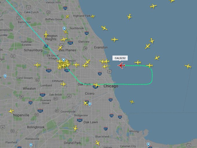
Flight tracking provided additional evidence that air traffic was a contributor to the formation of this localized pocket of snow. Planes arriving from the west made a looping turn over Lake Michigan while on approach into Chicago's O'Hare airport, a similar pattern to how the radar echoes appeared.
As the airplanes descended for landing they flew through water-laden clouds in temperature that were below freezing, the National Weather Service in Grand Rapids, Michigan, said. Ice crystals formed as a result.
This is called inadvertent cloud seeding, according to a study by Andrew Heymsfield and collaborators.
They concluded that aircraft propellers and wings cause the formation of those ice crystals. There are zones of locally low pressure along the wing and propeller tips which allow the air to expand and cool well below the original temperature of the cloud layer, forming ice crystals.
Hole-punch clouds, or canal clouds, can also develop from this type of cloud seeding. Satellite imagery showed the formation of a hole-punch cloud over Lake Michigan on Tuesday.
Satellite image of a hole-punch cloud due to aircraft seeding over southwest Lake Michigan Tuesday morning.
(CIRA/RAMMB/NOAA)
These rare cloud formations develop in altocumulus cloud layers as airplanes pass through them.
The altocumulus cloud layer is composed of small water droplets that are below freezing, called supercooled water droplets. If ice crystals can form in the layer of supercooled droplets, they will grow rapidly and shrink or possibly evaporate the droplets completely.
Studies, including the one by Heymsfield, have shown that aircraft passing through these cloud layers can trigger the formation of the heavier ice crystals, which fall to earth and then leave the circular void in the blanket of clouds.
https://weather.com/news/news/2018-11-28-chicago-lake-michigan-airplanes-snow


No comments:
Post a Comment